
ATL: DEBBY - Post-Tropical
Moderator: S2k Moderators
-
Evil Jeremy

- S2K Supporter

- Posts: 5463
- Age: 32
- Joined: Mon Apr 10, 2006 2:10 pm
- Location: Los Angeles, CA
Re: ATL: INVEST 96L - Models
For what it's worth, the 18z GFS shows a SW FL landfall:
0 likes
Frances 04 / Jeanne 04 / Katrina 05 / Wilma 05 / Fay 08 / Debby 12 / Andrea 13 / Colin 16 / Hermine 16 / Matthew 16 / Irma 17
-
Aric Dunn
- Category 5

- Posts: 21238
- Age: 43
- Joined: Sun Sep 19, 2004 9:58 pm
- Location: Ready for the Chase.
- Contact:
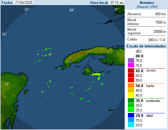
looking at radar out ogf cuba and sat s mor defined circ is possibly developing nw of the tip of cuba or ne of the yucatan.
0 likes
Note: If I make a post that is brief. Please refer back to previous posts for the analysis or reasoning. I do not re-write/qoute what my initial post said each time.
If there is nothing before... then just ask
Space & Atmospheric Physicist, Embry-Riddle Aeronautical University,
I believe the sky is falling...
If there is nothing before... then just ask
Space & Atmospheric Physicist, Embry-Riddle Aeronautical University,
I believe the sky is falling...
-
'CaneFreak

- Category 5
- Posts: 1487
- Joined: Mon Jun 05, 2006 10:50 am
- Location: New Bern, NC
Re:
Agreed. Do we have any surface observations to back that up? (i.e. west winds recorded in western cuba)
Aric Dunn wrote:looking at radar out ogf cuba and sat s mor defined circ is possibly developing nw of the tip of cuba or ne of the yucatan.
0 likes

Re: ATL: INVEST 96L - Discussion
0 likes
The following post is NOT an official forecast and should not be used as such. It is just the opinion of the poster and may or may not be backed by sound meteorological data. It is NOT endorsed by any professional institution including storm2k.org For Official Information please refer to the NHC and NWS products.
Re: ATL: INVEST 96L - Discussion
johngaltfla wrote:wxman57 wrote:Definitely a good reason for NHC to up development chances this evening. 6 more hours of development time in the 48 hr outlook. BY 8pm Saturday I expect it to be a strengthening TS.
I don't mean to sound sadistic, but a nice TS sweeping through here would cure our drought AND since I'm on a road trip to the USVI/BVI next week, that should help to suck all the storms north of there.
However, folks, I've been through quite a few strong TS, and PLEASE take precautions for flooding seriously, even if your "officials" say you are not in a flood plain in Florida. It doesn't take much on the West Coast of Florida to cause a flood once the ground is saturated.
if the storm organizes in the central gulf and then heads west, our forecast on the west coast of florida will dry out big time. i hope the westward trend continues but we'll just have to wait and see.
0 likes

Re: ATL: INVEST 96L - Discussion
Looks like original "empty swirl" is getting organized ( closer to S,E, Gulf)
The Yucatan system may be part of main Low's tail?
http://www.ssd.noaa.gov/goes/east/tatl/flash-vis.html
The Yucatan system may be part of main Low's tail?
http://www.ssd.noaa.gov/goes/east/tatl/flash-vis.html
0 likes
-
hurricanefloyd5

- Category 5
- Posts: 1659
- Age: 45
- Joined: Sun May 02, 2004 10:53 am
- Location: Spartanburg
- Contact:
Re:
Aric Dunn wrote:looking at radar out ogf cuba and sat s mor defined circ is possibly developing nw of the tip of cuba or ne of the yucatan.
can you post the radar loop from cuba here please
0 likes
-
tropicwatch

- Category 5
- Posts: 3426
- Age: 62
- Joined: Sat Jun 02, 2007 10:01 am
- Location: Panama City Florida
- Contact:
Re: ATL: INVEST 96L - Discussion
0 likes
Tropicwatch
Agnes 72', Eloise 75, Elena 85', Kate 85', Charley 86', Florence 88', Beryl 94', Dean 95', Erin 95', Opal 95', Earl 98', Georges 98', Ivan 2004', Arlene 2005', Dennis 2005', Ida 2009' Debby 2012' Irma 2017' Michael 2018'
Agnes 72', Eloise 75, Elena 85', Kate 85', Charley 86', Florence 88', Beryl 94', Dean 95', Erin 95', Opal 95', Earl 98', Georges 98', Ivan 2004', Arlene 2005', Dennis 2005', Ida 2009' Debby 2012' Irma 2017' Michael 2018'

Re: ATL: INVEST 96L - Discussion
I would echo what tailgater said, plus time of day plays with satpic as well. The core seems to be finding a nice convective swirl on the Yucatan, just my two shillings!
Personal Forecast Disclaimer:
The posts in this forum are NOT official forecast and should not be used as such. They are just the opinion of the poster and may or may not be backed by sound meteorological data. They are NOT endorsed by any professional institution or storm2k.org. For official information, please refer to the NHC and NWS products.
0 likes
-
HurricaneBrain

- S2K Supporter
- Posts: 520
- Joined: Thu Jun 30, 2011 2:07 pm
Landfall probability:
Mexico - 5%
Texas - 37.5%
Louisiana - 20%
Mississippi, Alabama, or Florida - 37.5%
Personal Forecast Disclaimer:
The posts in this forum are NOT official forecast and should not be used as such. They are just the opinion of the poster and may or may not be backed by sound meteorological data. They are NOT endorsed by any professional institution or storm2k.org. For official information, please refer to the NHC and NWS products.
0 likes
-
caneman
Re: Re:
Ntxw wrote:Lane wrote:On topic: I do have a question about the ridge/trough that maybe starting to make the models go west. Could the trough/ridge end up being weaker than forecast causing another change/shift in models?
Key will be the ridge. The trough is already in existence and heading east/northeast. The -NAO will allow it to deepen along the east coast. If this system were to evolve quickly it would race to Florida and quickly move through the Peninsula with the trough. This is why the GFS not long ago showed it already off the east coast of FL for several runs. A stronger elongated ridge will tend to swing the models west. A caveat of a stronger east coast trough is shear would then quickly rip it apart (again why GFS has not been gun-ho as the other models in intensity). So really the upcoming ridge is very important for the models as changes in it can have different solutions per model runs.
Doesn't necessarily rip it apart. We've had many storms on the West coast of Florida where they actually seem to held their own or intensified. All about timing and such. Remember Charley (as an example - not forecasting that intensity)
Last edited by caneman on Thu Jun 21, 2012 5:37 pm, edited 1 time in total.
0 likes

Re: ATL: INVEST 96L - Discussion
0 likes
-
OuterBanker
- S2K Supporter
- Posts: 1761
- Joined: Wed Feb 26, 2003 10:53 am
- Location: Nags Head, NC
- Contact:
Re: ATL: INVEST 96L - Models
Jeremy, that's the only scenario going ene. I think it's making the trough too strong.
Also, what's that low se of Hatteras at 996mb?
Also, what's that low se of Hatteras at 996mb?
0 likes
Re: ATL: INVEST 96L - Models
18Z GFS still holding on to the East solution....going against all other global models that are out currently. GFDL will run soon....that will be interesting.
0 likes


Re: Re:
caneman wrote:Doesn't necessarily rip it apart. We've had many storms on the West coast of Florida where they actually seem to held their own or intensified. All about timing and such. Remember Charley (as an example - not forecasting that intensity)
Certainly, but I was referencing why the GFS runs had a weaker system. And this time of year it would tend to become more subtropical if that were the case. Charley was later in the season where conditions are much more favorable.
0 likes
The above post and any post by Ntxw is NOT an official forecast and should not be used as such. It is just the opinion of the poster and may or may not be backed by sound meteorological data. It is NOT endorsed by any professional institution including Storm2k. For official information, please refer to NWS products.
Help support Storm2K!

-
SunnyThoughts
- Category 5
- Posts: 2263
- Joined: Wed Jul 09, 2003 12:42 pm
- Location: Pensacola, Florida
-
cycloneye

- Admin

- Posts: 149275
- Age: 69
- Joined: Thu Oct 10, 2002 10:54 am
- Location: San Juan, Puerto Rico
Re: ATL: INVEST 96L - Models
ROCK wrote:18Z GFS still holding on to the East solution....going against all other global models that are out currently. GFDL will run soon....that will be interesting.
Dont forget the HWRF that was also upgraded.
0 likes
Visit the Caribbean-Central America Weather Thread where you can find at first post web cams,radars
and observations from Caribbean basin members Click Here
and observations from Caribbean basin members Click Here
-
caneman
Re: ATL: INVEST 96L - Models
Evil Jeremy wrote:For what it's worth, the 18z GFS shows a SW FL landfall:
http://raleighwx.americanwx.com/models/ ... cal114.gif
Is it also predicting quicker development though?
0 likes
-
MiamiHurricanes10

- S2K Supporter
- Posts: 260
- Joined: Mon Jul 19, 2010 7:56 pm
- Location: Miami, Florida
-
lrak

- S2K Supporter
- Posts: 1770
- Age: 59
- Joined: Thu Jun 21, 2007 2:48 pm
- Location: Corpus Christi, TX
Re:
blazess556 wrote:Merida / lic Manuel Crecencio, (MMMD)
Elev: 11 ft; Latitude: 20.94686; Longitude: -89.65214
It is reporting 1006.8 mb.
Current Weather Conditions:
Campeche, Camp., Mexico
Wind from the WNW (300 degrees) at 12 MPH (10 KT)
Visibility 7 mile(s)
Sky conditions mostly cloudy
Temperature 82 F (28 C)
Dew Point 75 F (24 C)
Relative Humidity 78%
Pressure (altimeter) 29.75 in. Hg (1007 hPa)
ob MMCP 212143Z 30010KT 7SM SCT020 BKN100 28/24 A2975 RMK 8/520
0 likes
AKA karl
Also
Personal Forecast Disclaimer:
My posts on this forum are NOT official forecast and should not be used as such. My posts are my basic observations and are definitely not backed by any "well some" meteorological knowledge. For official information, please refer to the NHC and NWS products.
Also
Personal Forecast Disclaimer:
My posts on this forum are NOT official forecast and should not be used as such. My posts are my basic observations and are definitely not backed by any "well some" meteorological knowledge. For official information, please refer to the NHC and NWS products.
Who is online
Users browsing this forum: Google Adsense [Bot] and 70 guests