

jeff wrote:Aric Dunn wrote:only timr will tell. just some rotational dynamics ... will see but i dont se much north of the yucatsn
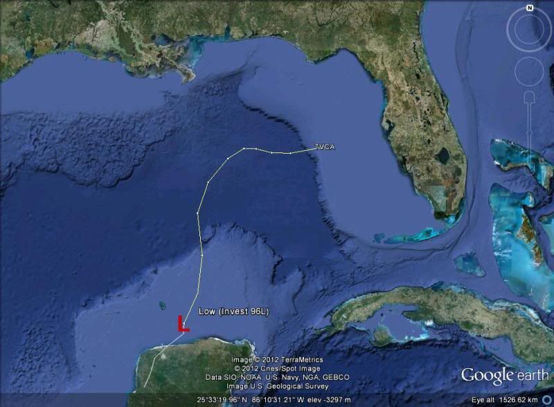
The circulation is ill defined and spans upwards of 150 miles as stated by wxman. NHC will track the broad center and not the vorticity centers that can/will rotate around the main broad center. Again this is very much like a large monsoon trough/depression...large and sprawling....it will take time to consolidate.
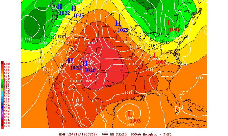
Things are actually playing out to some degree much like the models showed last week with a weak and broad low ejecting out of MX into the BOC (the broad low as done just that, but slightly more to the north and east than the models were showing last week). That slight NE ejection seems to have been the starting point of the differences between the models with respect to FL or the W Gulf. Ensemble means continue to favor the western Gulf with the GFS ensembles more split into the two camps. Hopefully some of this will clear up before NHC has to put out a 5 day forecast...luckily they have slow motion on their side.
The posts in this forum are NOT official forecast and should not be used as such. They are just the opinion of the poster and may or may not be backed by sound meteorological data. They are NOT endorsed by any professional institution or storm2k.org. For official information, please refer to the NHC and NWS products.
Yes as mentioned, it will be a slow process. Convection is on the decrease in a dramatic way this evening and the low is broad. It still has a long way to go before getting classified. Will be interesting how much convection decreases now that the heating of the day is lost over the Yucatan. A named system is possible but still would be this weekend not sooner more than likely. I don't see whatever comes of this being strong. That said, I will up my development chances from my thinking last night to around 50%.


