ATL: DEBBY - Post-Tropical
Moderator: S2k Moderators
-
Evil Jeremy

- S2K Supporter

- Posts: 5463
- Age: 32
- Joined: Mon Apr 10, 2006 2:10 pm
- Location: Los Angeles, CA
Re: ATL: INVEST 96L - Models
tolakram wrote:I'm thinking if the GFS is going to flip it will be on the full run, not the 6z or 18z. Remind me again what the full run has that the intermediate does not?
Fresh data. I thought that the intermediate runs just were based off of extrapolated data from the previous run instead of new information.
0 likes
Frances 04 / Jeanne 04 / Katrina 05 / Wilma 05 / Fay 08 / Debby 12 / Andrea 13 / Colin 16 / Hermine 16 / Matthew 16 / Irma 17
-
jlauderdal
- S2K Supporter
- Posts: 7240
- Joined: Wed May 19, 2004 5:46 am
- Location: NE Fort Lauderdale
- Contact:
Re:
CrazyC83 wrote:Wherever this goes, it will have a TON of moisture!
there is plenty of moisture already at 26. 1, 80.1 right now, the 2-4 inch forecast looks to verify easily
0 likes
-
Dean4Storms
- S2K Supporter
- Posts: 6358
- Age: 63
- Joined: Sun Aug 31, 2003 1:01 pm
- Location: Miramar Bch. FL
If it does not from there NE of the Yucatan, I'll be surprised....
http://tropic.ssec.wisc.edu/real-time/s ... 000&loop=0
http://tropic.ssec.wisc.edu/real-time/s ... 000&loop=0
0 likes
-
TeamPlayersBlue

- Category 5

- Posts: 3529
- Joined: Tue Feb 02, 2010 1:44 am
- Location: Denver/Applewood, CO
Well we knew this process would take a long time lol. One of the sat loops above i saw like 3 possible circulations. That little swirl looks neat though. Im currently in Yuma AZ where its about 111F and wont be back in time for any kind of Tropical fun. At the least, im glad this storm is very broad and wherever it goes, it will provide PLENTY of rain to areas that need it.
0 likes
Personal Forecast Disclaimer:
The posts in this forum are NOT official forecast and should not be used as such. They are just the opinion of the poster and may or may not be backed by sound meteorological data. They are NOT endorsed by any professional institution or storm2k.org. For official information, please refer to the NHC and NWS products.
The posts in this forum are NOT official forecast and should not be used as such. They are just the opinion of the poster and may or may not be backed by sound meteorological data. They are NOT endorsed by any professional institution or storm2k.org. For official information, please refer to the NHC and NWS products.
-
SeaBrz_FL

- S2K Supporter
- Posts: 472
- Age: 70
- Joined: Thu Aug 12, 2004 10:47 am
- Location: Cape Canaveral, FL
Re: ATL: INVEST 96L - Discussion
tolakram wrote:If you look at the latest loop you can start to see inflow setting up on the west side.
Dangit! I expected some rain this weekend, but not a TS actually forming on top of us.
The oddest thing around here is that none of the regulars are guessing on direction for a storm that is in the Gulf. I know the models are in conflict, but come on my S2K Heros, I depend on your gut feelings. They have always been correct a day or two before the official forecast.
Staying tuned ... and I hope this is not a CY2005 repeat.
Cheers
0 likes
Donna/WPB 1960 - terrorized for life  . Fourth of six generations living on the FL East Coast since the 50's.
-
Hurricane Andrew

- S2K Supporter
- Posts: 1891
- Age: 27
- Joined: Sun May 23, 2010 2:53 pm
- Location: KS

-
TropicalAnalystwx13

- Category 5
- Posts: 2109
- Age: 28
- Joined: Tue Jul 19, 2011 8:20 pm
- Location: Wilmington, NC
- Contact:

-
USTropics
- Professional-Met

- Posts: 2737
- Joined: Sun Aug 12, 2007 3:45 am
- Location: Florida State University
Re: ATL: INVEST 96L - Models
Not sure if this has been posted yet but the experimental FIM 12z model run has an intensifying 96L stalling in the central GOM just off the coast for up to 120-140 hours before slowly moving westward with a northern Texas landfall.

For those who don't know what the experimental FIM model is, here is a little bit of background information:
The next generation of the U.S.-based global model, the Flow-following finite-volume Icosahedral Model (FIM), began in experimental operation in 2008 and will replace the GFS at an undetermined point several years in the future.
0 likes
-
Hurricane Andrew
- S2K Supporter
- Posts: 1891
- Age: 27
- Joined: Sun May 23, 2010 2:53 pm
- Location: KS
Re: ATL: INVEST 96L - Discussion
The posts in this forum are NOT official forecast and should not be used as such. They are just the opinion of the poster and may or may not be backed by sound meteorological data. They are NOT endorsed by any professional institution or storm2k.org. For official information, please refer to the NHC and NWS products.
The SAT images used in this post are not mine
Any thoughts on the 8pm TWO? Also,these are 2 maps I made with powerpoint. (Not a forecast).

Uploaded with ImageShack.us

Uploaded with ImageShack.us
0 likes
The Enthusiast
NREMT-AEMT, WX nerd
Irene '11, Sandy '12, Irma '17 (SAR)
"Hard to think we were born to live this way..." -Wage War
-
TropicalAnalystwx13
- Category 5
- Posts: 2109
- Age: 28
- Joined: Tue Jul 19, 2011 8:20 pm
- Location: Wilmington, NC
- Contact:
-
Kingarabian

- S2K Supporter
- Posts: 16350
- Joined: Sat Aug 08, 2009 3:06 am
- Location: Honolulu, Hawaii
Re:
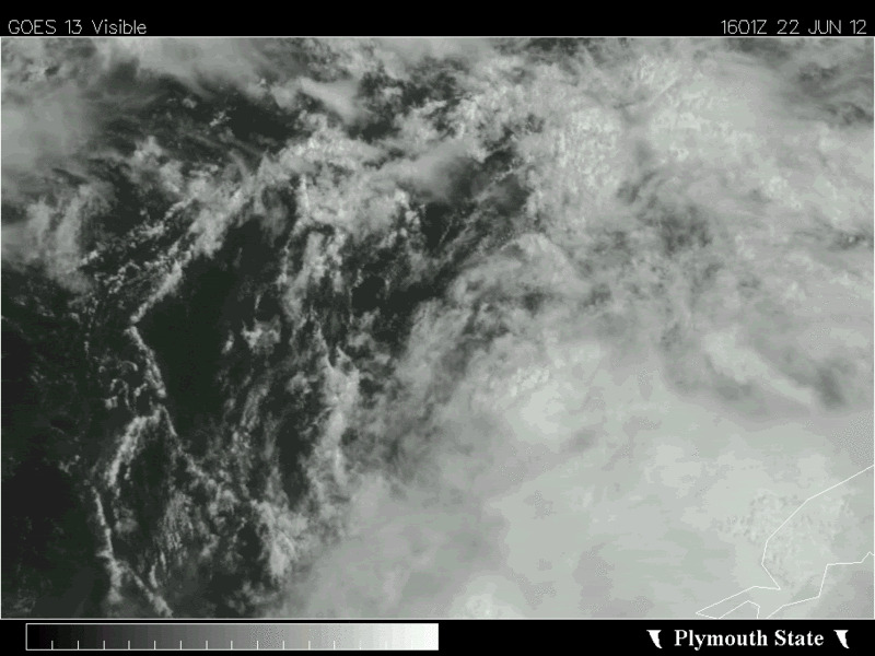
TropicalAnalystwx13 wrote:The system has made a lot of progress today. In my own non-professional opinion, I believe recon will find a tropical depression tomorrow afternoon.
[img]Image/img]
IF true, that's one heck of an ugly mess of a tropical depression..
0 likes
RIP Kobe Bryant
-
Evil Jeremy
- S2K Supporter
- Posts: 5463
- Age: 32
- Joined: Mon Apr 10, 2006 2:10 pm
- Location: Los Angeles, CA
Re: Re:
Kingarabian wrote:TropicalAnalystwx13 wrote:The system has made a lot of progress today. In my own non-professional opinion, I believe recon will find a tropical depression tomorrow afternoon.
[img]Image/img]
IF true, that's one heck of an ugly mess of a tropical depression..
Well, tomorrow afternoon is aprox 18 hours away, enough time for this to shape up.
0 likes
Frances 04 / Jeanne 04 / Katrina 05 / Wilma 05 / Fay 08 / Debby 12 / Andrea 13 / Colin 16 / Hermine 16 / Matthew 16 / Irma 17

-
TheShrimper
- Category 2

- Posts: 516
- Joined: Sun Aug 01, 2004 5:05 pm
Re:
NDG wrote:So far this is the best surface vorticity that 96L has spit out, perhaps it could become the dominant circulation.
http://i20.photobucket.com/albums/b245/ ... 840_an.gif
Where would you put that at NDG ?
0 likes
-
TeamPlayersBlue
- Category 5
- Posts: 3529
- Joined: Tue Feb 02, 2010 1:44 am
- Location: Denver/Applewood, CO
Interesting that you can see that vorticity spinning from almost the beginning of the loop. Look where it comes out of when the loop starts over and you can see part of it spinning underneath the clouds
0 likes
Personal Forecast Disclaimer:
The posts in this forum are NOT official forecast and should not be used as such. They are just the opinion of the poster and may or may not be backed by sound meteorological data. They are NOT endorsed by any professional institution or storm2k.org. For official information, please refer to the NHC and NWS products.
The posts in this forum are NOT official forecast and should not be used as such. They are just the opinion of the poster and may or may not be backed by sound meteorological data. They are NOT endorsed by any professional institution or storm2k.org. For official information, please refer to the NHC and NWS products.


European ensemble mean favors western Gulf solution, particularly South Texas.
http://raleighwx.americanwx.com/models/ ... SLP096.gif
http://raleighwx.americanwx.com/models/ ... SLP120.gif
http://raleighwx.americanwx.com/models/ ... SLP096.gif
http://raleighwx.americanwx.com/models/ ... SLP120.gif
0 likes
-
PrettyCreole

- Tropical Wave

- Posts: 5
- Joined: Mon May 07, 2012 1:31 pm
- Location: New Orleans, LA
Re: ATL: INVEST 96L - Discussion
I know that El Nino is suppose to kick in later on this year, but if this system becomes Debbie, does anyone on here think that this year may have as many storms as 2005???
0 likes
2005 Katrina Survivor
The posts in this forum are NOT official forecast and should not be used as such. They are just the opinion of the poster and may or may not be backed by sound meteorological data. They are NOT endorsed by any professional institution or storm2k.org. For official information, please refer to the NHC and NWS products.
The posts in this forum are NOT official forecast and should not be used as such. They are just the opinion of the poster and may or may not be backed by sound meteorological data. They are NOT endorsed by any professional institution or storm2k.org. For official information, please refer to the NHC and NWS products.


Re: ATL: INVEST 96L - Discussion
PrettyCreole wrote:I know that El Nino is suppose to kick in later on this year, but if this system becomes Debbie, does anyone on here think that this year may have as many storms as 2005???
No.
The odds of the Atlantic having 27 named systems again is slim to none.
0 likes
I'm no expert, everything I say should be taken with a large amount of salt. I could easily be very, very wrong.
~Zanthe Go Coyotes~
~Zanthe Go Coyotes~
Who is online
Users browsing this forum: No registered users and 21 guests