

OMG! The pictures are incredibile. I'm praying for you Floridians.
I do have a question. Are people evacuating?
If so, what is it like there since there is only one direction to head out?
It's a headache in my state, and we have 3 ways to go.
Please be safe people.
DEBBY: Florida, N Gulf Coast Preps/Obs
Moderator: S2k Moderators
Forum rules

The posts in this forum are NOT official forecasts and should not be used as such. They are just the opinion of the poster and may or may not be backed by sound meteorological data. They are NOT endorsed by any professional institution or STORM2K. For official information, please refer to products from the National Hurricane Center and National Weather Service.


Re: DEBBY: Florida, N Gulf Coast Preps/Obs
 PHOTO/BN9 Viewer Randy Scragg) Damage in Grand Hampton neighborhood in Tampa.
Debby's high winds crashed this tree onto a car in Sanibel Island

(PHOTO/BN9 Viewer Billy Tisko) Car under water water Belcher Road and 142nd Ave. in Largo
0 likes

PRELIMINARY LOCAL STORM REPORT
NATIONAL WEATHER SERVICE TALLAHASSEE FL
705 PM EDT MON JUN 25 2012
..TIME... ...EVENT... ...CITY LOCATION... ...LAT.LON...
..DATE... ....MAG.... ..COUNTY LOCATION..ST.. ...SOURCE....
..REMARKS..
0703 PM HEAVY RAIN 1 SW WOODVILLE 30.31N 84.25W
06/25/2012 E0.00 INCH LEON FL PUBLIC
OVER A FOOT OF WATER OVER AMHERST RD IN THE FOREST GROVE
SUBDIVISION. JEREMY RD. IMPASSABLE, WATER TO HOOD OF
TRUCK.
&&
$$
HARRIGAN
--------------------------------------------------------------------------------
000
NWUS52 KTAE 252259
LSRTAE
PRELIMINARY LOCAL STORM REPORT
NATIONAL WEATHER SERVICE TALLAHASSEE FL
658 PM EDT MON JUN 25 2012
..TIME... ...EVENT... ...CITY LOCATION... ...LAT.LON...
..DATE... ....MAG.... ..COUNTY LOCATION..ST.. ...SOURCE....
..REMARKS..
0602 PM HEAVY RAIN WOODVILLE 30.31N 84.25W
06/25/2012 M10.00 INCH LEON FL PUBLIC
SINCE 1 PM TODAY.
NATIONAL WEATHER SERVICE TALLAHASSEE FL
705 PM EDT MON JUN 25 2012
..TIME... ...EVENT... ...CITY LOCATION... ...LAT.LON...
..DATE... ....MAG.... ..COUNTY LOCATION..ST.. ...SOURCE....
..REMARKS..
0703 PM HEAVY RAIN 1 SW WOODVILLE 30.31N 84.25W
06/25/2012 E0.00 INCH LEON FL PUBLIC
OVER A FOOT OF WATER OVER AMHERST RD IN THE FOREST GROVE
SUBDIVISION. JEREMY RD. IMPASSABLE, WATER TO HOOD OF
TRUCK.
&&
$$
HARRIGAN
--------------------------------------------------------------------------------
000
NWUS52 KTAE 252259
LSRTAE
PRELIMINARY LOCAL STORM REPORT
NATIONAL WEATHER SERVICE TALLAHASSEE FL
658 PM EDT MON JUN 25 2012
..TIME... ...EVENT... ...CITY LOCATION... ...LAT.LON...
..DATE... ....MAG.... ..COUNTY LOCATION..ST.. ...SOURCE....
..REMARKS..
0602 PM HEAVY RAIN WOODVILLE 30.31N 84.25W
06/25/2012 M10.00 INCH LEON FL PUBLIC
SINCE 1 PM TODAY.
0 likes
-
Hurricane Mac

- Tropical Low

- Posts: 15
- Age: 40
- Joined: Sat Aug 18, 2007 7:33 pm
- Location: Sumter, SC
- Contact:
Re: DEBBY: Florida, N Gulf Coast Preps/Obs
Channel 4 (WJXT) in Jacksonville, FL has these images of the flood waters from the First Coast. Significant flooding in residential areas. They have received so much rain in between Debby & Beryl.
http://www.news4jax.com/news/-/475880/15228674/-/cpkce9z/-/index.html
http://www.news4jax.com/news/-/475880/15228674/-/cpkce9z/-/index.html
0 likes
I am no meteorologist, but I did study it at the University of Miami for 3 years before changing majors, so take everything with a ton of salt and believe just about nothing that I say. Check with the NHC and the pros for official predictions.
-
northjaxpro

- S2K Supporter

- Posts: 8900
- Joined: Mon Sep 27, 2010 11:21 am
- Location: Jacksonville, FL
BULLETIN - EAS ACTIVATION REQUESTED
FLASH FLOOD WARNING
NATIONAL WEATHER SERVICE JACKSONVILLE FL
914 PM EDT MON JUN 25 2012
THE NATIONAL WEATHER SERVICE IN JACKSONVILLE HAS ISSUED A
* FLASH FLOOD WARNING FOR...
NORTHERN ST. JOHNS COUNTY IN NORTHEAST FLORIDA
DUVAL COUNTY IN NORTHEAST FLORIDA
NASSAU COUNTY IN NORTHEAST FLORIDA
* UNTIL 1115 PM EDT
* AT 913 PM EDT...NATIONAL WEATHER SERVICE DOPPLER RADAR INDICATED
VERY HEAVY RAIN ASSOCIATED WITH TROPICAL RAIN BANDS OVER THE
WARNED AREA. RAINFALL RATES IN EXCESS OF 2 INCHES PER HOUR OVER
SATURATED AND FLOOD PRONE LOCATIONS WILL RESULT IN FLASH FLOODING
DURING THE NEXT FEW HOURS.
* LOCATIONS IN THE WARNING INCLUDE BUT ARE NOT LIMITED TO YULEE...
UNF...TALBOT ISLAND...SAN PABLO...SAN MARCO...RIVERSIDE...ORTEGA...
OCEANWAY...NORMANDY...NEPTUNE BEACH...RATLIFF...MAYPORT...LITTLE
TALBOT ISLAND...JACKSONVILLE INTERNATIONAL AIRPORT...JACKSONVILLE
BEACH...FORT CAROLINE...FERNANDINA BEACH...DOWNTOWN JACKSONVILLE...
CALLAHAN...BRYCEVILLE...ARLINGTON AND AMELIA CITY.
PRECAUTIONARY/PREPAREDNESS ACTIONS...
ADDITIONAL RAINFALL AMOUNTS OF 2 TO 5 INCHES ARE POSSIBLE IN THE
WARNED AREA THROUGH MIDNIGHT.
BE ESPECIALLY CAUTIOUS AT NIGHT WHEN IT IS HARDER TO RECOGNIZE THE
DANGERS OF FLOODING. IF FLASH FLOODING IS OBSERVED ACT QUICKLY. MOVE
UP TO HIGHER GROUND TO ESCAPE FLOOD WATERS. DO NOT STAY IN AREAS
SUBJECT TO FLOODING WHEN WATER BEGINS RISING.
MOST FLOOD DEATHS OCCUR IN AUTOMOBILES. NEVER DRIVE YOUR VEHICLE INTO
AREAS WHERE THE WATER COVERS THE ROADWAY. FLOOD WATERS ARE USUALLY
DEEPER THAN THEY APPEAR. JUST ONE FOOT OF FLOWING WATER IS POWERFUL
ENOUGH TO SWEEP VEHICLES OFF THE ROAD. WHEN ENCOUNTERING FLOODED
ROADS MAKE THE SMART CHOICE...TURN AROUND...DONT DROWN.
REPORT FLOODING TO THE NEAREST LAW ENFORCEMENT AGENCY OR YOUR COUNTY
EMERGENCY MANAGEMENT...OR YOU CAN ALSO CALL THE NATIONAL WEATHER
SERVICE IN JACKSONVILLE DIRECTLY AT 800-499-1594 TO REPORT FLOODING
0 likes
NEVER, EVER SAY NEVER in the tropics and weather in general, and most importantly, with life itself!!
________________________________________________________________________________________
Fay 2008 Beryl 2012 Debby 2012 Colin 2016 Hermine 2016 Julia 2016 Matthew 2016 Irma 2017 Dorian 2019
________________________________________________________________________________________
Fay 2008 Beryl 2012 Debby 2012 Colin 2016 Hermine 2016 Julia 2016 Matthew 2016 Irma 2017 Dorian 2019
-
cycloneye

- Admin

- Posts: 149291
- Age: 69
- Joined: Thu Oct 10, 2002 10:54 am
- Location: San Juan, Puerto Rico
Re: DEBBY: Florida, N Gulf Coast Preps/Obs
URGENT - IMMEDIATE BROADCAST REQUESTED
CIVIL EMERGENCY MESSAGE
WAKULLA COUNTY EMERGENCY MANAGEMENT
RELAYED BY NATIONAL WEATHER SERVICE TALLAHASSEE FL
913 PM EDT MON JUN 25 2012
THE FOLLOWING MESSAGE IS TRANSMITTED AT THE REQUEST OF THE
WAKULLA COUNTY EMERGENCY MANAGEMENT.
THERE IS A VOLUNTARY EVACUATION OF LOW-LYING AREAS AND LOCATIONS
NEAR RIVERS...STREAMS...AND CREEKS IN WAKULLA COUNTY. A SHELTER
HAS BEEN OPENED AT THE CRAWFORDVILLE ELEMENTARY SCHOOL AT 379
ARRAN ROAD.
PEOPLE WHO DECIDE TO EVACUATE LOW LYING AREAS SHOULD USE EXTREME
CAUTION...AND SHOULD NOT CROSS FLOODED ROADWAYS. OTHERWISE...
TRAVEL ACROSS WAKULLA COUNTY IS NOT ADVISED. NUMEROUS ROADS ARE
UNDER WATER...SEVERAL FEET DEEP IN SOME LOCATIONS.
A FLASH FLOOD EMERGENCY IS IN EFFECT AND IF YOU SEE RAPIDLY
RISING WATER YOU SHOULD SEEK HIGHER GROUND IMMEDIATELY!
$$
08
0 likes
Visit the Caribbean-Central America Weather Thread where you can find at first post web cams,radars
and observations from Caribbean basin members Click Here
and observations from Caribbean basin members Click Here
-
Dave

- Retired Staff

- Posts: 13442
- Age: 75
- Joined: Tue Aug 01, 2006 3:57 pm
- Location: Milan Indiana
- Contact:
BULLETIN - EAS ACTIVATION REQUESTED
FLASH FLOOD WARNING
NATIONAL WEATHER SERVICE TALLAHASSEE FL
1105 PM EDT MON JUN 25 2012
THE NATIONAL WEATHER SERVICE IN TALLAHASSEE HAS EXTENDED THE
* FLASH FLOOD EMERGENCY FOR...
NORTHEASTERN FRANKLIN COUNTY IN FLORIDA...
SOUTHEASTERN LIBERTY COUNTY IN FLORIDA...
WAKULLA COUNTY IN FLORIDA...
* UNTIL 515 AM EDT TUESDAY
* AT 1101 PM EDT...EXTREME FLASH FLOODING CONTINUES ACROSS WAKULLA
COUNTY...PARTICULARLY ALONG THE SOPCHOPPY RIVER INCLUDING THE TOWN
OF SOPCHOPPY. WATER HAS ALREADY ENTERED HOMES IN SOPCHOPPY AND THE
SOPCHOPPY RIVER IS EXPECTED TO CREST FAR ABOVE ITS PREVIOUS RECORD
CREST. SIGNIFICANT FLASH FLOODING IS ALSO LIKELY OCCURRING ACROSS
RURAL PORTIONS OF SOUTHEASTERN LIBERTY AND NORTHEASTERN FRANKLIN
COUNTIES.
THIS IS A LIFE THREATENING SITUATION AND MANY AREAS THAT HAVE NOT
FLOODED IN RECENT MEMORY WILL FLOOD TONIGHT.
* LOCATIONS IN THE WARNING INCLUDE BUT ARE NOT LIMITED TO SAINT MARKS
AND CRAWFORDVILLE
PRECAUTIONARY/PREPAREDNESS ACTIONS...
BE ESPECIALLY CAUTIOUS AT NIGHT WHEN IT IS HARDER TO RECOGNIZE THE
DANGERS OF FLOODING. IF FLASH FLOODING IS OBSERVED ACT QUICKLY. MOVE
UP TO HIGHER GROUND TO ESCAPE FLOOD WATERS. DO NOT STAY IN AREAS
SUBJECT TO FLOODING WHEN WATER BEGINS RISING.
DO NOT UNDERESTIMATE THE POWER OF FLOOD WATERS. ONLY A FEW INCHES OF
RAPIDLY FLOWING WATER CAN QUICKLY CARRY AWAY YOUR VEHICLE.
0 likes
This post is NOT AN OFFICIAL FORECAST and should not be used as such. It is just the opinion of the poster and may or may not be backed by sound meteorological data. It is NOT endorsed by any professional institution including storm2k.org. For Official Information please refer to the NHC and NWS products.
PRELIMINARY LOCAL STORM REPORT
NATIONAL WEATHER SERVICE JACKSONVILLE FL
1049 PM EDT MON JUN 25 2012
..TIME... ...EVENT... ...CITY LOCATION... ...LAT.LON...
..DATE... ....MAG.... ..COUNTY LOCATION..ST.. ...SOURCE....
..REMARKS..
1044 PM FLOOD 2 WSW MACCLENNY 30.26N 82.16W
06/25/2012 BAKER FL BROADCAST MEDIA
INTERSTATE 10 WESTBOUND AT MILE MARKER 324 NEAR GLEN ST.
MARY CLOSED DUE TO FLOODING.
PRELIMINARY LOCAL STORM REPORT
NATIONAL WEATHER SERVICE JACKSONVILLE FL
1044 PM EDT MON JUN 25 2012
..TIME... ...EVENT... ...CITY LOCATION... ...LAT.LON...
..DATE... ....MAG.... ..COUNTY LOCATION..ST.. ...SOURCE....
..REMARKS..
1030 PM FLOOD 2 WSW SANDERSON 30.24N 82.30W
06/25/2012 BAKER FL BROADCAST MEDIA
INTERSTATE 10 EASTBOUND AT MILE MARKER 317 NEAR SANDERSON
CLOSED DUE TO FLOODING.
PRELIMINARY LOCAL STORM REPORT
NATIONAL WEATHER SERVICE JACKSONVILLE FL
1001 PM EDT MON JUN 25 2012
..TIME... ...EVENT... ...CITY LOCATION... ...LAT.LON...
..DATE... ....MAG.... ..COUNTY LOCATION..ST.. ...SOURCE....
..REMARKS..
0900 PM FLOOD 2 NNW JASPER 30.55N 82.98W
06/25/2012 HAMILTON FL LAW ENFORCEMENT
U.S. HIGHWAY 129 AT COUNTY ROAD 150 IN JASPER CLOSED DUE
TO FLOODING.
PUBLIC INFORMATION STATEMENT...CORRECTED HEADLINE
NATIONAL WEATHER SERVICE TAMPA BAY RUSKIN FL
958 PM EDT MON JUN 25 2012
...NWS DAMAGE SURVEY FOR 06/24/2012 TORNADO EVENTS...
.OVERVIEW...TROPICAL STORM DEBBY CAUSED 7 TORNADOS ACROSS WEST
CENTRAL AND SOUTHWEST FLORIDA ON SUNDAY JUNE 24.
.REFERENCE TORNADO...HARDEE COUNTY EAST OF BOWLING GREEN
RATING: EF-0
ESTIMATED PEAK WIND: 75-85 MPH
PATH LENGTH /STATUTE/: 15.6 MILES
PATH WIDTH /MAXIMUM/: 100 YARDS
FATALITIES: 0
INJURIES: 0
START DATE: JUN 24 2012
START TIME: 1015 AM EDT
START LOCATION: 8 SW ZOLFO SPRINGS / HARDEE COUNTY / FL
START LAT/LON: 27.4000 / -81.8700
END DATE: JUN 24 2012
END TIME: 1030 AM EDT
END LOCATION: 3 WEST BOWLING GREEN / HARDEE COUNTY / FL
END_LAT/LON: 27.6300 / -82.8800
SURVEY SUMMARY: SPORADIC DAMAGE TO ORANGE GROOVES ALONG PATH. ONE
BARN RECEIVED MODERATE DAMAGE AND TRACTOR DAMAGED.
.REFERENCE TORNADO...VENUS TORNADO
RATING: EF-2
ESTIMATED PEAK WIND: 115-120 MPH
PATH LENGTH /STATUTE/: 3.6 MILES
PATH WIDTH /MAXIMUM/: 150 YARDS
FATALITIES: 1
INJURIES: 1
START DATE: JUN 24 2012
START TIME: 1223 PM EDT
START LOCATION: 2 SSW VENUS / HIGHLANDS / FL
START LAT/LON: 27.0400 / -81.3600
END DATE: JUN 24 2012
END TIME: 1229 PM EDT
END LOCATION: 2 NNW VENUS / HIGHLANDS / FL
END_LAT/LON: 27.0900 / -82.3600
SURVEY SUMMARY: THE 32-YEAR-OLD VENUS MOTHER WHO DIED FROM
INJURIES AFTER A TORNADO FLUNG HER 200 FEET AWAY FROM HER
HOME WAS FOUND CRADLING HER 3-YEAR-OLD DAUGHTER IN HER ARMS.
SEE COMPLETE HERNANDO TODAY ARTICLE AT HTTP://BIT.LY/KXFQQV
.REFERENCE TORNADO...LAKE JUNE TORNADO
RATING: EF-1
ESTIMATED PEAK WIND: 95-100 MPH
PATH LENGTH /STATUTE/: 5.0 MILES
PATH WIDTH /MAXIMUM/: 100 YARDS
FATALITIES: 0
INJURIES: 0
START DATE: JUN 24 2012
START TIME: 323 PM EDT
START LOCATION: 5 WSW LAKE PLACID / HIGHLANDS / FL
START LAT/LON: 27.2700 / -81.4400
END DATE: JUN 24 2012
END TIME: 330 PM EDT
END LOCATION: 3 NNW LAKE PLACID
END_LAT/LON: 27.3300 / -82.3900
SURVEY SUMMARY: PUBLIC VIDEO OF THIS TORNADO. WATCHED IT VISUALLY
FOR 4 MINUTES AS IT HIT POWER LINES AND KICKED UP DEBRIS. THE 600
BLOCK OF LAKE JUNE ROAD ON THE NORTH SIDE OF THE LAKE HAD DAMAGED
HOMES.
.REFERENCE TORNADO...THOMPSON NURSERY ROAD
RATING: EF-0
ESTIMATED PEAK WIND: 75-80 MPH
PATH LENGTH /STATUTE/: 0.25 MILES
PATH WIDTH /MAXIMUM/: 25 YARDS
FATALITIES: 0
INJURIES: 0
START DATE: JUN 24 2012
START TIME: 655 PM EDT
START LOCATION: 5 SE WINTER HAVEN / POLK / FL
START LAT/LON: 27.9600 / -81.6800
END DATE: JUN 24 2012
END TIME: 656 PM EDT
END LOCATION: 5 SE WINTER HAVEN / POLK / FL
END_LAT/LON: 27.9700 / -81.6700
SURVEY SUMMARY: TRAINED SPOTTER REPORTED MINOR DAMAGE AS A
FUNNEL CLOUD BRIEFLY TOUCHED DOWN NEAR THE INTERSECTION OF
THOMPSON NURSERY ROAD AND STATE ROAD 653.
.REFERENCE TORNADO...EAST WINTER HAVEN TORNADO
RATING: EF-2
ESTIMATED PEAK WIND: 115-120 MPH
PATH LENGTH /STATUTE/: 7.0 MILES
PATH WIDTH /MAXIMUM/: 150 YARDS
FATALITIES: 0
INJURIES: 1
START DATE: JUN 24 2012
START TIME: 804 PM EDT
START LOCATION: 5 SE WINTER HAVEN / POLK / FL
START LAT/LON: 27.9500 / -81.6800
END DATE: JUN 24 2012
END TIME: 812 PM EDT
END LOCATION: 3 NE WINTER HAVEN / POLK / FL
END_LAT/LON: 28.0400 / -81.6800
SURVEY SUMMARY: POLK COUNTY EMERGENCY MANAGMENT REPORTED A
NARROW PATH OF DAMAGE TO INCLUDE DAMAGE TO AT LEAST 17 HOMES.
A BIG BOX STORE LOST PART OF THE ROOF. POWER LINES DOWN AND
ROAD BLOCKED ON DUNDEE ROAD. THE SWISS MOBILE HOME PARK AT
END OF THE TORNADO PATH NEED TO TARP MANY HOMES DUE TO ROOF
DAMAGE.
.REFERENCE TORNADO...PASS-A-GRILLE TORNADO
RATING: EF-1
ESTIMATED PEAK WIND: 80-85 MPH
PATH LENGTH /STATUTE/: 3.3 MILES
PATH WIDTH /MAXIMUM/: 50 YARDS
FATALITIES: 0
INJURIES: 0
START DATE: JUN 24 2012
START TIME: 821 PM EDT
START LOCATION: PASS-A-GRILLE / PINELLAS / FL
START LAT/LON: 27.7000 / -82.7400
END DATE: JUN 24 2012
END TIME: 825 PM EDT
END LOCATION: 3 NE PASS-A-GRILLE / PINELLAS / FL
END_LAT/LON: 27.7400 / -82.7200
SURVEY SUMMARY: WATERSPOUT MOVED ONSHORE AS A TORNADO AND
DESTROYED THE TOP FLOOR OF A TOURIST RENTAL BUILDING. NO ONE
WAS IN THE TOP UNITS AND NO INJURIES WERER REPORTED IN THE
BOTTOM UNITS. THE TORNADO CAUSED MODERATE DAMAGE TO THE
PASS-A-GRILLE MARINA.
.REFERENCE TORNADO...SOUTH LECANTO ROAD TORNADO
RATING: EF-1
ESTIMATED PEAK WIND: 100-105 MPH
PATH LENGTH /STATUTE/: 5 MILES
PATH WIDTH /MAXIMUM/: 100 YARDS
FATALITIES: 0
INJURIES: 0
START DATE: JUN 24 2012
START TIME: 957 PM EDT
START LOCATION: 3 SE SUGARMILL WOODS
START LAT/LON: 28.7000 / -82.4700
END DATE: JUN 24 2012
END TIME: 1003 PM EDT
END LOCATION: 5 NW SUGARMILL WOODS
END_LAT/LON: 28.7700 / -82.4500
SURVEY SUMMARY: NARROW DAMAGE PATH. 20 HOMES WITH MINOR DAMAGE.
2 MOBILE HOMES DESTROYED AND ONE BLOCK HOME WITH MAJOR DAMAGE.
NUMEROUS TREES DOWNED.
EF SCALE: THE ENHANCED FUJITA SCALE CLASSIFIES TORNADOES INTO
THE FOLLOWING CATEGORIES.
EF0...WEAK......65 TO 85 MPH
EF1...WEAK......86 TO 110 MPH
EF2...STRONG....111 TO 135 MPH
EF3...STRONG....136 TO 165 MPH
EF4...VIOLENT...166 TO 200MPH
EF5...VIOLENT...>200MPH
NOTE:
THE INFORMATION IN THIS STATEMENT IS PRELIMINARY AND SUBJECT TO
CHANGE PENDING FINAL REVIEW OF THE EVENTS AND PUBICATION IN
NWS STORM DATA.
$$
NOAH
NATIONAL WEATHER SERVICE JACKSONVILLE FL
1049 PM EDT MON JUN 25 2012
..TIME... ...EVENT... ...CITY LOCATION... ...LAT.LON...
..DATE... ....MAG.... ..COUNTY LOCATION..ST.. ...SOURCE....
..REMARKS..
1044 PM FLOOD 2 WSW MACCLENNY 30.26N 82.16W
06/25/2012 BAKER FL BROADCAST MEDIA
INTERSTATE 10 WESTBOUND AT MILE MARKER 324 NEAR GLEN ST.
MARY CLOSED DUE TO FLOODING.
PRELIMINARY LOCAL STORM REPORT
NATIONAL WEATHER SERVICE JACKSONVILLE FL
1044 PM EDT MON JUN 25 2012
..TIME... ...EVENT... ...CITY LOCATION... ...LAT.LON...
..DATE... ....MAG.... ..COUNTY LOCATION..ST.. ...SOURCE....
..REMARKS..
1030 PM FLOOD 2 WSW SANDERSON 30.24N 82.30W
06/25/2012 BAKER FL BROADCAST MEDIA
INTERSTATE 10 EASTBOUND AT MILE MARKER 317 NEAR SANDERSON
CLOSED DUE TO FLOODING.
PRELIMINARY LOCAL STORM REPORT
NATIONAL WEATHER SERVICE JACKSONVILLE FL
1001 PM EDT MON JUN 25 2012
..TIME... ...EVENT... ...CITY LOCATION... ...LAT.LON...
..DATE... ....MAG.... ..COUNTY LOCATION..ST.. ...SOURCE....
..REMARKS..
0900 PM FLOOD 2 NNW JASPER 30.55N 82.98W
06/25/2012 HAMILTON FL LAW ENFORCEMENT
U.S. HIGHWAY 129 AT COUNTY ROAD 150 IN JASPER CLOSED DUE
TO FLOODING.
PUBLIC INFORMATION STATEMENT...CORRECTED HEADLINE
NATIONAL WEATHER SERVICE TAMPA BAY RUSKIN FL
958 PM EDT MON JUN 25 2012
...NWS DAMAGE SURVEY FOR 06/24/2012 TORNADO EVENTS...
.OVERVIEW...TROPICAL STORM DEBBY CAUSED 7 TORNADOS ACROSS WEST
CENTRAL AND SOUTHWEST FLORIDA ON SUNDAY JUNE 24.
.REFERENCE TORNADO...HARDEE COUNTY EAST OF BOWLING GREEN
RATING: EF-0
ESTIMATED PEAK WIND: 75-85 MPH
PATH LENGTH /STATUTE/: 15.6 MILES
PATH WIDTH /MAXIMUM/: 100 YARDS
FATALITIES: 0
INJURIES: 0
START DATE: JUN 24 2012
START TIME: 1015 AM EDT
START LOCATION: 8 SW ZOLFO SPRINGS / HARDEE COUNTY / FL
START LAT/LON: 27.4000 / -81.8700
END DATE: JUN 24 2012
END TIME: 1030 AM EDT
END LOCATION: 3 WEST BOWLING GREEN / HARDEE COUNTY / FL
END_LAT/LON: 27.6300 / -82.8800
SURVEY SUMMARY: SPORADIC DAMAGE TO ORANGE GROOVES ALONG PATH. ONE
BARN RECEIVED MODERATE DAMAGE AND TRACTOR DAMAGED.
.REFERENCE TORNADO...VENUS TORNADO
RATING: EF-2
ESTIMATED PEAK WIND: 115-120 MPH
PATH LENGTH /STATUTE/: 3.6 MILES
PATH WIDTH /MAXIMUM/: 150 YARDS
FATALITIES: 1
INJURIES: 1
START DATE: JUN 24 2012
START TIME: 1223 PM EDT
START LOCATION: 2 SSW VENUS / HIGHLANDS / FL
START LAT/LON: 27.0400 / -81.3600
END DATE: JUN 24 2012
END TIME: 1229 PM EDT
END LOCATION: 2 NNW VENUS / HIGHLANDS / FL
END_LAT/LON: 27.0900 / -82.3600
SURVEY SUMMARY: THE 32-YEAR-OLD VENUS MOTHER WHO DIED FROM
INJURIES AFTER A TORNADO FLUNG HER 200 FEET AWAY FROM HER
HOME WAS FOUND CRADLING HER 3-YEAR-OLD DAUGHTER IN HER ARMS.
SEE COMPLETE HERNANDO TODAY ARTICLE AT HTTP://BIT.LY/KXFQQV
.REFERENCE TORNADO...LAKE JUNE TORNADO
RATING: EF-1
ESTIMATED PEAK WIND: 95-100 MPH
PATH LENGTH /STATUTE/: 5.0 MILES
PATH WIDTH /MAXIMUM/: 100 YARDS
FATALITIES: 0
INJURIES: 0
START DATE: JUN 24 2012
START TIME: 323 PM EDT
START LOCATION: 5 WSW LAKE PLACID / HIGHLANDS / FL
START LAT/LON: 27.2700 / -81.4400
END DATE: JUN 24 2012
END TIME: 330 PM EDT
END LOCATION: 3 NNW LAKE PLACID
END_LAT/LON: 27.3300 / -82.3900
SURVEY SUMMARY: PUBLIC VIDEO OF THIS TORNADO. WATCHED IT VISUALLY
FOR 4 MINUTES AS IT HIT POWER LINES AND KICKED UP DEBRIS. THE 600
BLOCK OF LAKE JUNE ROAD ON THE NORTH SIDE OF THE LAKE HAD DAMAGED
HOMES.
.REFERENCE TORNADO...THOMPSON NURSERY ROAD
RATING: EF-0
ESTIMATED PEAK WIND: 75-80 MPH
PATH LENGTH /STATUTE/: 0.25 MILES
PATH WIDTH /MAXIMUM/: 25 YARDS
FATALITIES: 0
INJURIES: 0
START DATE: JUN 24 2012
START TIME: 655 PM EDT
START LOCATION: 5 SE WINTER HAVEN / POLK / FL
START LAT/LON: 27.9600 / -81.6800
END DATE: JUN 24 2012
END TIME: 656 PM EDT
END LOCATION: 5 SE WINTER HAVEN / POLK / FL
END_LAT/LON: 27.9700 / -81.6700
SURVEY SUMMARY: TRAINED SPOTTER REPORTED MINOR DAMAGE AS A
FUNNEL CLOUD BRIEFLY TOUCHED DOWN NEAR THE INTERSECTION OF
THOMPSON NURSERY ROAD AND STATE ROAD 653.
.REFERENCE TORNADO...EAST WINTER HAVEN TORNADO
RATING: EF-2
ESTIMATED PEAK WIND: 115-120 MPH
PATH LENGTH /STATUTE/: 7.0 MILES
PATH WIDTH /MAXIMUM/: 150 YARDS
FATALITIES: 0
INJURIES: 1
START DATE: JUN 24 2012
START TIME: 804 PM EDT
START LOCATION: 5 SE WINTER HAVEN / POLK / FL
START LAT/LON: 27.9500 / -81.6800
END DATE: JUN 24 2012
END TIME: 812 PM EDT
END LOCATION: 3 NE WINTER HAVEN / POLK / FL
END_LAT/LON: 28.0400 / -81.6800
SURVEY SUMMARY: POLK COUNTY EMERGENCY MANAGMENT REPORTED A
NARROW PATH OF DAMAGE TO INCLUDE DAMAGE TO AT LEAST 17 HOMES.
A BIG BOX STORE LOST PART OF THE ROOF. POWER LINES DOWN AND
ROAD BLOCKED ON DUNDEE ROAD. THE SWISS MOBILE HOME PARK AT
END OF THE TORNADO PATH NEED TO TARP MANY HOMES DUE TO ROOF
DAMAGE.
.REFERENCE TORNADO...PASS-A-GRILLE TORNADO
RATING: EF-1
ESTIMATED PEAK WIND: 80-85 MPH
PATH LENGTH /STATUTE/: 3.3 MILES
PATH WIDTH /MAXIMUM/: 50 YARDS
FATALITIES: 0
INJURIES: 0
START DATE: JUN 24 2012
START TIME: 821 PM EDT
START LOCATION: PASS-A-GRILLE / PINELLAS / FL
START LAT/LON: 27.7000 / -82.7400
END DATE: JUN 24 2012
END TIME: 825 PM EDT
END LOCATION: 3 NE PASS-A-GRILLE / PINELLAS / FL
END_LAT/LON: 27.7400 / -82.7200
SURVEY SUMMARY: WATERSPOUT MOVED ONSHORE AS A TORNADO AND
DESTROYED THE TOP FLOOR OF A TOURIST RENTAL BUILDING. NO ONE
WAS IN THE TOP UNITS AND NO INJURIES WERER REPORTED IN THE
BOTTOM UNITS. THE TORNADO CAUSED MODERATE DAMAGE TO THE
PASS-A-GRILLE MARINA.
.REFERENCE TORNADO...SOUTH LECANTO ROAD TORNADO
RATING: EF-1
ESTIMATED PEAK WIND: 100-105 MPH
PATH LENGTH /STATUTE/: 5 MILES
PATH WIDTH /MAXIMUM/: 100 YARDS
FATALITIES: 0
INJURIES: 0
START DATE: JUN 24 2012
START TIME: 957 PM EDT
START LOCATION: 3 SE SUGARMILL WOODS
START LAT/LON: 28.7000 / -82.4700
END DATE: JUN 24 2012
END TIME: 1003 PM EDT
END LOCATION: 5 NW SUGARMILL WOODS
END_LAT/LON: 28.7700 / -82.4500
SURVEY SUMMARY: NARROW DAMAGE PATH. 20 HOMES WITH MINOR DAMAGE.
2 MOBILE HOMES DESTROYED AND ONE BLOCK HOME WITH MAJOR DAMAGE.
NUMEROUS TREES DOWNED.
EF SCALE: THE ENHANCED FUJITA SCALE CLASSIFIES TORNADOES INTO
THE FOLLOWING CATEGORIES.
EF0...WEAK......65 TO 85 MPH
EF1...WEAK......86 TO 110 MPH
EF2...STRONG....111 TO 135 MPH
EF3...STRONG....136 TO 165 MPH
EF4...VIOLENT...166 TO 200MPH
EF5...VIOLENT...>200MPH
NOTE:
THE INFORMATION IN THIS STATEMENT IS PRELIMINARY AND SUBJECT TO
CHANGE PENDING FINAL REVIEW OF THE EVENTS AND PUBICATION IN
NWS STORM DATA.
$$
NOAH
0 likes
-
cycloneye
- Admin
- Posts: 149291
- Age: 69
- Joined: Thu Oct 10, 2002 10:54 am
- Location: San Juan, Puerto Rico
Re: DEBBY: Florida, N Gulf Coast Preps/Obs
Red Cross opens shelter at Florida High in Leon County
6:25 PM, Jun 25, 2012
The Capital Area Chapter of the American Red Cross opened a shelter at 6 p.m. today at the Florida State University High School (Florida High), 3000 School House Road off of Capital Circle Southeast, according to a news release from Leon County.
The Florida High shelter has been designated as a pet-friendly shelter for this event only, according to the release. Pet owners should bring veterinarian records as well as food and medicine or other essential items needed to care for their pets.
Those evacuating to the shelter should bring prescription medications, copies of important documents, blankets, baby items and other vital supplies.
The shelter may become crowded, therefore, the Red Cross asks that you do not bring any unnecessary items. This shelter will remain open as needed.
Official updates can be found on the Leon County Emergency Information Portal
(EIP) at http://www.LeonCountyFL.gov/ei/ .
Leon County Emergency Management is advising that residents to monitor the latest forecasts and be prepared to take necessary precautions to protect life
and property. Drivers should use caution and adhere to any official signage.
The National Weather Service also warns that residents should not drive cars through flooded areas and that if they see flood waters to turn around and find another route.
Residents are also encouraged not to attempt to walk through floodwaters. Any and all flood water should be considered to be contaminated. Do not allow children to play in, wade through or swim in flood water.
Residents requiring more information or assistance should call Leon County Emergency Management at (850) 488-5921.
0 likes
Visit the Caribbean-Central America Weather Thread where you can find at first post web cams,radars
and observations from Caribbean basin members Click Here
and observations from Caribbean basin members Click Here
Voluntary evacuation issued near Black Creek
Officials: Black Creek could reach 22 feet
CLAY COUNTY, Fla. - A voluntary evacuation notice has been issued for residents living near the Black Creek in Clay County as the creek rises due to rainfall from Tropical Storm Debby.
Late Monday, a Local State of Emergency was declared in Clay County, as the Black Creek was 5.5 feet above flood stage.
A shelter was being opened at Middleburg High School at 3750 County Road 220.
Sandbags and sand would be available at Fire Station 14 at 4003 Everett Avenue and Fire Station 22 at 5995 Pine Avenue.
Residents needed assistance can call the Emergency Operations hotline at 904-248-7703.
http://www.news4jax.com/weather/Volunta ... index.html
0 likes
-
CrazyC83
- Professional-Met

- Posts: 34315
- Joined: Tue Mar 07, 2006 11:57 pm
- Location: Deep South, for the first time!
Re: DEBBY: Florida, N Gulf Coast Preps/Obs
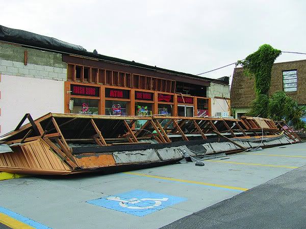
Map of all rotations (NOT tornado tracks necessarily) from Debby over the weekend, mostly from Sunday's outbreak, from the SPC site.

0 likes
-
thetruesms

- Professional-Met
- Posts: 844
- Age: 42
- Joined: Thu Aug 16, 2007 1:14 pm
- Location: Tallahasee, FL
- Contact:


PRELIMINARY LOCAL STORM REPORT
NATIONAL WEATHER SERVICE JACKSONVILLE FL
755 AM EDT TUE JUN 26 2012
..TIME... ...EVENT... ...CITY LOCATION... ...LAT.LON...
..DATE... ....MAG.... ..COUNTY LOCATION..ST.. ...SOURCE....
..REMARKS..
0754 AM FLOOD 2 S WOODBINE 30.93N 81.72W
06/26/2012 CAMDEN GA PUBLIC
PUBLIC REPORT OF HOUSE SURROUNDED BY WATER ON THRIFT ROAD
2 MILES SOUTH OF WOODBINE.
0 likes
-
Terry
- S2K Supporter
- Posts: 1450
- Joined: Wed Aug 11, 2004 8:25 pm
- Location: Lakeland and Anna Maria Island, FL
- Contact:
Re: DEBBY: Florida, N Gulf Coast Preps/Obs
We are not suffering anything like the flooded out areas in North FL or the rivers, but it hasn't been smooth sailing, either. Stay safe, peeps!
Down the street from me in Holmes Beach, FL on Anna Maria Island. This happened in the wee hours of Monday a.m.
Friend's dock just before high tide yesterday. We really haven't seen canal flooding like this since Elena. Many are saying it's more like an even back in the 60's.

Typical road at the North end of the island yesterday.. even at low tide with only a few drops of rain.

The beach erosion has been like nothing I've seen. This was yesterday and is one of a few turtle nests remaining.

Down the street from me in Holmes Beach, FL on Anna Maria Island. This happened in the wee hours of Monday a.m.
Friend's dock just before high tide yesterday. We really haven't seen canal flooding like this since Elena. Many are saying it's more like an even back in the 60's.
Typical road at the North end of the island yesterday.. even at low tide with only a few drops of rain.
The beach erosion has been like nothing I've seen. This was yesterday and is one of a few turtle nests remaining.
0 likes

Re: DEBBY: Florida, N Gulf Coast Preps/Obs
Flooding Continues—Evacuation Area Extended
New Port Richey, Fla., -- Pasco County’s evacuation order has been extended for communities at risk to flooding between the Anclote and Pithlachascotee Rivers. The boundaries are as follows:
o The western boundary of the evacuation area is the Anclote River/Thys Rd.
o The eastern boundary of the evacuation is Little Rd.
o The northern boundary is Plathe Rd.
o The southern boundary begins on Perrine Ranch Road and runs east to the intersection of Perrine Ranch Road, turns north on Seven Springs Boulevard, then runs east along Mitchell Ranch Road and continues east on S.R. 54 to the intersection of S.R. 54 and Little Rd.
o The evacuation order also includes other locations ordered evacuated by local authorities due to conditions posing a threat to life, health or safety.
Communities located in the area need to evacuate and emergency responders are arriving by boat and vehicles to assist residents.
0 likes


Re: DEBBY: Florida, N Gulf Coast Preps/Obs
Black Creek in Middleburg Fl is forecast to hit 25 feet, just short of the all time record of 25.3 feet recorded in 1919.
Flood stage is 16 feet.
I live near a conservation area flood plain that drains into a branch of Black Creek. It has been flooded to say the least. Usually bone dry, has 3-4 feet of water, but Im in no flood danger at least. It would take a thousand year flood to get my house lol.... (lets hope this isn't a 1000 year flood)
0 likes
Who is online
Users browsing this forum: No registered users and 73 guests