ozonepete wrote:wxman57 wrote:Debby's best days are way behind it. It's merged with the cold front and is ingesting plenty of dry air as it accelerates up the front into higher and higher shear. NHC will probably issue the final advisory this morning or they may wait until this afternoon. Bones says it's time to call this one. And he says he's looking forward to a nice [b]quiet[/b] 4th of July week.
Always nice to see Bones but he may be replaced by Lazarus soon. I agree its got a tough road ahead to re-strengthen, but for clarification, the latest HPC surface analysis and their forecast charts show Debby is not merged with the front (it's a stationary front now) and isn't forecast to merge with it either.
Here's the HPC?NCEP loop (for those who don't know, all TC positions are done in cooperation with the NHC):
http://www.hpc.ncep.noaa.gov/basicwx/day0-7loop.html
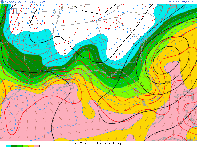
Just because the met didn't indicate that they'd merged, doesn't mean it isn't so. They probably kept the front away from Debby because the NHC hadn't declared it frontal yet. But I can clearly see that it's part of the front now. The front was incorrectly analyzed as being in southern Georgia when it's actually south to near Tampa now. Dew points are in the mid 60s down to the north-central FL peninsula. That's not MT air, it's behind the front.
My current analysis (below) indicates that the cold front is not in Georgia, it's well south into central Florida. The wind shift has just about reached Tampa, but the mid 60s dew points lag a bit behind the front. The frontal boundary clearly connects into what's left of Debby - it's not way off to the north.


