Texas Summer 2012

U.S. & Caribbean Weather Discussions and Severe Weather Events

Moderator: S2k Moderators

Forum rules

The posts in this forum are NOT official forecast and should not be used as such. They are just the opinion of the poster and may or may not be backed by sound meteorological data. They are NOT endorsed by any professional institution or STORM2K.

Help Support Storm2K
Message
Author
User avatar
Ntxw
Storm2k Moderator
Storm2k Moderator
Posts: 22731
Joined: Wed Oct 21, 2009 6:34 pm
Location: DFW, Texas

#221 Postby Ntxw » Tue Jun 26, 2012 4:35 pm

Pockets of 110+ around Vernon, Seymour, and Laredo Texas. Everyone else is baking between 100-108. Word is there is a mass gathering at an undisclosed icebox at PWC demanding El Nino from the chief of staff and removal of the cockroach death ridge.

Image

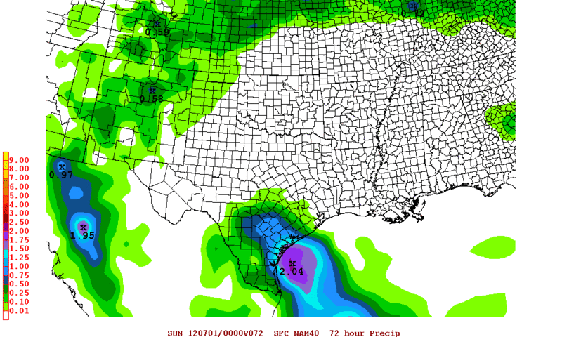
There's still a lot of instability hugging the coast. I still question initiation in other areas but maybe outflow from the couple supercells in SE TX might do it.

Image
0 likes   
The above post and any post by Ntxw is NOT an official forecast and should not be used as such. It is just the opinion of the poster and may or may not be backed by sound meteorological data. It is NOT endorsed by any professional institution including Storm2k. For official information, please refer to NWS products.

  Help support Storm2K!
Help Support Storm2K

weatherdude1108
Category 5
Category 5
Posts: 4228
Joined: Tue Dec 13, 2011 1:04 pm
Location: Northwest Austin/Cedar Park, TX

#222 Postby weatherdude1108 » Tue Jun 26, 2012 4:40 pm

Plenty of fuel out there to aid in the growth of whatever forms in this unstable environment! 8-)
0 likes   

User avatar
Portastorm
Storm2k Moderator
Storm2k Moderator
Posts: 9914
Age: 62
Joined: Fri Jul 11, 2003 9:16 am
Location: Round Rock, TX
Contact:

Re: Texas Summer 2012

#223 Postby Portastorm » Tue Jun 26, 2012 4:46 pm

RECORD EVENT REPORT
NATIONAL WEATHER SERVICE AUSTIN/SAN ANTONIO, TX
423 PM CDT TUE JUN 26 2012

...RECORD HIGH TEMPERATURE SET AT AUSTIN CAMP MABRY...

A RECORD HIGH TEMPERATURE OF 109 DEGREES WAS SET AT AUSTIN
CAMP MABRY THIS AFTERNOON. THIS BREAKS THE PREVIOUS RECORD
HIGH OF 105 DEGREES SET IN 2009.
0 likes   
Any forecasts under my name are to be taken with a grain of salt. Get your best forecasts from the National Weather Service and National Hurricane Center.

User avatar
gboudx
S2K Supporter
S2K Supporter
Posts: 4080
Joined: Thu Sep 04, 2003 1:39 pm
Location: Rockwall, Tx but from Harvey, La

Re: Texas Summer 2012

#224 Postby gboudx » Tue Jun 26, 2012 5:38 pm

Portastorm wrote:RECORD EVENT REPORT
NATIONAL WEATHER SERVICE AUSTIN/SAN ANTONIO, TX
423 PM CDT TUE JUN 26 2012

...RECORD HIGH TEMPERATURE SET AT AUSTIN CAMP MABRY...

A RECORD HIGH TEMPERATURE OF 109 DEGREES WAS SET AT AUSTIN
CAMP MABRY THIS AFTERNOON. THIS BREAKS THE PREVIOUS RECORD
HIGH OF 105 DEGREES SET IN 2009.


Can you make that heat go away from July 8-12? We're heading down to the Lost Pines Resort near Bastrop and would appreciate it.

But seriously, who takes a vacation to Texas in July? I guess the same dumb people(us) that took a vacation to Grapevine last summer to the Great Wolf Lodge. We're sadistic.
0 likes   

User avatar
Rgv20
S2K Supporter
S2K Supporter
Posts: 2466
Age: 38
Joined: Wed Jan 05, 2011 5:42 pm
Location: Edinburg/McAllen Tx

#225 Postby Rgv20 » Tue Jun 26, 2012 9:13 pm

Lets all give a big thanks to Debby for providing that extra heat..... :(


000
NOUS44 KBRO 270017
PNSBRO
TXZ248>257-271230-

PUBLIC INFORMATION STATEMENT
NATIONAL WEATHER SERVICE BROWNSVILLE TX
717 PM CDT TUE JUN 26 2012

...RECORD HEAT IN THE RIO GRANDE VALLEY AND DEEP SOUTH TEXAS...

A STRONG RIDGE OF HIGH PRESSURE AND THE BROAD CIRCULATION OF
TROPICAL STORM DEBBY COMBINED TO PRODUCE THE HOTTEST TEMPERATURES OF
THE EARLY SUMMER SEASON.
DRY AIR ROTATING AROUND THE CIRCULATION OF
THE NEARLY STALLED TROPICAL CYCLONE AND THE COMPRESSION OF DRY AIR
ASSOCIATED WITH THE HIGH PRESSURE ALLOWED FOR TEMPERATURES TO SOAR
WELL ABOVE THE CENTURY MARK. TRIPLE DIGIT HEAT WAS OBSERVED AT ALL
REPORTING STATIONS IN THE RIO GRANDE VALLEY AND DEEP SOUTH TEXAS
WITH EXCEPTION OF ALONG THE IMMEDIATE COAST LINE OF SOUTH PADRE
ISLAND. ALL FOUR REGIONAL AIRPORTS OR CLIMATE REPORTING STATIONS SET
OR TIED DAILY AND/OR MONTHLY RECORDS. THIS IS THE SECOND DAY IN A
ROW THAT THE BROWNSVILLE AIRPORT BROKE A 112 YEAR OLD RECORD.


SOME HIGH TEMPERATURES AROUND DEEP SOUTH TEXAS TUESDAY:

FALCON DAM 110 DEGREES
ZAPATA 108
FALFURRIAS 107
HEBBRONVILLE 106
SAN MANUEL 108
EDINBURG 106
SANTA ANA NWR 106
RIO GRANDE CITY 105
HARLINGEN 106* NEW DAILY AND TIED MONTHLY RECORD (1945,1956)
MCALLEN 102* TIED DAILY RECORD (1998/2002)
WESLACO (AIRPORT) 104
BROWNSVILLE 103* NEW DAILY AND TIED MONTHLY RECORD (1900,1918)
BAYVIEW (AIRPORT) 101* NEW DAILY AND MONTHLY RECORD (1995,2012)
LAGUNA ATASCOSA 100
SOUTH PADRE IS 93


$$

GB
0 likes   
The following post is NOT an official forecast and should not be used as such. It is just the opinion of the poster and may or may not be backed by sound meteorological data. It is NOT endorsed by any professional institution including storm2k.org For Official Information please refer to the NHC and NWS products.

User avatar
vbhoutex
Storm2k Executive
Storm2k Executive
Posts: 29096
Age: 73
Joined: Wed Oct 09, 2002 11:31 pm
Location: Cypress, TX
Contact:

Re: Texas Summer 2012

#226 Postby vbhoutex » Tue Jun 26, 2012 9:14 pm

Official 105f in Houston. 102f at Hobby Airport. 105f here at the house too. UGH!!! 1 severe Tstorm across NW and W Metro. In Copperfield my daughter had dime size hail, tree limbs and street signs down. Here at the house while that was going on? NADA except for continued triple digit heat. :firedevil:
0 likes   
Skywarn, C.E.R.T.
Please click below to donate to STORM2K to help with the expenses of keeping the site going:
Image

Shoshana
Category 5
Category 5
Posts: 1414
Joined: Thu Sep 09, 2004 7:50 pm
Location: NE Austin

Re: Texas Summer 2012

#227 Postby Shoshana » Tue Jun 26, 2012 10:07 pm

Portastorm wrote:RECORD EVENT REPORT
NATIONAL WEATHER SERVICE AUSTIN/SAN ANTONIO, TX
423 PM CDT TUE JUN 26 2012

...RECORD HIGH TEMPERATURE SET AT AUSTIN CAMP MABRY...

A RECORD HIGH TEMPERATURE OF 109 DEGREES WAS SET AT AUSTIN
CAMP MABRY THIS AFTERNOON. THIS BREAKS THE PREVIOUS RECORD
HIGH OF 105 DEGREES SET IN 2009.


Yup, we hit 109 at the house too.
0 likes   

weatherdude1108
Category 5
Category 5
Posts: 4228
Joined: Tue Dec 13, 2011 1:04 pm
Location: Northwest Austin/Cedar Park, TX

#228 Postby weatherdude1108 » Tue Jun 26, 2012 11:44 pm

Car read 113 upon startup on the parking lot. Didn't drop below 108 the whole drive home. Car A/C was having a hard time equilibrating.

Just another day in paradise. :sun:
0 likes   

User avatar
Rgv20
S2K Supporter
S2K Supporter
Posts: 2466
Age: 38
Joined: Wed Jan 05, 2011 5:42 pm
Location: Edinburg/McAllen Tx

#229 Postby Rgv20 » Wed Jun 27, 2012 8:42 am

We have a 40% chance of Rain for Saturday and Sunday! 8-)

LONG TERM /THURSDAY NIGHT THROUGH TUESDAY/...THE HOT AND DRY
CONDITIONS THAT WILL DOMINATE DURING THE SHORT TERM PORTION OF THE
FORECAST WILL CONTINUE DURING THE FIRST 12 HOURS OF THE LONG TERM
PORTION. HOWEVER...A SIGNIFICANT CHANGE IS EXPECTED TO OCCUR IN
THE PATTERN...AS A MID-LEVEL LOW PRESSURE SYSTEM DEVELOPS OVER
SOUTH AND DEEP SOUTH TEXAS AND LINGERS BEFORE SLOWLY MOVING TOWARDS
THE WEST. ISOLATED SHOWERS AND THUNDERSTORMS FRIDAY WILL GIVE WAY
TO SCATTERED ACTIVITY SATURDAY AND SUNDAY BEFORE BECOMING ISOLATED
AGAIN MONDAY AND TUESDAY.
THE INCREASED CLOUDINESS AND RAINFALL
WILL SERVE TO KNOCK WELL ABOVE NORMAL TEMPERATURES TO NEAR NORMAL
LEVELS AS THE FORECAST PROGRESSES.
0 likes   
The following post is NOT an official forecast and should not be used as such. It is just the opinion of the poster and may or may not be backed by sound meteorological data. It is NOT endorsed by any professional institution including storm2k.org For Official Information please refer to the NHC and NWS products.

User avatar
horselattitudesfarm
Category 1
Category 1
Posts: 315
Joined: Thu Jul 16, 2009 5:55 pm
Location: Asheville, NC (formerly from Dallas, TX)

Re: Texas Summer 2012

#230 Postby horselattitudesfarm » Wed Jun 27, 2012 10:34 am

I love this webpage:
http://ticker.mesonet.org/select.php?mo ... 27&yr=2012

The description from there webpage is as follows:

"The Ticker is a daily e-publication of OCS's Climate Information Group. Originally launched in 1998 to provide updates during a severe flash-drought, the Ticker evolved to present developments in science, research, emerging climate issues and interesting weather phenomena to a wide audience. Ticker subscribers range from 2nd-grade students to media outlets to college professors to members of the U.S. House of Representatives."

Eventhough it talks mainly about Oklahoma weather, there is a lot there that pertains to us here in Texas. There are lots of good statistics and pictures also.

Here is a sample:
MESONET TICKER ... MESONET TICKER ... MESONET TICKER ... MESONET TICKER ...
June 27, 2012 June 27, 2012 June 27, 2012 June 27, 2012


Welcome to the party, pal!

Quoting the great Officer John McClane of the New York City Police Department is
a great way to start a conversation. I only wish there was equally good prose
following it. But now much more of the country is getting a good dose of what
Oklahoma, Texas, New Mexico and Louisiana experienced last year. So welcome,
Kansas-Nebraska-Arkansas-Missouri-etc.-and so forth, to your OWN summer from
Hell.

Records will no doubt be shattered today somewhere. So the heat wave has set
in and the drought is worsening, not just here in Oklahoma but across much of
the interior of the U.S. Should it concern you?

Do you eat and/or produce food? If you answered "yes," then yes, you should be
concerned.

Word from the USDA shows how poorly things are getting.

* Six percent of the country's pasture/rangeland dropped into the "poor/very poor"
category this week. That's the largest one-week expansion on record dating back
to 1996.
* The "poor/very poor" extent has expanded 12 percent in the last four weeks,
worst since a 13 percent decline ending in July 2001.
* 34 percent of the pastures/rangeland covering the U.S. are now in the "poor/very
poor" category. For the month of June, only June 30, 2002, had worse.

In other words, not only is it bad, it is particularly bad for June across much
of interior U.S. Let's take a look at some of that via some maps.

June 24 Pasture/Rangeland in "poor/very poor" condition
http://ticker.mesonet.org/archive/20120 ... geland.png

The good news locally is that Oklahoma is still in pretty good shape, at least
for now. All the states surrounding us, however, are not faring quite as well.
Things aren't horrible, except for maybe New Mexico, Colorado and Arkansas, but
it's the speed of deterioration under the "upper ridge of death" that is the
true concern, because it looks to stay around for awhile. Take a look at the
change in 1-week and 4-weeks.

1-week change
http://ticker.mesonet.org/archive/20120 ... change.png
0 likes   

Shoshana
Category 5
Category 5
Posts: 1414
Joined: Thu Sep 09, 2004 7:50 pm
Location: NE Austin

#231 Postby Shoshana » Wed Jun 27, 2012 2:57 pm

105 at the house. No idea what it is at Mabry, I think they had a melt down yesterday, it's not registering at wunderground. Bergstrom 101.


108 at the house at 3:42pm. And it's supposed to be cooler than yesterday?????

108.9 @3:58
0 likes   

User avatar
somethingfunny
ChatStaff
ChatStaff
Posts: 3926
Age: 36
Joined: Thu May 31, 2007 10:30 pm
Location: McKinney, Texas

#232 Postby somethingfunny » Wed Jun 27, 2012 4:30 pm

It feels quite nice today. Only 101 and we have a decent breeze. 8-)
0 likes   
I am not a meteorologist, and any posts made by me are not official forecasts or to be interpreted as being intelligent. These posts are just my opinions and are probably silly opinions.

User avatar
Portastorm
Storm2k Moderator
Storm2k Moderator
Posts: 9914
Age: 62
Joined: Fri Jul 11, 2003 9:16 am
Location: Round Rock, TX
Contact:

Re:

#233 Postby Portastorm » Wed Jun 27, 2012 7:46 pm

Shoshana wrote:105 at the house. No idea what it is at Mabry, I think they had a melt down yesterday, it's not registering at wunderground. Bergstrom 101.


108 at the house at 3:42pm. And it's supposed to be cooler than yesterday?????

108.9 @3:58


Camp Mabry hit 106 degrees and set a daily high temp record. I got this info from Mark Murray, KVUE chief meteorologist.
0 likes   
Any forecasts under my name are to be taken with a grain of salt. Get your best forecasts from the National Weather Service and National Hurricane Center.

weatherdude1108
Category 5
Category 5
Posts: 4228
Joined: Tue Dec 13, 2011 1:04 pm
Location: Northwest Austin/Cedar Park, TX

Re: Re:

#234 Postby weatherdude1108 » Wed Jun 27, 2012 8:19 pm

Portastorm wrote:
Shoshana wrote:105 at the house. No idea what it is at Mabry, I think they had a melt down yesterday, it's not registering at wunderground. Bergstrom 101.


108 at the house at 3:42pm. And it's supposed to be cooler than yesterday?????

108.9 @3:58


Camp Mabry hit 106 degrees and set a daily high temp record. I got this info from Mark Murray, KVUE chief meteorologist.


And we are PROUD of that 106 degrees BY GOLLY!!
0 likes   

User avatar
South Texas Storms
Professional-Met
Professional-Met
Posts: 4201
Joined: Thu Jun 24, 2010 12:28 am
Location: Houston, TX

Re: Texas Summer 2012

#235 Postby South Texas Storms » Wed Jun 27, 2012 8:19 pm

Here is my latest weather article, which includes a sneak peek at what kind of winter weather we may be having this year!

http://www.examiner.com/article/chance- ... er-outlook
0 likes   

User avatar
vbhoutex
Storm2k Executive
Storm2k Executive
Posts: 29096
Age: 73
Joined: Wed Oct 09, 2002 11:31 pm
Location: Cypress, TX
Contact:

Re: Texas Summer 2012

#236 Postby vbhoutex » Wed Jun 27, 2012 8:32 pm

101f at the house and officially here in Houston today. Even as hot as that was it was noticeably more comfortable than yesterday. Supposedly we are only getting into the upper 90s tomorrow. I HOPE!! Watering to keep the grass alive again.
0 likes   
Skywarn, C.E.R.T.
Please click below to donate to STORM2K to help with the expenses of keeping the site going:
Image

User avatar
Texas Snowman
Storm2k Moderator
Storm2k Moderator
Posts: 6151
Joined: Fri Jan 25, 2008 11:29 am
Location: Denison, Texas

#237 Postby Texas Snowman » Wed Jun 27, 2012 10:28 pm

Looking at the news and photos coming out of Colorado Springs about the Waldo Canyon wildfire, it got me to thinking about the wildfires in Texas last summer.

Especially the Bastrop Complex wildfire. So I went to Wikipedia to check out the final numbers. They were and still are just staggering to me:

"1,691 homes were destroyed by the fire, making it the most destructive single wildfire in Texas history. After being largely contained in late September, the fire was finally declared controlled on October 10, and declared extinguished on October 29, having killed two people and inflicted an estimated $325 million of insured property damage."

http://en.wikipedia.org/wiki/Bastrop_Co ... mplex_fire
0 likes   
The above post and any post by Texas Snowman is NOT an official forecast and should not be used as such. It is just the opinion of the poster and may or may not be backed by sound meteorological data. It is NOT endorsed by any professional institution including storm2k.org. For official information, please refer to NWS products.

User avatar
Texas Snowman
Storm2k Moderator
Storm2k Moderator
Posts: 6151
Joined: Fri Jan 25, 2008 11:29 am
Location: Denison, Texas

#238 Postby Texas Snowman » Wed Jun 27, 2012 10:30 pm

And lest we forget just how bad the summer of 2011 really was, again, from the Wikipedia article on the Bastrop Complex wildfire, here's a reminder:

"In the months before the Bastrop County Complex fire, Texas was affected by a series of wildfires amid several distinct record-breaking meteorological conditions conducive to combustion. During 2011, Texas endured its most severe single-year drought since the 1950s, received the lowest single-year rainfall since 1895, and experienced the hottest June–August period of any U.S. state at any point in time on record—exceeding that of even the Dust Bowl of the 1930s."

http://en.wikipedia.org/wiki/Bastrop_Co ... mplex_fire
0 likes   
The above post and any post by Texas Snowman is NOT an official forecast and should not be used as such. It is just the opinion of the poster and may or may not be backed by sound meteorological data. It is NOT endorsed by any professional institution including storm2k.org. For official information, please refer to NWS products.

weatherdude1108
Category 5
Category 5
Posts: 4228
Joined: Tue Dec 13, 2011 1:04 pm
Location: Northwest Austin/Cedar Park, TX

#239 Postby weatherdude1108 » Wed Jun 27, 2012 11:03 pm

Car thermometer read 115 upon startup at work parking lot at 4:30. But it cooled down to a crisp 104 when I got moving, then fluctuated between 106 and 109 on the dark asphalt they insist on using for roads in this part of the world. We have concrete at work, but it gets HOT on our lot.

I have seen "flash drought" being used here sometimes. I always see "flash flood." What causes it? Could late 2010-2011 be considered a flash drought?
0 likes   

User avatar
Rgv20
S2K Supporter
S2K Supporter
Posts: 2466
Age: 38
Joined: Wed Jan 05, 2011 5:42 pm
Location: Edinburg/McAllen Tx

#240 Postby Rgv20 » Wed Jun 27, 2012 11:30 pm

Looks like over here in deep South Texas we might get some rain on Saturday thru Sunday....0zNAM shows Precipitable Water in the 1.8 to 2.00 inches and the storms might be slow moving as the NAM forecast Storm Motion in the 5 to 10 knots on Saturday.

Image
0 likes   
The following post is NOT an official forecast and should not be used as such. It is just the opinion of the poster and may or may not be backed by sound meteorological data. It is NOT endorsed by any professional institution including storm2k.org For Official Information please refer to the NHC and NWS products.


Return to “USA & Caribbean Weather”

Who is online

Users browsing this forum: Google Adsense [Bot], TomballEd and 33 guests