From 8 PM discussion:
THE MONSOON TROUGH EXTENDS ACROSS W AFRICA TO THE COAST OF
GUINEA BISSAU AT 12N16W CONTINUING ACROSS ATLC WATERS THROUGH A
1009 MB SURFACE LOW AT 9N32W TO 8N41W. SCATTERED
MODERATE/ISOLATED STRONG CONVECTION IS FROM 8N-12N BETWEEN
16W-24W. SIMILAR ACTIVITY IS NEAR THE SURFACE LOW FROM 7N-10N
BETWEEN 31W-41W.
Pouch P10L SW of Cape Verde islands (Is invest 99L)
Moderator: S2k Moderators
Forum rules

The posts in this forum are NOT official forecasts and should not be used as such. They are just the opinion of the poster and may or may not be backed by sound meteorological data. They are NOT endorsed by any professional institution or STORM2K. For official information, please refer to products from the National Hurricane Center and National Weather Service.
-
cycloneye

- Admin

- Posts: 149275
- Age: 69
- Joined: Thu Oct 10, 2002 10:54 am
- Location: San Juan, Puerto Rico
Re: Pouch P10L SW of Cape Verde islands
0 likes
Visit the Caribbean-Central America Weather Thread where you can find at first post web cams,radars
and observations from Caribbean basin members Click Here
and observations from Caribbean basin members Click Here
-
TropicalAnalystwx13

- Category 5

- Posts: 2109
- Age: 28
- Joined: Tue Jul 19, 2011 8:20 pm
- Location: Wilmington, NC
- Contact:
-
cycloneye
- Admin
- Posts: 149275
- Age: 69
- Joined: Thu Oct 10, 2002 10:54 am
- Location: San Juan, Puerto Rico
Re: Pouch P10L SW of Cape Verde islands
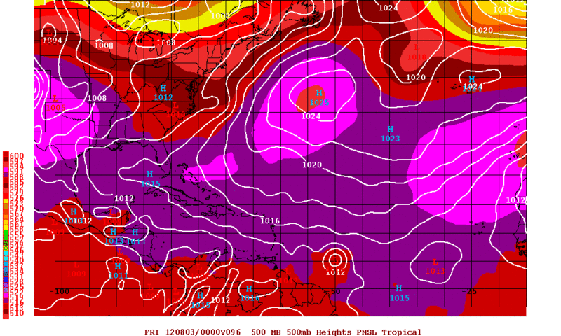
The big picture. The big question is which pouch will cause the lid to go away soon.


http://www.met.nps.edu/~mtmontgo/storms2012/P10L.html
http://www.met.nps.edu/~mtmontgo/storms2012/P10L.html
0 likes
Visit the Caribbean-Central America Weather Thread where you can find at first post web cams,radars
and observations from Caribbean basin members Click Here
and observations from Caribbean basin members Click Here

IMO, the reason why models are picking up on development with P10L is because it stays in a low latitude near 10N all across the Atlantic, away from the SAL and near 28C SSTs. Now the question is if can detach away from the ITCZ, from the past events they seem to take a bit longer for development than what the models show.
18z GFS

18z GFS
0 likes
-
cycloneye
- Admin
- Posts: 149275
- Age: 69
- Joined: Thu Oct 10, 2002 10:54 am
- Location: San Juan, Puerto Rico
Re: Pouch P10L SW of Cape Verde islands

0 likes
Visit the Caribbean-Central America Weather Thread where you can find at first post web cams,radars
and observations from Caribbean basin members Click Here
and observations from Caribbean basin members Click Here
-
cycloneye
- Admin
- Posts: 149275
- Age: 69
- Joined: Thu Oct 10, 2002 10:54 am
- Location: San Juan, Puerto Rico
Re: Pouch P10L SW of Cape Verde islands
If the UKMET model is right,shear may not be a big problem in the MDR area for whatever 10L turns into.

0 likes
Visit the Caribbean-Central America Weather Thread where you can find at first post web cams,radars
and observations from Caribbean basin members Click Here
and observations from Caribbean basin members Click Here

Re: Pouch P10L SW of Cape Verde islands
IMO, this is our boy we need to watch as it will be moving over some of the hottest ssts in the ALT....what I will find interesting is how it does at such a low lat and of the course the graveyard the E carib has been in the past. Ie how does SA influence it.
got plenty of potential out there...you can see on this map what I am talking about concerning MDR sst's. The GOM is mighty toasty as well.....
http://wxmaps.org/pix/hurpot.html#ATL
got plenty of potential out there...you can see on this map what I am talking about concerning MDR sst's. The GOM is mighty toasty as well.....
http://wxmaps.org/pix/hurpot.html#ATL
0 likes
-
TropicalAnalystwx13
- Category 5
- Posts: 2109
- Age: 28
- Joined: Tue Jul 19, 2011 8:20 pm
- Location: Wilmington, NC
- Contact:
The following post is NOT an official forecast and should not be used as such. It is just the opinion of the poster and may or may not be backed by sound meteorological data. It is NOT endorsed by any professional institution including storm2k.org. For Official Information please refer to the NHC and NWS products.
The only negative factor against development of this wave is dry air. Given that it has a large moisture envelope visible on water vapor imagery, we should see this become at least a weak tropical storm if it takes the southern route into the Caribbean and a potential hurricane if it takes the more northern route (more likely IMO) towards the NE Caribbean islands.
The only negative factor against development of this wave is dry air. Given that it has a large moisture envelope visible on water vapor imagery, we should see this become at least a weak tropical storm if it takes the southern route into the Caribbean and a potential hurricane if it takes the more northern route (more likely IMO) towards the NE Caribbean islands.
0 likes
-
cycloneye
- Admin
- Posts: 149275
- Age: 69
- Joined: Thu Oct 10, 2002 10:54 am
- Location: San Juan, Puerto Rico
Re: Pouch P10L SW of Cape Verde islands
Another perspective image, this one from RAMDIS. It may not look hot for development now,but it has a good spin to the clouds if you look at loop I posted 4 posts above.

0 likes
Visit the Caribbean-Central America Weather Thread where you can find at first post web cams,radars
and observations from Caribbean basin members Click Here
and observations from Caribbean basin members Click Here
-
Rgv20

- S2K Supporter

- Posts: 2466
- Age: 39
- Joined: Wed Jan 05, 2011 5:42 pm
- Location: Edinburg/McAllen Tx
0zGFS continues to show development of this wave....Thru Thursday evening is at 50W.
0 likes
The following post is NOT an official forecast and should not be used as such. It is just the opinion of the poster and may or may not be backed by sound meteorological data. It is NOT endorsed by any professional institution including storm2k.org For Official Information please refer to the NHC and NWS products.
-
Aric Dunn
- Category 5
- Posts: 21238
- Age: 43
- Joined: Sun Sep 19, 2004 9:58 pm
- Location: Ready for the Chase.
- Contact:
From its progression today I would not be surprised to see this possibly develop by late Tuesday into wed.
Also 00z nogaps a little more aggressive with it .
https://www.fnmoc.navy.mil/wxmap_cgi/cg ... t=Tropical
Also 00z nogaps a little more aggressive with it .
https://www.fnmoc.navy.mil/wxmap_cgi/cg ... t=Tropical
0 likes
Note: If I make a post that is brief. Please refer back to previous posts for the analysis or reasoning. I do not re-write/qoute what my initial post said each time.
If there is nothing before... then just ask
Space & Atmospheric Physicist, Embry-Riddle Aeronautical University,
I believe the sky is falling...
If there is nothing before... then just ask
Space & Atmospheric Physicist, Embry-Riddle Aeronautical University,
I believe the sky is falling...

-
cycloneye
- Admin
- Posts: 149275
- Age: 69
- Joined: Thu Oct 10, 2002 10:54 am
- Location: San Juan, Puerto Rico
Re: Pouch P10L SW of Cape Verde islands
TROPICAL WEATHER OUTLOOK
NWS NATIONAL HURRICANE CENTER MIAMI FL
200 AM EDT MON JUL 30 2012
FOR THE NORTH ATLANTIC...CARIBBEAN SEA AND THE GULF OF MEXICO...
A TROPICAL WAVE ACCOMPANIED BY A SURFACE LOW PRESSURE SYSTEM IS
LOCATED ABOUT 750 MILES SOUTHWEST OF THE CAPE VERDE ISLANDS. THIS
DISTURBANCE IS SHOWING SIGNS OF ORGANIZATION...AND ENVIRONMENTAL
CONDITIONS ARE CONDUCIVE FOR SOME GRADUAL DEVELOPMENT TO OCCUR OVER
THE NEXT FEW DAYS. THIS SYSTEM HAS A LOW CHANCE...20 PERCENT...OF
BECOMING A TROPICAL CYCLONE DURING THE NEXT 48 HOURS AS IT MOVES
WESTWARD AT ABOUT 15 MPH.
ELSEWHERE...TROPICAL CYCLONE FORMATION IS NOT EXPECTED DURING THE
NEXT 48 HOURS.
$$
FORECASTER STEWART
0 likes
Visit the Caribbean-Central America Weather Thread where you can find at first post web cams,radars
and observations from Caribbean basin members Click Here
and observations from Caribbean basin members Click Here
-
floridasun78
- Category 5
- Posts: 3755
- Joined: Sun May 17, 2009 10:16 pm
- Location: miami fl
Re: Pouch P10L SW of Cape Verde islands-20%
so this wave beat other one by leedward to get yellow circle
0 likes
-
Hurricaneman

- Category 5
- Posts: 7404
- Age: 45
- Joined: Tue Aug 31, 2004 3:24 pm
- Location: central florida
Re: Pouch P10L SW of Cape Verde islands-20%
floridasun78 wrote:so this wave beat other one by leedward to get yellow circle
The posts in this forum are NOT official forecast and should not be used as such. They are just the opinion of the poster and may or may not be backed by sound meteorological data. They are NOT endorsed by any professional institution or storm2k.org. For official information, please refer to the NHC and NWS products
The reasoning is that the models develop this and it has a clear cut circulation unlike Pouch7 which has little to no circulation or model support to speak of
0 likes
-
cycloneye
- Admin
- Posts: 149275
- Age: 69
- Joined: Thu Oct 10, 2002 10:54 am
- Location: San Juan, Puerto Rico
Re: Pouch P10L SW of Cape Verde islands-20%
Is invest 99L so thread is locked. Go to the 99L thread to continue the discussions about this system.
viewtopic.php?f=59&t=113175&hilit=&p=2241445#p2241445
viewtopic.php?f=59&t=113175&hilit=&p=2241445#p2241445
0 likes
Visit the Caribbean-Central America Weather Thread where you can find at first post web cams,radars
and observations from Caribbean basin members Click Here
and observations from Caribbean basin members Click Here
Who is online
Users browsing this forum: TeamPlayersBlue and 76 guests