ATL: FLORENCE - Post-Tropical
Moderator: S2k Moderators
-
hurricanetrack

- HurricaneTrack.com

- Posts: 1781
- Joined: Tue Dec 02, 2003 10:46 pm
- Location: Wilmington, NC
- Contact:
-
Fego

- S2K Supporter

- Posts: 767
- Age: 66
- Joined: Sun Apr 18, 2004 7:58 pm
- Location: San Juan, Puerto Rico
- Contact:
Re: ATL: INVEST 90L
A different road if we compare it with Ernesto's.
TROPICAL CYCLONE GUIDANCE MESSAGE
NWS NATIONAL HURRICANE CENTER MIAMI FL
1227 UTC FRI AUG 3 2012
DISCLAIMER...NUMERICAL MODELS ARE SUBJECT TO LARGE ERRORS.
PLEASE REFER TO NHC OFFICIAL FORECASTS FOR TROPICAL CYCLONE
AND SUBTROPICAL CYCLONE INFORMATION.
ATLANTIC OBJECTIVE AIDS FOR
DISTURBANCE INVEST (AL902012) 20120803 1200 UTC
...00 HRS... ...12 HRS... ...24 HRS. .. ...36 HRS...
120803 1200 120804 0000 120804 1200 120805 0000
LAT LON LAT LON LAT LON LAT LON
BAMS 12.3N 24.5W 13.3N 27.2W 13.8N 30.2W 14.1N 32.9W
BAMD 12.3N 24.5W 13.0N 26.9W 13.9N 29.2W 14.6N 31.3W
BAMM 12.3N 24.5W 13.2N 26.8W 14.0N 29.2W 14.6N 31.3W
LBAR 12.3N 24.5W 13.1N 27.6W 14.1N 30.9W 15.1N 34.0W
SHIP 30KTS 33KTS 38KTS 44KTS
DSHP 30KTS 33KTS 38KTS 44KTS
...48 HRS... ...72 HRS... ...96 HRS. .. ..120 HRS...
120805 1200 120806 1200 120807 1200 120808 1200
LAT LON LAT LON LAT LON LAT LON
BAMS 13.8N 35.2W 13.4N 38.3W 14.6N 42.7W 17.4N 49.9W
BAMD 15.1N 33.3W 15.9N 37.5W 17.5N 43.1W 20.3N 48.7W
BAMM 14.9N 33.4W 15.4N 37.8W 16.7N 43.7W 19.1N 50.3W
LBAR 16.0N 36.8W 17.3N 41.9W 18.5N 46.5W 17.1N 50.7W
SHIP 47KTS 52KTS 54KTS 55KTS
DSHP 47KTS 52KTS 54KTS 55KTS
...INITIAL CONDITIONS...
LATCUR = 12.3N LONCUR = 24.5W DIRCUR = 280DEG SPDCUR = 15KT
LATM12 = 12.0N LONM12 = 21.7W DIRM12 = 280DEG SPDM12 = 15KT
LATM24 = 11.5N LONM24 = 17.8W
WNDCUR = 30KT RMAXWD = 60NM WNDM12 = 30KT
CENPRS = 1006MB OUTPRS = 1012MB OUTRAD = 150NM SDEPTH = S
RD34NE = 0NM RD34SE = 0NM RD34SW = 0NM RD34NW = 0NM
$$
NNNN
0 likes
Go Giants! Go Niners! Go Warriors!
-
TropicalAnalystwx13

- Category 5
- Posts: 2109
- Age: 28
- Joined: Tue Jul 19, 2011 8:20 pm
- Location: Wilmington, NC
- Contact:

-
tolakram
- Admin

- Posts: 20179
- Age: 62
- Joined: Sun Aug 27, 2006 8:23 pm
- Location: Florence, KY (name is Mark)
Re: ATL: INVEST 90L
Up to 50%
A WELL-DEFINED LOW PRESSURE AREA ASSOCIATED WITH A TROPICAL WAVE IS
LOCATED OVER THE EASTERN TROPICAL ATLANTIC ABOUT 135 MILES
SOUTH-SOUTHWEST OF THE CAPE VERDE ISLANDS. ALTHOUGH ENVIRONMENTAL
CONDITIONS ARE CURRENTLY CONDUCIVE FOR TROPICAL CYCLONE
FORMATION...DRY AIR AND COOLER WATERS COULD INHIBIT ADDITIONAL
DEVELOPMENT IN A DAY OR TWO. THIS SYSTEM HAS A MEDIUM CHANCE...50
PERCENT...OF BECOMING A TROPICAL CYCLONE DURING THE NEXT 48 HOURS
AS IT MOVES WEST-NORTHWESTWARD AT ABOUT 15 MPH.
http://www.nhc.noaa.gov/text/refresh/MI ... 1746.shtml
0 likes
M a r k
- - - - -
Join us in chat: Storm2K Chatroom Invite. Android and IOS apps also available.
The posts in this forum are NOT official forecasts and should not be used as such. Posts are NOT endorsed by any professional institution or STORM2K.org. For official information and forecasts, please refer to NHC and NWS products.
-
TropicalAnalystwx13
- Category 5
- Posts: 2109
- Age: 28
- Joined: Tue Jul 19, 2011 8:20 pm
- Location: Wilmington, NC
- Contact:
-
hurricanes1234
- Category 5
- Posts: 2908
- Joined: Sat Jul 28, 2012 6:19 pm
- Location: Trinidad and Tobago
Re: ATL: INVEST 90L
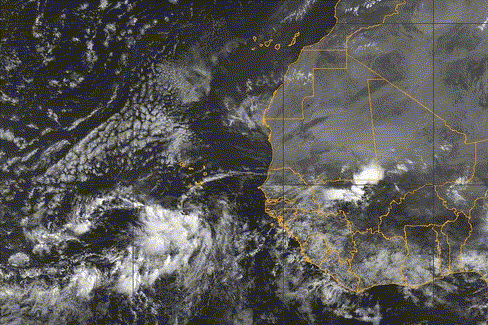
There is no floater as yet for 90L. 91L only has a floater because it's close to land and affecting people. Does anyone have a substitute for this lack of image data regarding 90L?
0 likes
PLEASE NOTE: With the exception of information from weather agencies that I may copy and paste here, my posts will NEVER be official, since I am NOT a meteorologist. They are solely my amateur opinion, and may or may not be accurate. Therefore, please DO NOT use them as official details, particularly when making important decisions. Thank you.
-
tolakram
- Admin
- Posts: 20179
- Age: 62
- Joined: Sun Aug 27, 2006 8:23 pm
- Location: Florence, KY (name is Mark)
Re: ATL: INVEST 90L
hurricanes1234 wrote:There is no floater as yet for 90L. 91L only has a floater because it's close to land and affecting people. Does anyone have a substitute for this lack of image data regarding 90L?
It's in a tough spot, beyond the range of the GOES sat at the moment.
http://www.tropicaltidbits.com/satellite/#self
0 likes
M a r k
- - - - -
Join us in chat: Storm2K Chatroom Invite. Android and IOS apps also available.
The posts in this forum are NOT official forecasts and should not be used as such. Posts are NOT endorsed by any professional institution or STORM2K.org. For official information and forecasts, please refer to NHC and NWS products.
- - - - -
Join us in chat: Storm2K Chatroom Invite. Android and IOS apps also available.
The posts in this forum are NOT official forecasts and should not be used as such. Posts are NOT endorsed by any professional institution or STORM2K.org. For official information and forecasts, please refer to NHC and NWS products.
-
TropicalAnalystwx13
- Category 5
- Posts: 2109
- Age: 28
- Joined: Tue Jul 19, 2011 8:20 pm
- Location: Wilmington, NC
- Contact:
-
Bocadude85

- Category 5
- Posts: 2991
- Age: 39
- Joined: Mon Apr 18, 2005 2:20 pm
- Location: Honolulu,Hi
Re:
TropicalAnalystwx13 wrote:SAB says 90L is very close to tropical depression status.
03/1745 UTC 13.3N 25.7W T1.5/1.5 90L -- Atlantic
looks a lot better then Ernesto
0 likes

Development this quickly this far out usually leads to a fairly quick turn to the North and this type doesn't generally get as far west as The Islands
Personal Forecast Disclaimer:
The posts in this forum are NOT official forecast and should not be used as such. They are just the opinion of the poster and may or may not be backed by sound meteorological data. They are NOT endorsed by any professional institution or storm2k.org. For official information, please refer to the NHC and NWS products.
0 likes
-
JamesCaneTracker
- Tropical Storm

- Posts: 207
- Joined: Fri Jun 22, 2012 1:33 pm
- Location: Portland, Maine
Re:
fci wrote:Development this quickly this far out usually leads to a fairly quick turn to the North and this type doesn't generally get as far west as The Islands
Personal Forecast Disclaimer:
The posts in this forum are NOT official forecast and should not be used as such. They are just the opinion of the poster and may or may not be backed by sound meteorological data. They are NOT endorsed by any professional institution or storm2k.org. For official information, please refer to the NHC and NWS products.
But from what Mark Sudduth was just saying over on Hurricanetrack.com the models are forecasting the ridge of High Pressure to go no where for atleast the next week or so which would keep it on a general westward track. If there isn't a Break in the High Pressure then there is no place for it to go but west...
0 likes
-
TropicalAnalystwx13
- Category 5
- Posts: 2109
- Age: 28
- Joined: Tue Jul 19, 2011 8:20 pm
- Location: Wilmington, NC
- Contact:

-
Weatherboy1

- Category 5
- Posts: 1190
- Age: 50
- Joined: Mon Jul 05, 2004 1:50 pm
- Location: Jupiter/Sarasota, FL
-
gatorcane

- S2K Supporter
- Posts: 23708
- Age: 48
- Joined: Sun Mar 13, 2005 3:54 pm
- Location: Boca Raton, FL
Re:
fci wrote:I understand but since I seem to tend towards climatology. It generally seems if the storm really blows up that close to the Cape Verde islands it generally turns away and never makes it even over to 50w
Generally yes but remember IKE? Its certainly possible:

Last edited by gatorcane on Fri Aug 03, 2012 2:54 pm, edited 4 times in total.
0 likes
-
Weatherboy1
- Category 5
- Posts: 1190
- Age: 50
- Joined: Mon Jul 05, 2004 1:50 pm
- Location: Jupiter/Sarasota, FL
And yes, climatology would generally suggest this will be a "fish" if it develops this early. However, models are generally forecasting a W to WNW track for the next several days as opposed to an immediate hook to the north. So it's always possible that IF this gets a number/name, it becomes a long-track storm of concern (Eventually) to the islands. We'll see!
0 likes
-
SunnyThoughts
- Category 5
- Posts: 2263
- Joined: Wed Jul 09, 2003 12:42 pm
- Location: Pensacola, Florida


-
brunota2003

- S2K Supporter
- Posts: 9476
- Age: 35
- Joined: Sat Jul 30, 2005 9:56 pm
- Location: Stanton, KY...formerly Havelock, NC
- Contact:
It certainly looks close to TD status...with this one only tossing around the fishes, don't expect a quick upgrade from the NHC...they have enough on their plates with Ernesto and 91L, so they'll probably take their time with this one and make sure it is going to really hold together.
0 likes
Just a small town southern boy helping other humans.

Re: ATL: INVEST 90L
For early August, this is extremely impressive. I'm not surprised it was declared an Invest today, but by how organized and strong it is (Almost looks like a 55 knot TS!!!  ). It wouldn't shock me if it was declared a TD today and this is coming from someone who didn't think anything around there would form this season. Yesterday when briefly checking the CV area, I noticed how good it looked coming off Africa. Now this is a true CV system while I don't consider Ernesto one because it didn't form near those islands. I also don't recall the models picking up on this particular wave but one later on that came off more north and became powerful in the long range. Very interesting.
There are hot towers firing near the center and very cold cloud tops below -80ºC which I think is sustaining (can't be sure with lack of good loops); that is rare in the far eastern Atlantic.
GCANE wrote:Rain-rate very near or at Hot-Tower levels.
http://www.nrlmry.navy.mil/tcdat/tc12/A ... W.55pc.jpg
There are hot towers firing near the center and very cold cloud tops below -80ºC which I think is sustaining (can't be sure with lack of good loops); that is rare in the far eastern Atlantic.
0 likes
Who is online
Users browsing this forum: No registered users and 27 guests