ATL: ERNESTO - Post-Tropical

Moderator: S2k Moderators

Message
Author
User avatar
Blown Away
S2K Supporter
S2K Supporter
Posts: 10152
Joined: Wed May 26, 2004 6:17 am

Re: ATL: ERNESTO - Tropical Storm

#1521 Postby Blown Away » Fri Aug 03, 2012 12:28 pm

Image

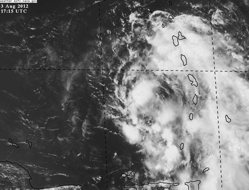
July/August tracks near Ernesto's current location. Seema CA or SE/Tx likely tracks and more poleward earlier if Ernesto develops quicker. JHMO :D
0 likes   
Hurricane Eye Experience: David 79, Irene 99, Frances 04, Jeanne 04, Wilma 05... EYE COMING MY WAY IN 2024…
Hurricane Brush Experience: Andrew 92, Erin 95, Floyd 99, Matthew 16, Irma 17, Ian 22, Nicole 22…

Stormlover2012
Category 1
Category 1
Posts: 262
Joined: Sat Jun 23, 2012 11:03 am

Re: ATL: ERNESTO - Models

#1522 Postby Stormlover2012 » Fri Aug 03, 2012 12:29 pm

guys weaker storm is going into mexico just plain and simple, if it gets to a hurr like nhc suggest then it will hit la or all the way down to brownsville, this isnt a florida storm or miss its a la-all the way down to brownsville if its strong

Personal Forecast Disclaimer:
The posts in this forum are NOT official forecast and should not be used as such. They are just the opinion of the poster and may or may not be backed by sound meteorological data. They are NOT endorsed by any professional institution or storm2k.org. For official information, please refer to the NHC and NWS products.
Last edited by Ivanhater on Fri Aug 03, 2012 12:33 pm, edited 1 time in total.
Reason: Add Disclaimer
0 likes   

User avatar
mcheer23
Professional-Met
Professional-Met
Posts: 436
Age: 32
Joined: Sun Jun 24, 2012 8:24 pm
Location: Sugar Land, Texas

Re: ATL: ERNESTO - Models

#1523 Postby mcheer23 » Fri Aug 03, 2012 12:30 pm

Stormlover2012 wrote:guys weaker storm is going into mexico just plain and simple, if it gets to a hurr like nhc suggest then it will hit la or all the way down to brownsville, this isnt a florida storm or miss its a la-all the way down to brownsville if its strong


Florida Panhandle is still in play
0 likes   

User avatar
Ivanhater
Storm2k Moderator
Storm2k Moderator
Posts: 11162
Age: 38
Joined: Fri Jul 01, 2005 8:25 am
Location: Pensacola

Re: ATL: ERNESTO - Models

#1524 Postby Ivanhater » Fri Aug 03, 2012 12:34 pm

I see we have some new people in here. If you make a forecast with certainties or absolutes you must add the personal disclaimer, period.
0 likes   
Michael

User avatar
Blown Away
S2K Supporter
S2K Supporter
Posts: 10152
Joined: Wed May 26, 2004 6:17 am

Re: ATL: ERNESTO - Models

#1525 Postby Blown Away » Fri Aug 03, 2012 12:35 pm

mcheer23 wrote:
Stormlover2012 wrote:guys weaker storm is going into mexico just plain and simple, if it gets to a hurr like nhc suggest then it will hit la or all the way down to brownsville, this isnt a florida storm or miss its a la-all the way down to brownsville if its strong


Florida Panhandle is still in play


If Ernesto is a hurricane before 70W, then anywhere west and north of 70W are in play. The Florida peninsula is not in the clear at this point. Many of the models are turning Ernesto into the Yucatan channel or western Cuba, but the big boys GFS/Euro are determined to drive Ernesto into CA and if one of those guys shift north then everybody from Bahamas to Mexico is in play! Of course this is only my opinion. :D
0 likes   
Hurricane Eye Experience: David 79, Irene 99, Frances 04, Jeanne 04, Wilma 05... EYE COMING MY WAY IN 2024…
Hurricane Brush Experience: Andrew 92, Erin 95, Floyd 99, Matthew 16, Irma 17, Ian 22, Nicole 22…

Stormlover2012
Category 1
Category 1
Posts: 262
Joined: Sat Jun 23, 2012 11:03 am

Re: ATL: ERNESTO - Models

#1526 Postby Stormlover2012 » Fri Aug 03, 2012 12:49 pm

i get alot of my info from my impact weather buddy and im always a realistic guy and not just going to throw something out if im not confident in it, i mean we can all see the storm isnt looking all that great, the models that have a strong system push it and make it the nw, weaker storm gfs,euro,cmc now all have weak storm and it goes west, cmc had strong storm previous runs and has la and upper texas coast... i dont see this thing hitting florida, ive been in rita and ike and i dont mind a florida hit but i feel this wont be a florida hit even though florida is due!! high pressure in south east is strong!!!

Personal Forecast Disclaimer:
The posts in this forum are NOT official forecast and should not be used as such. They are just the opinion of the poster and may or may not be backed by sound meteorological data. They are NOT endorsed by any professional institution or storm2k.org. For official information, please refer to the NHC and NWS products.
Last edited by tolakram on Fri Aug 03, 2012 12:51 pm, edited 1 time in total.
Reason: added disclaimer
0 likes   

JGrin87
Tropical Storm
Tropical Storm
Posts: 121
Joined: Thu Feb 11, 2010 2:06 am
Location: Houston, Texas

#1527 Postby JGrin87 » Fri Aug 03, 2012 12:50 pm

Given the latest microwave, convection firing, and warmer waters, I think Ernie is about to intensify nicely

Personal Forecast Disclaimer:
The posts in this forum are NOT official forecast and should not be used as such. They are just the opinion of the poster and may or may not be backed by sound meteorological data. They are NOT endorsed by any professional institution or storm2k.org. For official information, please refer to the NHC and NWS products.
0 likes   

User avatar
ROCK
Category 5
Category 5
Posts: 9484
Age: 54
Joined: Tue Aug 17, 2004 7:30 am
Location: Kemah, Texas

Re: ATL: ERNESTO - Models

#1528 Postby ROCK » Fri Aug 03, 2012 12:51 pm

Stormlover2012 wrote:i get alot of my info from my impact weather buddy and im always a realistic guy and not just going to throw something out if im not confident in it, i mean we can all see the storm isnt looking all that great, the models that have a strong system push it and make it the nw, weaker storm gfs,euro,cmc now all have weak storm and it goes west, cmc had strong storm previous runs and has la and upper texas coast... i dont see this thing hitting florida, ive been in rita and ike and i dont mind a florida hit but i feel this wont be a florida hit even though florida is due!! high pressure in south east is strong!!!


yes thats good and all.....but just put a disclaimer at the bottom....then you will be fine...of course you might take some hits by the FL folks.... :lol:
0 likes   

User avatar
ROCK
Category 5
Category 5
Posts: 9484
Age: 54
Joined: Tue Aug 17, 2004 7:30 am
Location: Kemah, Texas

Re: ATL: ERNESTO - Models

#1529 Postby ROCK » Fri Aug 03, 2012 12:53 pm

well the 12Z HWRF still sticking to Western Cuba towards FL Panhandle....


http://www.sfwmd.gov/portal/page/portal ... el%20plots
0 likes   

JPmia
S2K Supporter
S2K Supporter
Posts: 1070
Joined: Thu Jun 03, 2004 11:01 pm
Location: Fort Lauderdale, FL

Re: ATL: ERNESTO - Models

#1530 Postby JPmia » Fri Aug 03, 2012 12:55 pm

ROCK wrote:well the 12Z HWRF still sticking to Western Cuba towards FL Panhandle....


http://www.sfwmd.gov/portal/page/portal ... el%20plots


Rock.. that is the GFDL I believe.. still showing the weakness near the Panhandle.. interesting.
0 likes   

User avatar
ROCK
Category 5
Category 5
Posts: 9484
Age: 54
Joined: Tue Aug 17, 2004 7:30 am
Location: Kemah, Texas

Re: ATL: ERNESTO - Models

#1531 Postby ROCK » Fri Aug 03, 2012 12:55 pm

NAM wants to bring it up the channel....

http://mag.ncep.noaa.gov/NCOMAGWEB/appc ... mageSize=M
0 likes   

User avatar
ROCK
Category 5
Category 5
Posts: 9484
Age: 54
Joined: Tue Aug 17, 2004 7:30 am
Location: Kemah, Texas

Re: ATL: ERNESTO - Models

#1532 Postby ROCK » Fri Aug 03, 2012 12:56 pm

JPmia wrote:
ROCK wrote:well the 12Z HWRF still sticking to Western Cuba towards FL Panhandle....


http://www.sfwmd.gov/portal/page/portal ... el%20plots


Rock.. that is the GFDL I believe.. still showing the weakness near the Panhandle.. interesting.


yep my bad....I need a break. Been looking at this way too long.
0 likes   

User avatar
Blown Away
S2K Supporter
S2K Supporter
Posts: 10152
Joined: Wed May 26, 2004 6:17 am

Re: ATL: ERNESTO - Models

#1533 Postby Blown Away » Fri Aug 03, 2012 12:58 pm

ROCK wrote:
Stormlover2012 wrote:i get alot of my info from my impact weather buddy and im always a realistic guy and not just going to throw something out if im not confident in it, i mean we can all see the storm isnt looking all that great, the models that have a strong system push it and make it the nw, weaker storm gfs,euro,cmc now all have weak storm and it goes west, cmc had strong storm previous runs and has la and upper texas coast... i dont see this thing hitting florida, ive been in rita and ike and i dont mind a florida hit but i feel this wont be a florida hit even though florida is due!! high pressure in south east is strong!!!


yes thats good and all.....but just put a disclaimer at the bottom....then you will be fine...of course you might take some hits by the FL folks.... :lol:


Hey I feel that comment is targeted at me!! :grrr:

Lol, I agree w/ your analysis. IMO if Ernie deepens quickly, before 70W, then Florida may be in play. Models not showing that and CA or GOM looks likely for now! I will stay with my old buddy the GFS until he betrays me! JMHO

Nothing is impossible, just check out the 2006 Ernesto NHC track and see how quickly things can change.
http://www.nhc.noaa.gov/archive/2006/gr ... p_5W.shtml
0 likes   
Hurricane Eye Experience: David 79, Irene 99, Frances 04, Jeanne 04, Wilma 05... EYE COMING MY WAY IN 2024…
Hurricane Brush Experience: Andrew 92, Erin 95, Floyd 99, Matthew 16, Irma 17, Ian 22, Nicole 22…

User avatar
South Texas Storms
Professional-Met
Professional-Met
Posts: 4231
Joined: Thu Jun 24, 2010 12:28 am
Location: Houston, TX

Re: ATL: ERNESTO - Models

#1534 Postby South Texas Storms » Fri Aug 03, 2012 12:58 pm

ROCK wrote:well the 12Z HWRF still sticking to Western Cuba towards FL Panhandle....


http://www.sfwmd.gov/portal/page/portal ... el%20plots


Rock a lot of those models have not been updated on that map yet. The 12z run of the CMC will show up as the 18z CMC. Same for the GFS (AVNO) and the GFDL and HWRF.
The CMC doesn't run 4 times a day. It just changes the time of the run every time the map updates.
0 likes   

User avatar
ROCK
Category 5
Category 5
Posts: 9484
Age: 54
Joined: Tue Aug 17, 2004 7:30 am
Location: Kemah, Texas

Re: ATL: ERNESTO - Models

#1535 Postby ROCK » Fri Aug 03, 2012 1:00 pm

South Texas Storms wrote:
ROCK wrote:well the 12Z HWRF still sticking to Western Cuba towards FL Panhandle....


http://www.sfwmd.gov/portal/page/portal ... el%20plots


Rock a lot of those models have not been updated on that map yet. The 12z run of the CMC will show up as the 18z CMC. Same for the GFS (AVNO) and the GFDL and HWRF.
The CMC doesn't run 4 times a day. It just changes the time of the run every time the map updates.


finally, someone explains that to me....I was like look a 18Z CMC run!!!.... duh....thanks for the clarification...
0 likes   

Stormlover2012
Category 1
Category 1
Posts: 262
Joined: Sat Jun 23, 2012 11:03 am

Re: ATL: ERNESTO - Models

#1536 Postby Stormlover2012 » Fri Aug 03, 2012 1:02 pm

nah man nothing towards you i promise!! im just a athletic director that loves weather lol
0 likes   

Ikester
Professional-Met
Professional-Met
Posts: 361
Age: 39
Joined: Mon Jun 21, 2010 5:00 pm
Location: Jacksonville, FL

Re: ATL: ERNESTO - Models

#1537 Postby Ikester » Fri Aug 03, 2012 1:08 pm

I suspect the long wave trough over the eastern Conus will be of greater influence than it's given credence. The models don't seem to handle troughs well at all. We experienced this with Debby. King Euro (my fav. model) along with many others gave too much weight to the ridge. By 96 hours, the ridge, unlike with Debby, will be WAY out over the mountain west with a fairly deep trough digging into the eastern conus. The ridge amplifies even more going into 144 hours basically in the same position. I see a pretty big weakness in the atmosphere and would definitely give more weight to the models showing a northward bias than the ones that send it to Mexico. AT THIS POINT (which is always subject to change) I see no reason why the trough won't continue to dig being that there are several shortwave impulses imbedded in the trough. My point here is that it is way too early to rule any one spot out.

http://wxmaps.org/pix/avnmr.vort.html
0 likes   

tolakram
Admin
Admin
Posts: 20012
Age: 62
Joined: Sun Aug 27, 2006 8:23 pm
Location: Florence, KY (name is Mark)

Re: ATL: ERNESTO - Tropical Storm

#1538 Postby tolakram » Fri Aug 03, 2012 1:13 pm

Latest. Will it be able to maintain the convection this time?

Image
0 likes   
M a r k
- - - - -
Join us in chat: Storm2K Chatroom Invite. Android and IOS apps also available.

The posts in this forum are NOT official forecasts and should not be used as such. Posts are NOT endorsed by any professional institution or STORM2K.org. For official information and forecasts, please refer to NHC and NWS products.

User avatar
South Texas Storms
Professional-Met
Professional-Met
Posts: 4231
Joined: Thu Jun 24, 2010 12:28 am
Location: Houston, TX

Re: ATL: ERNESTO - Models

#1539 Postby South Texas Storms » Fri Aug 03, 2012 1:24 pm

Ikester wrote:I suspect the long wave trough over the eastern Conus will be of greater influence than it's given credence. The models don't seem to handle troughs well at all. We experienced this with Debby. King Euro (my fav. model) along with many others gave too much weight to the ridge. By 96 hours, the ridge, unlike with Debby, will be WAY out over the mountain west with a fairly deep trough digging into the eastern conus. The ridge amplifies even more going into 144 hours basically in the same position. I see a pretty big weakness in the atmosphere and would definitely give more weight to the models showing a northward bias than the ones that send it to Mexico. AT THIS POINT (which is always subject to change) I see no reason why the trough won't continue to dig being that there are several shortwave impulses imbedded in the trough. My point here is that it is way too early to rule any one spot out.

http://wxmaps.org/pix/avnmr.vort.html


:uarrow: Good post sir.

12z Euro isn't much help. It initialized it too weak and sends it pretty much due west into CA in 96 hours.
0 likes   

User avatar
vbhoutex
Storm2k Executive
Storm2k Executive
Posts: 29113
Age: 73
Joined: Wed Oct 09, 2002 11:31 pm
Location: Cypress, TX
Contact:

Re: ATL: ERNESTO - Models

#1540 Postby vbhoutex » Fri Aug 03, 2012 1:32 pm

Ikester wrote:I suspect the long wave trough over the eastern Conus will be of greater influence than it's given credence. The models don't seem to handle troughs well at all. We experienced this with Debby. King Euro (my fav. model) along with many others gave too much weight to the ridge. By 96 hours, the ridge, unlike with Debby, will be WAY out over the mountain west with a fairly deep trough digging into the eastern conus. The ridge amplifies even more going into 144 hours basically in the same position. I see a pretty big weakness in the atmosphere and would definitely give more weight to the models showing a northward bias than the ones that send it to Mexico. AT THIS POINT (which is always subject to change) I see no reason why the trough won't continue to dig being that there are several shortwave impulses imbedded in the trough. My point here is that it is way too early to rule any one spot out.

http://wxmaps.org/pix/avnmr.vort.html

I am certainly not a met, but if Ernesto is still weak or at least a lot weaker than is thought in the W Caribbean, I would think we would be dealing with a more Westerly course, with much less chance of a N or NW turn. Are you taking this into your thoughts in this discussion or are you assuming Ernesto will be a cane at that point?
0 likes   
Skywarn, C.E.R.T.
Please click below to donate to STORM2K to help with the expenses of keeping the site going:
Image


Return to “2012”

Who is online

Users browsing this forum: No registered users and 22 guests