

FLIGHT ONE -TEAL 72-
A. 05/1200, 1800Z
B. AFXXX 0605A ERNESTO
C. 05/0930Z
D. 15.5N 74.5W
E. 05/1130Z TO 05/1800Z
F. SFC TO 10,000 FT
ATL: ERNESTO - Post-Tropical
Moderator: S2k Moderators
-
Rgv20

- S2K Supporter

- Posts: 2466
- Age: 39
- Joined: Wed Jan 05, 2011 5:42 pm
- Location: Edinburg/McAllen Tx
0zECMWF has Ernesto near Belize/Yucatan by Tuesday Evening..
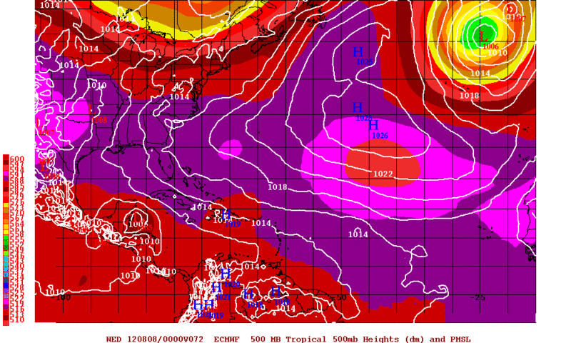
BOC by Thursday Evening
Final landfall around Tampico, Mx by Friday Evening
BOC by Thursday Evening
Final landfall around Tampico, Mx by Friday Evening
0 likes
The following post is NOT an official forecast and should not be used as such. It is just the opinion of the poster and may or may not be backed by sound meteorological data. It is NOT endorsed by any professional institution including storm2k.org For Official Information please refer to the NHC and NWS products.
-
brunota2003

- S2K Supporter
- Posts: 9476
- Age: 35
- Joined: Sat Jul 30, 2005 9:56 pm
- Location: Stanton, KY...formerly Havelock, NC
- Contact:
Hi! Welcome to the forums! I'm heading off to bed, but perhaps someone else can take a peek at the loops and answer your question.
On second thought...I looked and it doesn't look like anything new has formed near the core, so much as the debris from the tops of the convection has/is in the process of dissipating.
On second thought...I looked and it doesn't look like anything new has formed near the core, so much as the debris from the tops of the convection has/is in the process of dissipating.
0 likes
Just a small town southern boy helping other humans.
-
brunota2003
- S2K Supporter
- Posts: 9476
- Age: 35
- Joined: Sat Jul 30, 2005 9:56 pm
- Location: Stanton, KY...formerly Havelock, NC
- Contact:
-
Rgv20
- S2K Supporter
- Posts: 2466
- Age: 39
- Joined: Wed Jan 05, 2011 5:42 pm
- Location: Edinburg/McAllen Tx
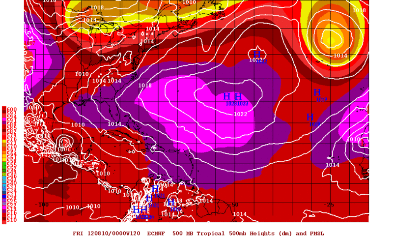
Fairly impressive how the 0zNOGAPS follows the Official NHC Forecast all the way thru 120hrs! 
By Friday Evening Ernesto is close to making a second landfall in Mexico..
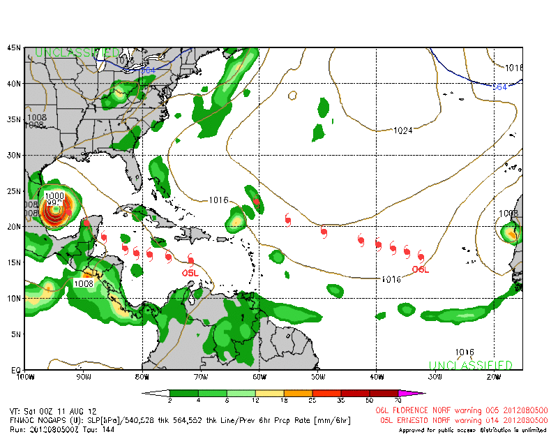
By Friday Evening Ernesto is close to making a second landfall in Mexico..
0 likes
The following post is NOT an official forecast and should not be used as such. It is just the opinion of the poster and may or may not be backed by sound meteorological data. It is NOT endorsed by any professional institution including storm2k.org For Official Information please refer to the NHC and NWS products.
-
Wx_Warrior
- Category 5

- Posts: 2718
- Joined: Thu Aug 03, 2006 3:58 pm
- Location: Beaumont, TX
-
ozonepete
- Professional-Met

- Posts: 4743
- Joined: Mon Sep 07, 2009 3:23 pm
- Location: From Ozone Park, NYC / Now in Brooklyn, NY
Re:
Wx_Warrior wrote:From JB per Twitter:
"This has now weakened 8 mb since entering the Caribbean, How is it it can do that and be as strong as when it was 1001. Makes no sense at 1009mb, this is NOT A 60 MPH STORM and is more likely an open wave. its racing west.. only at 15, but near 74"
Just remember that JB (Joe Bastardi) has no official qualifications to forecast tropical cyclones, unlike the NHC forecasters and the pro-mets on this site. He has often been wrong with important forecasts. You can check his track record by googling him. Then make your own judgement.
0 likes
-
Wx_Warrior
- Category 5
- Posts: 2718
- Joined: Thu Aug 03, 2006 3:58 pm
- Location: Beaumont, TX
Re: ATL: ERNESTO - Tropical Storm
I live & die by the JB/EURO. Ain't talkin' Justin Bieber either LOL.
Interesting "storm"
Interesting "storm"
0 likes
-
AJC3

- Admin

- Posts: 4153
- Age: 62
- Joined: Tue Aug 31, 2004 7:04 pm
- Location: Ballston Spa, New York
- Contact:
Re: Re:
ozonepete wrote:Wx_Warrior wrote:From JB per Twitter:
"This has now weakened 8 mb since entering the Caribbean, How is it it can do that and be as strong as when it was 1001. Makes no sense at 1009mb, this is NOT A 60 MPH STORM and is more likely an open wave. its racing west.. only at 15, but near 74"
Just remember that JB (Joe Bastardi) has no official qualifications to forecast tropical cyclones, unlike the NHC forecasters and the pro-mets on this site. He has often been wrong with important forecasts. You can check his track record by googling him. Then make your own judgement.
JB is a very polarizing figure on S2K, mainly because of his frequent pointed comments toward NHC, CPC, NWS, as well as his outspoken views on anthropogenic global warming and what some might call self-aggrandizing style of discourse. He has a large number of vocal fans on here and an equally vocal throng of detractors.
There is nothing wrong with reposting his thoughts, however one thing this forum will not be is a secondary bully pulpit for his tweet-rants, such as the ongoing one where he is impugning the integrity of NHC. Just a little something to keep in mind when reposting his comments on here - us mods have already had to break up too many "JB wars" over the years.
0 likes

Re: ATL: ERNESTO - Models
Just got back from the bar and I see no change really.....MX it is...unless I am seeing double.... 
0 likes
-
Kingarabian

- S2K Supporter
- Posts: 16351
- Joined: Sat Aug 08, 2009 3:06 am
- Location: Honolulu, Hawaii
-
Nederlander
- S2K Supporter
- Posts: 1259
- Joined: Sat Jul 19, 2008 4:28 pm
- Location: Conroe, TX
Re: ATL: ERNESTO - Tropical Storm
Convection blowing up closer to the center. Maybe its finally stacking itself vertically?

0 likes
-
Hurricane Alexis

- Category 2

- Posts: 683
- Age: 29
- Joined: Thu Jun 14, 2012 7:59 pm
- Location: Miami,Florida
Re: ATL: ERNESTO - Tropical Storm
SUMMARY OF 500 AM EDT...0900 UTC...INFORMATION
----------------------------------------------
LOCATION...15.1N 74.8W
ABOUT 240 MI...385 KM SE OF KINGSTON JAMAICA
ABOUT 560 MI...900 KM E OF CABO GRACIAS A DIOS ON NIC/HON BORDER
MAXIMUM SUSTAINED WINDS...50 MPH...85 KM/H
PRESENT MOVEMENT...W OR 275 DEGREES AT 22 MPH...35 KM/H
MINIMUM CENTRAL PRESSURE...1007 MB...29.74 INCHES
0 likes
Personal Forecast Disclaimer:
The posts in this forum are NOT official forecast and should not be used as such. They are just the opinion of the poster and may or may not be backed by sound meteorological data. They are NOT endorsed by any professional institution or storm2k.org. For official information, please refer to the NHC and NWS products.
The posts in this forum are NOT official forecast and should not be used as such. They are just the opinion of the poster and may or may not be backed by sound meteorological data. They are NOT endorsed by any professional institution or storm2k.org. For official information, please refer to the NHC and NWS products.
-
somethingfunny

- ChatStaff

- Posts: 3926
- Age: 37
- Joined: Thu May 31, 2007 10:30 pm
- Location: McKinney, Texas
Re: ATL: ERNESTO - Tropical Storm
Ernie's been vertically stacked repeatedly - the problem is the low level circulation keeps outrunning the mid level circulation. The old MLC convection is dying off and new convection is firing above the LLC. It's a good sign for Ernesto's tenacity; IMO this isn't going to degenerate into an open wave any time soon, or at least it won't remain open for long if/when it does open up. We'll see if it stays stacked this time, but I suspect it will be another day or two for this storm to get its' act together. Gotta get away from South America and all that dry air first.
0 likes
I am not a meteorologist, and any posts made by me are not official forecasts or to be interpreted as being intelligent. These posts are just my opinions and are probably silly opinions.
-
somethingfunny
- ChatStaff
- Posts: 3926
- Age: 37
- Joined: Thu May 31, 2007 10:30 pm
- Location: McKinney, Texas
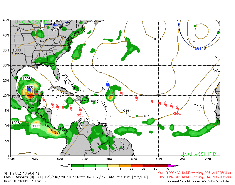
Uh oh, I was feeling pretty confident that this storm was headed to Mexico until I saw the NOGAPS agreeing with that solution. 
0 likes
I am not a meteorologist, and any posts made by me are not official forecasts or to be interpreted as being intelligent. These posts are just my opinions and are probably silly opinions.
-
Hurricane Alexis
- Category 2
- Posts: 683
- Age: 29
- Joined: Thu Jun 14, 2012 7:59 pm
- Location: Miami,Florida
0 likes
Personal Forecast Disclaimer:
The posts in this forum are NOT official forecast and should not be used as such. They are just the opinion of the poster and may or may not be backed by sound meteorological data. They are NOT endorsed by any professional institution or storm2k.org. For official information, please refer to the NHC and NWS products.
The posts in this forum are NOT official forecast and should not be used as such. They are just the opinion of the poster and may or may not be backed by sound meteorological data. They are NOT endorsed by any professional institution or storm2k.org. For official information, please refer to the NHC and NWS products.
-
AJC3
- Admin
- Posts: 4153
- Age: 62
- Joined: Tue Aug 31, 2004 7:04 pm
- Location: Ballston Spa, New York
- Contact:
Re: ATL: ERNESTO - Tropical Storm
You can clearly see on this M/I image from a little over 2 hours ago, how the low level vorticity center of Ernesto was displaced to the WNW of the convective mass, which is now dissipating. You can also see the humble beginnings of the new convective blowup (reds), centered near 15.5N 74W. Extrapolating a 20 knot forward motion in the 2 hours since that M/I image was taken, the center of the new blowup is displaced about 1.5 degrees to the east of Ernesto's LLC. That would put the LLC near the western edge of the CI canopy on IR.

0 likes

Re: ATL: ERNESTO - Tropical Storm
Still racing along at 22 MPH and outpacing the convection this morning. Typical for a weak storm in the Caribbean and I remember one of the early GFS runs had Ernesto depicted as an open wave at this longitude. South of Jamaica is where the slow down usually occurs so the next 24 hours should eliminate a lot of possible solutions.
Thought I was seeing a stair step pattern beginning to appear in the tracking data earlier. That sometimes is a sign that a storm is putting on the brakes. The coordinates jumping north a little when a temporary LLC forms under each new convective burst then he tracks west again as the LLC outruns the convection.
Thought I was seeing a stair step pattern beginning to appear in the tracking data earlier. That sometimes is a sign that a storm is putting on the brakes. The coordinates jumping north a little when a temporary LLC forms under each new convective burst then he tracks west again as the LLC outruns the convection.
Last edited by Nimbus on Sun Aug 05, 2012 4:55 am, edited 1 time in total.
0 likes

Re: ATL: ERNESTO - Tropical Storm
Cyclenall wrote:JPmia wrote:What's interesting about these latest developments with Ernesto is that right about now for the past few days he would begin his usual weakening, but the reports we're seeing this evening are the opposite.
Don't you mean overnight/late morning?
Well it turns out Ernesto really does do this every morning.
ozonepete wrote:LOL, yeah I know what he's saying. I just want to hear him say it straightforward on the record so we can quote him later tomorrow.
Well I just read a bunch of this thread from early yesterday and a lot of people are munching on crow on this one. Many thought it was about to become a hurricane but now instead we are debating whether its actually a TC.
fci wrote:Ah, it is posts like these that make S2K so entertaining!
And I used to get all worked up over them and then get in trouble for being sarcastic and getting on my soapbox about Storms and damage and get so serious followed by suspension, blah, blah, blah.
No, not anymore!
A fun post as I watch people get frustrated by the ebbs and flows of the tropics and surely tomorrow if Ernesto strengthens, there will be frantic posts in the other direction.
Thanks, posts like these make the time go by!!!!
I'm glad you liked it, it may sound silly but its the truth. I do not enjoy tropical systems that "toy" with us like this as the vast majority of TCs do not behave like this. When such favorable conditions present themselves with a hurricane looking TC that is actually an open wave, that is unbearable. If Ernesto looks like its strengthening today, it'll probably be weakening instead as usual
Shuriken wrote:Well...you had to know coming in that only about 0.5% (wild-ass guess) of Invests are going to result in a major hurricane that scares land.
If you think you have it miserable now as a storm freak looking back fondly on 2005 and 2006, imagine getting David and Frederick in 1979 and Allen (early) in 1980, and then nothing major-scary for three years until Alica. -- I'm sure there are longer and more boring stretches of nothing exciting recently, but that's the one I remember.
(Peeps in Brazil be wondering how many centuries it'll be before another "Hurricane Catalina".)
I know about this but we are comparing apples to oranges here.
ConvergenceZone wrote:Yea I know, very few storms actually make it to hurricane status, but I do find that I'd rather waste my energy on the storms that actually are worth watching.....
And this is why I'm PO. The last TC to pull off a Caribbean into GOM track while strengthening beyond major was Hurricane Gustav of 2008.
ozonepete wrote:Looks like it's finally slowing down now. That should stop the "self-imposed" shear and aid in strengthening.
PRESENT MOVEMENT...W OR 275 DEGREES AT 22 MPH...35 KM/H
0 likes
Who is online
Users browsing this forum: No registered users and 53 guests