Don't think we've seen the last of Florence, but I've been wrong before. Whenever you have a surface circulation in mid August at this latitude ya can't count it out.
----------------
This is not an official forecast by any means - just an observation.
ATL: FLORENCE - Post-Tropical
Moderator: S2k Moderators

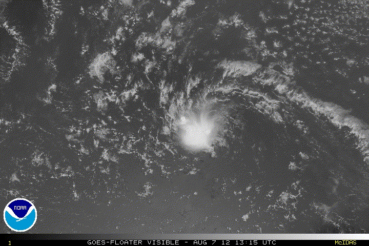
Has some convection for the first time in a while lets see what happens, will it stay, or poof again? Not that it's anywhere close to its former self, just a step in that direction.

not a prediction BTW but
The posts in this forum are NOT official forecast and should not be used as such. They are just the opinion of the poster and may or may not be backed by sound meteorological data. They are NOT endorsed by any professional institution or storm2k.org. For official information, please refer to the NHC and NWS products.
0 likes
I am just an amateur and a "noob" at that so any speculations that I have made are just that, uneducated speculations. Please refer to the NHC for accurate information.
Thank you all for your thoughts, I've loved reading through this community since '06 and finally decided to post more actively.
-JJ
Thank you all for your thoughts, I've loved reading through this community since '06 and finally decided to post more actively.
-JJ
-
Hurricane Alexis

- Category 2

- Posts: 683
- Age: 29
- Joined: Thu Jun 14, 2012 7:59 pm
- Location: Miami,Florida
A SMALL AREA OF SHOWERS AND THUNDERSTORMS HAS REDEVELOPED NEAR THE
POST-TROPICAL REMNANT LOW OF FLORENCE...LOCATED ABOUT 1150 MILES
EAST OF THE NORTHERN LEEWARD ISLANDS. ENVIRONMENTAL CONDITIONS ARE
NOT CONDUCIVE FOR REDEVELOPMENT...AND THIS SYSTEM HAS A LOW
CHANCE...10 PERCENT...OF AGAIN BECOMING A TROPICAL CYCLONE DURING
THE NEXT 48 HOURS AS IT MOVES WESTWARD AT ABOUT 20 MPH.
0 likes
Personal Forecast Disclaimer:
The posts in this forum are NOT official forecast and should not be used as such. They are just the opinion of the poster and may or may not be backed by sound meteorological data. They are NOT endorsed by any professional institution or storm2k.org. For official information, please refer to the NHC and NWS products.
The posts in this forum are NOT official forecast and should not be used as such. They are just the opinion of the poster and may or may not be backed by sound meteorological data. They are NOT endorsed by any professional institution or storm2k.org. For official information, please refer to the NHC and NWS products.
-
cycloneye

- Admin

- Posts: 149275
- Age: 69
- Joined: Thu Oct 10, 2002 10:54 am
- Location: San Juan, Puerto Rico
Re: ATL: FLORENCE - Post Tropical
8 AM TWO.
SHOWER ACTIVITY HAS INCREASED THIS MORNING NEAR THE POST-TROPICAL
REMNANT LOW OF FLORENCE...LOCATED ABOUT 1000 MILES EAST OF THE
NORTHERN LEEWARD ISLANDS. HOWEVER...ENVIRONMENTAL CONDITIONS ARE
NOT CONDUCIVE FOR REDEVELOPMENT...AND THIS SYSTEM HAS A LOW
CHANCE...10 PERCENT...OF AGAIN BECOMING A TROPICAL CYCLONE DURING
THE NEXT 48 HOURS AS IT MOVES WESTWARD AT ABOUT 20 MPH.
0 likes
Visit the Caribbean-Central America Weather Thread where you can find at first post web cams,radars
and observations from Caribbean basin members Click Here
and observations from Caribbean basin members Click Here
-
cycloneye
- Admin
- Posts: 149275
- Age: 69
- Joined: Thu Oct 10, 2002 10:54 am
- Location: San Juan, Puerto Rico
Re: ATL: FLORENCE - Models
The BAMS are running again for ex Florence.
12z Models

12z Models
Code: Select all
WHXX01 KWBC 071249
CHGHUR
TROPICAL CYCLONE GUIDANCE MESSAGE
NWS NATIONAL HURRICANE CENTER MIAMI FL
1249 UTC TUE AUG 7 2012

DISCLAIMER...NUMERICAL MODELS ARE SUBJECT TO LARGE ERRORS.
PLEASE REFER TO NHC OFFICIAL FORECASTS FOR TROPICAL CYCLONE
AND SUBTROPICAL CYCLONE INFORMATION.

ATLANTIC OBJECTIVE AIDS FOR

DISTURBANCE FLORENCE (AL062012) 20120807 1200 UTC

...00 HRS... ...12 HRS... ...24 HRS. .. ...36 HRS...
120807 1200 120808 0000 120808 1200 120809 0000

LAT LON LAT LON LAT LON LAT LON
BAMS 17.0N 46.7W 18.4N 50.8W 20.0N 55.0W 21.8N 58.7W
BAMD 17.0N 46.7W 18.2N 49.5W 19.6N 52.1W 21.1N 54.2W
BAMM 17.0N 46.7W 17.9N 49.9W 19.2N 53.2W 20.7N 56.2W
LBAR 17.0N 46.7W 18.0N 50.1W 19.2N 53.3W 20.6N 56.1W
SHIP 25KTS 27KTS 30KTS 34KTS
DSHP 25KTS 27KTS 30KTS 34KTS

...48 HRS... ...72 HRS... ...96 HRS. .. ..120 HRS...
120809 1200 120810 1200 120811 1200 120812 1200

LAT LON LAT LON LAT LON LAT LON
BAMS 23.6N 61.6W 27.1N 65.1W 29.7N 66.2W 31.6N 66.8W
BAMD 22.3N 55.5W 22.1N 57.0W 20.2N 60.5W 18.7N 65.9W
BAMM 22.2N 58.7W 23.9N 61.8W 24.2N 65.5W 24.1N 69.9W
LBAR 21.7N 58.5W 22.8N 61.8W 23.1N 65.3W 21.8N 70.0W
SHIP 34KTS 33KTS 38KTS 46KTS
DSHP 34KTS 33KTS 38KTS 46KTS

...INITIAL CONDITIONS...
LATCUR = 17.0N LONCUR = 46.7W DIRCUR = 275DEG SPDCUR = 20KT
LATM12 = 16.6N LONM12 = 42.4W DIRM12 = 274DEG SPDM12 = 17KT
LATM24 = 16.3N LONM24 = 39.5W
WNDCUR = 25KT RMAXWD = 40NM WNDM12 = 25KT
CENPRS = 1010MB OUTPRS = 1013MB OUTRAD = 150NM SDEPTH = M
RD34NE = 0NM RD34SE = 0NM RD34SW = 0NM RD34NW = 0NM
0 likes
Visit the Caribbean-Central America Weather Thread where you can find at first post web cams,radars
and observations from Caribbean basin members Click Here
and observations from Caribbean basin members Click Here
-
cycloneye
- Admin
- Posts: 149275
- Age: 69
- Joined: Thu Oct 10, 2002 10:54 am
- Location: San Juan, Puerto Rico
Re: ATL: FLORENCE - Post Tropical
2 PM TWO.
DISORGANIZED SHOWER ACTIVITY CONTINUES IN ASSOCIATION WITH THE
POST-TROPICAL REMNANT LOW OF FLORENCE...LOCATED ABOUT 875 MILES
EAST OF THE NORTHERN LEEWARD ISLANDS. ENVIRONMENTAL CONDITIONS ARE
NOT CONDUCIVE FOR REDEVELOPMENT...AND THIS SYSTEM HAS A LOW
CHANCE...10 PERCENT...OF AGAIN BECOMING A TROPICAL CYCLONE DURING
THE NEXT 48 HOURS AS IT MOVES WESTWARD AT ABOUT 20 MPH.
0 likes
Visit the Caribbean-Central America Weather Thread where you can find at first post web cams,radars
and observations from Caribbean basin members Click Here
and observations from Caribbean basin members Click Here
-
Blown Away

- S2K Supporter

- Posts: 10253
- Joined: Wed May 26, 2004 6:17 am
Re: ATL: FLORENCE - Post Tropical

12z BAMS for ex-Flo. Maybe Flo could become a homegrown comeback?
0 likes
Hurricane Eye Experience: David 79, Irene 99, Frances 04, Jeanne 04, Wilma 05… Hurricane Brush Experience: Andrew 92, Erin 95, Floyd 99, Matthew 16, Irma 17, Ian 22, Nicole 22…
-
Extratropical94

- Professional-Met

- Posts: 3545
- Age: 31
- Joined: Wed Oct 20, 2010 6:36 am
- Location: Hamburg, Germany
- Contact:
18Z Best Track, pressure up one millibar (12Z had her at 1010)
AL, 06, 2012080718, , BEST, 0, 176N, 485W, 25, 1011, LO
AL, 06, 2012080718, , BEST, 0, 176N, 485W, 25, 1011, LO
0 likes
54° 11' 59'' N, 9° 9' 20'' E
Boomer Sooner!
Go Broncos! Go Cards!
Clinching counties, one at a time: https://mob-rule.com/user-gifs/USA/xtrp94.gif
- Daniel
Boomer Sooner!
Go Broncos! Go Cards!
Clinching counties, one at a time: https://mob-rule.com/user-gifs/USA/xtrp94.gif
- Daniel
-
floridasun78
- Category 5

- Posts: 3755
- Joined: Sun May 17, 2009 10:16 pm
- Location: miami fl

Re: ATL: FLORENCE - Post Tropical
In 48 hours. I agree. They are 90% against it.
Sent from my XT910 using Tapatalk 2
Sent from my XT910 using Tapatalk 2
0 likes
-
tolakram
- Admin
- Posts: 20178
- Age: 62
- Joined: Sun Aug 27, 2006 8:23 pm
- Location: Florence, KY (name is Mark)
Re: ATL: FLORENCE - Post Tropical
0 likes
M a r k
- - - - -
Join us in chat: Storm2K Chatroom Invite. Android and IOS apps also available.
The posts in this forum are NOT official forecasts and should not be used as such. Posts are NOT endorsed by any professional institution or STORM2K.org. For official information and forecasts, please refer to NHC and NWS products.
-
cycloneye
- Admin
- Posts: 149275
- Age: 69
- Joined: Thu Oct 10, 2002 10:54 am
- Location: San Juan, Puerto Rico
Re: ATL: FLORENCE - Post Tropical
8 PM TWO.
SHOWER ACTIVITY HAS WEAKENED IN ASSOCIATION WITH THE REMNANT LOW
OF FLORENCE LOCATED ABOUT 750 MILES EAST OF THE NORTHERN LEEWARD
ISLANDS. ENVIRONMENTAL CONDITIONS ARE NOT CONDUCIVE FOR
REDEVELOPMENT...AND THIS SYSTEM HAS A LOW CHANCE...NEAR 0
PERCENT...OF BECOMING A TROPICAL CYCLONE AGAIN DURING THE NEXT 48
HOURS AS IT MOVES WEST-NORTHWESTWARD AT ABOUT 20 MPH.
0 likes
Visit the Caribbean-Central America Weather Thread where you can find at first post web cams,radars
and observations from Caribbean basin members Click Here
and observations from Caribbean basin members Click Here
-
floridasun78
- Category 5
- Posts: 3755
- Joined: Sun May 17, 2009 10:16 pm
- Location: miami fl
-
weatherSnoop

- S2K Supporter
- Posts: 702
- Age: 63
- Joined: Wed Oct 09, 2002 10:06 pm
- Location: Tampa, FL
- Contact:
Re:
floridasun78 wrote:ex FLORENCE is done going run into shear in eastern carribbean
guess that is why convection is forming east of the center. First time we have seen that this season.
0 likes
-
floridasun78
- Category 5
- Posts: 3755
- Joined: Sun May 17, 2009 10:16 pm
- Location: miami fl


Re: ATL: FLORENCE - Post Tropical
whats its doing is carving up the SAL so 92L doesnt have some much to work with....
0 likes
-
floridasun78
- Category 5
- Posts: 3755
- Joined: Sun May 17, 2009 10:16 pm
- Location: miami fl
Re: ATL: FLORENCE - Post Tropical
ROCK wrote:whats its doing is carving up the SAL so 92L doesnt have some much to work with....
you think 92l dont have chance too
0 likes
Re: ATL: FLORENCE - Post Tropical
floridasun78 wrote:ROCK wrote:whats its doing is carving up the SAL so 92L doesnt have some much to work with....
you think 92l dont have chance too
see my post about 92L...and the intensity models...in that thread...
0 likes
Re: ATL: FLORENCE - Post Tropical
she is fixing to run into a 50kt shear zone.....decapitation wont be long...IMO
0 likes


Who is online
Users browsing this forum: Google [Bot] and 57 guests