Strong wave emerging Africa (Is Invest 93L)
Moderator: S2k Moderators
Forum rules

The posts in this forum are NOT official forecasts and should not be used as such. They are just the opinion of the poster and may or may not be backed by sound meteorological data. They are NOT endorsed by any professional institution or STORM2K. For official information, please refer to products from the National Hurricane Center and National Weather Service.


-
jaxfladude
- Category 5

- Posts: 1249
- Joined: Wed Aug 24, 2005 9:36 pm
- Location: Jacksonville, Fla
-
cycloneye

- Admin

- Posts: 149479
- Age: 69
- Joined: Thu Oct 10, 2002 10:54 am
- Location: San Juan, Puerto Rico
Re:
Cainer wrote:I remember in either 2007 or 2008, a wave was given a code orange while still over Africa, but then poofed when it hit the water and didn't develop. Maybe that's why the NHC is leery of mentioning them in their TWO's.
That was Bertha of 2008. I found this first TWO made as it just emerged for wave that spawned Bertha.
TROPICAL WEATHER OUTLOOK
NWS TPC/NATIONAL HURRICANE CENTER MIAMI FL
200 AM EDT TUE JUL 1 2008
FOR THE NORTH ATLANTIC...CARIBBEAN SEA AND THE GULF OF MEXICO...
A STRONG TROPICAL WAVE HAS EMERGED OFF THE WEST COAST OF AFRICA...
ACCOMPANIED BY A LARGE AREA OF SHOWERS AND THUNDERSTORMS AND A WEAK
SURFACE LOW. THIS WAVE SHOWS SOME SIGNS OF ORGANIZATION...AND
ENVIRONMENTAL CONDITIONS COULD ALLOW FOR SOME SLOW DEVELOPMENT OF
THE SYSTEM AS IT MOVES TO THE WEST AT ABOUT 15 TO 20 MPH.
ELSEWHERE...TROPICAL CYCLONE FORMATION IS NOT EXPECTED DURING THE
NEXT 48 HOURS.
$$
FORECASTER BLAKE
0 likes
Visit the Caribbean-Central America Weather Thread where you can find at first post web cams,radars
and observations from Caribbean basin members Click Here
and observations from Caribbean basin members Click Here
-
Riptide

- Category 2

- Posts: 753
- Age: 34
- Joined: Fri Jul 23, 2010 3:33 pm
- Location: Cape May, New Jersey
- Contact:
Re:
jaxfladude wrote:I love(to hate)this time of hurricane season...
Everything looks fine in my opinion, we are still seasonally above average and I expect development from at least one of these waves, either 92L or the African system.
0 likes
-
jaxfladude
- Category 5
- Posts: 1249
- Joined: Wed Aug 24, 2005 9:36 pm
- Location: Jacksonville, Fla
Re: Re:
Riptide wrote:jaxfladude wrote:I love(to hate)this time of hurricane season...
Everything looks fine in my opinion, we are still seasonally above average and I expect development from at least one of these waves, either 92L or the African system.
Which is why I do not want anymore named systems, already went thru Beryl and Debby, house nearly got flooded....do not want to go thru a possible third time this season(the big one).
0 likes
Stay safe y'all

-
WYNweather
- Tropical Depression

- Posts: 65
- Joined: Wed Jul 20, 2011 1:14 pm

-
Riptide
- Category 2
- Posts: 753
- Age: 34
- Joined: Fri Jul 23, 2010 3:33 pm
- Location: Cape May, New Jersey
- Contact:
Re: Strong wave over Africa (Pouch 13L)
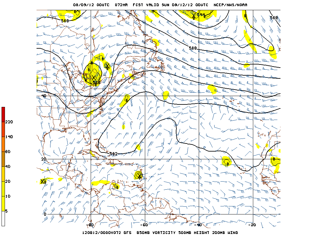
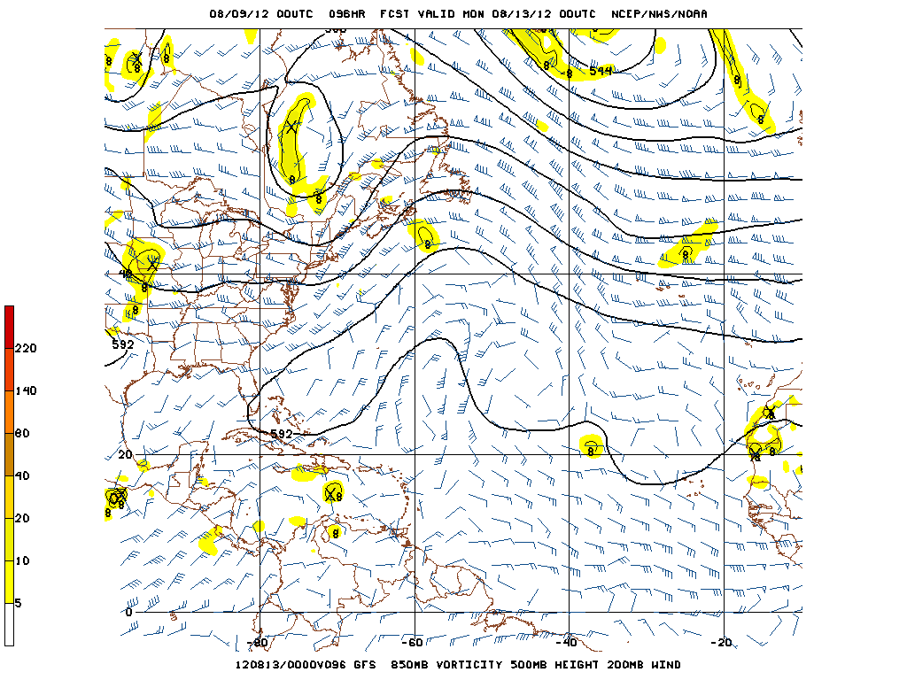
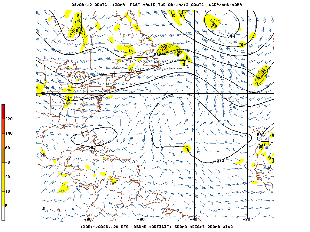
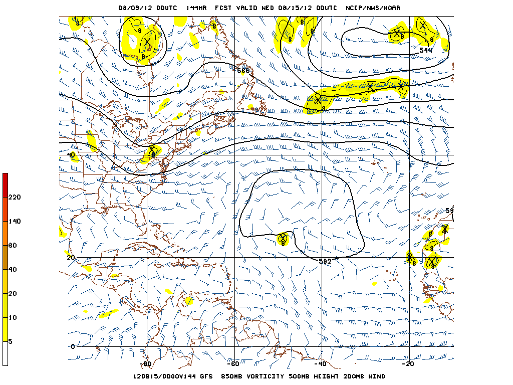
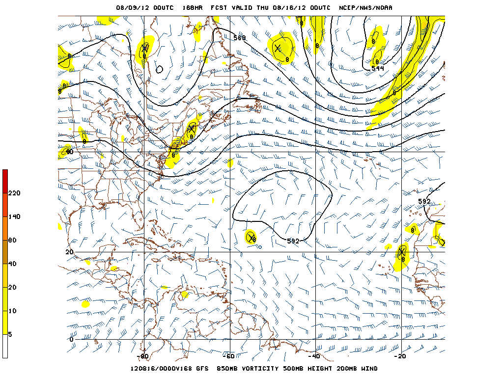
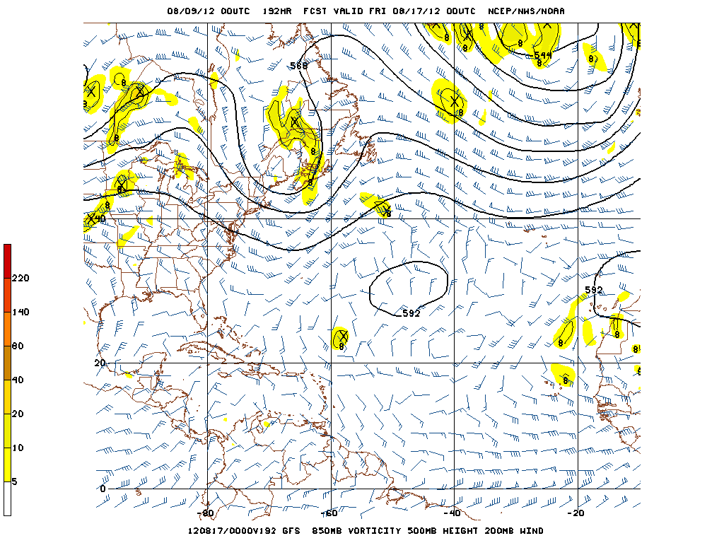
Nothing to work with on the GFS tonight; the wave weakens too much because it travels too far north into lower SST's and dry air as soon as it comes off Africa.
0 likes
-
KBBOCA
- S2K Supporter

- Posts: 1559
- Joined: Fri Sep 05, 2003 5:27 am
- Location: Formerly Boca Raton, often West Africa. Currently Charlotte NC
The weather station at Kedougou Senegal is reporting again. Pressure 1006 as of 00:00 GMT.
http://www.wunderground.com/history/air ... atename=NA
http://www.wunderground.com/history/air ... atename=NA
0 likes

Re:
CrazyC83 wrote:I wonder if this will pull a Christine and develop right out of the gate?
Christine was unique in that it was declared a TD at 11.0N - 14.0W.
It literally left the coast as a Strong Tropical Depression.
Until it was brought up in regards to 13L, I never knew that the NWS had actually designated a TD before a system exited Africa.
Fascinating.....
0 likes
Re: Re:
fci wrote:CrazyC83 wrote:I wonder if this will pull a Christine and develop right out of the gate?
Christine was unique in that it was declared a TD at 11.0N - 14.0W.
It literally left the coast as a Strong Tropical Depression.
Until it was brought up in regards to 13L, I never knew that the NWS had actually designated a TD before a system exited Africa.
Fascinating.....
NHC never issued advisories on Christine until it was near the islands. During post season analysis they tracked it back to Africa. Does make me wonder if it really can meet the definition of a tropical cyclone without ever being over water but they must have found enough evidence.
0 likes
-
somethingfunny

- ChatStaff

- Posts: 3926
- Age: 37
- Joined: Thu May 31, 2007 10:30 pm
- Location: McKinney, Texas
Re:
Cainer wrote:I remember in either 2007 or 2008, a wave was given a code orange while still over Africa, but then poofed when it hit the water and didn't develop. Maybe that's why the NHC is leery of mentioning them in their TWO's.
I remember when this happened, and I've seen some other strong global model signatures fail to materialize as they came off the coast.
Then you have systems like Christine in 1973 and Beryl in 1982, which form practically over Senegal, but never manage to overcome SAL and shear in the Atlantic.
Beryl actually did quite a bit of damage to the Cape Verde Islands, which usually escape tropical cyclone impacts since they're north of the typical track and storms usually don't develop that far east anyway. This P13L is one they need to watch, for sure.
0 likes
I am not a meteorologist, and any posts made by me are not official forecasts or to be interpreted as being intelligent. These posts are just my opinions and are probably silly opinions.
-
cycloneye
- Admin
- Posts: 149479
- Age: 69
- Joined: Thu Oct 10, 2002 10:54 am
- Location: San Juan, Puerto Rico
Re: Strong wave over Africa (Pouch 13L)
Tropical Wave with Low Pressure introduced by TAFB at 06z surface analysis
NHC at TWO may begin to talk about it today.

NHC at TWO may begin to talk about it today.
0 likes
Visit the Caribbean-Central America Weather Thread where you can find at first post web cams,radars
and observations from Caribbean basin members Click Here
and observations from Caribbean basin members Click Here
-
Gustywind

- Category 5
- Posts: 12334
- Joined: Mon Sep 03, 2007 7:29 am
- Location: Baie-Mahault, GUADELOUPE
Ernesto and two Atlantic disturbances
Stu Ostro, Senior Meteorologist, The Weather Channel
Aug 9, 2012 12:22 am ET

http://www.weather.com/newscenter/tropical/
AFRICA
- A strong tropical wave with a low-level circulation is about to move off the coast of Africa. It could develop into a tropical cyclone when it's over the water, though recent model runs have trended toward being less gung-ho in forecasting that, perhaps because they have it moving WNW to upwards of 20 degrees north latitude, where the air is drier and the water cooler. Previously, model runs had been fairly consistently showing it reaching the United States the week after next; that is beyond the time frame at which there can be confidence in details of a system's track (and that only matters if it becomes a significant storm).
Stu Ostro, Senior Meteorologist, The Weather Channel
Aug 9, 2012 12:22 am ET
http://www.weather.com/newscenter/tropical/
AFRICA
- A strong tropical wave with a low-level circulation is about to move off the coast of Africa. It could develop into a tropical cyclone when it's over the water, though recent model runs have trended toward being less gung-ho in forecasting that, perhaps because they have it moving WNW to upwards of 20 degrees north latitude, where the air is drier and the water cooler. Previously, model runs had been fairly consistently showing it reaching the United States the week after next; that is beyond the time frame at which there can be confidence in details of a system's track (and that only matters if it becomes a significant storm).
0 likes
Who is online
Users browsing this forum: kevin and 149 guests