
Immediate future, not as hot with daytime thunderstorms making more of an appearance especially eastern and southern half of the state. Dog days are numbered
Texas Summer 2012
Moderator: S2k Moderators
Forum rules

The posts in this forum are NOT official forecast and should not be used as such. They are just the opinion of the poster and may or may not be backed by sound meteorological data. They are NOT endorsed by any professional institution or STORM2K.
Changes are afoot in the mid-latitudes. The heat ridge is being compressed and heading NW. A PV anomaly is growing influence near the arctic regions and will be the first true source of cooler air. Of course it gets nowhere near Texas but it is a sign that the weather patterns on our side of the globe is changing. Stronger systems are on the march toward Alaska.
Immediate future, not as hot with daytime thunderstorms making more of an appearance especially eastern and southern half of the state. Dog days are numbered . I say by labor day we get our first taste of a real front! If there is a tropical system that effects Texas then it will likely make it happen quicker.
Immediate future, not as hot with daytime thunderstorms making more of an appearance especially eastern and southern half of the state. Dog days are numbered
0 likes
The above post and any post by Ntxw is NOT an official forecast and should not be used as such. It is just the opinion of the poster and may or may not be backed by sound meteorological data. It is NOT endorsed by any professional institution including Storm2k. For official information, please refer to NWS products.
Help support Storm2K!
-
weatherdude1108
- Category 5

- Posts: 4228
- Joined: Tue Dec 13, 2011 1:04 pm
- Location: Northwest Austin/Cedar Park, TX
I know I'm probably grasping at straws here, but as I look at the satellite loop over the Gulf of Mexico, there appears to be some kind of upper or mid-level low pressure going on (counter-clockwise motion of clouds).
I guess my question is could this upper or mid-level Low nudge Ernesto more towards the north as it approaches this Low in the Gulf?
I haven't seen any discussion or chatter about it. Just curious.
I guess my question is could this upper or mid-level Low nudge Ernesto more towards the north as it approaches this Low in the Gulf?
I haven't seen any discussion or chatter about it. Just curious.
0 likes
The preceding post is NOT an official forecast, and should not be used as such. It is only the opinion of the poster and may or may not be backed by sound meteorological data. It is NOT endorsed by any professional institution including storm2k.org. For Official Information please refer to the NHC and NWS products.
-
Portastorm

- Storm2k Moderator

- Posts: 9955
- Age: 63
- Joined: Fri Jul 11, 2003 9:16 am
- Location: Round Rock, TX
- Contact:
Re: Texas Summer 2012
Speaking as a weather weenie here and not as a moderator ... I don't know if we know. 
I can tell you that I had pretty much written off Ernesto last night in terms of having any impact whatsoever on Texas' weather. Based on what he's done this morning, I've changed that opinion. I still think it is a very long shot for Ernesto to move north enough to impact any Texas weather, including the Valley ... but, if he really ramps up and intensifies, who knows ... he may end up moving further poleward than the global models predicted.
I can tell you that I had pretty much written off Ernesto last night in terms of having any impact whatsoever on Texas' weather. Based on what he's done this morning, I've changed that opinion. I still think it is a very long shot for Ernesto to move north enough to impact any Texas weather, including the Valley ... but, if he really ramps up and intensifies, who knows ... he may end up moving further poleward than the global models predicted.
0 likes
Any forecasts under my name are to be taken with a grain of salt. Get your best forecasts from the National Weather Service and National Hurricane Center.
-
Tireman4

- S2K Supporter

- Posts: 5903
- Age: 60
- Joined: Fri Jun 30, 2006 1:08 pm
- Location: Humble, Texas
- Contact:
This just in:
I have nominated Porta and his team of cracked ( I mean crack) staff of mets at the PWC to take a vacation and go back to met school. Free on the state of Texas. Now back to the regularly scheduled program. Yeah, I had written Ernesto off too. Now, by the slimmest of margins, we may get "some" precipitation out of it. Who knows? Welcome to weather!!
I have nominated Porta and his team of cracked ( I mean crack) staff of mets at the PWC to take a vacation and go back to met school. Free on the state of Texas.
0 likes
-
somethingfunny

- ChatStaff

- Posts: 3926
- Age: 37
- Joined: Thu May 31, 2007 10:30 pm
- Location: McKinney, Texas
Re: Texas Summer 2012
More than Ernesto (which I'm pretty sure is going to be a Mexico storm), I'm watching the global models for next week, or a week and a half or so from now. They show Ernesto's remnants combining with a larger, more broad trough of low pressure across Central America, with a low trying to consolidate in the Bay of Campeche as the rest of the trough sinks into the EPAC. Most of the model runs don't do much with that low, but a few runs have closed it off and taken it NNW towards the Rio Grande Valley, similar to Hermine in 2010. It's far from a certainty right now, but something to watch.
0 likes
I am not a meteorologist, and any posts made by me are not official forecasts or to be interpreted as being intelligent. These posts are just my opinions and are probably silly opinions.
-
South Texas Storms

- Professional-Met

- Posts: 4259
- Joined: Thu Jun 24, 2010 12:28 am
- Location: Houston, TX
Re: Texas Summer 2012
somethingfunny wrote:More than Ernesto (which I'm pretty sure is going to be a Mexico storm), I'm watching the global models for next week, or a week and a half or so from now. They show Ernesto's remnants combining with a larger, more broad trough of low pressure across Central America, with a low trying to consolidate in the Bay of Campeche as the rest of the trough sinks into the EPAC. Most of the model runs don't do much with that low, but a few runs have closed it off and taken it NNW towards the Rio Grande Valley, similar to Hermine in 2010. It's far from a certainty right now, but something to watch.
Yeah I was just talking to Porta about that last night! Yesterday's 18z GFS run, today's 0z and 6z GFS run show something similar to that happening. It reminds me a lot of Hermine from 2010 too. I'm definitely keeping a close eye on it.
0 likes
-
Rgv20

- S2K Supporter
- Posts: 2466
- Age: 39
- Joined: Wed Jan 05, 2011 5:42 pm
- Location: Edinburg/McAllen Tx
Well the 12zNAM takes it north....lol I see Ernesto going as far north as Tampico but no more than that.
0 likes
The following post is NOT an official forecast and should not be used as such. It is just the opinion of the poster and may or may not be backed by sound meteorological data. It is NOT endorsed by any professional institution including storm2k.org For Official Information please refer to the NHC and NWS products.
-
Portastorm
- Storm2k Moderator
- Posts: 9955
- Age: 63
- Joined: Fri Jul 11, 2003 9:16 am
- Location: Round Rock, TX
- Contact:
Re:
Rgv20 wrote:Well the 12zNAM takes it north....lol I see Ernesto going as far north as Tampico but no more than that.
Yeah, I agree. My guess is north of Chetumal (1st landfall) and Tampico (2nd landfall).
I'm intrigued by the potential Hermine, the 2012 version, which the GFS is advertising. Our friend in San Antonio (South Texas Storms) needs some tropical excitement!
0 likes
Any forecasts under my name are to be taken with a grain of salt. Get your best forecasts from the National Weather Service and National Hurricane Center.
-
South Texas Storms
- Professional-Met
- Posts: 4259
- Joined: Thu Jun 24, 2010 12:28 am
- Location: Houston, TX
Re: Re:
Portastorm wrote:Rgv20 wrote:Well the 12zNAM takes it north....lol I see Ernesto going as far north as Tampico but no more than that.
Yeah, I agree. My guess is north of Chetumal (1st landfall) and Tampico (2nd landfall).
I'm intrigued by the potential Hermine, the 2012 version, which the GFS is advertising. Our friend in San Antonio (South Texas Storms) needs some tropical excitement!
I agree with yall on Ernesto, and yes I do Porta!
Today's 12z Euro now shows a slug of 2 inch PWs coming up from the BOC in 240 hours. Similar to the GFS. We need some rain!
0 likes
-
Rgv20
- S2K Supporter
- Posts: 2466
- Age: 39
- Joined: Wed Jan 05, 2011 5:42 pm
- Location: Edinburg/McAllen Tx
Well it was fun speculating about Ernesto now on to the next..
At least it is almost September, that is the wettest month here in the Rio Grande Valley.
At least it is almost September, that is the wettest month here in the Rio Grande Valley.
0 likes
The following post is NOT an official forecast and should not be used as such. It is just the opinion of the poster and may or may not be backed by sound meteorological data. It is NOT endorsed by any professional institution including storm2k.org For Official Information please refer to the NHC and NWS products.
-
weatherdude1108
- Category 5
- Posts: 4228
- Joined: Tue Dec 13, 2011 1:04 pm
- Location: Northwest Austin/Cedar Park, TX
Hottest July in 117 years of records in the lower 48. I'm somehow not surprised. I think the lack of snowpack last Winter may have contributed, among other things. Hmmm. 
http://www.weather.com/news/noaa-report-july-20120808
http://www.weather.com/news/noaa-report-july-20120808
0 likes
The preceding post is NOT an official forecast, and should not be used as such. It is only the opinion of the poster and may or may not be backed by sound meteorological data. It is NOT endorsed by any professional institution including storm2k.org. For Official Information please refer to the NHC and NWS products.
-
Rgv20
- S2K Supporter
- Posts: 2466
- Age: 39
- Joined: Wed Jan 05, 2011 5:42 pm
- Location: Edinburg/McAllen Tx
From the NWS Brownsville afternoon discussion....Something to keep an eye out for possible tropical development?
"BY MONDAY...AN INVERTED TROUGH MOVES FROM THE BAY OF CAMPECHE TOWARDS
OUR AREA. RAIN CHANCES INCREASE MONDAY THROUGH WEDNESDAY WITH THE
BEST CHANCES APPEARING TO BE ON TUESDAY. DIFFERENCES IN THE MODELS
CONCERNING THIS FEATURE WITH THE EC LEAVING AS AN INVERTED TROUGH
WHEREAS GFS CLOSES OFF A LOW IN THE AREA. WENT AHEAD AND BUMPED
POPS UP IN THIS TIMEFRAME. TROUGH/LOW WILL PUSH NORTH OF THE
REGION BY THE END OF THE PERIOD."
0 likes
The following post is NOT an official forecast and should not be used as such. It is just the opinion of the poster and may or may not be backed by sound meteorological data. It is NOT endorsed by any professional institution including storm2k.org For Official Information please refer to the NHC and NWS products.
-
Portastorm
- Storm2k Moderator
- Posts: 9955
- Age: 63
- Joined: Fri Jul 11, 2003 9:16 am
- Location: Round Rock, TX
- Contact:
Re: Texas Summer 2012
There's been some chatter in the 92L model thread today about the NOGAPS and CMC spinning up a system in the Bay of Campeche and moving it north next week. Perhaps that's the same thing which BRO is referring to? Hmmm ...
0 likes
Any forecasts under my name are to be taken with a grain of salt. Get your best forecasts from the National Weather Service and National Hurricane Center.
-
weatherdude1108
- Category 5
- Posts: 4228
- Joined: Tue Dec 13, 2011 1:04 pm
- Location: Northwest Austin/Cedar Park, TX
-
Portastorm
- Storm2k Moderator
- Posts: 9955
- Age: 63
- Joined: Fri Jul 11, 2003 9:16 am
- Location: Round Rock, TX
- Contact:
Re:
weatherdude1108 wrote:Have you all seen the radar? Stuff north of Williamson County moving south.
I'll let you know if I get in on any of this stuff, or if it's another mirage.
I saw it. Figured it would go "poof" before it reach my house like it usually does.
Good luck to you, though!
0 likes
Any forecasts under my name are to be taken with a grain of salt. Get your best forecasts from the National Weather Service and National Hurricane Center.
-
weatherdude1108
- Category 5
- Posts: 4228
- Joined: Tue Dec 13, 2011 1:04 pm
- Location: Northwest Austin/Cedar Park, TX
Re: Re:
Portastorm wrote:weatherdude1108 wrote:Have you all seen the radar? Stuff north of Williamson County moving south.
I'll let you know if I get in on any of this stuff, or if it's another mirage.
I saw it. Figured it would go "poof" before it reach my house like it usually does.
Good luck to you, though!
Thanks, but it poofed here too.
Nothing.
0 likes
Re: Texas Summer 2012
Even with all the activity around me last several days I haven't gotten a drop either! Frustrating ugh! Hoping the "cool front" tomorrow can build a more solid line and sweep through and continue into central Texas. Doubt it though...
0 likes
The above post and any post by Ntxw is NOT an official forecast and should not be used as such. It is just the opinion of the poster and may or may not be backed by sound meteorological data. It is NOT endorsed by any professional institution including Storm2k. For official information, please refer to NWS products.
Help support Storm2K!
Help support Storm2K!
-
Rgv20
- S2K Supporter
- Posts: 2466
- Age: 39
- Joined: Wed Jan 05, 2011 5:42 pm
- Location: Edinburg/McAllen Tx
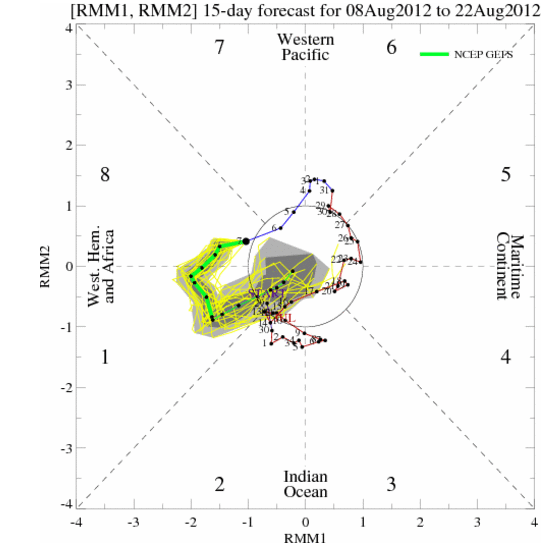
Taking a closer look at the GFS, the idea of something popping up in the western gulf is not out of the question.....the MJO should be in the favorable Phase 1 and a couple of the Ensembles support the Operational run on trying to close off a low sometime Tuesday.

0 likes
The following post is NOT an official forecast and should not be used as such. It is just the opinion of the poster and may or may not be backed by sound meteorological data. It is NOT endorsed by any professional institution including storm2k.org For Official Information please refer to the NHC and NWS products.
-
Rgv20
- S2K Supporter
- Posts: 2466
- Age: 39
- Joined: Wed Jan 05, 2011 5:42 pm
- Location: Edinburg/McAllen Tx
The last couple runs of the GFS really backed off the idea of a weak closed low in the Western Gulf....At least by Monday and Tuesday here in Deep South Texas we could get a few passing showers.
For today there is some of Ernesto's moisture trying to reach the RGV but Rain chances should stayed confined in the coastal sections....I did wash my car yesterday so is a given it will rain in my area later this afternoon!
For today there is some of Ernesto's moisture trying to reach the RGV but Rain chances should stayed confined in the coastal sections....I did wash my car yesterday so is a given it will rain in my area later this afternoon!
0 likes
The following post is NOT an official forecast and should not be used as such. It is just the opinion of the poster and may or may not be backed by sound meteorological data. It is NOT endorsed by any professional institution including storm2k.org For Official Information please refer to the NHC and NWS products.
-
Portastorm
- Storm2k Moderator
- Posts: 9955
- Age: 63
- Joined: Fri Jul 11, 2003 9:16 am
- Location: Round Rock, TX
- Contact:
Re: Texas Summer 2012
Interesting little convergence zone forming this Friday afternoon across the Austin metro area. Hope these showers build into something which provides me and weatherdude1108 with some generous rainfall!
0 likes
Any forecasts under my name are to be taken with a grain of salt. Get your best forecasts from the National Weather Service and National Hurricane Center.
Return to “USA & Caribbean Weather”
Who is online
Users browsing this forum: Google [Bot], HurricaneBelle, wxman22 and 148 guests