ATL: ERNESTO - Post-Tropical
Moderator: S2k Moderators
-
brunota2003

- S2K Supporter

- Posts: 9476
- Age: 35
- Joined: Sat Jul 30, 2005 9:56 pm
- Location: Stanton, KY...formerly Havelock, NC
- Contact:
-
HurricaneBill
- Category 5

- Posts: 3419
- Joined: Sun Apr 11, 2004 5:51 pm
- Location: East Longmeadow, MA, USA

-
cycloneye

- Admin

- Posts: 149275
- Age: 69
- Joined: Thu Oct 10, 2002 10:54 am
- Location: San Juan, Puerto Rico
Re: ATL: ERNESTO - Advisories
092347
TCPAT5
BULLETIN
TROPICAL STORM ERNESTO INTERMEDIATE ADVISORY NUMBER 34A
NWS NATIONAL HURRICANE CENTER MIAMI FL AL052012
700 PM CDT THU AUG 09 2012
...ERNESTO PRODUCING HEAVY RAINS ACROSS SOUTHERN MEXICO AS IT MOVES
INLAND...
SUMMARY OF 700 PM CDT...0000 UTC...INFORMATION
----------------------------------------------
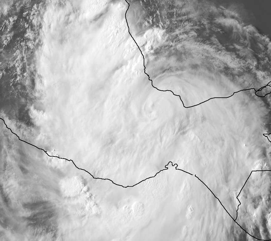
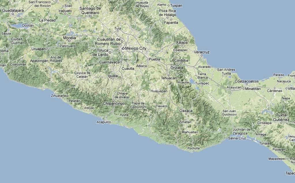
LOCATION...18.2N 95.8W
ABOUT 90 MI...150 KM W OF COATZACOALCOS MEXICO
ABOUT 75 MI...120 KM SSE OF VERACRUZ MEXICO
MAXIMUM SUSTAINED WINDS...45 MPH...75 KM/H
PRESENT MOVEMENT...W OR 270 DEGREES AT 11 MPH...18 KM/H
MINIMUM CENTRAL PRESSURE...996 MB...29.41 INCHES
WATCHES AND WARNINGS
--------------------
CHANGES WITH THIS ADVISORY...
NONE.
SUMMARY OF WATCHES AND WARNINGS IN EFFECT...
A TROPICAL STORM WARNING IS IN EFFECT FOR...
* VERACRUZ TO CHILITEPEC MEXICO
FOR STORM INFORMATION SPECIFIC TO YOUR...PLEASE MONITOR PRODUCTS
ISSUED BY YOUR NATIONAL METEOROLOGICAL SERVICE.
DISCUSSION AND 48-HOUR OUTLOOK
------------------------------
AT 700 PM CDT...0000 UTC...THE CENTER OF TROPICAL STORM ERNESO WAS
LOCATED NEAR LATITUDE 18.2 NORTH...LONGITUDE 95.8 WEST. ERNESTO IS
MOVING TOWARD THE WEST NEAR 11 MPH...18 KM/H...AND THIS MOTION IS
EXPECTED TO CONTINUE FOR THE NEXT DAY OR TWO. ON THE FORECAST
TRACK...ERNESTO WILL CONTINUE MOVING INLAND OVER SOUTHERN MEXICO
TONIGHT AND FRIDAY.
MAXIMUM SUSTAINED WINDS HAVE DECREASED TO NEAR 45 MPH...75 KM/H...
WITH HIGHER GUSTS. THESE STRONG WINDS ARE PRIMARILY OCCURRING OVER
WATER TO THE NORTHEAST OF THE CENTER. WEAKENING IS FORECAST DURING
THE NEXT 48 HOURS...AND ERNESTO IS EXPECTED TO DISSIPATE OVER THE
HIGH TERRAIN OF SOUTHERN MEXICO IN DAY OR TWO.
TROPICAL STORM FORCE WINDS EXTEND OUTWARD UP TO 120 MILES...195 KM
MAINLY TO THE NORTHEAST OF THE CENTER.
THE ESTIMATED MINIMUM CENTRAL PRESSURE IS 996 MB...29.41 INCHES.
HAZARDS AFFECTING LAND
----------------------
WIND...TROPICAL STORM CONDITIONS WILL CONTINUE IN THE TROPICAL STORM
WARNING AREA AND NEAR THE CENTER OF ERNESTO THIS EVENING. THESE
WINDS WILL GRADUALLY BEGIN TO SUBSIDE LATER TONIGHT.
RAINFALL...ERNESTO IS EXPECTED TO PRODUCE TOTAL ADDITIONAL RAINFALL
ACCUMULATIONS OF 3 TO 6 INCHES OVER THE MEXICAN STATES OF
VERACRUZ...TABASCO...PUEBLA...AND OAXACA THROUGH FRIDAY NIGHT.
ISOLATED MAXIMUM STORM TOTAL AMOUNTS OF 15 INCHES ASSOCIATED WITH
ERNESTO ARE POSSIBLE. THESE RAINS MAY PRODUCE LIFE-THREATENING
FLASH FLOODS AND MUD SLIDES OVER AREAS OF HIGHER TERRAIN.
STORM SURGE...A STORM SURGE OF 1 TO 3 FEET ABOVE NORMAL TIDE LEVELS
IS POSSIBLE IN AREAS OF ONSHORE WINDS IN THE WARNING AREA. NEAR THE
COAST...THE SURGE WILL BE ACCOMPANIED BY LARGE AND DANGEROUS WAVES.
THESE CONDITIONS WILL LIKELY BEGIN TO SUBSIDE LATER TONIGHT.
NEXT ADVISORY
-------------
NEXT COMPLETE ADVISORY...1000 PM CDT.
$$
FORECASTER BRENNAN
TCPAT5
BULLETIN
TROPICAL STORM ERNESTO INTERMEDIATE ADVISORY NUMBER 34A
NWS NATIONAL HURRICANE CENTER MIAMI FL AL052012
700 PM CDT THU AUG 09 2012
...ERNESTO PRODUCING HEAVY RAINS ACROSS SOUTHERN MEXICO AS IT MOVES
INLAND...
SUMMARY OF 700 PM CDT...0000 UTC...INFORMATION
----------------------------------------------
LOCATION...18.2N 95.8W
ABOUT 90 MI...150 KM W OF COATZACOALCOS MEXICO
ABOUT 75 MI...120 KM SSE OF VERACRUZ MEXICO
MAXIMUM SUSTAINED WINDS...45 MPH...75 KM/H
PRESENT MOVEMENT...W OR 270 DEGREES AT 11 MPH...18 KM/H
MINIMUM CENTRAL PRESSURE...996 MB...29.41 INCHES
WATCHES AND WARNINGS
--------------------
CHANGES WITH THIS ADVISORY...
NONE.
SUMMARY OF WATCHES AND WARNINGS IN EFFECT...
A TROPICAL STORM WARNING IS IN EFFECT FOR...
* VERACRUZ TO CHILITEPEC MEXICO
FOR STORM INFORMATION SPECIFIC TO YOUR...PLEASE MONITOR PRODUCTS
ISSUED BY YOUR NATIONAL METEOROLOGICAL SERVICE.
DISCUSSION AND 48-HOUR OUTLOOK
------------------------------
AT 700 PM CDT...0000 UTC...THE CENTER OF TROPICAL STORM ERNESO WAS
LOCATED NEAR LATITUDE 18.2 NORTH...LONGITUDE 95.8 WEST. ERNESTO IS
MOVING TOWARD THE WEST NEAR 11 MPH...18 KM/H...AND THIS MOTION IS
EXPECTED TO CONTINUE FOR THE NEXT DAY OR TWO. ON THE FORECAST
TRACK...ERNESTO WILL CONTINUE MOVING INLAND OVER SOUTHERN MEXICO
TONIGHT AND FRIDAY.
MAXIMUM SUSTAINED WINDS HAVE DECREASED TO NEAR 45 MPH...75 KM/H...
WITH HIGHER GUSTS. THESE STRONG WINDS ARE PRIMARILY OCCURRING OVER
WATER TO THE NORTHEAST OF THE CENTER. WEAKENING IS FORECAST DURING
THE NEXT 48 HOURS...AND ERNESTO IS EXPECTED TO DISSIPATE OVER THE
HIGH TERRAIN OF SOUTHERN MEXICO IN DAY OR TWO.
TROPICAL STORM FORCE WINDS EXTEND OUTWARD UP TO 120 MILES...195 KM
MAINLY TO THE NORTHEAST OF THE CENTER.
THE ESTIMATED MINIMUM CENTRAL PRESSURE IS 996 MB...29.41 INCHES.
HAZARDS AFFECTING LAND
----------------------
WIND...TROPICAL STORM CONDITIONS WILL CONTINUE IN THE TROPICAL STORM
WARNING AREA AND NEAR THE CENTER OF ERNESTO THIS EVENING. THESE
WINDS WILL GRADUALLY BEGIN TO SUBSIDE LATER TONIGHT.
RAINFALL...ERNESTO IS EXPECTED TO PRODUCE TOTAL ADDITIONAL RAINFALL
ACCUMULATIONS OF 3 TO 6 INCHES OVER THE MEXICAN STATES OF
VERACRUZ...TABASCO...PUEBLA...AND OAXACA THROUGH FRIDAY NIGHT.
ISOLATED MAXIMUM STORM TOTAL AMOUNTS OF 15 INCHES ASSOCIATED WITH
ERNESTO ARE POSSIBLE. THESE RAINS MAY PRODUCE LIFE-THREATENING
FLASH FLOODS AND MUD SLIDES OVER AREAS OF HIGHER TERRAIN.
STORM SURGE...A STORM SURGE OF 1 TO 3 FEET ABOVE NORMAL TIDE LEVELS
IS POSSIBLE IN AREAS OF ONSHORE WINDS IN THE WARNING AREA. NEAR THE
COAST...THE SURGE WILL BE ACCOMPANIED BY LARGE AND DANGEROUS WAVES.
THESE CONDITIONS WILL LIKELY BEGIN TO SUBSIDE LATER TONIGHT.
NEXT ADVISORY
-------------
NEXT COMPLETE ADVISORY...1000 PM CDT.
$$
FORECASTER BRENNAN
0 likes
Visit the Caribbean-Central America Weather Thread where you can find at first post web cams,radars
and observations from Caribbean basin members Click Here
and observations from Caribbean basin members Click Here
-
tolakram
- Admin
- Posts: 20179
- Age: 62
- Joined: Sun Aug 27, 2006 8:23 pm
- Location: Florence, KY (name is Mark)
Re: ATL: ERNESTO - Tropical Storm
If you speed this live loop up you can see the decapitation in process. The LLC has obviously slammed into the mountains.
http://wwwghcc.msfc.nasa.gov/cgi-bin/ge ... mframes=15
http://wwwghcc.msfc.nasa.gov/cgi-bin/ge ... mframes=15
0 likes
M a r k
- - - - -
Join us in chat: Storm2K Chatroom Invite. Android and IOS apps also available.
The posts in this forum are NOT official forecasts and should not be used as such. Posts are NOT endorsed by any professional institution or STORM2K.org. For official information and forecasts, please refer to NHC and NWS products.
-
Kingarabian

- S2K Supporter
- Posts: 16348
- Joined: Sat Aug 08, 2009 3:06 am
- Location: Honolulu, Hawaii
I'm confident he will make it out alive!
Personal Forecast Disclaimer:
The posts in this forum are NOT official forecast and should not be used as such. They are just the opinion of the poster and may or may not be backed by sound meteorological data. They are NOT endorsed by any professional institution or storm2k.org. For official information, please refer to the NHC and NWS products.
0 likes
RIP Kobe Bryant
-
cycloneye
- Admin
- Posts: 149275
- Age: 69
- Joined: Thu Oct 10, 2002 10:54 am
- Location: San Juan, Puerto Rico
Re: ATL: ERNESTO - Advisories
WTNT45 KNHC 100241
TCDAT5
TROPICAL STORM ERNESTO DISCUSSION NUMBER 35
NWS NATIONAL HURRICANE CENTER MIAMI FL AL052012
1000 PM CDT THU AUG 09 2012
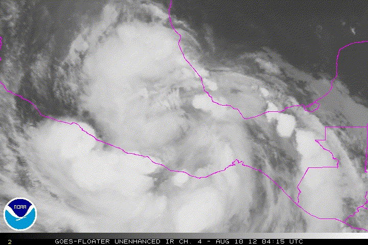
DEEP CONVECTION HAS DECREASED SUBSTANTIALLY NEAR THE CENTER OF
ERNESTO OVER THE THE PAST FEW HOURS...AND THE INTENSITY HAS BEEN
REDUCED TO 35 KT FOR THIS ADVISORY. ADDITIONAL WEAKENING IS
EXPECTED AS THE CYCLONE CONTINUES MOVING INLAND OVER THE HIGH
TERRAIN OF SOUTHERN MEXICO...AND THE LOW-LEVEL CIRCULATION IS
FORECAST TO DISSIPATE BY 24 HOURS.
THE INITIAL MOTION ESTIMATE IS 265/12...A LITTLE FASTER THAN BEFORE.
THIS GENERAL MOTION SHOULD CONTINUE UNTIL DISSIPATION AS ERNESTO IS
STEERED A LITTLE SOUTH OF DUE WEST BY THE SUBTROPICAL RIDGE
CENTERED OVER NORTHERN MEXICO AND THE SOUTHWESTERN UNITED STATES.
ALTHOUGH THE LOW-LEVEL CIRCULATION OF ERNESTO IS FORECAST TO
DISSIPATE OVER THE HIGH TERRAIN...THE GLOBAL MODELS CONTINUE TO
SUGGEST THAT A NEW TROPICAL CYCLONE COULD DEVELOP IN THE EASTERN
PACIFIC ASSOCIATED WITH THE MID-LEVEL REMNANT CIRCULATION IN 2 TO 3
DAYS. PLEASE SEE THE EASTERN PACIFIC TROPICAL WEATHER OUTLOOK
FOR MORE INFORMATION ON THIS POSSIBILITY.
VERY HEAVY RAINFALL IS EXPECTED TO CONTINUE EVEN AFTER ERNESTO
DISSIPATES...AND THESE RAINS WILL LIKELY PRODUCE FLASH FLOODING
OVER MUCH OF SOUTHERN MEXICO FOR THE NEXT DAY OR TWO.
FORECAST POSITIONS AND MAX WINDS
INIT 10/0300Z 18.1N 96.7W 35 KT 40 MPH
12H 10/1200Z 17.8N 98.4W 30 KT 35 MPH...INLAND
24H 11/0000Z...DISSIPATED
$$
FORECASTER BRENNAN
TCDAT5
TROPICAL STORM ERNESTO DISCUSSION NUMBER 35
NWS NATIONAL HURRICANE CENTER MIAMI FL AL052012
1000 PM CDT THU AUG 09 2012
DEEP CONVECTION HAS DECREASED SUBSTANTIALLY NEAR THE CENTER OF
ERNESTO OVER THE THE PAST FEW HOURS...AND THE INTENSITY HAS BEEN
REDUCED TO 35 KT FOR THIS ADVISORY. ADDITIONAL WEAKENING IS
EXPECTED AS THE CYCLONE CONTINUES MOVING INLAND OVER THE HIGH
TERRAIN OF SOUTHERN MEXICO...AND THE LOW-LEVEL CIRCULATION IS
FORECAST TO DISSIPATE BY 24 HOURS.
THE INITIAL MOTION ESTIMATE IS 265/12...A LITTLE FASTER THAN BEFORE.
THIS GENERAL MOTION SHOULD CONTINUE UNTIL DISSIPATION AS ERNESTO IS
STEERED A LITTLE SOUTH OF DUE WEST BY THE SUBTROPICAL RIDGE
CENTERED OVER NORTHERN MEXICO AND THE SOUTHWESTERN UNITED STATES.
ALTHOUGH THE LOW-LEVEL CIRCULATION OF ERNESTO IS FORECAST TO
DISSIPATE OVER THE HIGH TERRAIN...THE GLOBAL MODELS CONTINUE TO
SUGGEST THAT A NEW TROPICAL CYCLONE COULD DEVELOP IN THE EASTERN
PACIFIC ASSOCIATED WITH THE MID-LEVEL REMNANT CIRCULATION IN 2 TO 3
DAYS. PLEASE SEE THE EASTERN PACIFIC TROPICAL WEATHER OUTLOOK
FOR MORE INFORMATION ON THIS POSSIBILITY.
VERY HEAVY RAINFALL IS EXPECTED TO CONTINUE EVEN AFTER ERNESTO
DISSIPATES...AND THESE RAINS WILL LIKELY PRODUCE FLASH FLOODING
OVER MUCH OF SOUTHERN MEXICO FOR THE NEXT DAY OR TWO.
FORECAST POSITIONS AND MAX WINDS
INIT 10/0300Z 18.1N 96.7W 35 KT 40 MPH
12H 10/1200Z 17.8N 98.4W 30 KT 35 MPH...INLAND
24H 11/0000Z...DISSIPATED
$$
FORECASTER BRENNAN
0 likes
Visit the Caribbean-Central America Weather Thread where you can find at first post web cams,radars
and observations from Caribbean basin members Click Here
and observations from Caribbean basin members Click Here

ECM makes a strong TS out of Ernesto/remains in the EPAC, looks like there is more then enough left of Ernesto to develop in the EPAC, whether its classed as Ernesto or not.
0 likes
Personal Forecast Disclaimer:
The posts in this forum are NOT official forecast and should not be used as such. They are just the opinion of the poster and may or may not be backed by sound meteorological data. They are NOT endorsed by any professional institution or storm2k.org. For official information, please refer to the NHC and NWS products
The posts in this forum are NOT official forecast and should not be used as such. They are just the opinion of the poster and may or may not be backed by sound meteorological data. They are NOT endorsed by any professional institution or storm2k.org. For official information, please refer to the NHC and NWS products
-
cycloneye
- Admin
- Posts: 149275
- Age: 69
- Joined: Thu Oct 10, 2002 10:54 am
- Location: San Juan, Puerto Rico
Re: ATL: ERNESTO - Tropical Depression
Up to 60%.
A LARGE AREA OF DISTURBED WEATHER ALONG THE SOUTHERN COAST OF MEXICO
IS ASSOCIATED WITH THE BROAD CIRCULATION OF WEAKENING TROPICAL
DEPRESSION ERNESTO. ENVIRONMENTAL CONDITIONS ARE FAVORABLE FOR THIS
DISTURBANCE TO DEVELOP AS IT MOVES WESTWARD AWAY FROM THE COAST OF
MEXICO. THERE IS A HIGH CHANCE...60 PERCENT...OF TROPICAL CYCLONE
FORMATION DURING THE NEXT 48 HOURS.
0 likes
Visit the Caribbean-Central America Weather Thread where you can find at first post web cams,radars
and observations from Caribbean basin members Click Here
and observations from Caribbean basin members Click Here
-
tolakram
- Admin
- Posts: 20179
- Age: 62
- Joined: Sun Aug 27, 2006 8:23 pm
- Location: Florence, KY (name is Mark)
Re: ATL: ERNESTO - Tropical Depression
Looks to me like the circulation dissipated last night. You can see the mountains in this loop.
0 likes
M a r k
- - - - -
Join us in chat: Storm2K Chatroom Invite. Android and IOS apps also available.
The posts in this forum are NOT official forecasts and should not be used as such. Posts are NOT endorsed by any professional institution or STORM2K.org. For official information and forecasts, please refer to NHC and NWS products.
- - - - -
Join us in chat: Storm2K Chatroom Invite. Android and IOS apps also available.
The posts in this forum are NOT official forecasts and should not be used as such. Posts are NOT endorsed by any professional institution or STORM2K.org. For official information and forecasts, please refer to NHC and NWS products.
-
tolakram
- Admin
- Posts: 20179
- Age: 62
- Joined: Sun Aug 27, 2006 8:23 pm
- Location: Florence, KY (name is Mark)
Re: ATL: ERNESTO - Tropical Depression
30 frame live loop. The sat had all kinds of issues last night so you'll have to turn off all the bad frames.
You could make the case, I suppose, that some kind of circulation made it into the Pacific. I'll let the NHC make that call and agree with whatever they say.
http://wwwghcc.msfc.nasa.gov/cgi-bin/ge ... mframes=30
You could make the case, I suppose, that some kind of circulation made it into the Pacific. I'll let the NHC make that call and agree with whatever they say.
http://wwwghcc.msfc.nasa.gov/cgi-bin/ge ... mframes=30
0 likes
M a r k
- - - - -
Join us in chat: Storm2K Chatroom Invite. Android and IOS apps also available.
The posts in this forum are NOT official forecasts and should not be used as such. Posts are NOT endorsed by any professional institution or STORM2K.org. For official information and forecasts, please refer to NHC and NWS products.
- - - - -
Join us in chat: Storm2K Chatroom Invite. Android and IOS apps also available.
The posts in this forum are NOT official forecasts and should not be used as such. Posts are NOT endorsed by any professional institution or STORM2K.org. For official information and forecasts, please refer to NHC and NWS products.
-
tolakram
- Admin
- Posts: 20179
- Age: 62
- Joined: Sun Aug 27, 2006 8:23 pm
- Location: Florence, KY (name is Mark)
Re: ATL: ERNESTO - Tropical Depression
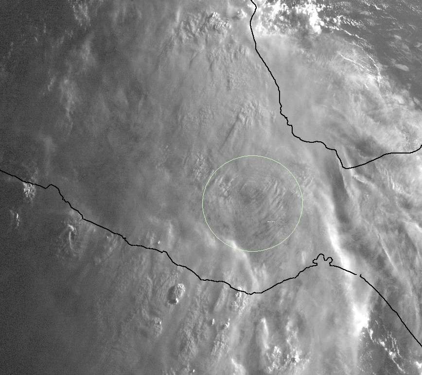
First Visible. Is that what remains of the LLC, stuck on the edge of the mountains?
0 likes
M a r k
- - - - -
Join us in chat: Storm2K Chatroom Invite. Android and IOS apps also available.
The posts in this forum are NOT official forecasts and should not be used as such. Posts are NOT endorsed by any professional institution or STORM2K.org. For official information and forecasts, please refer to NHC and NWS products.
- - - - -
Join us in chat: Storm2K Chatroom Invite. Android and IOS apps also available.
The posts in this forum are NOT official forecasts and should not be used as such. Posts are NOT endorsed by any professional institution or STORM2K.org. For official information and forecasts, please refer to NHC and NWS products.
-
tolakram
- Admin
- Posts: 20179
- Age: 62
- Joined: Sun Aug 27, 2006 8:23 pm
- Location: Florence, KY (name is Mark)
Re: ATL: ERNESTO - Tropical Depression
More frames will be available soon, but last to frames seem to show what's left of the LLC.
http://wwwghcc.msfc.nasa.gov/cgi-bin/ge ... umframes=5
http://wwwghcc.msfc.nasa.gov/cgi-bin/ge ... umframes=5
0 likes
M a r k
- - - - -
Join us in chat: Storm2K Chatroom Invite. Android and IOS apps also available.
The posts in this forum are NOT official forecasts and should not be used as such. Posts are NOT endorsed by any professional institution or STORM2K.org. For official information and forecasts, please refer to NHC and NWS products.
- - - - -
Join us in chat: Storm2K Chatroom Invite. Android and IOS apps also available.
The posts in this forum are NOT official forecasts and should not be used as such. Posts are NOT endorsed by any professional institution or STORM2K.org. For official information and forecasts, please refer to NHC and NWS products.
-
tolakram
- Admin
- Posts: 20179
- Age: 62
- Joined: Sun Aug 27, 2006 8:23 pm
- Location: Florence, KY (name is Mark)
Re: ATL: ERNESTO - Tropical Depression
Had it moved due south it might have made it, but too many mountains in the way, IMO.
0 likes
M a r k
- - - - -
Join us in chat: Storm2K Chatroom Invite. Android and IOS apps also available.
The posts in this forum are NOT official forecasts and should not be used as such. Posts are NOT endorsed by any professional institution or STORM2K.org. For official information and forecasts, please refer to NHC and NWS products.
- - - - -
Join us in chat: Storm2K Chatroom Invite. Android and IOS apps also available.
The posts in this forum are NOT official forecasts and should not be used as such. Posts are NOT endorsed by any professional institution or STORM2K.org. For official information and forecasts, please refer to NHC and NWS products.
-
Extratropical94

- Professional-Met

- Posts: 3545
- Age: 31
- Joined: Wed Oct 20, 2010 6:36 am
- Location: Hamburg, Germany
- Contact:
1st question: Does a storm that crosses over really keep its original name? I'm thinking of storms like Hurricane Joan-Miriam that kept intact throughout the land passage and still got renamed...
2nd question: Now, that Ernesto is officially declared dissipated, is it 100% certain that the EPAC system will not be named Ernesto again?
3rd question: Is there a thread for that 60% disturbance yet?
Any comments or answers are appreciated. Thanks in advance.
2nd question: Now, that Ernesto is officially declared dissipated, is it 100% certain that the EPAC system will not be named Ernesto again?
3rd question: Is there a thread for that 60% disturbance yet?
Any comments or answers are appreciated. Thanks in advance.
0 likes
54° 11' 59'' N, 9° 9' 20'' E
Boomer Sooner!
Go Broncos! Go Cards!
Clinching counties, one at a time: https://mob-rule.com/user-gifs/USA/xtrp94.gif
- Daniel
Boomer Sooner!
Go Broncos! Go Cards!
Clinching counties, one at a time: https://mob-rule.com/user-gifs/USA/xtrp94.gif
- Daniel
-
tolakram
- Admin
- Posts: 20179
- Age: 62
- Joined: Sun Aug 27, 2006 8:23 pm
- Location: Florence, KY (name is Mark)
Re: ATL: ERNESTO - Tropical Depression
NHC discussion tells you. No thread for the remains yet.
000
WTNT45 KNHC 101435
TCDAT5
REMNANTS OF ERNESTO DISCUSSION NUMBER 37
NWS NATIONAL HURRICANE CENTER MIAMI FL AL052012
1000 AM CDT FRI AUG 10 2012
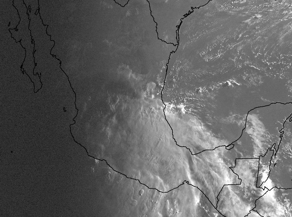
SURFACE OBSERVATIONS FROM MEXICO INDICATE THAT THE LOW-LEVEL CENTER
OF CIRCULATION HAS BECOME DISRUPTED BY THE HIGH TERRAIN AND IS NO
LONGER TRACKABLE. ERNESTO NOW CONSISTS OF A BROAD AREA OF LOW
PRESSURE OVER SOUTHERN MEXICO. HEAVY RAINFALL ASSOCIATED WITH THE
REMNANTS OF ERNESTO WILL CONTINUE DURING THE NEXT DAY OR TWO.
THESE RAINS WILL LIKELY PRODUCE FLASH FLOODING OVER MUCH OF
SOUTHERN MEXICO.
THE REMNANTS OF ERNESTO ARE EXPECTED TO MOVE OFF MEXICO INTO THE
EASTERN PACIFIC WITH THE POTENTIAL TO BECOME A TROPICAL CYCLONE. IF
THIS IS THE CASE...IT WILL ACQUIRE A NEW DEPRESSION NUMBER...OR A
NEW NAME IF IT BECOMES A TROPICAL STORM.
THIS IS THE LAST ADVISORY ISSUED BY THE NATIONAL HURRICANE CENTER ON
ERNESTO.
FORECAST POSITIONS AND MAX WINDS
INIT 10/1500Z 18.0N 99.2W 20 KT 25 MPH
12H 11/0000Z...DISSIPATED
$$
FORECASTER AVILA
000
WTNT45 KNHC 101435
TCDAT5
REMNANTS OF ERNESTO DISCUSSION NUMBER 37
NWS NATIONAL HURRICANE CENTER MIAMI FL AL052012
1000 AM CDT FRI AUG 10 2012
SURFACE OBSERVATIONS FROM MEXICO INDICATE THAT THE LOW-LEVEL CENTER
OF CIRCULATION HAS BECOME DISRUPTED BY THE HIGH TERRAIN AND IS NO
LONGER TRACKABLE. ERNESTO NOW CONSISTS OF A BROAD AREA OF LOW
PRESSURE OVER SOUTHERN MEXICO. HEAVY RAINFALL ASSOCIATED WITH THE
REMNANTS OF ERNESTO WILL CONTINUE DURING THE NEXT DAY OR TWO.
THESE RAINS WILL LIKELY PRODUCE FLASH FLOODING OVER MUCH OF
SOUTHERN MEXICO.
THE REMNANTS OF ERNESTO ARE EXPECTED TO MOVE OFF MEXICO INTO THE
EASTERN PACIFIC WITH THE POTENTIAL TO BECOME A TROPICAL CYCLONE. IF
THIS IS THE CASE...IT WILL ACQUIRE A NEW DEPRESSION NUMBER...OR A
NEW NAME IF IT BECOMES A TROPICAL STORM.
THIS IS THE LAST ADVISORY ISSUED BY THE NATIONAL HURRICANE CENTER ON
ERNESTO.
FORECAST POSITIONS AND MAX WINDS
INIT 10/1500Z 18.0N 99.2W 20 KT 25 MPH
12H 11/0000Z...DISSIPATED
$$
FORECASTER AVILA
0 likes
M a r k
- - - - -
Join us in chat: Storm2K Chatroom Invite. Android and IOS apps also available.
The posts in this forum are NOT official forecasts and should not be used as such. Posts are NOT endorsed by any professional institution or STORM2K.org. For official information and forecasts, please refer to NHC and NWS products.
- - - - -
Join us in chat: Storm2K Chatroom Invite. Android and IOS apps also available.
The posts in this forum are NOT official forecasts and should not be used as such. Posts are NOT endorsed by any professional institution or STORM2K.org. For official information and forecasts, please refer to NHC and NWS products.
-
Extratropical94
- Professional-Met
- Posts: 3545
- Age: 31
- Joined: Wed Oct 20, 2010 6:36 am
- Location: Hamburg, Germany
- Contact:
Thanks Mark, I haven't read that disco yet. 
I guess there's no need to make one then as long as it's not a numbered TC.
I guess there's no need to make one then as long as it's not a numbered TC.
0 likes
54° 11' 59'' N, 9° 9' 20'' E
Boomer Sooner!
Go Broncos! Go Cards!
Clinching counties, one at a time: https://mob-rule.com/user-gifs/USA/xtrp94.gif
- Daniel
Boomer Sooner!
Go Broncos! Go Cards!
Clinching counties, one at a time: https://mob-rule.com/user-gifs/USA/xtrp94.gif
- Daniel
-
tolakram
- Admin
- Posts: 20179
- Age: 62
- Joined: Sun Aug 27, 2006 8:23 pm
- Location: Florence, KY (name is Mark)
Re:
Extratropical94 wrote:Thanks Mark, I haven't read that disco yet.
I guess there's no need to make one then as long as it's not a numbered TC.
You can start one in Talking Tropics if you want, I'm sure someone will at some point. I would like to think they will activate an invest in the EPAC soon, but really no clue.
0 likes
M a r k
- - - - -
Join us in chat: Storm2K Chatroom Invite. Android and IOS apps also available.
The posts in this forum are NOT official forecasts and should not be used as such. Posts are NOT endorsed by any professional institution or STORM2K.org. For official information and forecasts, please refer to NHC and NWS products.
- - - - -
Join us in chat: Storm2K Chatroom Invite. Android and IOS apps also available.
The posts in this forum are NOT official forecasts and should not be used as such. Posts are NOT endorsed by any professional institution or STORM2K.org. For official information and forecasts, please refer to NHC and NWS products.


Re:
Extratropical94 wrote:1st question: Does a storm that crosses over really keep its original name? I'm thinking of storms like Hurricane Joan-Miriam that kept intact throughout the land passage and still got renamed...
2nd question: Now, that Ernesto is officially declared dissipated, is it 100% certain that the EPAC system will not be named Ernesto again?
3rd question: Is there a thread for that 60% disturbance yet?
Any comments or answers are appreciated. Thanks in advance.
1st answer: Nope. Whenever a storm's center of circulation is >50% into the EPAC or ATL basins, the storm is assigned the upcoming name from the basin that the storm crossed into. For example, if Ernesto survives his trip across Mexico, he will be renamed Ernesto-Hector.
2nd answer: See above.
3rd answer: Yes. Look below the thread for Florence.
0 likes
Personal Forecast Disclaimer:
The posts in this forum are NOT official forecast and should not be used as such. They are just the opinion of the poster and may or may not be backed by sound meteorological data. They are NOT endorsed by any professional institution or storm2k.org.
Hope this helped
The posts in this forum are NOT official forecast and should not be used as such. They are just the opinion of the poster and may or may not be backed by sound meteorological data. They are NOT endorsed by any professional institution or storm2k.org.
Hope this helped
-
tolakram
- Admin
- Posts: 20179
- Age: 62
- Joined: Sun Aug 27, 2006 8:23 pm
- Location: Florence, KY (name is Mark)
Re: Re:
greenkat wrote:
1st answer: Nope. Whenever a storm's center of circulation is >50% into the EPAC or ATL basins, the storm is assigned the upcoming name from the basin that the storm crossed into. For example, if Ernesto survives his trip across Mexico, he will be renamed Ernesto-Hector.
2nd answer: See above.
3rd answer: Yes. Look below the thread for Florence.
Hi greenkat, do you have a source for #1. Not familiar with the two-name designation.
Based on my info I think the policy is rather simple. If the LLC survived it would keep the same name, otherwise it will be treated as a new EPAC storm. Since the NHC has declared Ernesto as dissipated a new name will be given if the remnants 'regenerate'.
0 likes
M a r k
- - - - -
Join us in chat: Storm2K Chatroom Invite. Android and IOS apps also available.
The posts in this forum are NOT official forecasts and should not be used as such. Posts are NOT endorsed by any professional institution or STORM2K.org. For official information and forecasts, please refer to NHC and NWS products.
- - - - -
Join us in chat: Storm2K Chatroom Invite. Android and IOS apps also available.
The posts in this forum are NOT official forecasts and should not be used as such. Posts are NOT endorsed by any professional institution or STORM2K.org. For official information and forecasts, please refer to NHC and NWS products.
Who is online
Users browsing this forum: No registered users and 72 guests