I think some of the forecasters are looking at what COULD happen, as opposed to what is out there.
Jeff Masters at Wunderground:
"Another area to watch this weekend will be the Gulf of Mexico, where a fall-like cold front is expected to stall out. Though no models are showing tropical storm development will occur, wind shear is predicted to be low to moderate this weekend, and cold fronts stalled out over the Gulf of Mexico often serve as the seed for tropical storms."
ATL: HELENE - Post-Tropical
Moderator: S2k Moderators
-
Houstonia

- S2K Supporter

- Posts: 829
- Age: 61
- Joined: Fri Oct 11, 2002 9:45 am
- Location: Sharpstown, Houston, Harris County, Southeast Texas.
Re: ATL: SEVEN - Remnants
0 likes
-
wxman57

- Moderator-Pro Met

- Posts: 23175
- Age: 68
- Joined: Sat Jun 21, 2003 8:06 pm
- Location: Houston, TX (southwest)
Re: ATL: SEVEN - Remnants
Agree, Houstonia. Gulf does look like a favorable environment for thunderstorms in the coming week, and all thunderstorm complexes should be monitored closely.
0 likes
Re: ATL: SEVEN - Remnants
[quote="wxman57"]Agree, Houstonia. Gulf does look like a favorable environment for thunderstorms in the coming week, and all thunderstorm complexes should be monitored closely.[/quote]
This tidbit from NWS Tallahassee....
At surface, models diverge but in better agreement
than 24hrs ago. As the upper trough digs, GFS lifts ridge axis NWD
and develops an area of low PRESSURE in the WRN Gulf and steers it
and deeper tropical moisture with locally heavy RAINFALL NEWD
toward the FL Panhandle during weekend. Conversely, ECMWF shifts
ridge axis SWD, and shows no such Gulf low development. But both
models now show upper flow at base of trough largely parallel to
front on Sun and stalls front just north of CWA keeping CWA in
warm sector.
0 likes

-
floridasun78
- Category 5

- Posts: 3755
- Joined: Sun May 17, 2009 10:16 pm
- Location: miami fl
-
tropicwatch

- Category 5
- Posts: 3426
- Age: 62
- Joined: Sat Jun 02, 2007 10:01 am
- Location: The Villages, Florida
- Contact:
"in the WRN Gulf and steers it
and deeper tropical moisture with locally heavy RAINFALL NEWD
toward the FL Panhandle during weekend"
This scenario would keep me off my boat for another weekend. I hope it doesn't happen that way. There is a King Mackerel with my name on it waiting to be caught
and deeper tropical moisture with locally heavy RAINFALL NEWD
toward the FL Panhandle during weekend"
This scenario would keep me off my boat for another weekend. I hope it doesn't happen that way. There is a King Mackerel with my name on it waiting to be caught
0 likes
Tropicwatch
Agnes 72', Eloise 75, Elena 85', Kate 85', Charley 86', Florence 88', Beryl 94', Dean 95', Erin 95', Opal 95', Earl 98', Georges 98', Ivan 2004', Arlene 2005', Dennis 2005', Ida 2009' Debby 2012' Irma 2017' Michael 2018'
Agnes 72', Eloise 75, Elena 85', Kate 85', Charley 86', Florence 88', Beryl 94', Dean 95', Erin 95', Opal 95', Earl 98', Georges 98', Ivan 2004', Arlene 2005', Dennis 2005', Ida 2009' Debby 2012' Irma 2017' Michael 2018'
-
cycloneye

- Admin

- Posts: 149505
- Age: 69
- Joined: Thu Oct 10, 2002 10:54 am
- Location: San Juan, Puerto Rico
Re: ATL: SEVEN - Remnants
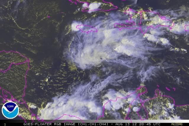
8 PM EDT TWO:
SHOWERS AND THUNDERSTORMS ASSOCIATED WITH A TROPICAL WAVE...THE
REMNANTS OF TROPICAL DEPRESSION SEVEN...OVER THE WEST-CENTRAL
CARIBBEAN SEA HAVE DECREASSED THIS EVENING. ALTHOUGH UPPER-LEVEL
WINDS COULD BECOME MORE CONDUCIVE FOR REGENERATION...THE WAVE IS
LIKELY TO INTERACT WITH CENTRAL AMERICA BEFORE SIGNIFICANT
DEVELOPMENT OCCURS. THIS SYSTEM HAS A LOW CHANCE...20 PERCENT...OF
BECOMING A TROPICAL CYCLONE AGAIN DURING THE NEXT 48 HOURS AS IT
MOVES WESTWARD AROUND 20 MPH. AN AIR FORCE RESERVE RECONNAISSANCE
AIRCRAFT IS SCHEDULED TO INVESTIGATE THE DISTURBANCE TUESDAY
AFTERNOON...IF NECESSARY.
0 likes
Visit the Caribbean-Central America Weather Thread where you can find at first post web cams,radars
and observations from Caribbean basin members Click Here
and observations from Caribbean basin members Click Here
-
Ev1948
- S2K Supporter
- Posts: 65
- Joined: Mon Jun 28, 2010 6:16 pm
- Location: Florida USA -from South New Jersey
Re: ATL: SEVEN - Remnants
I don't know where to put this, but who or what is Bones? Been seeing the name posted a lot. 
Last edited by Ev1948 on Mon Aug 13, 2012 8:11 pm, edited 1 time in total.
0 likes

-
rainstorm


Re: ATL: SEVEN - Models
ROCK wrote:floridasun78 wrote:
i dont see any thing
Look in the BOC at the end of the run
wow. looks like some rain.
0 likes

-
cycloneye
- Admin
- Posts: 149505
- Age: 69
- Joined: Thu Oct 10, 2002 10:54 am
- Location: San Juan, Puerto Rico
Re: ATL: SEVEN - Remnants
8 AM TWO.
A TROPICAL WAVE...THE REMNANTS OF TROPICAL DEPRESSION SEVEN...
IS PRODUCING SHOWERS AND THUNDERSTORMS OVER THE WEST-CENTRAL
CARIBBEAN SEA. ALTHOUGH ENVIRONMENTAL CONDITIONS ARE MARGINALLY
CONDUCIVE FOR REGENERATION...SIGNIFICANT DEVELOPMENT IS NOT
EXPECTED BEFORE THE WAVE BEGINS TO MOVE ACROSS CENTRAL AMERICA
LATER TODAY. THIS SYSTEM HAS A LOW CHANCE...20 PERCENT...OF
BECOMING A TROPICAL CYCLONE AGAIN DURING THE NEXT 48 HOURS.
REGARDLESS OF DEVELOPMENT...HEAVY RAINS AND GUSTY WINDS WILL BE
POSSIBLE ACROSS PORTIONS OF CENTRAL AMERICA TODAY AND WEDNESDAY
AS THE WAVE MOVES WESTWARD AT 15 TO 20 MPH.
0 likes
Visit the Caribbean-Central America Weather Thread where you can find at first post web cams,radars
and observations from Caribbean basin members Click Here
and observations from Caribbean basin members Click Here
I would had thought that our TX members would be excited about the last 3 runs of the GFS. Whether it redevelops or not of least bringing the moisture up from TD7 remants to TX by early next week.
Unlike Ernesto a deep trough will dig down the MS river valley along with a stronger Bermuda ridge east of FL will create southerly winds across the western GOM. I could see this happening. The only thing going against this scenario is that the GFS still does not have any other global model support with the ECMWF & CMC showing a stronger ridge across the GOM to push everything towards MX.
Unlike Ernesto a deep trough will dig down the MS river valley along with a stronger Bermuda ridge east of FL will create southerly winds across the western GOM. I could see this happening. The only thing going against this scenario is that the GFS still does not have any other global model support with the ECMWF & CMC showing a stronger ridge across the GOM to push everything towards MX.
0 likes
-
Rgv20

- S2K Supporter
- Posts: 2466
- Age: 39
- Joined: Wed Jan 05, 2011 5:42 pm
- Location: Edinburg/McAllen Tx
0 likes
The following post is NOT an official forecast and should not be used as such. It is just the opinion of the poster and may or may not be backed by sound meteorological data. It is NOT endorsed by any professional institution including storm2k.org For Official Information please refer to the NHC and NWS products.
-
wxman57
- Moderator-Pro Met
- Posts: 23175
- Age: 68
- Joined: Sat Jun 21, 2003 8:06 pm
- Location: Houston, TX (southwest)
Re: ATL: SEVEN - Models
I already have measured 49.84" of rain this year (total of 21" in 2011). Don't really need more rain in SE TX. They can have it in south TX and the Hill Country.
0 likes
-
Nikki

- S2K Supporter
- Posts: 291
- Joined: Mon Jun 21, 2010 3:38 pm
- Location: Santa Fe, TX (yes I typed that right TEXAS not New Mexico, I am about 20 miles from Galveston, TX)
Re: ATL: SEVEN - Models
wxman57 wrote:I already have measured 49.84" of rain this year (total of 21" in 2011). Don't really need more rain in SE TX. They can have it in south TX and the Hill Country.
You took the words "right out of my mouth". I was going to say the same thing, if this "storm" is going to bring rain to TX, let it be in the places that need it the most!!
0 likes
My name is Nicole and this is what I go by in Storm2k chat! Come chat with us! We have fun in there too!!
A teacher's purpose is not to create students in her own image, but to develop students who can create their own image. ~Author Unknown
Alicia, Allison, Rita, Ike
A teacher's purpose is not to create students in her own image, but to develop students who can create their own image. ~Author Unknown
Alicia, Allison, Rita, Ike
-
wxwatcher1999
- Category 1

- Posts: 264
- Joined: Sat Aug 04, 2012 10:19 am
If it redevelops in the boc how far north is it showing landfall?
0 likes
Personal Forecast Disclaimer:
The posts in this forum are NOT official forecast and should not be used as such. They are just the opinion of the poster and may or may not be backed by sound meteorological data. They are NOT endorsed by any professional institution or storm2k.org. For official information, please refer to the NHC and NWS products.
The posts in this forum are NOT official forecast and should not be used as such. They are just the opinion of the poster and may or may not be backed by sound meteorological data. They are NOT endorsed by any professional institution or storm2k.org. For official information, please refer to the NHC and NWS products.
Who is online
Users browsing this forum: No registered users and 67 guests