Modoki: Generally central based El Nino where warmest waters are nearer to the international dateline Nino 3.4 and is usually accompanied by cooler waters off SA (not always)

EP (eastern pacific) traditional: Warm throughout with greatest warming in Nino 3 and 1+2

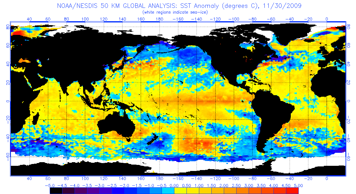
Now you might be asking why I posted 2009's El Nino under Modoki. In fact it was a Modoki, the strongest of the bunch. Why? Modoki in it's simplest terms states that the warmest waters reside in Nino 3.4 and cooler elsewhere.
1986, 1991-1992, 1994-1995, 2002-2003, 2004-2005, and 2009-2010 were all Modoki. 2006-2007 was iffy but some consider it a possibility.
EP traditional El Nino 1982-1983 and 1997-1998
Taking this data we see that for the past 20+ years (since satellite data was available) we see that Modoki Nino's are not as uncommon, one could argue otherwise that traditional Nino's are rarer and often the strongest.
How this correlates to tropical season? There isn't enough satellite data to go back beyond 1979 so there's no definitive answer. The phrase modoki tends to bring more tropical cyclone activity in the Atlantic is used a lot. I haven't found data to prove that so. If anyone does please feel free to! You could say EP Ninos are better at squashing activity but that's simple logic given they are the strongest anyway.
As why 2004 was such a strange active Nino for hurricane season. It was a very weak Nino even at it's peak so at best neutral conditions probably existed during the season. If one takes a look at the MEI index (covers atmosphere, sea temps, wind patterns etc) 2004 was more neutral like than Nino, the index never went beyond 0.672 and the average for that summer was even lower. This doesn't explain all why the devastating hurricanes happened but maybe we can clear up some modoki fog.
Credit to Ptarmigan's previous post on some of this data