Low pressure system in northernmost Gulf of Mexico has been designated Invest 90L. Discuss.
BEGIN
NHC_ATCF
invest_al902012.invest
FSTDA
R
U
040
010
0000
201209050953
NONE
NOTIFY=ATRP
END
INVEST, AL, L, , , , , 90, 2012, DB, O, 2012090506, 9999999999, , , , , , METWATCH, , AL902012
AL, 90, 2012090418, , BEST, 0, 336N, 874W, 15, 1010, DB, 0, , 0, 0, 0, 0,
AL, 90, 2012090500, , BEST, 0, 322N, 877W, 15, 1010, DB, 0, , 0, 0, 0, 0,
AL, 90, 2012090506, , BEST, 0, 307N, 879W, 20, 1010, DB, 34, NEQ, 0, 0, 0, 0, 1011, 150, 0, 0, 0, L, 0, , 0, 0, INVEST, S,
ATL: INVEST 90L - Discussion
Moderator: S2k Moderators
-
crownweather

- S2K Supporter

- Posts: 602
- Age: 51
- Joined: Sat Aug 12, 2006 9:21 am
- Location: Sturbridge, Massachusetts
- Contact:
ATL: INVEST 90L - Discussion
Last edited by cycloneye on Wed Sep 05, 2012 1:00 pm, edited 3 times in total.
Reason: added atcf
Reason: added atcf
0 likes
Rob Lightbown
Crown Weather Services
https://crownweather.com
Crown Weather Services
https://crownweather.com

-
cycloneye

- Admin

- Posts: 149843
- Age: 69
- Joined: Thu Oct 10, 2002 10:54 am
- Location: San Juan, Puerto Rico
Re: ATL: INVEST 90L - Discussion
In case anyone missed last night's Facebook message by NHC about which name this will be if it develops,here it is.
Our view is that while this disturbance has some association with Isaac, the primary remnant of Isaac was a separate decaying circulation to the north of this one. Therefore, should this disturbance develop into a tropical cyclone it would get a new name.
Our view is that while this disturbance has some association with Isaac, the primary remnant of Isaac was a separate decaying circulation to the north of this one. Therefore, should this disturbance develop into a tropical cyclone it would get a new name.
0 likes
Visit the Caribbean-Central America Weather Thread where you can find at first post web cams,radars
and observations from Caribbean basin members Click Here
and observations from Caribbean basin members Click Here
-
northjaxpro

- S2K Supporter
- Posts: 8900
- Joined: Mon Sep 27, 2010 11:21 am
- Location: Jacksonville, FL
Conditions look marginally conducive for 90L to spin-up to a TD or possibly a TS in the next 48 hours. Shear may pick up some this weekend as a significant trough dropping down southeast from Canada wil bring a cold front down to pick up 90L. Another significant rainmaker in store for the weekend for areas in Florida and potentially up the East Coast depending on the ultimate track this tropical entity takes when the trough grabs it.
__________________
The posts in this forum are NOT official forecast. They are just the opinion of this poster. For official information, please refer to the NHC and NWS products
__________________
The posts in this forum are NOT official forecast. They are just the opinion of this poster. For official information, please refer to the NHC and NWS products
0 likes
NEVER, EVER SAY NEVER in the tropics and weather in general, and most importantly, with life itself!!
________________________________________________________________________________________
Fay 2008 Beryl 2012 Debby 2012 Colin 2016 Hermine 2016 Julia 2016 Matthew 2016 Irma 2017 Dorian 2019
________________________________________________________________________________________
Fay 2008 Beryl 2012 Debby 2012 Colin 2016 Hermine 2016 Julia 2016 Matthew 2016 Irma 2017 Dorian 2019
-
superstareporter
- Tropical Low

- Posts: 31
- Joined: Mon Aug 27, 2012 12:06 pm
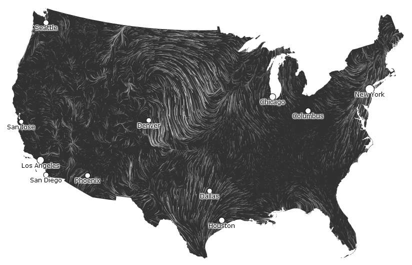
Look at the little circulation on this incredibly cool map! I am just in awe with who ever developed this concept for mapping the surface winds.
http://hint.fm/wind/
http://hint.fm/wind/
0 likes
-
cycloneye
- Admin
- Posts: 149843
- Age: 69
- Joined: Thu Oct 10, 2002 10:54 am
- Location: San Juan, Puerto Rico
Re: ATL: INVEST 90L - Discussion
8 AM TWO:
A LOW PRESSURE SYSTEM LOCATED ALONG THE COAST OF THE WESTERN FLORIDA
PANHANDLE WILL MOVE SOUTHWARD INTO THE NORTH-CENTRAL GULF OF MEXICO
LATER TODAY. ENVIRONMENTAL CONDITIONS ARE MARGINALLY CONDUCIVE FOR
SOME GRADUAL DEVELOPMENT OF THIS DISTURBANCE AS IT MOVES SOUTHWARD
TO SOUTH-SOUTHWESTWARD AT 5 TO 10 MPH OVER THE NEXT FEW DAYS. THIS
SYSTEM HAS A LOW CHANCE...20 PERCENT...OF BECOMING A TROPICAL
CYCLONE DURING THE NEXT 48 HOURS.
0 likes
Visit the Caribbean-Central America Weather Thread where you can find at first post web cams,radars
and observations from Caribbean basin members Click Here
and observations from Caribbean basin members Click Here
-
LSU2001

- S2K Supporter
- Posts: 1711
- Age: 58
- Joined: Sat Sep 11, 2004 11:01 pm
- Location: Cut Off, Louisiana
Re: ATL: INVEST 90L - Discussion
Here in lower Lafourche Parish we have west wind about 10-15 mph with lots of low scud clouds moving to the east. It sure looks like there is a definite surface circulation to our east. As 90L continues to drift south I would expect the winds to turn out of the east so I guess we will just have to wait and see.
Tim
Personal Forecast Disclaimer:
The posts in this forum are NOT official forecast and should not be used as such. They are just the opinion of the poster and may or may not be backed by sound meteorological data. They are NOT endorsed by any professional institution or storm2k.org. For official information, please refer to the NHC and NWS products.
0 likes
Personal Forecast Disclaimer:
The posts in this forum are NOT official forecast and should not be used as such. They are NOT endorsed by any professional institution or storm2k.org. For official information, please refer to the NHC and NWS products.
The posts in this forum are NOT official forecast and should not be used as such. They are NOT endorsed by any professional institution or storm2k.org. For official information, please refer to the NHC and NWS products.
-
Dean4Storms
- S2K Supporter
- Posts: 6358
- Age: 63
- Joined: Sun Aug 31, 2003 1:01 pm
- Location: Miramar Bch. FL
1009mb and a dead calm wind here in Destin now. I think this makes a run at a weak TS, we'll see!
0 likes
My opinion and statements DO NOT represent the opinion of the EMA, NHC, NWS, or any other professional agency, organization, or group. For official information, please refer to the NHC and NWS products.
-
Dean4Storms
- S2K Supporter
- Posts: 6358
- Age: 63
- Joined: Sun Aug 31, 2003 1:01 pm
- Location: Miramar Bch. FL
If radar is pretty much indicative of the Low then it does look like it's right on top of me.
http://radar.weather.gov/ridge/radar.ph ... X&loop=yes
http://radar.weather.gov/ridge/radar.ph ... X&loop=yes
0 likes
-
Dean4Storms
- S2K Supporter
- Posts: 6358
- Age: 63
- Joined: Sun Aug 31, 2003 1:01 pm
- Location: Miramar Bch. FL
Scroll down to my weather sites graph and you can see how my winds here have just gone downhill....
Looks like the center passed to my south just after 5am!
http://www.wunderground.com/weatherstat ... =KFLMIRAM6
Looks like the center passed to my south just after 5am!
http://www.wunderground.com/weatherstat ... =KFLMIRAM6
0 likes
-
tolakram
- Admin
- Posts: 20189
- Age: 62
- Joined: Sun Aug 27, 2006 8:23 pm
- Location: Florence, KY (name is Mark)
Re:
Dean4Storms wrote:Scroll down to my weather sites graph and you can see how my winds here have just gone downhill....
Looks like the center passed to my south just after 5am!
http://www.wunderground.com/weatherstat ... =KFLMIRAM6
As of the 8am weather reports the center still appears to be in the panhandle of Florida.
http://hint.fm/wind/
For those stuck with a slow browser who can't view that map:
0 likes
M a r k
- - - - -
Join us in chat: Storm2K Chatroom Invite. Android and IOS apps also available.
The posts in this forum are NOT official forecasts and should not be used as such. Posts are NOT endorsed by any professional institution or STORM2K.org. For official information and forecasts, please refer to NHC and NWS products.
-
AnnularCane

- S2K Supporter
- Posts: 2965
- Joined: Thu Jun 08, 2006 9:18 am
- Location: Wytheville, VA
Re: ATL: INVEST 90L - Discussion
It's gray and overcast here and looks like it's going to rain any minute, but according to radar everything is moving away from me.
0 likes
-
OuterBanker
- S2K Supporter
- Posts: 1761
- Joined: Wed Feb 26, 2003 10:53 am
- Location: Nags Head, NC
- Contact:

-
CrazyC83
- Professional-Met

- Posts: 34316
- Joined: Tue Mar 07, 2006 11:57 pm
- Location: Deep South, for the first time!
Re: Re:
micktooth wrote:CrazyC83 wrote:AL, 90, 2012090512, , BEST, 0, 307N, 864W, 25, 1010, LO
Status change: DB to LO
Can you please explain what "DB" and "LO" mean? Thanks!
Disturbance and Low (means now there is a weak circulation)
0 likes
-
Aric Dunn
- Category 5

- Posts: 21238
- Age: 43
- Joined: Sun Sep 19, 2004 9:58 pm
- Location: Ready for the Chase.
- Contact:
This does have a pretty decent chance to develop and depending on how quickly it can develop once it moves offshore/reforms later today will give it a better chance to strengthen. nearly all guidance keeps it well offshore for 3 to in some cases 4 days plenty of time be come a TS and cant even rule out a minimal hurricane. shear looks to be on the low to medium side.
0 likes
Note: If I make a post that is brief. Please refer back to previous posts for the analysis or reasoning. I do not re-write/qoute what my initial post said each time.
If there is nothing before... then just ask
Space & Atmospheric Physicist, Embry-Riddle Aeronautical University,
I believe the sky is falling...
If there is nothing before... then just ask
Space & Atmospheric Physicist, Embry-Riddle Aeronautical University,
I believe the sky is falling...
-
petit_bois

- Tropical Storm

- Posts: 227
- Joined: Tue Jun 22, 2010 12:04 pm
- Location: Petit Bois Island Mississippi
Re: ATL: INVEST 90L - Discussion
Strong thunderstorms moved from north to south last night... looks like they
are rallying and forming this. Obviously the ground is VERY saturated throughout
the entire region.
are rallying and forming this. Obviously the ground is VERY saturated throughout
the entire region.
0 likes
Resident of the Atlantic Basin's Major Hurricane Hit Capital!
Camille (200+winds), Frederic, Goerges, Katrina... and many many more.
Disclaimer: I'm likely the smartest guy here... but I have no idea where a tropical cyclone will go. I suggest you take my opinion as a grain of salt. I suggest you look to the National Hurricane Center for accurate info.
Camille (200+winds), Frederic, Goerges, Katrina... and many many more.
Disclaimer: I'm likely the smartest guy here... but I have no idea where a tropical cyclone will go. I suggest you take my opinion as a grain of salt. I suggest you look to the National Hurricane Center for accurate info.
Who is online
Users browsing this forum: No registered users and 44 guests