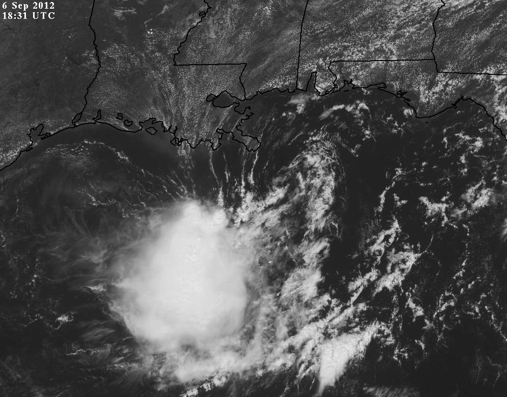
wxman57 wrote:Aric Dunn wrote:wxman57 wrote:Don't look for recon to provide much more information than we're already receiving from the numerous surface obs in the northern Gulf. Here's a GARP plot of surface obs/satellite. I identified the LLC with the red crosshairs (28.2N/88.5W). The nearest significant convection is about 100 miles to the SW. Surface winds are peaking out at 25 kts. Lacking any persistent (or any at all) convection near the center, it would not qualify for upgrade to a TD by the NHC's own standards.
Shear may drop off briefly on Saturday morning just before the increasing westerly winds aloft ahead of the cold front reach the disturbance. That would be its best window of opportunity to get convection over the center and perhaps become "Nadine" before it's taken apart by increasing shear.
[img]http://home.comcast.net/~cgh57/90La.gif[/ig]
This buoy recently just reported winds of 42kts. appears to be stronger than it looks. fairly high background pressures could be the reason for it.
http://www.ndbc.noaa.gov/station_page.php?station=42360
That's about 135nm SW of the LLC in that heavier convection. Still wouldn't qualify for upgrade based on the exposed center.
you as well as many have seen TD come from exposed centers ... its happened a couple times this year already. by definition it has closed circ and persistent convection no matter how from the center the convection is.