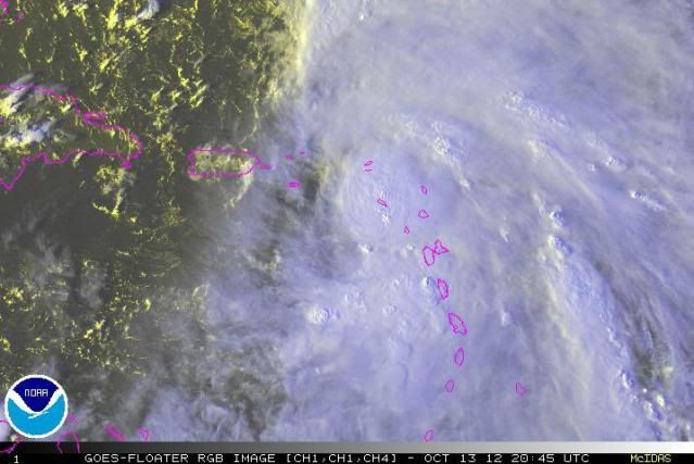
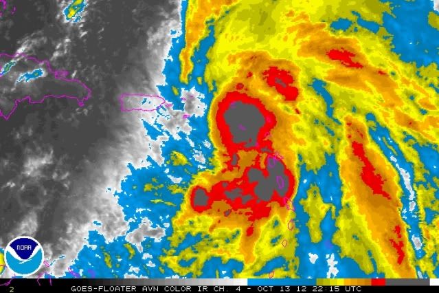
knotimpaired wrote:Luis,
Please give me the link again for local observations.
K
You only have to look up in the forum for the sticky thread
viewtopic.php?f=59&t=113923&hilit=&p=2280089#p2280089
Moderator: S2k Moderators

knotimpaired wrote:Luis,
Please give me the link again for local observations.
K


Patti wrote:Results for St.Maarten/St.Martin (18.05N, 63.12W):
The approximate Closest Point of Approach (CPA) is located near 18.0N, 63.5W or about 25.0 miles (40.3 km) from your location. The estimated time of when the center of the storm will be at that location is in about 5 hours and 40 minutes from now (Saturday, October 13 at 10:36PM AST).

caribepr wrote:Patti wrote:Results for St.Maarten/St.Martin (18.05N, 63.12W):
The approximate Closest Point of Approach (CPA) is located near 18.0N, 63.5W or about 25.0 miles (40.3 km) from your location. The estimated time of when the center of the storm will be at that location is in about 5 hours and 40 minutes from now (Saturday, October 13 at 10:36PM AST).
Our (Culebra) closest point went from 24 miles at the 11 o'clock update to 105 miles at the 5 pm update. At the same time, we have gone from a watch to a warning. Hmmm.


kungfut wrote:St john east end.
So far . nothing.
Last two nights were worse.
Where is it??? Even the seas have gone down.
So far nothing. Dead air and no rain. I see stars up above on east end


Gustywind wrote:Very perturbed night in Guadeloupe! Very strong rain and tstorms have posed big troubles in some areas with huge flooding and rivers under their blanket, trees down. Guadeloupe is now under a red alert since 4AM. No real improvement is expected today. Stay tuned, i will give you more about the worrying situation here.
Here is the latest from Meteo-France Guadeloupe
[size=150]Sunday, October 14, 2012Weather-France Guadeloupe, Hello!04AM, the level of vigilance is: red for strong rains/storms, be extremely careful![/size]
Intense storm stormy bands through the archipelago since the beginning of night in the wake of the storm Rafael. Large storms erupted on Basse-Terre, in particular of Vieux-Habitants in Capesterre. Accumulations reached 100-150 mm in 3 hours in this sector.
For the next 3 hours, pluvial episodes - stormy continue follow up from the southwest of the archipelago.The wind blows in gusts of 50 to 80 km/h from Southeast to South to the passage of these storms.These observations and their immediate evolution will fund day around 06 45 AM

caribepr wrote:Gustywind wrote:Very perturbed night in Guadeloupe! Very strong rain and tstorms have posed big troubles in some areas with huge flooding and rivers under their blanket, trees down. Guadeloupe is now under a red alert since 4AM. No real improvement is expected today. Stay tuned, i will give you more about the worrying situation here.
Here is the latest from Meteo-France Guadeloupe
[size=150]Sunday, October 14, 2012Weather-France Guadeloupe, Hello!04AM, the level of vigilance is: red for strong rains/storms, be extremely careful![/size]
Intense storm stormy bands through the archipelago since the beginning of night in the wake of the storm Rafael. Large storms erupted on Basse-Terre, in particular of Vieux-Habitants in Capesterre. Accumulations reached 100-150 mm in 3 hours in this sector.
For the next 3 hours, pluvial episodes - stormy continue follow up from the southwest of the archipelago.The wind blows in gusts of 50 to 80 km/h from Southeast to South to the passage of these storms.These observations and their immediate evolution will fund day around 06 45 AM
Sorry to hear this report, Gusty, hoping there is no loss of life.
Users browsing this forum: No registered users and 53 guests