
http://www.instantweathermaps.com/GFS-p ... M&hour=075
Moderator: S2k Moderators


gatorcane wrote:That 06z GFS certainly has a decent west shift from the 00z... a little too close to South Florida than I would like to see. One more shift west like that certainly would not be good.
gatorcane wrote:That 06z GFS certainly has a decent west shift from the 00z... a little too close to South Florida than I would like to see. One more shift west like that certainly would not be good. The NOGAPS is very similar to the GFS and even more west.
gatorcane wrote:That 06z GFS certainly has a decent west shift from the 00z... a little too close to South Florida than I would like to see. One more shift west like that certainly would not be good. The NOGAPS is very similar to the GFS and even more west.


CalmBeforeStorm wrote:http://raleighwx.americanwx.com/models/gfdl/06zgfdl500mbHGHTPMSLgfdlLoop.html
6z GFDL shows a closer pass to Florida but also shows a much larger, expanding wind field. If this verified parts of the eastern coast of Florida would certainly experience tropical storm force winds.


gatorcane wrote:CalmBeforeStorm wrote:http://raleighwx.americanwx.com/models/gfdl/06zgfdl500mbHGHTPMSLgfdlLoop.html
6z GFDL shows a closer pass to Florida but also shows a much larger, expanding wind field. If this verified parts of the eastern coast of Florida would certainly experience tropical storm force winds.
That GFDL run has also shifted significantly west and is close to the latest GFS and NOGAPS solution taking this east of Florida but a bit too close for comfort right now, but still just far enough east the worst would be offshore. Should see some very strong winds along the SE Coast of Florida if that track verifies especially with an expanding wind field.

Aric Dunn wrote:yeah the longer it takes to start moving north quicker the more time the trough has to flatten out and weaken. i noticed the gfs yesterday had slown way down between 120 to 144 hrs similar to the euro.. now it has at least in the short to medium range come into better agreement with the euro. timing is of course key. the slower this moves the more likely there will be some westward shifts.
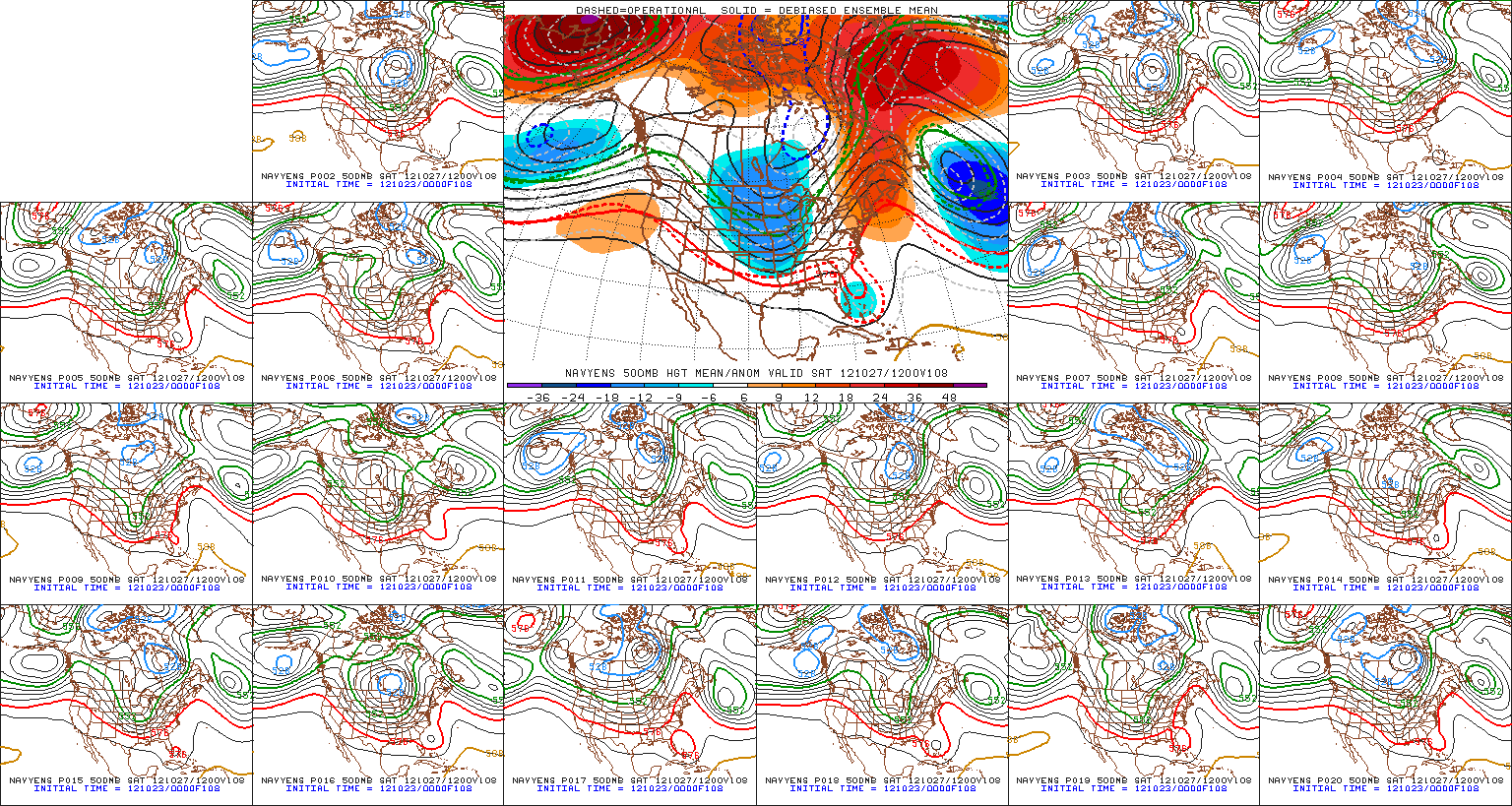
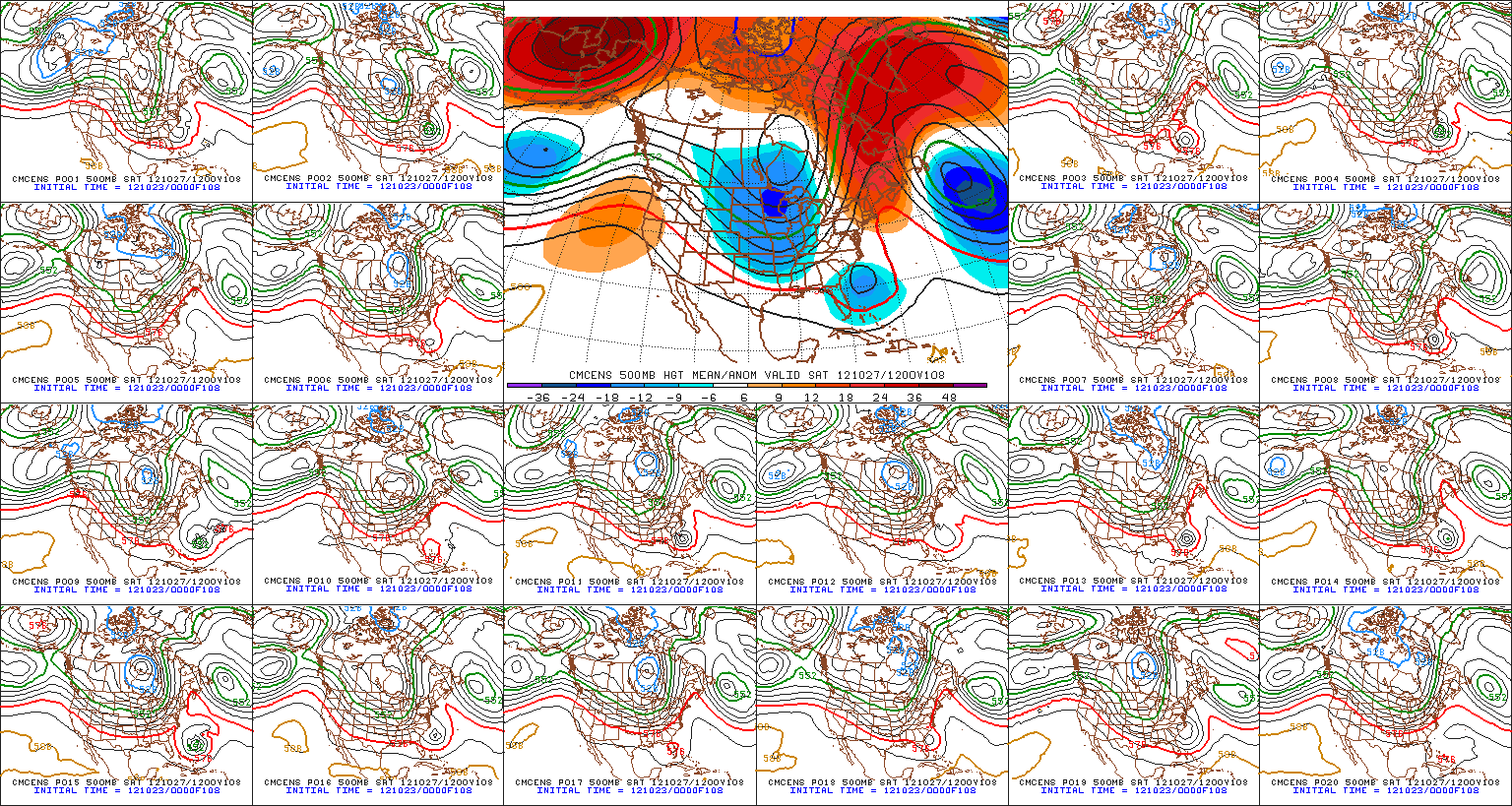
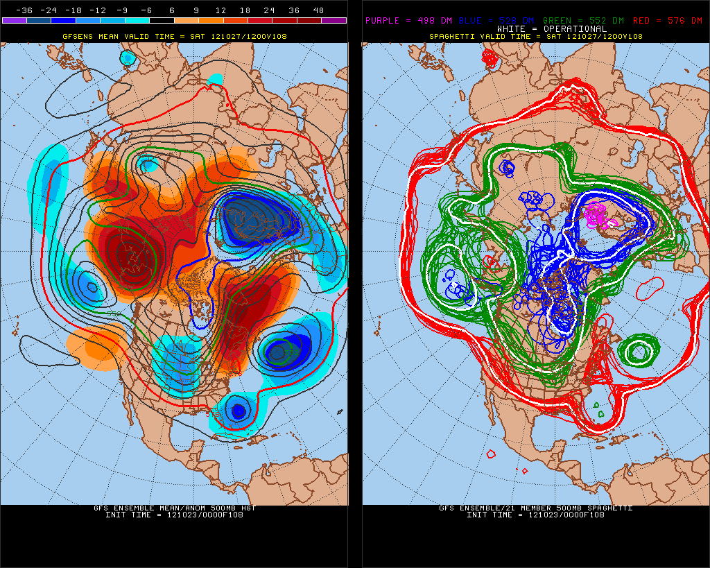
Also noticed quite a bit more of the GFS ensemble members now showing a more Euro solution.
CrazyC83 wrote:If this hits Florida then goes up the east coast with the trough and not weakening, how many people would be impacted? Like 100 million?
Users browsing this forum: No registered users and 24 guests


