mred53 wrote:
Looks like it's going right up Delaware Bay.
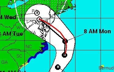
Be careful interpolating between the NHC's 48 and 72 hour positions. Unfortunately, they do not include 12hr positions. The 48 and 72 hr points are connected with a straight line, making it appear as though their track is into Delaware Bay. Sandy will not be moving NW at landfall but probably almost due west. This means the NHC track would be into southern NJ if they had a 60hr point placed well to the north (and a bit east) of their 48 hr point.