ATL: SANDY - Remnants - Discussion
Moderator: S2k Moderators
-
Evil Jeremy

- S2K Supporter

- Posts: 5463
- Age: 32
- Joined: Mon Apr 10, 2006 2:10 pm
- Location: Los Angeles, CA
-
brunota2003

- S2K Supporter
- Posts: 9476
- Age: 35
- Joined: Sat Jul 30, 2005 9:56 pm
- Location: Stanton, KY...formerly Havelock, NC
- Contact:
TWC just said they no longer expect the water to reach or exceed record levels at the Battery...and that it won't be as bad because the winds are weakening thanks to lack of precip? (Did I say that right? I'm sure someone else saw it too).
0 likes
Just a small town southern boy helping other humans.
-
SunnyThoughts
- Category 5

- Posts: 2263
- Joined: Wed Jul 09, 2003 12:42 pm
- Location: Pensacola, Florida
PRELIMINARY LOCAL STORM REPORT
NATIONAL WEATHER SERVICE NEW YORK NY
531 PM EDT MON OCT 29 2012
..TIME... ...EVENT... ...CITY LOCATION... ...LAT.LON...
..DATE... ....MAG.... ..COUNTY LOCATION..ST.. ...SOURCE....
..REMARKS..
0500 PM NON-TSTM WND GST EATONS NECK 40.95N 73.39W
10/29/2012 M82 MPH SUFFOLK NY MESONET
MESONET
NATIONAL WEATHER SERVICE NEW YORK NY
531 PM EDT MON OCT 29 2012
..TIME... ...EVENT... ...CITY LOCATION... ...LAT.LON...
..DATE... ....MAG.... ..COUNTY LOCATION..ST.. ...SOURCE....
..REMARKS..
0500 PM NON-TSTM WND GST EATONS NECK 40.95N 73.39W
10/29/2012 M82 MPH SUFFOLK NY MESONET
MESONET
0 likes
-
Evil Jeremy
- S2K Supporter
- Posts: 5463
- Age: 32
- Joined: Mon Apr 10, 2006 2:10 pm
- Location: Los Angeles, CA
Re:
brunota2003 wrote:TWC just said they no longer expect the water to reach or exceed record levels at the Battery...and that it won't be as bad because the winds are weakening thanks to lack of precip? (Did I say that right? I'm sure someone else saw it too).
They said something along those lines.
0 likes
Frances 04 / Jeanne 04 / Katrina 05 / Wilma 05 / Fay 08 / Debby 12 / Andrea 13 / Colin 16 / Hermine 16 / Matthew 16 / Irma 17
-
karenfromheaven

- Tropical Storm

- Posts: 171
- Age: 71
- Joined: Thu Sep 09, 2004 4:45 pm
- Location: North Naples, FL
Re:
brunota2003 wrote:TWC just said they no longer expect the water to reach or exceed record levels at the Battery...and that it won't be as bad because the winds are weakening thanks to lack of precip? (Did I say that right? I'm sure someone else saw it too).
They said record surge was 11.2f. They said low precip on backside of circulation would bring less wind down to ground level and possible lessen the surge.
0 likes
-
ozonepete
- Professional-Met

- Posts: 4743
- Joined: Mon Sep 07, 2009 3:23 pm
- Location: From Ozone Park, NYC / Now in Brooklyn, NY
Re: Re:
karenfromheaven wrote:brunota2003 wrote:TWC just said they no longer expect the water to reach or exceed record levels at the Battery...and that it won't be as bad because the winds are weakening thanks to lack of precip? (Did I say that right? I'm sure someone else saw it too).
They said record surge was 11.2f. They said low precip on backside of circulation would bring less wind down to ground level and possible lessen the surge.
I can't see how the Battery will not get topped. Mixing of wind to the surface is not key here. It's a storm surge that has already built and must come in.
0 likes
-
x-y-no

- Category 5
- Posts: 8359
- Age: 65
- Joined: Wed Aug 11, 2004 12:14 pm
- Location: Fort Lauderdale, FL
Re: Re:
Evil Jeremy wrote:brunota2003 wrote:TWC just said they no longer expect the water to reach or exceed record levels at the Battery...and that it won't be as bad because the winds are weakening thanks to lack of precip? (Did I say that right? I'm sure someone else saw it too).
They said something along those lines.
We'll see. The surge at Battery does seem to have leveled off, at least for now, at a bit under 7 feet. If it stays there through high tide, the peak level should be about 11 feet which would be less than the record (but enough to cause some substantial flooding of the subway system.
0 likes
Re: Re:
r22weiss wrote:Sonica wrote:Evil Jeremy wrote:Sandy still a hurricane. All TS warnings remaining are gone. TWC fail lol.
And a lot of people on here jumping on with that. TWC should be more careful to say facts not predictions.
IMO
While NHC is still classifying Sandy as a hurricane, satellite and radar representation shows that it has made the transition to a extra-tropical storm and has been absorbed into the large upper level circulation. Symantics at this point because the effects on the northeast are still the same.
I'd be willing to bet that this hasn't been "tropical" for a few days now. Of course, a 940mb extratropical gale center is still something to be reckoned with, but is it truly a hurricane in the strict warm-core sense? It certainly doesn't look like one in the satellite pictures, and hasn't for a few days.
0 likes
Re: ATL: SANDY - Hurricane - Discussion
TWC says local weather stations are detecting a landfall of the eye between Sea Isle City, NJ and Ocean City, NJ. That is in between Cape May and Atlantic City.
0 likes
-
Evil Jeremy
- S2K Supporter
- Posts: 5463
- Age: 32
- Joined: Mon Apr 10, 2006 2:10 pm
- Location: Los Angeles, CA
Discussion finally out:
AIRCRAFT DATA INDICATE THAT THERE ARE STRONG TEMPERATURE CONTRASTS VERY NEAR
A MODEST RESIDUAL WARM CORE. WATER VAPOR IMAGERY INDICATES THAT
SANDY IS BECOMING ABSORBED WITHIN A LARGE MID-LATITUDE CYCLONIC
CIRCULATION. ALL OF THESE CONSIDERATIONS LEAD US TO CONCLUDE THAT
THE MOST APPROPRIATE CLASSIFICATION AT ADVISORY TIME IS
EXTRATROPICAL. HOWEVER...FOR CONTINUITY OF SERVICE NHC WILL
CONTINUE TO ISSUE ADVISORIES THROUGH LANDFALL. A POST-STORM
ANALYSIS WILL RE-EXAMINE THE TIMING OF EXTRATROPICAL TRANSITION.
WE ANTICIPATES THAT THE LAST NHC ADVISORY ON SANDY WILL BE ISSUED AT
11 PM EDT TONIGHT.
Last edited by Evil Jeremy on Mon Oct 29, 2012 5:02 pm, edited 2 times in total.
0 likes
Frances 04 / Jeanne 04 / Katrina 05 / Wilma 05 / Fay 08 / Debby 12 / Andrea 13 / Colin 16 / Hermine 16 / Matthew 16 / Irma 17
-
ozonepete
- Professional-Met
- Posts: 4743
- Joined: Mon Sep 07, 2009 3:23 pm
- Location: From Ozone Park, NYC / Now in Brooklyn, NY
Re: Re:
Patrick99 wrote: I'd be willing to bet that this hasn't been "tropical" for a few days now. Of course, a 940mb extratropical gale center is still something to be reckoned with, but is it truly a hurricane in the strict warm-core sense? It certainly doesn't look like one in the satellite pictures, and hasn't for a few days.
That is completely wrong. It has been tropical until at least mid-day today. What scientific basis are you using to come up with that statement?
0 likes
-
ozonepete
- Professional-Met
- Posts: 4743
- Joined: Mon Sep 07, 2009 3:23 pm
- Location: From Ozone Park, NYC / Now in Brooklyn, NY
Re: ATL: SANDY - Hurricane - Discussion
5PM NYC area:
REGIONAL WEATHER ROUNDUP
NATIONAL WEATHER SERVICE NEW YORK NY
500 PM EDT MON OCT 29 2012
NOTE: "FAIR" INDICATES FEW OR NO CLOUDS BELOW 12,000 FEET WITH NO
SIGNIFICANT WEATHER AND/OR OBSTRUCTIONS TO VISIBILITY.
REGIONAL WEATHER ROUNDUP
NATIONAL WEATHER SERVICE NEW YORK NY
500 PM EDT MON OCT 29 2012
NOTE: "FAIR" INDICATES FEW OR NO CLOUDS BELOW 12,000 FEET WITH NO
SIGNIFICANT WEATHER AND/OR OBSTRUCTIONS TO VISIBILITY.
Code: Select all
NYZ071-072-176-178-NJZ106-104-292200-
NEW YORK CITY METRO AREA


CITY           SKY/WX    TMP DP  RH WIND       PRES   REMARKS
CENTRAL PARK   LGT RAIN  59  58  96 NE24G52   28.61F FOG
LAGUARDIA APRT LGT RAIN  63  60  88 NE45G55   28.58F FOG
KENNEDY INTL   LGT RAIN  63  60  90 NE45G61   28.54F FOG
NEWARK/LIBERTY RAIN      60  58  92 NE36G52   28.57F FOG
TETERBORO      LGT RAIN  60  58  92 NE23G44   28.60F FOG
WHITE PLAINS   RAIN      60  56  86 NE21G48   28.67F VSB 1
0 likes
-
GoneBabyGone
- Tropical Storm
- Posts: 101
- Joined: Sat Aug 30, 2008 4:28 pm
Re: ATL: SANDY - Hurricane - Discussion
edit wrong pic
Last edited by GoneBabyGone on Mon Oct 29, 2012 5:09 pm, edited 1 time in total.
0 likes
-
SunnyThoughts
- Category 5
- Posts: 2263
- Joined: Wed Jul 09, 2003 12:42 pm
- Location: Pensacola, Florida
 Battery continuing to rise
-
WilmingtonSandbar
- S2K Supporter
- Posts: 505
- Joined: Sun Aug 29, 2010 12:11 pm
- Location: Southport, NC
Re: ATL: SANDY - Hurricane - Discussion
Just wanted to add how far reaching the wind field is. It has expanded to go over my house yet again. I am 30 miles south of Wilmington, NC. We will go through periods of calm to periods of gusty wind that is equal to or stronger than what we had on Saturday when the bulk of the storm was brushing past us.
0 likes
Diana X2 (look it up), Bertha, Fran, Bonnie, Floyd, Dennis, Charley, Ophelia, Ernesto, Irene, Matthew, And Florence
-
GoneBabyGone
- Tropical Storm
- Posts: 101
- Joined: Sat Aug 30, 2008 4:28 pm

-
SunnyThoughts
- Category 5
- Posts: 2263
- Joined: Wed Jul 09, 2003 12:42 pm
- Location: Pensacola, Florida
Life guard station slammed againstthe boardwalk at long beach, LI live on news feed http://abclocal.go.com/wabc/livenow?id=8857235
0 likes
-
nashrobertsx
- Tropical Depression

- Posts: 85
- Joined: Fri Aug 15, 2008 3:55 pm
-
tolakram
- Admin

- Posts: 20179
- Age: 62
- Joined: Sun Aug 27, 2006 8:23 pm
- Location: Florence, KY (name is Mark)
Re: ATL: SANDY - Hurricane - Discussion
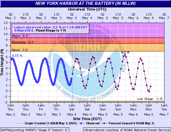
Battery water levels

0 likes
M a r k
- - - - -
Join us in chat: Storm2K Chatroom Invite. Android and IOS apps also available.
The posts in this forum are NOT official forecasts and should not be used as such. Posts are NOT endorsed by any professional institution or STORM2K.org. For official information and forecasts, please refer to NHC and NWS products.
-
nashrobertsx
- Tropical Depression
- Posts: 85
- Joined: Fri Aug 15, 2008 3:55 pm
In the height of the storm, the NHC just can't wait to wash their hands of this thing.. very strange... maybe something to do with insurance claims and how they classify these things.... just seems strange to me... very strange..
WE ANTICIPATES THAT THE LAST NHC ADVISORY ON SANDY WILL BE ISSUED AT
11 PM EDT TONIGHT. SINCE ALL COASTAL TROPICAL CYCLONE WARNINGS HAVE
BEEN DISCONTINUED...THERE WILL BE NO INTERMEDIATE PUBLIC ADVISORIES
ISSUED BETWEEN NOW AND THE 11 PM NHC ADVISORY. TO PROVIDE A
CONTINUOUS FLOW OF INFORMATION...NHC WILL ISSUE TROPICAL CYCLONE
UPDATES AT 7 PM AND 9 PM EDT...AND AT THE TIME OF LANDFALL. THESE
UPDATES ARE ISSUED UNDER WMO HEADER WTNT63...AND AWIPS HEADER
TCUAT3...AND WILL ALSO BE AVAILABLE ON THE NHC WEBSITE. BEGINNING
AT 5 AM EDT TUESDAY...PUBLIC ADVISORIES WILL BE ISSUED BY THE
HYDROMETEOROLOGICAL PREDICTION CENTER...HPC...UNDER THE SAME WMO
AND AWIPS HEADERS AS THE NHC PUBLIC ADVISORIES...WHICH WILL ALSO BE
AVAILABLE VIA THE NHC WEBSITE.
0 likes
Who is online
Users browsing this forum: No registered users and 20 guests