ATL: SANDY - Remnants - Discussion
Moderator: S2k Moderators
-
brunota2003

- S2K Supporter

- Posts: 9476
- Age: 35
- Joined: Sat Jul 30, 2005 9:56 pm
- Location: Stanton, KY...formerly Havelock, NC
- Contact:
-
karenfromheaven

- Tropical Storm

- Posts: 171
- Age: 71
- Joined: Thu Sep 09, 2004 4:45 pm
- Location: North Naples, FL

-
OverlandHurricane
- S2K Supporter
- Posts: 58
- Joined: Thu Aug 28, 2008 4:50 pm
- Location: Minnesota
Re: ATL: SANDY - Post-Tropical - Discussion
From ConEdison's Twitter page:
@ConEdison
#ConEd - No Con Edison employees are trapped in a building. The story spreading is a rumor.
@ConEdison
#ConEd - No Con Edison employees are trapped in a building. The story spreading is a rumor.
0 likes
-
Hogweed
Re: Re:
FutureEM wrote:IT IS FOR FLOODING per:
http://www.altoonamirror.com/page/content.detail/id/565627/-Updated-9-35-p-m---Sandy-brings-rain--snow--outages--damage.html?nav=742
That Twitter account affixed Nuclear Warning for hype and to cause confusion.
Yes the nuclear problems are at Oyster Creek.
0 likes
-
Tyler Penland
- Tropical Depression

- Posts: 63
- Joined: Fri Aug 19, 2011 12:32 pm
- Location: Blowing Rock, NC
RT@BREAKING: 100's of people trapped in the water and in a building fire. Coney Island Hospital on fire. FDNY can't get to it. #Sandy
0 likes
****The above is NOT AN OFFICIAL FORECAST. I am in no way affiliated with the NWS or storm2k, and most likely don't share their opinion. Please refer to NWS/NHC products for official advisories/warnings/forecasts.****
But if you insist, trust me, I'm a physicist.
But if you insist, trust me, I'm a physicist.


Re:
Tyler Penland wrote:RT@BREAKING: 100's of people trapped in the water and in a building fire. Coney Island Hospital on fire. FDNY can't get to it. #Sandy
This was reported a while ago too. I don't believe it's true, and haven't heard it on the scanner.
0 likes
-
cycloneye

- Admin

- Posts: 149275
- Age: 69
- Joined: Thu Oct 10, 2002 10:54 am
- Location: San Juan, Puerto Rico
Re:
Tyler Penland wrote:RT@BREAKING: 100's of people trapped in the water and in a building fire. Coney Island Hospital on fire. FDNY can't get to it. #Sandy
Is there a reliable source to the information?
0 likes
Visit the Caribbean-Central America Weather Thread where you can find at first post web cams,radars
and observations from Caribbean basin members Click Here
and observations from Caribbean basin members Click Here

Re: ATL: SANDY - Post-Tropical - Discussion
Ok...looked at maps again...if the WTC and Wall street flooding is real then this woud have appeared to flood well into zones B and C...they only evacuated zone A.
0 likes
-
Tyler Penland
- Tropical Depression
- Posts: 63
- Joined: Fri Aug 19, 2011 12:32 pm
- Location: Blowing Rock, NC
Re: Re:
bahamaswx wrote:Tyler Penland wrote:RT@BREAKING: 100's of people trapped in the water and in a building fire. Coney Island Hospital on fire. FDNY can't get to it. #Sandy
This was reported a while ago too. I don't believe it's true, and haven't heard it on the scanner.
New info that says FDNY on scene and no confirmed fire/injuries yet.
0 likes
****The above is NOT AN OFFICIAL FORECAST. I am in no way affiliated with the NWS or storm2k, and most likely don't share their opinion. Please refer to NWS/NHC products for official advisories/warnings/forecasts.****
But if you insist, trust me, I'm a physicist.
But if you insist, trust me, I'm a physicist.

Re:
brunota2003 wrote:Well, I will say this...I am emotionally and physically exhausted from this storm, now. I'll see y'all tomorrow, have a good night!
Me too. Keep wanting to go sleep, but just can't pull myself away yet.
0 likes

Re:
Tyler Penland wrote:RT@BREAKING: 100's of people trapped in the water and in a building fire. Coney Island Hospital on fire. FDNY can't get to it. #Sandy
Per FDNY's Official Twitter:
FDNY @FDNY
There is much misinformation being spread about #Sandy's impact on #NYC. You can get reliable info from @NYCMayorsOffice, @NotifyNYC & us.
FDNY @FDNY
#FDNY units are on scene at Coney Island Hospital. No confirmed fire or reports of injuries at this time.
0 likes
-
KBBOCA
- S2K Supporter
- Posts: 1559
- Joined: Fri Sep 05, 2003 5:27 am
- Location: Formerly Boca Raton, often West Africa. Currently Charlotte NC
Just checking out the coverage at the Wall Street Journal.
Some good reporting.
Note: the online verison of WSJ will be totally free and available to all today and tomorrow.
http://online.wsj.com/home-page
State by State roundup
http://blogs.wsj.com/dispatch/2012/10/2 ... -at-sandy/
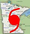
Good God! Even WISCONSIN is getting effects from this storm. Absolutely totally UNBELIEVABLE!!!
Some good reporting.
Note: the online verison of WSJ will be totally free and available to all today and tomorrow.
http://online.wsj.com/home-page
State by State roundup
http://blogs.wsj.com/dispatch/2012/10/2 ... -at-sandy/
Good God! Even WISCONSIN is getting effects from this storm. Absolutely totally UNBELIEVABLE!!!
0 likes

Re: ATL: SANDY - Post-Tropical - Discussion
My God - Like probably many others who might post here on S2K occassionally to those who post quite frequently, I am just now actually backed away from my monitor for the first time in hours. I probably need to step away from the hundreds of twitter updates, dual N.Y. TV stations' live reporting, incredibly awesome range of meteorological & news updates right here at S2K. Watching this SURREAL event unfold, all the while when Sandy was less than an hour from landfall I must admit there was just no way I was openly willing to admit that I expecting this event to unfold the way it has. With a hurricane, the onset of conditions build up to a cresendo and practically climax at "center landfall". Even though I could comprehend the dynamics that would ultimately cause Sandy to potentially cause perilless impacts to millions of people in the Northeast, it was so odd to watch landfall start to occur with really a relative limited amount of drama. What a contradiction of drama it has been to watch all of the series of events unfold AFTER what so many people would have anticipated was the epicenter of the event - when Sandy actually came in at or close to Cape May, NJ.
Just goes to show how complex severe weather, location of events, topographic circumstances can be, and why there has to ultimately be a better means to guage impact & damage risk assessments. Just crazy to think how an area so small such as South Miami-Dade County can be decimated by a Cat. 5 hurricane, yet in West Palm Beach Andrew was a relative minimal event. Meanwhile, you have a Cat 1 hurricane (Sandy) wind intensity cause such a tremendous storm surge and impact people, cause accidents, and evolve ino blizzard conditions hundreds of miles away. People will always make comparisons of events. Just like the long debated analogy is it the "size of the ship" or the "motion of the ocean"? Perhaps the best answer is "Who Cares". Unique events cause unique risks and people need to slow down and have the humility to listen to those in place to make those calls and best appraise whether or not the public should be inconvenienced. Why, because the alternative might just be needlessly being crushed by a tree or drowning in a basement full of water. When it comes down to it, just how important is "brovado" or being self righteous when the alternative could be so grave.
Just goes to show how complex severe weather, location of events, topographic circumstances can be, and why there has to ultimately be a better means to guage impact & damage risk assessments. Just crazy to think how an area so small such as South Miami-Dade County can be decimated by a Cat. 5 hurricane, yet in West Palm Beach Andrew was a relative minimal event. Meanwhile, you have a Cat 1 hurricane (Sandy) wind intensity cause such a tremendous storm surge and impact people, cause accidents, and evolve ino blizzard conditions hundreds of miles away. People will always make comparisons of events. Just like the long debated analogy is it the "size of the ship" or the "motion of the ocean"? Perhaps the best answer is "Who Cares". Unique events cause unique risks and people need to slow down and have the humility to listen to those in place to make those calls and best appraise whether or not the public should be inconvenienced. Why, because the alternative might just be needlessly being crushed by a tree or drowning in a basement full of water. When it comes down to it, just how important is "brovado" or being self righteous when the alternative could be so grave.
0 likes
Andy D
(For official information, please refer to the NHC and NWS products.)
(For official information, please refer to the NHC and NWS products.)
Re: ATL: SANDY - Post-Tropical - Discussion
People that are spreading these ridiculous rumors from unverified sources need to be banned or at least suspended. There are far too many people who think it's a great badge of honor to be the first to report tragedy. The outcome of that mentality is these people look for reports of mayhem and destruction. As soon as they find it, from any source, doesn't matter if it's a brand new Twitter account or some dumb reporter trying to make a name for himself, they post it here and elsewhere, thus fanning the flames of another rumor.
0 likes
-
SouthernBreeze

- Category 1

- Posts: 284
- Age: 69
- Joined: Tue Aug 31, 2004 4:54 pm
- Location: SC/NC line- on the SC Coast
Re: ATL: SANDY - Post-Tropical - Discussion
http://www.app.com/viewart/20121029/NJNEWS/310290013/At-least-20-fires-raging-Ocean-County?odyssey=mod|defcon|text|Frontpage
At least 20 fires raging in Ocean County
11:36 PM
Ocean County Administrator Carl W. Block said there are at least 20 fires raging in the county, and most of them are in places where high water is making it difficult, if not impossible, for firefighters to fight the blazes.
At least 20 fires raging in Ocean County
11:36 PM
Ocean County Administrator Carl W. Block said there are at least 20 fires raging in the county, and most of them are in places where high water is making it difficult, if not impossible, for firefighters to fight the blazes.
0 likes
-
Caribwxgirl
- S2K Supporter
- Posts: 287
- Joined: Mon Aug 15, 2011 7:25 pm
- Location: Budapest, Hungary (from Kingston, Jamaica)
Great post Chaser1
0 likes
Personal Forecast Disclaimer:
The posts in this forum are NOT official forecast. They are just the opinion of the poster and may or may not be backed by sound meteorological data. They are NOT endorsed by any professional institutions or storm2k.org. For official information refer to the NHC and NWS products.
The posts in this forum are NOT official forecast. They are just the opinion of the poster and may or may not be backed by sound meteorological data. They are NOT endorsed by any professional institutions or storm2k.org. For official information refer to the NHC and NWS products.
Re: ATL: SANDY - Post-Tropical - Discussion
0 likes
Andy D
(For official information, please refer to the NHC and NWS products.)
(For official information, please refer to the NHC and NWS products.)
-
SevenTreesFarm
- Tropical Wave

- Posts: 9
- Joined: Fri Oct 26, 2012 9:37 pm
- Location: Everson, WA
- Contact:
Re: ATL: SANDY - Post-Tropical - Discussion
chaser1 wrote:My God - Like probably many others who might post here on S2K occassionally to those who post quite frequently, I am just now actually backed away from my monitor for the first time in hours. I probably need to step away from the hundreds of twitter updates, dual N.Y. TV stations' live reporting, incredibly awesome range of meteorological & news updates right here at S2K. Watching this SURREAL event unfold, all the while when Sandy was less than an hour from landfall I must admit there was just no way I was openly willing to admit that I expecting this event to unfold the way it has. With a hurricane, the onset of conditions build up to a cresendo and practically climax at "center landfall". Even though I could comprehend the dynamics that would ultimately cause Sandy to potentially cause perilless impacts to millions of people in the Northeast, it was so odd to watch landfall start to occur with really a relative limited amount of drama. What a contradiction of drama it has been to watch all of the series of events unfold AFTER what so many people would have anticipated was the epicenter of the event - when Sandy actually came in at or close to Cape May, NJ.
Just goes to show how complex severe weather, location of events, topographic circumstances can be, and why there has to ultimately be a better means to guage impact & damage risk assessments. Just crazy to think how an area so small such as South Miami-Dade County can be decimated by a Cat. 5 hurricane, yet in West Palm Beach Andrew was a relative minimal event. Meanwhile, you have a Cat 1 hurricane (Sandy) wind intensity cause such a tremendous storm surge and impact people, cause accidents, and evolve ino blizzard conditions hundreds of miles away. People will always make comparisons of events. Just like the long debated analogy is it the "size of the ship" or the "motion of the ocean"? Perhaps the best answer is "Who Cares". Unique events cause unique risks and people need to slow down and have the humility to listen to those in place to make those calls and best appraise whether or not the public should be inconvenienced. Why, because the alternative might just be needlessly being crushed by a tree or drowning in a basement full of water. When it comes down to it, just how important is "brovado" or being self righteous when the alternative could be so grave.
Exactly!
I'm so jacked in right now, and I can't fathom getting any sleep.
I live on the Cascadia subduction fault, which is getting bumped by constant earthquakes to the north of us. I am so worried I'll be woken up by the real deal tonight, and have my own catastrophe to deal with.
This storm should be the incentive for everyone to get their ducks in a row, be prepared, in the best way for the risks they face. Stock up. Be aware.
0 likes

Re: ATL: SANDY - Post-Tropical - Discussion
chaser1 wrote:My God - Like probably many others who might post here on S2K occassionally to those who post quite frequently, I am just now actually backed away from my monitor for the first time in hours. I probably need to step away from the hundreds of twitter updates, dual N.Y. TV stations' live reporting, incredibly awesome range of meteorological & news updates right here at S2K. Watching this SURREAL event unfold, all the while when Sandy was less than an hour from landfall I must admit there was just no way I was openly willing to admit that I expecting this event to unfold the way it has. With a hurricane, the onset of conditions build up to a cresendo and practically climax at "center landfall". Even though I could comprehend the dynamics that would ultimately cause Sandy to potentially cause perilless impacts to millions of people in the Northeast, it was so odd to watch landfall start to occur with really a relative limited amount of drama. What a contradiction of drama it has been to watch all of the series of events unfold AFTER what so many people would have anticipated was the epicenter of the event - when Sandy actually came in at or close to Cape May, NJ.
Just goes to show how complex severe weather, location of events, topographic circumstances can be, and why there has to ultimately be a better means to guage impact & damage risk assessments. Just crazy to think how an area so small such as South Miami-Dade County can be decimated by a Cat. 5 hurricane, yet in West Palm Beach Andrew was a relative minimal event. Meanwhile, you have a Cat 1 hurricane (Sandy) wind intensity cause such a tremendous storm surge and impact people, cause accidents, and evolve ino blizzard conditions hundreds of miles away. People will always make comparisons of events. Just like the long debated analogy is it the "size of the ship" or the "motion of the ocean"? Perhaps the best answer is "Who Cares". Unique events cause unique risks and people need to slow down and have the humility to listen to those in place to make those calls and best appraise whether or not the public should be inconvenienced. Why, because the alternative might just be needlessly being crushed by a tree or drowning in a basement full of water. When it comes down to it, just how important is "brovado" or being self righteous when the alternative could be so grave.
Very true. I am more scared of a large storm that does not have strong winds than a small storm with strong winds.
0 likes
Re: ATL: SANDY - Post-Tropical - Discussion
Wow! 790K customers on Long Island without power.
http://www.newsday.com/news/weather/hur ... -1.4165032
http://www.newsday.com/news/weather/hur ... -1.4165032
0 likes
Who is online
Users browsing this forum: No registered users and 59 guests