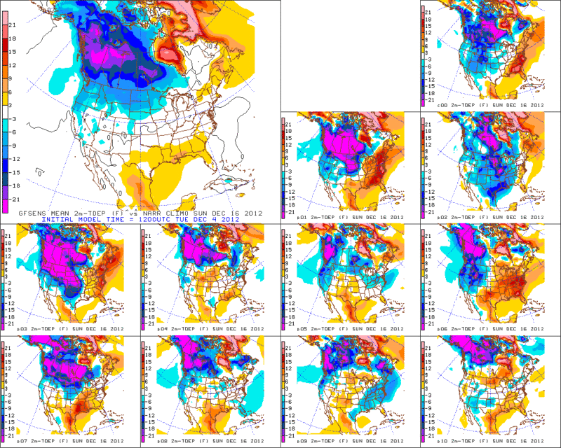
Texas Winter 2012-2013

Winter Weather Discussion

Moderator: S2k Moderators

Forum rules

The posts in this forum are NOT official forecast and should not be used as such. They are just the opinion of the poster and may or may not be backed by sound meteorological data. They are NOT endorsed by any professional institution or STORM2K.

Help Support Storm2K
Message
Author
ouamber
Tropical Depression
Tropical Depression
Posts: 54
Joined: Wed Jan 04, 2012 4:29 pm

Re: Texas Winter 2012-2013

#461 Postby ouamber » Tue Dec 04, 2012 11:42 am

Hello Everyone,

I am long time follower of your website and enjoy the knowledge you guys bring to the table. I do have a question for any of you. I live in Tulsa, and was wondering what our chances of getting snow from the storm would be? I try to follow the models, but they confuse me. I was once told that the best storm track for Tulsa was for it to be around the Aklatex area, but I'm not sure. I've looked at some models that are giving us snow, and some that don't give us anything at all. Again, any responses would be great. I used to live in Ardmore, so I would love when Dallas got snow, because that usually meant we did too. Here's hoping for a better winter than last year!!

-Amber :P
0 likes   

User avatar
CaptinCrunch
S2K Supporter
S2K Supporter
Posts: 8728
Age: 57
Joined: Mon Nov 03, 2003 4:33 pm
Location: Kennedale, TX (Tarrant Co.)

Re: Texas Winter 2012-2013

#462 Postby CaptinCrunch » Tue Dec 04, 2012 11:44 am

wxman57 wrote:12Z GFS is pretty much in line with the 00Z Euro as far as the timing of the front across TX on Monday. It indicates maybe a few snow flurries in the panhandle (maybe more so with secondary disturbance on Tuesday) but that's about it. It is sad to see the 80s leaving us, possibly for the rest of 2012...


So says The Grinch!......lol
0 likes   

User avatar
Ntxw
Storm2k Moderator
Storm2k Moderator
Posts: 22785
Joined: Wed Oct 21, 2009 6:34 pm
Location: DFW, Texas

#463 Postby Ntxw » Tue Dec 04, 2012 12:10 pm

A couple of reminders since we will be model hugging the rest of this week.

1. Don't focus on the surface features, it will change every run. Stick to 500mb until 2-3 days away, the models will flip back and forth like crazy

2. This is not some insane arctic outbreak, it is your typical December cold where chances of events might happen. As usual assume cold air will move faster and may be a bit colder than modeled

3. Lastly it is a full pattern change, so don't let the warm mongering crew bring you down! Follow the guidance of good ole palpatine down in scenic southwest Austin! :D
0 likes   
The above post and any post by Ntxw is NOT an official forecast and should not be used as such. It is just the opinion of the poster and may or may not be backed by sound meteorological data. It is NOT endorsed by any professional institution including Storm2k. For official information, please refer to NWS products.

  Help support Storm2K!
Help Support Storm2K

User avatar
Ntxw
Storm2k Moderator
Storm2k Moderator
Posts: 22785
Joined: Wed Oct 21, 2009 6:34 pm
Location: DFW, Texas

#464 Postby Ntxw » Tue Dec 04, 2012 2:41 pm

Also forgetting the other aspect, with unseasonably warm air already in place wouldn't be surprised to see severe weather ahead of the polar front next week especially if the shortwave is open. We have seen outbreaks in December before in recent memory.

Image
0 likes   
The above post and any post by Ntxw is NOT an official forecast and should not be used as such. It is just the opinion of the poster and may or may not be backed by sound meteorological data. It is NOT endorsed by any professional institution including Storm2k. For official information, please refer to NWS products.


  Help support Storm2K!

Help Support Storm2K


AggieSpirit
Tropical Storm
Tropical Storm
Posts: 223
Joined: Sat Nov 29, 2003 5:18 am
Location: Midlothian, TX

Re: Texas Winter 2012-2013

#465 Postby AggieSpirit » Tue Dec 04, 2012 3:41 pm

I want another 1983 or 1989 year - but with lots of snow.

That is my wishcast for this winter.
0 likes   

weatherdude1108
Category 5
Category 5
Posts: 4228
Joined: Tue Dec 13, 2011 1:04 pm
Location: Northwest Austin/Cedar Park, TX

#466 Postby weatherdude1108 » Tue Dec 04, 2012 4:01 pm

Check this out! :rain: :cold:
Remains to be seen. I take everything with a "grain of salt" lately.

AREA FORECAST DISCUSSION
NATIONAL WEATHER SERVICE AUSTIN/SAN ANTONIO TX
249 PM CST TUE DEC 4 2012

.DISCUSSION...
MOST OF THE SHOWERS AND THUNDERSTORMS HAVE EXITED TO THE EAST/SOUTHEAST
OF THE CWA...BUT WILL STILL SEE A FEW LINGERING SHOWERS ACROSS THE
COASTAL PLAINS THROUGH THIS AFTERNOON. A MUCH DRIER AIRMASS IS
SETTLING INTO THE REGION IN THE WAKE OF THE COLD FRONT...AS IS
EVIDENT BY DEWPOINTS ACROSS THE HILL COUNTRY IN THE 40S...OR ABOUT
15 TO 20-PLUS DEGREES LOWER THAN 24 HRS AGO. THE COMBINATION OF
THE DRY AIR AND MOSTLY CLEAR SKIES WILL ENABLE TEMPERATURES TO
FALL INTO THE 40S (UPPER 30S HILL COUNTRY) WEDNESDAY MORNING.

AFTERNOON TEMPERATURES ON WEDNESDAY WILL BE NOTICEABLY COOLER THAN
WE'VE HAD THE LAST SEVERAL DAYS...BUT STILL 5 OR MORE DEGREES HIGHER
THAN AVERAGE FOR EARLY DECEMBER. LOWS THURSDAY MORNING WILL BE
SEASONABLE. ONSHORE FLOW WILL RETURN THURSDAY ENABLING A RAPID
WARMING TREND OF BOTH HIGHS AND LOWS. HIGHS WILL BE BACK NEAR 80
ACROSS MOST OF THE CWA BY FRIDAY.

MOISTURE POOLING IN THE BOUNDARY LAYER BODES WELL FOR AT LEAST
SLIGHT CHANCES FOR RAIN MAINLY SOUTHEAST OF I-35 LATE IN THE
WEEKEND. RAIN CHANCES WILL EXPAND TO MOST OF THE CWA EARLY NEXT
WEEK AS ANOTHER COLD FRONT ARRIVES.
THE 12Z ECMWF AND GFS CONTINUE
TO HAVE TIMING DIFFERENCES...AS CAN BE EXPECTED THIS FAR OUT. FOR
NOW HAVE GONE WITH THE FROPA A LITTLE EARLIER ON MONDAY THAN THE
PREVIOUS FCST PACKAGE. TEMPERATURES IN THE WAKE OF THE FRONT LOOK
TO BE MUCH COLDER...WITH HIGHS POSSIBLY STAYING IN THE LOW 50S ON
TUESDAY...AND THE POTENTIAL FOR A WIDESPREAD NEAR/BELOW FREEZING
TEMPERATURES WEDNESDAY MORNING.
0 likes   
The preceding post is NOT an official forecast, and should not be used as such. It is only the opinion of the poster and may or may not be backed by sound meteorological data. It is NOT endorsed by any professional institution including storm2k.org. For Official Information please refer to the NHC and NWS products.

User avatar
CaptinCrunch
S2K Supporter
S2K Supporter
Posts: 8728
Age: 57
Joined: Mon Nov 03, 2003 4:33 pm
Location: Kennedale, TX (Tarrant Co.)

Re: Texas Winter 2012-2013

#467 Postby CaptinCrunch » Tue Dec 04, 2012 4:31 pm

We need some good rain out of this, you know one of those slow and steady rains that last a good 24hr straight.


AREA FORECAST DISCUSSION
NATIONAL WEATHER SERVICE FORT WORTH TX
249 PM CST TUE DEC 4 2012


.DISCUSSION...
COLD FRONT AND ASSOCIATED PRECIPITATION HAS CLEARED SOUTHEASTERN
COUNTIES. TEMPERATURES ON WEDNESDAY WILL NOW BE CLOSER TO CLIMATE
NORMALS...BUT WARM ADVECTION BEGINS AGAIN WEDNESDAY NIGHT. AS DEW
POINTS INCREASE BEFORE SUNRISE THURSDAY...EXPECT FOG TO DEVELOP
IN SOUTHEAST AND EASTERN COUNTIES. THIS FORECAST LEAVES FOG OUT
OF THE METROPLEX AND I-35 CORRIDOR...BUT FOG MAY BE EXPANDED IF
GUIDANCE SHOWS A GREATER AREA OF STAGNANT SATURATED LOW LEVEL
AIR. THIS TIME OF THE YEAR DENSE FOG IS POSSIBLE AS WELL SO WE
WILL CLOSELY MONITOR THIS PHENOMENA.

IN THE EXTENDED...ANOTHER WARM UP BEGINS THURSDAY WITH A STRONG
COLD FRONT FORECAST FOR NEXT SUNDAY. THE GFS/EURO DISAGREE ON
DETAILS OF THE SUNDAY SYSTEM BUT NOW AGREE FAIRLY WELL ON TIMING
OF THE COLD FRONT. THE GFS HAS WEAKENED THE UPPER SYSTEM COMPARED
TO YESTERDAY...AND THE ECMWF STRENGTHENED ITS SOLUTION...SO MODELS
APPEAR TO BE CONVERGING. CANADIAN MODEL FRONTAL TIMING ALSO LOOKS
SIMILAR.

WE EXPECT PRECIP TO START SUNDAY EVENING AND CONTINUE THROUGH
MONDAY AFTERNOON...BUT TIMING WILL LIKELY HAVE TO BE ADJUSTED. GFS
LAPSE RATES APPEAR STRONG ENOUGH TO WARRANT MENTION OF THUNDER
WITH THIS SYSTEM. AS MORE DETAILS BECOME AVAILABLE WE SHOULD BE
ABLE TO REFINE THE BETTER TIMES AND AREAS FOR THUNDERSTORM
OCCURRENCE.

NORTH TEXAS WILL NOT GET COLD ENOUGH FOR ANY WINTRY PRECIP...BUT
WE WILL SEE A SIGNIFICANT COOL OFF AFTER THE ATMOSPHERE DRIES OUT.
TUESDAY HIGHS WILL REMAIN GENERALLY IN THE 40S DUE TO CLOUDY SKIES
BEHIND THE FRONT. WEDNESDAY LOWS WILL LIKELY BE BELOW FREEZING FOR
MOST OF NORTH TEXAS AS WELL.
0 likes   

User avatar
gboudx
S2K Supporter
S2K Supporter
Posts: 4080
Joined: Thu Sep 04, 2003 1:39 pm
Location: Rockwall, Tx but from Harvey, La

Re: Texas Winter 2012-2013

#468 Postby gboudx » Tue Dec 04, 2012 4:36 pm

CaptinCrunch wrote:We need some good rain out of this, you know one of those slow and steady rains that last a good 24hr straight.


LOL, that only happens in fantasy lands where unicorns, ridden by leprechauns, hurdle pots o'gold near a rainbow. :cheesy:
0 likes   

User avatar
CaptinCrunch
S2K Supporter
S2K Supporter
Posts: 8728
Age: 57
Joined: Mon Nov 03, 2003 4:33 pm
Location: Kennedale, TX (Tarrant Co.)

Re: Texas Winter 2012-2013

#469 Postby CaptinCrunch » Tue Dec 04, 2012 4:41 pm

gboudx wrote:
CaptinCrunch wrote:We need some good rain out of this, you know one of those slow and steady rains that last a good 24hr straight.


LOL, that only happens in fantasy lands where unicorns, ridden by leprechauns, hurdle pots o'gold near a rainbow. :cheesy:


Well damnit I want that too!!! :ggreen: :cold:
0 likes   

User avatar
horselattitudesfarm
Category 1
Category 1
Posts: 315
Joined: Thu Jul 16, 2009 5:55 pm
Location: Asheville, NC (formerly from Dallas, TX)

Re: Texas Winter 2012-2013

#470 Postby horselattitudesfarm » Tue Dec 04, 2012 6:15 pm

Great quote from Gary McManus who writes the OCS Mesonet Ticker (for Oklahoma)

"I love this time of year ...

The Christmas decorations, people bustling about bundled up in the shorts, t-shirts and flip-flops, sweat flying from their brows from the heat and also the thought of their credit card bills. Luckily they can have all the hot chocolate they want ...
and they don't even have to heat the water! No, it has not been looking a lot like Christmas. Even though there are big changes possible for next week, the main story now is the heat. Record highs and warm-lows are cropping up left and right. Lows this morning were in the 50s and 60s for most of the state. In fact, those lows are as much as 10 degrees higher than the normal highs for December 3! Now there is a front coming through during the day so these numbers will probably go down tonight, but an incredibly warm morning for early December. If they last, they will have easily broken records for warmest lows for this date"

By the way, there is something wrong when I have to slather on mosquito repellant to keep swarms of mosquitos off when putting up Christmas Decorations! :double: :double:
0 likes   

User avatar
Ntxw
Storm2k Moderator
Storm2k Moderator
Posts: 22785
Joined: Wed Oct 21, 2009 6:34 pm
Location: DFW, Texas

Re: Texas Winter 2012-2013

#471 Postby Ntxw » Tue Dec 04, 2012 6:30 pm

horselattitudesfarm wrote:Great quote from Gary McManus who writes the OCS Mesonet Ticker (for Oklahoma)

"I love this time of year ...

The Christmas decorations, people bustling about bundled up in the shorts, t-shirts and flip-flops, sweat flying from their brows from the heat and also the thought of their credit card bills. Luckily they can have all the hot chocolate they want ...
and they don't even have to heat the water! No, it has not been looking a lot like Christmas. Even though there are big changes possible for next week, the main story now is the heat. Record highs and warm-lows are cropping up left and right. Lows this morning were in the 50s and 60s for most of the state. In fact, those lows are as much as 10 degrees higher than the normal highs for December 3! Now there is a front coming through during the day so these numbers will probably go down tonight, but an incredibly warm morning for early December. If they last, they will have easily broken records for warmest lows for this date"


The amazing thing is, only the US is bearing this unusual warmth while the rest of the population centers of the northern hemisphere (Europe, Far east, Africa, and even the Indian subcontinent and Canadian prairies) are dealing with one of the coldest hardships for November and December! Talk about downstream cold PDO ownage! An island of warmth in a sea of cold!
Last edited by Ntxw on Tue Dec 04, 2012 6:58 pm, edited 1 time in total.
0 likes   
The above post and any post by Ntxw is NOT an official forecast and should not be used as such. It is just the opinion of the poster and may or may not be backed by sound meteorological data. It is NOT endorsed by any professional institution including Storm2k. For official information, please refer to NWS products.


  Help support Storm2K!

Help Support Storm2K


weatherguy425
Tropical Storm
Tropical Storm
Posts: 180
Joined: Sun Aug 16, 2009 1:06 pm
Location: Houston, TX > Lubbock, TX > Savannah, GA
Contact:

Re: Texas Winter 2012-2013

#472 Postby weatherguy425 » Tue Dec 04, 2012 6:41 pm

Lol, what an odd 18z GFS run. lost the system almost entirely
0 likes   

User avatar
Rgv20
S2K Supporter
S2K Supporter
Posts: 2466
Age: 38
Joined: Wed Jan 05, 2011 5:42 pm
Location: Edinburg/McAllen Tx

#473 Postby Rgv20 » Tue Dec 04, 2012 7:10 pm

A little off topic (with regards to the early week system) but the GFS has been consistent on building up some really cold air in Western Canada/Alaska in the long range 10+ days out

12zGFS Ensemble Temperature Departure forecast valid for Sunday December 16....Up to -21F below normal! :cold:
Image
0 likes   
The following post is NOT an official forecast and should not be used as such. It is just the opinion of the poster and may or may not be backed by sound meteorological data. It is NOT endorsed by any professional institution including storm2k.org For Official Information please refer to the NHC and NWS products.

User avatar
TeamPlayersBlue
Category 5
Category 5
Posts: 3445
Joined: Tue Feb 02, 2010 1:44 am
Location: Denver/Applewood, CO

#474 Postby TeamPlayersBlue » Tue Dec 04, 2012 7:55 pm

Last year it built the cold air in the NW Yukon area but it never came down. It had to do with the Alaska low keeping it from coming down which has a similar setup now. We need that bad boy to go away! Positive PNA centered a bit further north than the models are showing would be perfect.
0 likes   
Personal Forecast Disclaimer:
The posts in this forum are NOT official forecast and should not be used as such. They are just the opinion of the poster and may or may not be backed by sound meteorological data. They are NOT endorsed by any professional institution or storm2k.org. For official information, please refer to the NHC and NWS products.

User avatar
Ntxw
Storm2k Moderator
Storm2k Moderator
Posts: 22785
Joined: Wed Oct 21, 2009 6:34 pm
Location: DFW, Texas

Re:

#475 Postby Ntxw » Tue Dec 04, 2012 8:32 pm

TeamPlayersBlue wrote:Last year it built the cold air in the NW Yukon area but it never came down. It had to do with the Alaska low keeping it from coming down which has a similar setup now. We need that bad boy to go away! Positive PNA centered a bit further north than the models are showing would be perfect.


That's a good assessment. The perfect set up would be a -EPO (Alaskan ridge) coupled with a +PNA, that is classic Mcfarland signature pattern. We're not getting a -EPO this go round though. The difference from last year when the cold built up in Canada is that this cold period coming up is -AO driven. Much like in 2009 and 2002, it never got crazy cold but the AO was so low it was forced to spill much like the situation we will be in. Of course, those two years were moderate El Nino's which the STJ didn't allow big warm ups like this year when the AO relaxed.

After the past few days of relaxation the AO is forecasted to retank and will set up shop for next week.
Image

Image
0 likes   
The above post and any post by Ntxw is NOT an official forecast and should not be used as such. It is just the opinion of the poster and may or may not be backed by sound meteorological data. It is NOT endorsed by any professional institution including Storm2k. For official information, please refer to NWS products.


  Help support Storm2K!

Help Support Storm2K


weatherguy425
Tropical Storm
Tropical Storm
Posts: 180
Joined: Sun Aug 16, 2009 1:06 pm
Location: Houston, TX > Lubbock, TX > Savannah, GA
Contact:

Re: Texas Winter 2012-2013

#476 Postby weatherguy425 » Tue Dec 04, 2012 11:11 pm

GFS is trying to yank away the prize. Lets hope it's just a hiccup.


-Will post image when model is fully in.
0 likes   

gpsnowman
S2K Supporter
S2K Supporter
Posts: 3185
Joined: Fri Jan 07, 2011 10:35 am
Location: Grand Prairie Tx

#477 Postby gpsnowman » Tue Dec 04, 2012 11:58 pm

If I knew how to post it I would but Larry Cosgrove has a nice write up and a little tease with the last sentence of the last paragraph. Hope it comes true! :cold:
0 likes   

SaskatchewanScreamer

Re:

#478 Postby SaskatchewanScreamer » Wed Dec 05, 2012 12:06 am

Rgv20 wrote:A little off topic (with regards to the early week system) but the GFS has been consistent on building up some really cold air in Western Canada/Alaska in the long range 10+ days out

12zGFS Ensemble Temperature Departure forecast valid for Sunday December 16....Up to -21F below normal! :cold:
Image


:blowup:

You folks had better get a lot of the above down there (after all you WANT it)!

Now I'll be digging in my closets for the winter wear I bought in Inuvik. :cry:
0 likes   

User avatar
Ntxw
Storm2k Moderator
Storm2k Moderator
Posts: 22785
Joined: Wed Oct 21, 2009 6:34 pm
Location: DFW, Texas

Re: Texas Winter 2012-2013

#479 Postby Ntxw » Wed Dec 05, 2012 12:47 am

weatherguy425 wrote:GFS is trying to yank away the prize. Lets hope it's just a hiccup.


-Will post image when model is fully in.


While the GFS is going north and splitting it, the Canadian goes 180 (opposed to it's central plains solution) and has a southern solution with the Ukmet. Euro a few days ago went from open progressive trough to cutoff low lately :D

It's all how they handle the vorticity, which dominates?
0 likes   
The above post and any post by Ntxw is NOT an official forecast and should not be used as such. It is just the opinion of the poster and may or may not be backed by sound meteorological data. It is NOT endorsed by any professional institution including Storm2k. For official information, please refer to NWS products.


  Help support Storm2K!

Help Support Storm2K


weatherguy425
Tropical Storm
Tropical Storm
Posts: 180
Joined: Sun Aug 16, 2009 1:06 pm
Location: Houston, TX > Lubbock, TX > Savannah, GA
Contact:

Re: Texas Winter 2012-2013

#480 Postby weatherguy425 » Wed Dec 05, 2012 12:59 am

Ntxw wrote:
weatherguy425 wrote:GFS is trying to yank away the prize. Lets hope it's just a hiccup.


-Will post image when model is fully in.


While the GFS is going north and splitting it, the Canadian goes 180 (opposed to it's central plains solution) and has a southern solution with the Ukmet. Euro a few days ago went from open progressive trough to cutoff low lately :D

It's all how they handle the vorticity, which dominates?


Ans I'm an admitted model hugging addict. The tid-bits I've picked up along the way and common sense tell me its just a few runs and the storm isn't even onshore yet. Then my instant-gratification winter lover side gets bummed. At-least all models suggest a general cool, "unsettled" trend. In fact, even if this first trough ejects north of the area, the GFS has been consistently hinting of embedded disturbances in the northwest flow. maybe a few shots at flurries for the High Plains of West Texas? Though I do prefer the 12z ECMWF over that! :grrr:
0 likes   


Return to “Winter Weather”

Who is online

Users browsing this forum: No registered users and 13 guests