
Mid Atlantic Winter 2012 - 2013
Moderator: S2k Moderators
Forum rules
 The posts in this forum are NOT official forecast and should not be used as such. They are just the opinion of the poster and may or may not be backed by sound meteorological data. They are NOT endorsed by any professional institution or STORM2K.

The posts in this forum are NOT official forecast and should not be used as such. They are just the opinion of the poster and may or may not be backed by sound meteorological data. They are NOT endorsed by any professional institution or STORM2K.
-
Stephanie

- S2K Supporter

- Posts: 23843
- Age: 63
- Joined: Thu Feb 06, 2003 9:53 am
- Location: Glassboro, NJ
Mid Atlantic Winter 2012 - 2013
The first big cold front of the fall is due to blow through this weekend. High temps in the Philadelphia area are only going to be in the mid to upper 50's. This past week has felt like late summer, slightly humid and warm in the upper 70's to low 80's. It's hard to believe that even just one month ago I was wearing shorts. Sunday will be sweats or fleece. 
0 likes
-
Stephanie
- S2K Supporter
- Posts: 23843
- Age: 63
- Joined: Thu Feb 06, 2003 9:53 am
- Location: Glassboro, NJ
Re: Mid Atlantic Winter 2012 - 2013
Cold front came through. Today it was in the chilly 50's with rain.
Just packed up my sandals, shorts and brought out the boots and sweats.
Just packed up my sandals, shorts and brought out the boots and sweats.
0 likes
-
Stephanie
- S2K Supporter
- Posts: 23843
- Age: 63
- Joined: Thu Feb 06, 2003 9:53 am
- Location: Glassboro, NJ
Re: Mid Atlantic Winter 2012 - 2013
Frost advisory for my area tonight. Almost right on schedule. Our average first frost date is October 15.
I was a windy day with 20 mph winds and temps maybe to about 60. It was the leaves blowing and the low, dark clouds that really enhanced the feeling of fall in the air. Colors are starting to show up in some trees, but there's still a few weeks before we're at peak.
I was a windy day with 20 mph winds and temps maybe to about 60. It was the leaves blowing and the low, dark clouds that really enhanced the feeling of fall in the air. Colors are starting to show up in some trees, but there's still a few weeks before we're at peak.
0 likes
-
itglobalsecure

- S2K Supporter
- Posts: 20
- Joined: Mon May 31, 2010 7:55 pm
- Location: Madison, WI
Re: Mid Atlantic Winter 2012 - 2013
Not looking forward to another Nor'easter on the heels of Sandy.
0 likes
-
wxman57

- Moderator-Pro Met

- Posts: 23175
- Age: 68
- Joined: Sat Jun 21, 2003 8:06 pm
- Location: Houston, TX (southwest)
Re: Mid Atlantic Winter 2012 - 2013
00Z Euro predicts 40-50+ mph NE-ENE winds on the coast of NJ to Long Island on Wednesday afternoon with the low center near southern Maryland.
0 likes
-
nashrobertsx
- Tropical Depression

- Posts: 85
- Joined: Fri Aug 15, 2008 3:55 pm
-
cycloneye

- Admin

- Posts: 149703
- Age: 69
- Joined: Thu Oct 10, 2002 10:54 am
- Location: San Juan, Puerto Rico
Re:
nashrobertsx wrote:Is there a more active thread on the NE storm coming this week? Maybe a place that post models and such and is pretty active? Maybe one of those moderators can create a special thread.... N'EASTER WEEK OF NOV 5 or something. Would like to read more on it and follow it closely. THANKS
Yes,you can follow the New England thread where the models are being posted.
viewtopic.php?f=22&t=113752&p=2288990#p2288990
0 likes
Visit the Caribbean-Central America Weather Thread where you can find at first post web cams,radars
and observations from Caribbean basin members Click Here
and observations from Caribbean basin members Click Here
-
Stephanie
- S2K Supporter
- Posts: 23843
- Age: 63
- Joined: Thu Feb 06, 2003 9:53 am
- Location: Glassboro, NJ
Re: Mid Atlantic Winter 2012 - 2013
Well, someone will be smiling down on all of us here in the Mid Atlantic this weekend - 60 degree temperatures. I fully expect to see men out in shorts and maybe a few women. Won't feel like Christmas but take advantage of decorating outside THIS WEEKEND. Mother Nature usually gives us the first weekend of December to decorate and then we're feeling more wintry after that. We've had snowfalls in early to mid December before. Enjoy this while you can!
0 likes
Re: Mid Atlantic Winter 2012 - 2013
We just had the driest November on record in Montreal... we broke the old record by more than 100%...
0 likes

-
brunota2003

- S2K Supporter
- Posts: 9476
- Age: 35
- Joined: Sat Jul 30, 2005 9:56 pm
- Location: Stanton, KY...formerly Havelock, NC
- Contact:
Well, I don't know about you guys (I guess eastern KY is considered "mid-Atlantic"), but I'm about sick of the rain! We picked up over 2.3 inches of rain between the 7th and 10th. the rivers and streams are up, up, up...the only thing that saved us from flooding, per the NWS in Jackson, is the dry spell we've been going through lately.
Also, this was an interesting article by the WFO, regarding major cold waves during winter here in Eastern KY:
http://www.crh.noaa.gov/news/display_cm ... 7&source=0
It seems that we have not seen a real cold wave since the mid 90s.
Also, this was an interesting article by the WFO, regarding major cold waves during winter here in Eastern KY:
http://www.crh.noaa.gov/news/display_cm ... 7&source=0
It seems that we have not seen a real cold wave since the mid 90s.
0 likes
Just a small town southern boy helping other humans.
-
Stephanie
- S2K Supporter
- Posts: 23843
- Age: 63
- Joined: Thu Feb 06, 2003 9:53 am
- Location: Glassboro, NJ
Re: Mid Atlantic Winter 2012 - 2013
November was pretty dry for us. I guess we were given a breather after Sandy, but she really didn't bring much flooding in my area. The past 3 days have been rainy, foggy and miserable, but warm. Today was more seasonal with highs in the upper 40's. Still not quite Christmas weather, but I'll take rain over snow anyday. 
0 likes
-
brunota2003
- S2K Supporter
- Posts: 9476
- Age: 35
- Joined: Sat Jul 30, 2005 9:56 pm
- Location: Stanton, KY...formerly Havelock, NC
- Contact:
We got our first snow today in Eastern KY! Picked up around 1.5" of the white stuff. NWS is saying next week (Tuesday/Wednesday), we could possibly see a significant snowstorm. Currently, the low is forecast to track right over the CWA...if it goes more NW than currently forecast, we receive more rain...more SE than forecast and more snow. We'll see!
0 likes
Just a small town southern boy helping other humans.
-
Stephanie
- S2K Supporter
- Posts: 23843
- Age: 63
- Joined: Thu Feb 06, 2003 9:53 am
- Location: Glassboro, NJ
Re: Mid Atlantic Winter 2012 - 2013
That was one big storm that hit our nation in so many ways. We were on the warm side and had wind and over an inch of rain. Unfortunately, as the storm ended before morning rush hour, it was high tide for the Delaware River (7:56 am) so all of the usual flooding areas and then some created havoc with rush hour traffic.
Today, it's windy, cold, the type where your eyes start to water when you go out. Winter is here and it feels like Christmas now! Wondering what will happen with the next storm coming around Christmas Day....
Today, it's windy, cold, the type where your eyes start to water when you go out. Winter is here and it feels like Christmas now! Wondering what will happen with the next storm coming around Christmas Day....
0 likes
-
Stephanie
- S2K Supporter
- Posts: 23843
- Age: 63
- Joined: Thu Feb 06, 2003 9:53 am
- Location: Glassboro, NJ
Re: Mid Atlantic Winter 2012 - 2013
A little snow came down yesterday evening as the storm began, but it did not stick. Just a nice addition to the Christmas Eve festivities and parties. Changed to rain later.
0 likes
-
tomboudreau

- Category 5

- Posts: 1869
- Age: 49
- Joined: Tue Feb 18, 2003 6:07 pm
- Location: Carnegie, PA
- Contact:
Getting ready for tomorrow. Looks like 4 to 8 inches of snow. Higher amounts if no mix takes place. Currently under a Winter Storm Watch but counties to my west, north, east, and southeast are under Winter Storm Warnings. Waiting to see what NWS Pittsburgh does this afternoon. Hopefully, work is smart and they close the building tomorrow.
0 likes
-
Stephanie
- S2K Supporter
- Posts: 23843
- Age: 63
- Joined: Thu Feb 06, 2003 9:53 am
- Location: Glassboro, NJ
Re: Mid Atlantic Winter 2012 - 2013
We had a little dusting overnight. I kind of wish I was awake to see it fall. It's just about all melted now.
0 likes
-
cycloneye
- Admin
- Posts: 149703
- Age: 69
- Joined: Thu Oct 10, 2002 10:54 am
- Location: San Juan, Puerto Rico
Re: Mid Atlantic Winter 2012 - 2013
SHORT RANGE FORECAST DISCUSSION
NWS HYDROMETEOROLOGICAL PREDICTION CENTER COLLEGE PARK MD
307 PM EST WED JAN 16 2013
VALID 00Z THU JAN 17 2013 - 00Z SAT JAN 19 2013
...SNOW IS EXPECTED OVER PARTS OF THE SOUTHEAST INTO PARTS OF THE
NORTHERN MID-ATLANTIC...
...HEAVY PRECIPITATION IS POSSIBLE OVER THE SOUTHERN APPALACHIANS
AND THE CAROLINAS...
A FRONT EXTENDING FROM THE MID-ATLANTIC SOUTHWARD TO THE EASTERN
GULF COAST WILL HAVE A WAVE OF LOW PRESSURE DEVELOP OVER THE
SOUTHEAST/EASTERN GULF COAST THAT WILL MOVE NORTHWARD TO WESTERN
SOUTH CAROLINA BY LATE THURSDAY AFTERNOON. OVERNIGHT THURSDAY THE
STORM WILL MOVE OFF THE SOUTHERN MID-ATLANTIC COAST AND OUT OVER
THE WESTERN ATLANTIC BY FRIDAY MORNING. SNOW WILL DEVELOP OVER
PARTS OF THE INTERIOR CENTRAL GULF COAST THAT WILL BECOME HEAVY
SNOW OVER THE SOUTHERN APPALACHIANS BY THURSDAY AFTERNOON AND OVER
PARTS OF THE CENTRAL APPALACHIANS BY THURSDAY EVENING. THE SNOW
WILL MOVE OFF THE MID-ATLANTIC COAST EARLY FRIDAY MORNING. IN
ADDITION ... RAIN WILL DEVELOP OVER PARTS OF THE CENTRAL GULF
COAST TO THE MID-ATLANTIC THAT WILL BECOME MODERATE TO HEAVY RAIN
ON THURSDAY ... MOVING OFF THE CAROLINA COAST OVERNIGHT THURSDAY.
ELSEWHERE ... STRONG HIGH PRESSURE OVER THE ROCKIES MAY TRIGGER
WINDY CONDITIONS OVER PARTS OF SOUTHERN CALIFORNIA.
ZIEGENFELDER
0 likes
Visit the Caribbean-Central America Weather Thread where you can find at first post web cams,radars
and observations from Caribbean basin members Click Here
and observations from Caribbean basin members Click Here
-
Stephanie
- S2K Supporter
- Posts: 23843
- Age: 63
- Joined: Thu Feb 06, 2003 9:53 am
- Location: Glassboro, NJ
Re: Mid Atlantic Winter 2012 - 2013
We had a quick 2 inches of snow in the Philadelphia area right around rush hour last night. All of the major and secondary roads were treated with brine before hand, but there were still problems. Most people drove SANELY and realized that the drive would be double the time.
Since it's been so cold and it was cold, it was a dry snow that made it look like there were crystals in them. Very pretty and fluffy. It's just enough to make it look pretty and with the bright sun today, even though it is cold, the driveway is all clear from it melting.
I'll take 1 -2 inch snowfalls anyday compared to mega-super snowstorms or ice.
0 likes
-
brunota2003
- S2K Supporter
- Posts: 9476
- Age: 35
- Joined: Sat Jul 30, 2005 9:56 pm
- Location: Stanton, KY...formerly Havelock, NC
- Contact:
Re: Mid Atlantic Winter 2012 - 2013
Well, the weather over the last month or so has been interesting. We had a couple small ice storms (one started out as rain, changing over to freezing rain, the other started out as snow and changed over to freezing rain). We didn't get more than a 0.1" of an inch of ice in either, but some locations nearby received up to 0.5"
Then, yesterday we had those storms roll through. Measured a peak gust of 26 mph in our little valley. I estimated winds of 50 to 55 mph up on the ridge tops, though. We had a tornado warned storm pass by just to our NW (it was approximately 3 miles from us). No tornado touched down, though...which is a good thing, because our schools did not delay (many in the area posted delays, and quite a few even closed!). My sister's school bus showed up during the storm! All the school buses were on the road during the tornado warning, and they KNEW the line was coming! Ugh. It was pretty cool hearing the siren go off at the elementary school (it's about 1/2 mile away), first time I've ever heard one in person for a tornado (they were used for the volunteer FD in coastal NC, but no tornado sirens)!
Then today, we got a 1/2" of snow this morning, which melted by this afternoon. As I sit here typing this, it is currently snowing, and I measured 3/4" about 40 minutes ago.
0 likes
Just a small town southern boy helping other humans.
-
brunota2003
- S2K Supporter
- Posts: 9476
- Age: 35
- Joined: Sat Jul 30, 2005 9:56 pm
- Location: Stanton, KY...formerly Havelock, NC
- Contact:
Re: Mid Atlantic Winter 2012 - 2013
Up to 1.5 inches at 11:50 pm, right as the winds were kicking up with the frontal passage.
Here is a photo of our bridge from then:
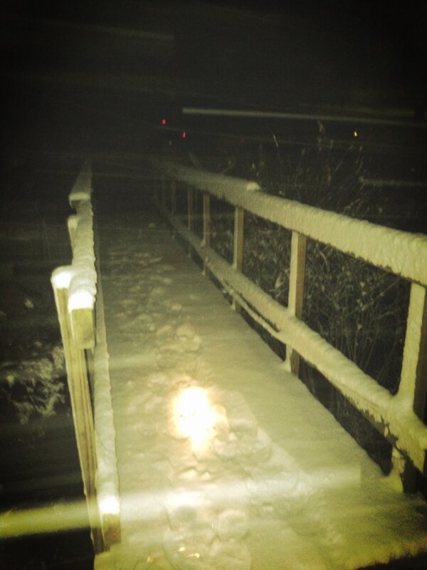
Here is a photo of our bridge from then:
0 likes
Just a small town southern boy helping other humans.
Who is online
Users browsing this forum: No registered users and 198 guests