Texas Winter 2012-2013

Winter Weather Discussion

Moderator: S2k Moderators

Forum rules

The posts in this forum are NOT official forecast and should not be used as such. They are just the opinion of the poster and may or may not be backed by sound meteorological data. They are NOT endorsed by any professional institution or STORM2K.

Help Support Storm2K
Message
Author
User avatar
TeamPlayersBlue
Category 5
Category 5
Posts: 3445
Joined: Tue Feb 02, 2010 1:44 am
Location: Denver/Applewood, CO

Re: Texas Winter 2012-2013

#1841 Postby TeamPlayersBlue » Fri Dec 28, 2012 12:15 pm

SaskatchewanScreamer wrote:
ThunderSleetDreams wrote:I'd gladly take that snow here in Houston. It would shut the city down for a solid week.


:lol: :lol: :lol: :lol: :lol: :lol: :lol: :lol: :lol: :lol: :lol:

You'd be shut down for the next three months! :wink:


It would be 75 just 2 days later, snow would be gone in 3 days!
0 likes   
Personal Forecast Disclaimer:
The posts in this forum are NOT official forecast and should not be used as such. They are just the opinion of the poster and may or may not be backed by sound meteorological data. They are NOT endorsed by any professional institution or storm2k.org. For official information, please refer to the NHC and NWS products.

User avatar
ThunderSleetDreams
S2K Supporter
S2K Supporter
Posts: 1477
Age: 43
Joined: Tue Dec 20, 2011 4:42 pm
Location: S of Weimar, TX

Re: Texas Winter 2012-2013

#1842 Postby ThunderSleetDreams » Fri Dec 28, 2012 12:16 pm

SaskatchewanScreamer wrote:
ThunderSleetDreams wrote:I'd gladly take that snow here in Houston. It would shut the city down for a solid week.


:lol: :lol: :lol: :lol: :lol: :lol: :lol: :lol: :lol: :lol: :lol:

You'd be shut down for the next three months! :wink:


Old Man Winter may be a frigid unforgiving bastard, but he's my frigid unforgiving bastard.
0 likes   
#NeverSummer

I hibernate when it gets above 75 degrees!

User avatar
Ntxw
Storm2k Moderator
Storm2k Moderator
Posts: 22790
Joined: Wed Oct 21, 2009 6:34 pm
Location: DFW, Texas

#1843 Postby Ntxw » Fri Dec 28, 2012 12:46 pm

The week before Christmas I made a post saying that perhaps up to 70% of the country could have snow on the ground around Christmas time (using maps on the 28th since the 25th snow isn't registered until the morning after by satellite and after the storms are done) the final number came in about 64%. This beats 2009's 60% which was the most since 1998 (I cannot find data prior to that) for the holiday. Florida was the only contiguous state that did not have snow (South Carolina may not have had some, but I can't verify eyeballing satellite images in the northwestern tip of the state.) on the 27th.

Only the snowiest periods of 2009-2010 (Feb) and 2010-2011 (Jan) featured such extent of snow to this magnitude
0 likes   
The above post and any post by Ntxw is NOT an official forecast and should not be used as such. It is just the opinion of the poster and may or may not be backed by sound meteorological data. It is NOT endorsed by any professional institution including Storm2k. For official information, please refer to NWS products.

  Help support Storm2K!
Help Support Storm2K

User avatar
Ntxw
Storm2k Moderator
Storm2k Moderator
Posts: 22790
Joined: Wed Oct 21, 2009 6:34 pm
Location: DFW, Texas

#1844 Postby Ntxw » Fri Dec 28, 2012 1:15 pm

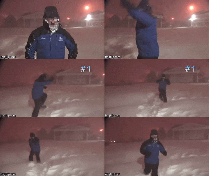
Crazy Canadian is trying to coat Portastorm in ice

Image
0 likes   
The above post and any post by Ntxw is NOT an official forecast and should not be used as such. It is just the opinion of the poster and may or may not be backed by sound meteorological data. It is NOT endorsed by any professional institution including Storm2k. For official information, please refer to NWS products.


  Help support Storm2K!

Help Support Storm2K


Dallasaggie01
Tropical Low
Tropical Low
Posts: 34
Joined: Thu Dec 24, 2009 10:36 am
Location: Dallas

Re: Texas Winter 2012-2013

#1845 Postby Dallasaggie01 » Fri Dec 28, 2012 1:19 pm

NTWX,
How do you feel about the Tues/Wed timeframe coming up? Most of the TV mets are predicting warmer than freezing temps, but I don't know that we've hit a projected high all week.
0 likes   

User avatar
Ntxw
Storm2k Moderator
Storm2k Moderator
Posts: 22790
Joined: Wed Oct 21, 2009 6:34 pm
Location: DFW, Texas

Re: Texas Winter 2012-2013

#1846 Postby Ntxw » Fri Dec 28, 2012 1:24 pm

Dallasaggie01 wrote:NTWX,
How do you feel about the Tues/Wed timeframe coming up? Most of the TV mets are predicting warmer than freezing temps, but I don't know that we've hit a projected high all week.


There will be several impulses. The leading impulse coming out will probably be a very cold rain New Year's eve (can still change but that's what model consensus says). As it passes on New Year's day another storm from NW Mexico/California is right behind it and this is the storm that may cause havoc with all kinds of weather from rain to freezing rain to sleet and even snow Weds/Thurs.
0 likes   
The above post and any post by Ntxw is NOT an official forecast and should not be used as such. It is just the opinion of the poster and may or may not be backed by sound meteorological data. It is NOT endorsed by any professional institution including Storm2k. For official information, please refer to NWS products.


  Help support Storm2K!

Help Support Storm2K


SaskatchewanScreamer

Re: Texas Winter 2012-2013

#1847 Postby SaskatchewanScreamer » Fri Dec 28, 2012 2:12 pm

TeamPlayersBlue wrote:
SaskatchewanScreamer wrote:
ThunderSleetDreams wrote:I'd gladly take that snow here in Houston. It would shut the city down for a solid week.


:lol: :lol: :lol: :lol: :lol: :lol: :lol: :lol: :lol: :lol: :lol:

You'd be shut down for the next three months! :wink:


It would be 75 just 2 days later, snow would be gone in 3 days!


:cry: not fair!!! :P
0 likes   

DonWrk
Category 1
Category 1
Posts: 488
Age: 37
Joined: Mon Jan 03, 2011 11:54 pm
Location: Collinsville, TX

#1848 Postby DonWrk » Fri Dec 28, 2012 2:57 pm

Getting to enjoy a few flurries north of the red river! It's so much better when it starts as all snow instead of transitioning from rain to snow.
0 likes   

User avatar
somethingfunny
ChatStaff
ChatStaff
Posts: 3926
Age: 37
Joined: Thu May 31, 2007 10:30 pm
Location: McKinney, Texas

Re: Texas Winter 2012-2013

#1849 Postby somethingfunny » Fri Dec 28, 2012 4:41 pm

A widespread deluge of cold rain for New Years to help out with the drought, but snow seems unlikely. Then it gets more interesting.

AREA FORECAST DISCUSSION
NATIONAL WEATHER SERVICE FORT WORTH TX
303 PM CST FRI DEC 28 2012

.DISCUSSION...
THE UPPER LEVEL SHORTWAVE TROUGH THAT WAS RESPONSIBLE FOR THE FOG
AND DRIZZLE HAS MOVED EAST OF THE AREA. IN ITS WAKE...SURFACE
PRESSURES ARE RISING AND NORTHWESTERLY WINDS ARE INCREASING WHICH
IS HELPING TO ADVECT COOLER AND MUCH DRIER AIR INTO THE REGION.
SKIES SHOULD CLEAR BY EARLY EVENING FOR MOST AREAS...BUT WINDS
SHOULD REMAIN ABOVE 5-10 MPH TONIGHT WHICH WILL LIMIT OPTIMAL
RADIATIVE HEAT LOSS. MODELS HAVE INITIALIZED TOO MUCH SNOW COVER
REMAINING ACROSS THE NORTHERN ZONES...WHEN IN FACT MUCH OF THIS
HAS ALREADY MELTED. THE RESULT IS THAT TEMPERATURES /BOTH PERFECT
PROG AND MOS GUIDANCE/ LOOK TOO COOL IN THIS AREA. WILL FORECAST
TEMPS A FEW DEGREES WARMER THAN GUIDANCE...BUT STILL A VERY COLD
NIGHT IS EXPECTED WITH LOWS IN THE 20S AREA WIDE. LOTS OF SUNSHINE
IS EXPECTED SATURDAY AND WINDS WILL LAY DOWN DURING THE DAY...BUT
HIGH TEMPS WILL REMAIN CHILLY AND IN THE 40S. GOOD RADIATIONAL
COOLING IS EXPECTED SATURDAY NIGHT WITH THE TYPICAL COLDER
LOCATIONS BOTTOMING OUT IN THE UPPER TEENS.

THE WEATHER WILL BE IN TRANSITION DURING THE DAY SUNDAY AS A
STRONG UPPER LEVEL TROUGH DIGS INTO THE DESERT SOUTHWEST AND
BEGINS TO IMPACT OUR REGION. MID-HIGH LEVEL PACIFIC MOISTURE WILL
INCREASE DURING THE DAY AND SKIES SHOULD BE CLOUDY BY SUNSET.
SATURATION WILL OCCUR FROM TOP-DOWN...AND RAIN WILL BEGIN TO
BREAK OUT SUNDAY NIGHT. WITH THE DRY/COOL AIR INITIALLY BELOW THE
PRECIPITATING LAYER...WOULD NOT BE SURPRISED TO SEE SOME SLEET
MIXED WITH THE RAIN INITIALLY. HOWEVER SURFACE TEMPS WOULD BE
SAFELY ABOVE FREEZING WHEN THIS OCCURS. AS THE UPPER LEVEL IMPULSE
MOVES ACROSS THE AREA MONDAY...ISENTROPIC LIFT WILL BE VERY STRONG
AND TAP INTO SOME UNSEASONABLY HIGH AMOUNTS OF GULF MOISTURE.
EXPECT WIDESPREAD RAIN ACROSS THE REGION MONDAY...BUT IT SHOULD
END FROM WEST TO EAST MONDAY EVENING...PERHAPS SALVAGING NEW YEARS
EVE ACTIVITIES.
IN THE WAKE OF THIS IMPULSE...WINDS WILL TURN TO
THE NORTH AND REINFORCE THE CHILLY WEATHER TUESDAY AND WEDNESDAY
WITH HIGHS IN THE 40S AND LOWS NEAR FREEZING.

FORECAST REMAINS A BIT UNCERTAIN WEDNESDAY AND THURSDAY AS ALL
MODEL GUIDANCE CONTINUES TO ADVERTISE ANOTHER PIECE OF UPPER LEVEL
ENERGY AT THE BASE OF THE TROUGH IN THE DESERT SOUTHWEST MOVING
IN FROM THE WEST WEDNESDAY NIGHT. THE AIRMASS WILL BE COLD ENOUGH
FOR SOME WINTRY PRECIP AND THE LIFT WILL CERTAINLY BE STRONG
ENOUGH. THE MISSING PIECE OF THE EQUATION IS MOISTURE BELOW 700MB.
IN FACT THERE IS UNANIMOUS AGREEMENT ON SNOW OCCURRING ALOFT OVER
THE AREA...BUT MOST GUIDANCE SHOWS TOO MUCH DRY AIR AT THE SURFACE
FOR THE SNOW TO WORK THROUGH TO REACH THE GROUND. THE ISSUE THAT
IS INHIBITING SNOW IS A VERY STRONG NORTHERN STREAM SHORTWAVE
TROUGH WHICH DROPS SOUTH FROM CANADA INTO THE PLAINS TUESDAY NIGHT
AND WEDNESDAY. THIS PIECE OF ENERGY SERVES TO KEEP/INTENSIFY THE
COLD/DRY AIRMASS IN THE LOW LEVELS WITH STRONGER NORTHERLY WINDS.
TO GET PRECIP WE WILL NEED TO SEE 850MB WINDS OPTIMALLY OUT OF A
SOUTHERLY DIRECTION...OR AT THE LEAST BECOME LIGHT ENOUGH TO LIMIT
THE DRY ADVECTION. A WEAKER NORTHERN STREAM SHORTWAVE TROUGH WOULD
ALLOW THE UPPER SYSTEM TO THE WEST TO TURN 850MB WINDS TO A MORE
FAVORABLE DIRECTION AND WOULD RESULT IN A WINTER EVENT FOR AT
LEAST PART OF OUR AREA.
THE PIECE OF ENERGY IN QUESTION IS STILL
ROTATING AROUND AN UPPER LOW IN THE BEARING SEA...BUT SHOULD BE
SAMPLED BY ALASKAN/CANADIAN RAOBS IN 2-3 DAYS. FOR NOW ONLY THE
CANADIAN MODEL SHOWS THIS NORTHERN TROUGH BEING WEAK AND THEREFORE
HAS A SIGNIFICANT WINTER SYSTEM WEDNESDAY AND WEDNESDAY NIGHT.
THE ECMWF OFFERS A GOOD COMPROMISE...HAVING LIGHT QPF OVER THE
SOUTHERN ZONES WHERE THE LOW LEVEL AIRMASS WONT BE QUITE AS
DEEP/DRY.
WILL INCLUDE A 20 POP FOR LIGHT RAIN ACROSS THE SOUTHERN
ZONES WEDNESDAY NIGHT...AND AWAIT A LITTLE MORE MODEL AGREEMENT
BEFORE RAISING CONCERNS FOR A WINTER EVENT IN THE OFFICIAL FCST.


We'll see how the Canadian performs with that northern stream over the next few days. :)
0 likes   
I am not a meteorologist, and any posts made by me are not official forecasts or to be interpreted as being intelligent. These posts are just my opinions and are probably silly opinions.

User avatar
wxman57
Moderator-Pro Met
Moderator-Pro Met
Posts: 22984
Age: 67
Joined: Sat Jun 21, 2003 8:06 pm
Location: Houston, TX (southwest)

Re: Texas Winter 2012-2013

#1850 Postby wxman57 » Fri Dec 28, 2012 5:24 pm

Portastorm wrote:Suffice to say that the operational runs from King Euro and the GFS appear to be in some discordance with the ensembles. We saw this with the last system and as Wxman57 has told us many times before ... don't buy into the model solutions until a few days before an event, even if at then.

The pattern itself still suggests the potential for more cold air dumps and a noisy, active subtropical jet.


Past 2 runs of the Euro have an inch or so of snow into Austin/San Antonio on Jan 2nd.
0 likes   

User avatar
TexasF6
S2K Supporter
S2K Supporter
Posts: 816
Joined: Mon Aug 09, 2004 9:33 pm
Location: Austin, TX

Re: Texas Winter 2012-2013

#1851 Postby TexasF6 » Fri Dec 28, 2012 5:33 pm

:uarrow: bring it on!
0 likes   

User avatar
dhweather
S2K Supporter
S2K Supporter
Posts: 6199
Joined: Sat Aug 14, 2004 9:29 pm
Location: Heath, TX
Contact:

Re: Texas Winter 2012-2013

#1852 Postby dhweather » Fri Dec 28, 2012 5:36 pm

wxman57 wrote:
Portastorm wrote:Suffice to say that the operational runs from King Euro and the GFS appear to be in some discordance with the ensembles. We saw this with the last system and as Wxman57 has told us many times before ... don't buy into the model solutions until a few days before an event, even if at then.

The pattern itself still suggests the potential for more cold air dumps and a noisy, active subtropical jet.


Past 2 runs of the Euro have an inch or so of snow into Austin/San Antonio on Jan 2nd.


Is the Euro on crack?

What about Dallas ? I've not looked at anything today.
0 likes   

WeatherDuck
Tropical Depression
Tropical Depression
Posts: 57
Joined: Sun Feb 06, 2011 8:05 pm
Location: Taylor, TX

Re: Texas Winter 2012-2013

#1853 Postby WeatherDuck » Fri Dec 28, 2012 5:37 pm

wxman57 wrote:
Portastorm wrote:Suffice to say that the operational runs from King Euro and the GFS appear to be in some discordance with the ensembles. We saw this with the last system and as Wxman57 has told us many times before ... don't buy into the model solutions until a few days before an event, even if at then.

The pattern itself still suggests the potential for more cold air dumps and a noisy, active subtropical jet.


Past 2 runs of the Euro have an inch or so of snow into Austin/San Antonio on Jan 2nd.


Sounds good. My kids' cousins were in central Arkansas for Christmas and got to enjoy eight inches of snow. My kids were a little jealous to say the least. Maybe they will be able to see some snow next week here in Taylor, Texas (30 miles NE of Austin).
0 likes   

gpsnowman
S2K Supporter
S2K Supporter
Posts: 3190
Joined: Fri Jan 07, 2011 10:35 am
Location: Grand Prairie Tx

#1854 Postby gpsnowman » Fri Dec 28, 2012 5:43 pm

Hey Wxman 57, what are your honest thoughts on the after New Year possible snow? One inch in San Antonio/Austin could mean big business for DFW. Hail King Euro!!!
0 likes   

User avatar
wxman57
Moderator-Pro Met
Moderator-Pro Met
Posts: 22984
Age: 67
Joined: Sat Jun 21, 2003 8:06 pm
Location: Houston, TX (southwest)

Re: Texas Winter 2012-2013

#1855 Postby wxman57 » Fri Dec 28, 2012 5:46 pm

dhweather wrote:
wxman57 wrote:
Portastorm wrote:Suffice to say that the operational runs from King Euro and the GFS appear to be in some discordance with the ensembles. We saw this with the last system and as Wxman57 has told us many times before ... don't buy into the model solutions until a few days before an event, even if at then.

The pattern itself still suggests the potential for more cold air dumps and a noisy, active subtropical jet.


Past 2 runs of the Euro have an inch or so of snow into Austin/San Antonio on Jan 2nd.


Is the Euro on crack?

What about Dallas ? I've not looked at anything today.


Nope, it has shown a large area of snow from El Paso through Midland and another patch over San Antonio and Austin on the 2nd. Nothing up in Dallas. Something like...

Image
0 likes   

Snowluvr
Tropical Low
Tropical Low
Posts: 44
Joined: Thu Jan 07, 2010 10:27 pm
Location: Lucedale, Ms

Re: Texas Winter 2012-2013

#1856 Postby Snowluvr » Fri Dec 28, 2012 6:29 pm

Any chance that snow makes it over to Louisiana or Mississippi?
0 likes   

User avatar
LaBreeze
Category 5
Category 5
Posts: 1497
Joined: Thu Sep 04, 2003 1:57 pm
Location: SW Louisiana

Re: Texas Winter 2012-2013

#1857 Postby LaBreeze » Fri Dec 28, 2012 6:36 pm

Snowluvr wrote:Any chance that snow makes it over to Louisiana or Mississippi?


Would be nice, Snowluvr, but I'm not holding my breath on that one. I just don't see it happening.
0 likes   

User avatar
Ntxw
Storm2k Moderator
Storm2k Moderator
Posts: 22790
Joined: Wed Oct 21, 2009 6:34 pm
Location: DFW, Texas

Re:

#1858 Postby Ntxw » Fri Dec 28, 2012 7:11 pm

gpsnowman wrote:Hey Wxman 57, what are your honest thoughts on the after New Year possible snow? One inch in San Antonio/Austin could mean big business for DFW. Hail King Euro!!!


This is not always true. Often times it's the opposite, for Austin/San Antonio to get snow DFW will more than likely get cut off from moisture and if it's snowing in DFW it's too warm for Austin. There is not a very good correlation for the two regions :P :wink:. They need it down there though been a long time.
0 likes   
The above post and any post by Ntxw is NOT an official forecast and should not be used as such. It is just the opinion of the poster and may or may not be backed by sound meteorological data. It is NOT endorsed by any professional institution including Storm2k. For official information, please refer to NWS products.


  Help support Storm2K!

Help Support Storm2K


gpsnowman
S2K Supporter
S2K Supporter
Posts: 3190
Joined: Fri Jan 07, 2011 10:35 am
Location: Grand Prairie Tx

#1859 Postby gpsnowman » Fri Dec 28, 2012 7:18 pm

:uarrow: Thanks for the input Ntxw. I guess some of the maps posted for that time period got me a little excited. Hopefully it will work out next week.
0 likes   

User avatar
Rgv20
S2K Supporter
S2K Supporter
Posts: 2466
Age: 39
Joined: Wed Jan 05, 2011 5:42 pm
Location: Edinburg/McAllen Tx

#1860 Postby Rgv20 » Sat Dec 29, 2012 1:48 am

0zECMWF continues to be on the Cold side on the mid week forecast :D

0zECMWF 850mb Temperatures for Thursday Evening..
Image
0 likes   
The following post is NOT an official forecast and should not be used as such. It is just the opinion of the poster and may or may not be backed by sound meteorological data. It is NOT endorsed by any professional institution including storm2k.org For Official Information please refer to the NHC and NWS products.


Return to “Winter Weather”

Who is online

Users browsing this forum: No registered users and 8 guests