2013 Steering Pattern / Early indicators

This is the general tropical discussion area. Anyone can take their shot at predicting a storms path.

Moderator: S2k Moderators

Forum rules

The posts in this forum are NOT official forecasts and should not be used as such. They are just the opinion of the poster and may or may not be backed by sound meteorological data. They are NOT endorsed by any professional institution or STORM2K. For official information, please refer to products from the National Hurricane Center and National Weather Service.

Help Support Storm2K
Message
Author
User avatar
cycloneye
Admin
Admin
Posts: 145303
Age: 68
Joined: Thu Oct 10, 2002 10:54 am
Location: San Juan, Puerto Rico

2013 Steering Pattern / Early indicators

#1 Postby cycloneye » Tue Jan 15, 2013 1:12 pm

As the title of the thread has the word early,that is why I am making this thread in Mid January. This topic is important to have this early to see how things are evolving in the important factor of the steering as we will see based on that which areas in the basin may have visits of tropical systems. Also,it will be important to see how the pressures will be and how the waters are in terms of being more warm or not. Let's see how things will evolve in the next monthly updates as is early in the game.


http://www.ecmwf.int/products/forecasts ... e%20mean!/


ECMWF ensemble mean January update for May,June,July has normal pressures in most of the Atlantic and Caribbean.

Image

ECMWF operational January update for May,June,July has higher pressures in most of the basin.

Image

ECMWF Sea Surface Temperature Anomalies for May,June,July has normal sst's in most of the basin except in the Gulf of Mexico where they are above normal.

Image
0 likes   
Visit the Caribbean-Central America Weather Thread where you can find at first post web cams,radars
and observations from Caribbean basin members Click Here

User avatar
TropicalAnalystwx13
Category 5
Category 5
Posts: 2109
Age: 27
Joined: Tue Jul 19, 2011 8:20 pm
Location: Wilmington, NC
Contact:

#2 Postby TropicalAnalystwx13 » Tue Jan 15, 2013 4:41 pm

Yeah, and the ECMWF also predicted a full-fledged El Niño (1.5 °C+) with unimaginably high pressures across the Atlantic the same time last year.

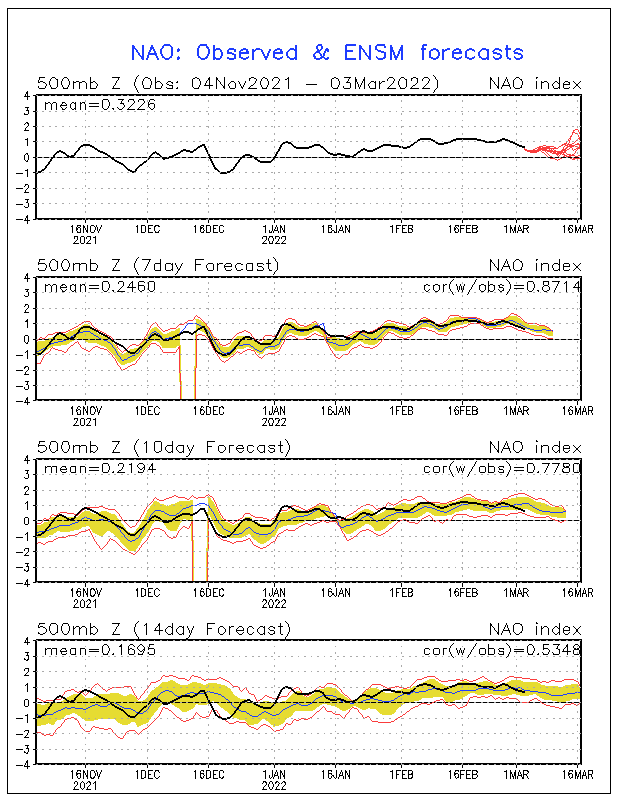
Don't expect this to come true. Especially if the NAO phase this winter is a harbinger (which it usually is). NAO has been mainly negative this winter, meaning it should flip to positive (strong high pressure) for the Spring, and back to negative (weak high pressure) for the Summer.
0 likes   

User avatar
cycloneye
Admin
Admin
Posts: 145303
Age: 68
Joined: Thu Oct 10, 2002 10:54 am
Location: San Juan, Puerto Rico

Re: 2013 Steering Pattern / Early indicators

#3 Postby cycloneye » Tue Jan 15, 2013 5:26 pm

Here is a comparison of the sst's between 2012 and 2013. Notice the difference in the GOM on the loop current extension that is bigger in 2013.

2012

Image

2013

Image

Closeup loop of Gulf of Mexico.

Image
0 likes   
Visit the Caribbean-Central America Weather Thread where you can find at first post web cams,radars
and observations from Caribbean basin members Click Here

User avatar
cycloneye
Admin
Admin
Posts: 145303
Age: 68
Joined: Thu Oct 10, 2002 10:54 am
Location: San Juan, Puerto Rico

Re: 2013 Steering Pattern / Early indicators

#4 Postby cycloneye » Wed Jan 16, 2013 2:56 pm

Here are the sst anomalies in the whole basin and for being January they look pretty warm with some areas well above normal. Let's see how this factor will continue to evolve in the next few months to see if it will continue this way or not. This is on January 12.

Image
0 likes   
Visit the Caribbean-Central America Weather Thread where you can find at first post web cams,radars
and observations from Caribbean basin members Click Here

User avatar
cycloneye
Admin
Admin
Posts: 145303
Age: 68
Joined: Thu Oct 10, 2002 10:54 am
Location: San Juan, Puerto Rico

Re: 2013 Steering Pattern / Early indicators

#5 Postby cycloneye » Tue Jan 22, 2013 3:55 pm

SST anomalies as of January 19 continue to show a warmer than average MDR and GOM. Also,the North Atlantic continues to be with very warm anomalies.

Image
0 likes   
Visit the Caribbean-Central America Weather Thread where you can find at first post web cams,radars
and observations from Caribbean basin members Click Here

User avatar
cycloneye
Admin
Admin
Posts: 145303
Age: 68
Joined: Thu Oct 10, 2002 10:54 am
Location: San Juan, Puerto Rico

Re: 2013 Steering Pattern / Early indicators

#6 Postby cycloneye » Wed Jan 23, 2013 3:41 pm

Another factor that will be important to watch will be the inestability in the Atlantic,Caribbean and Gulf of Mexico.Depending on how high or not the inestability will be,we will see more stronger storms.

Image

http://cat.cira.colostate.edu/
0 likes   
Visit the Caribbean-Central America Weather Thread where you can find at first post web cams,radars
and observations from Caribbean basin members Click Here

User avatar
cycloneye
Admin
Admin
Posts: 145303
Age: 68
Joined: Thu Oct 10, 2002 10:54 am
Location: San Juan, Puerto Rico

Re: 2013 Steering Pattern / Early indicators

#7 Postby cycloneye » Fri Jan 25, 2013 5:20 pm

Something that will be important to watch in the comming months will be the TCHP.Here is a comparison between 2012 and 2013 on January 24.

Image

Image
0 likes   
Visit the Caribbean-Central America Weather Thread where you can find at first post web cams,radars
and observations from Caribbean basin members Click Here

User avatar
Hurricane Andrew
S2K Supporter
S2K Supporter
Posts: 1891
Age: 26
Joined: Sun May 23, 2010 2:53 pm
Location: KS

#8 Postby Hurricane Andrew » Sat Jan 26, 2013 3:49 pm

Again, I say Hurricane Withdrawl.

:D

JK of course. I miss the tracking days too.
0 likes   

The Enthusiast
NREMT-AEMT, WX nerd

Irene '11, Sandy '12, Irma '17 (SAR)

"Hard to think we were born to live this way..." -Wage War

User avatar
cycloneye
Admin
Admin
Posts: 145303
Age: 68
Joined: Thu Oct 10, 2002 10:54 am
Location: San Juan, Puerto Rico

Re:

#9 Postby cycloneye » Sun Jan 27, 2013 6:08 pm

Hurricane Andrew wrote:Again, I say Hurricane Withdrawl.

:D

JK of course. I miss the tracking days too.


Time goes by so fast that without noticing the season will be here. The big questions are how active the season will be and how will the U.S fare in terms of landfalls and that is why this thread is made to look at the factors that will answer those questions.
0 likes   
Visit the Caribbean-Central America Weather Thread where you can find at first post web cams,radars
and observations from Caribbean basin members Click Here

User avatar
Hurricane Andrew
S2K Supporter
S2K Supporter
Posts: 1891
Age: 26
Joined: Sun May 23, 2010 2:53 pm
Location: KS

#10 Postby Hurricane Andrew » Tue Jan 29, 2013 6:42 pm

Based on how the SOI has acted this winter, are there any analogs?
0 likes   

The Enthusiast
NREMT-AEMT, WX nerd

Irene '11, Sandy '12, Irma '17 (SAR)

"Hard to think we were born to live this way..." -Wage War

User avatar
cycloneye
Admin
Admin
Posts: 145303
Age: 68
Joined: Thu Oct 10, 2002 10:54 am
Location: San Juan, Puerto Rico

Re: 2013 Steering Pattern / Early indicators

#11 Postby cycloneye » Sat Feb 02, 2013 1:14 pm

The next ECMWF Mean Sea Level Pressure (MSLP) update will be released on the 15th of Febuary. Let's see if it continues to show Higher pressures for most of the North Atlantic basin as it had on the January update and posted at the first post of thread.
0 likes   
Visit the Caribbean-Central America Weather Thread where you can find at first post web cams,radars
and observations from Caribbean basin members Click Here

User avatar
cycloneye
Admin
Admin
Posts: 145303
Age: 68
Joined: Thu Oct 10, 2002 10:54 am
Location: San Juan, Puerto Rico

Re: 2013 Steering Pattern / Early indicators

#12 Postby cycloneye » Mon Feb 04, 2013 1:02 pm

The vertical inestability as mentioned before in the thread will be important to watch. Here is the link where you can scroll down to see the graphics about that.

http://www.ssd.noaa.gov/PS/TROP/TCFP/atlantic.html
0 likes   
Visit the Caribbean-Central America Weather Thread where you can find at first post web cams,radars
and observations from Caribbean basin members Click Here

User avatar
NDG
S2K Supporter
S2K Supporter
Posts: 15446
Joined: Sun Jul 09, 2006 10:14 pm
Location: Orlando, FL

Re:

#13 Postby NDG » Tue Feb 05, 2013 9:19 am

TropicalAnalystwx13 wrote:Yeah, and the ECMWF also predicted a full-fledged El Niño (1.5 °C+) with unimaginably high pressures across the Atlantic the same time last year.

Don't expect this to come true. Especially if the NAO phase this winter is a harbinger (which it usually is). NAO has been mainly negative this winter, meaning it should flip to positive (strong high pressure) for the Spring, and back to negative (weak high pressure) for the Summer.


I disagree with you, the NAO so far this meteorological winter has been at least neutral if not slightly positive so far.

Edit: I just realized that you posted your comment regarding the NAO 3 weeks ago.

Image
0 likes   

User avatar
NDG
S2K Supporter
S2K Supporter
Posts: 15446
Joined: Sun Jul 09, 2006 10:14 pm
Location: Orlando, FL

Re: 2013 Steering Pattern / Early indicators

#14 Postby NDG » Tue Feb 05, 2013 9:23 am

cycloneye wrote:The vertical inestability as mentioned before in the thread will be important to watch. Here is the link where you can scroll down to see the graphics about that.

http://www.ssd.noaa.gov/PS/TROP/TCFP/atlantic.html


Could this be the 4th year in a row that instability will be lacking in the tropical Atlantic? We hope so, and it could make a big difference like the last couple of years.
I am starting to firmly believe that the lack of a any moderate to strong El Ninos during the last few years might have something to do with instability lacking in the western Hemisphere, IMO.
0 likes   

User avatar
wxman57
Moderator-Pro Met
Moderator-Pro Met
Posts: 22978
Age: 67
Joined: Sat Jun 21, 2003 8:06 pm
Location: Houston, TX (southwest)

Re: 2013 Steering Pattern / Early indicators

#15 Postby wxman57 » Tue Feb 05, 2013 10:00 am

Here's the Gulf of Mexico instability graphic for 2012. You can take off the image name at the end to get to the root folder of all 2012 files. The instability graphics end in "...ins.gif". As has been the case for the last several years, all parts of the Atlantic were more stable than normal (less instability). The lack of instability doesn't appear to affect the number of named storms, but it definitely appears to affect the intensity of the storms that develop. Only 1 major hurricane last year (possibly 2 with Sandy near Cuba). However, the more stable atmosphere could have played a part in the development of rather large but weaker hurricanes like Isaac and Sandy. Both of these storms lacked any very strong wind, and hurricane force winds were confined to a very small area. However they both had a very large area of TS winds that resulted in an extensive storm surge.

Question is - will the reduced instability (more stable air) continue into the heart of the 2013 season?

ftp://rammftp.cira.colostate.edu/schuma ... gmxins.gif
0 likes   

User avatar
Hurricane Jed
Category 2
Category 2
Posts: 545
Age: 37
Joined: Mon Jan 24, 2011 3:36 pm
Location: Cen Tex

#16 Postby Hurricane Jed » Sat Feb 09, 2013 7:03 pm

GOM has been quiet the past 4 seasons. Ida 09, Alex 10, Karl 10, Nate 11 and Isaac 12 have been the only GOM hurricanes. Ida transitioned before landfall, the next three affected Mexico primarily. Isaac was large but weak. I don't feel like that kind of luck is going to last.
0 likes   

User avatar
cycloneye
Admin
Admin
Posts: 145303
Age: 68
Joined: Thu Oct 10, 2002 10:54 am
Location: San Juan, Puerto Rico

Re: 2013 Steering Pattern / Early indicators

#17 Postby cycloneye » Mon Feb 11, 2013 10:21 am

The North Atlantic in general continues to look above normal in the anomalies.

January 19

Image

Febuary 9

Image
0 likes   
Visit the Caribbean-Central America Weather Thread where you can find at first post web cams,radars
and observations from Caribbean basin members Click Here

User avatar
cycloneye
Admin
Admin
Posts: 145303
Age: 68
Joined: Thu Oct 10, 2002 10:54 am
Location: San Juan, Puerto Rico

Re: 2013 Steering Pattern / Early indicators

#18 Postby cycloneye » Fri Feb 15, 2013 7:30 am

Here is the Febuary update from ECMWF of the MSLP for June,July and August and still shows higher pressures for a good chunck of the Tropical Atlantic and Caribbean,although less than last months update as you can see at the first post of thread.

Operational ECMWF

Image

Ensemble Mean

Image

SST Anomalies forecast for June,July and August.

Image
0 likes   
Visit the Caribbean-Central America Weather Thread where you can find at first post web cams,radars
and observations from Caribbean basin members Click Here

User avatar
wxman57
Moderator-Pro Met
Moderator-Pro Met
Posts: 22978
Age: 67
Joined: Sat Jun 21, 2003 8:06 pm
Location: Houston, TX (southwest)

Re: 2013 Steering Pattern / Early indicators

#19 Postby wxman57 » Fri Feb 15, 2013 8:48 am

Last year at this time, the forecast was for much higher pressures than the current forecast for JJA. Still somewhat unfavorable for development in the Caribbean and MDR.

Image
0 likes   

User avatar
cycloneye
Admin
Admin
Posts: 145303
Age: 68
Joined: Thu Oct 10, 2002 10:54 am
Location: San Juan, Puerto Rico

Re: 2013 Steering Pattern / Early indicators

#20 Postby cycloneye » Fri Feb 15, 2013 3:16 pm

wxman57 wrote:Last year at this time, the forecast was for much higher pressures than the current forecast for JJA. Still somewhat unfavorable for development in the Caribbean and MDR.

Image


I think vertical instability goes on hand with the MSLP as higher pressures and lack of mid-level moisture is not a combination that tropical cyclones like. Let's see what occurs in the next 2-3 months with both factors.
0 likes   
Visit the Caribbean-Central America Weather Thread where you can find at first post web cams,radars
and observations from Caribbean basin members Click Here


Return to “Talkin' Tropics”

Who is online

Users browsing this forum: Google Adsense [Bot], Noots and 51 guests