Texas Winter 2012-2013

Winter Weather Discussion

Moderator: S2k Moderators

Forum rules

The posts in this forum are NOT official forecast and should not be used as such. They are just the opinion of the poster and may or may not be backed by sound meteorological data. They are NOT endorsed by any professional institution or STORM2K.

Help Support Storm2K
Message
Author
User avatar
Texas Snowman
Storm2k Moderator
Storm2k Moderator
Posts: 6179
Joined: Fri Jan 25, 2008 11:29 am
Location: Denison, Texas

Re: Texas Winter 2012-2013

#3941 Postby Texas Snowman » Fri Feb 08, 2013 5:06 pm

wxman57 wrote:
orangeblood wrote:
wxman57 wrote:When I plot the 2m temps over that snowfall area next weekend I see the lowest temps the Euro is forecasting would be about 35-36 deg.


Well there is a very well respected met on here that always preaches these models usually are too slow and underestimate these cold air masses. The trend is not your friend this time around!!


After observing how the models have performed so far this winter, I'd be reluctant to believe any forecast that far out. Timing is quite important with snow events. I expect to see significant changes between now and the middle of next week, but not necessarily toward colder/snowier. Could easily be the other way.


But you're not reluctant to believe 80 and sunny that far out! :lol:
0 likes   
The above post and any post by Texas Snowman is NOT an official forecast and should not be used as such. It is just the opinion of the poster and may or may not be backed by sound meteorological data. It is NOT endorsed by any professional institution including storm2k.org. For official information, please refer to NWS products.

User avatar
Ntxw
Storm2k Moderator
Storm2k Moderator
Posts: 22786
Joined: Wed Oct 21, 2009 6:34 pm
Location: DFW, Texas

Re: Texas Winter 2012-2013

#3942 Postby Ntxw » Fri Feb 08, 2013 5:11 pm

Certainly North America is the place to be the next two weeks if you like winter. US is waking up from the quiet slumber (see below :darrow:), between the 12th and 25th ish there might be some semblance of near or below average coast to coast. Wxman57 could escape from those departures in Alaska!

Image
0 likes   
The above post and any post by Ntxw is NOT an official forecast and should not be used as such. It is just the opinion of the poster and may or may not be backed by sound meteorological data. It is NOT endorsed by any professional institution including Storm2k. For official information, please refer to NWS products.

  Help support Storm2K!
Help Support Storm2K

User avatar
Texas Snowman
Storm2k Moderator
Storm2k Moderator
Posts: 6179
Joined: Fri Jan 25, 2008 11:29 am
Location: Denison, Texas

Re: Texas Winter 2012-2013

#3943 Postby Texas Snowman » Fri Feb 08, 2013 5:12 pm

"@BigJoeBastardi: GFS ensemble has making of more widespread storm than this.. starting further south in the plains, winding up in ne"

Image
0 likes   
The above post and any post by Texas Snowman is NOT an official forecast and should not be used as such. It is just the opinion of the poster and may or may not be backed by sound meteorological data. It is NOT endorsed by any professional institution including storm2k.org. For official information, please refer to NWS products.

aggiecutter
Category 5
Category 5
Posts: 1753
Joined: Thu Oct 14, 2004 9:22 pm
Location: Texarkana

Re: Texas Winter 2012-2013

#3944 Postby aggiecutter » Fri Feb 08, 2013 6:15 pm

Snow is in the official forecast for the Texarkana area for next Tuesday night.

"HAZARDOUS WEATHER CONDITIONS
Hazardous Weather Outlook
7-DAY FORECAST
Tonight Partly cloudy, with a low around 36. East wind around 5 mph.
Saturday A 20 percent chance of showers and thunderstorms after noon. Partly sunny, with a high near 60. Southeast wind 5 to 10 mph.
Saturday Night Showers and thunderstorms. Some of the storms could produce heavy rainfall. Low around 53. Southeast wind around 10 mph. Chance of precipitation is 80%.
Sunday Showers and thunderstorms, mainly before noon. High near 72. South wind 10 to 15 mph becoming west in the afternoon. Winds could gust as high as 20 mph. Chance of precipitation is 80%.
Sunday Night Mostly cloudy, with a low around 40. West wind 5 to 10 mph becoming north after midnight.
Monday A 20 percent chance of showers. Mostly cloudy, with a high near 62.
Monday Night A 50 percent chance of showers and thunderstorms. Cloudy, with a low around 44.
Tuesday Showers likely and possibly a thunderstorm. Cloudy, with a high near 48. Chance of precipitation is 60%.
Tuesday Night A chance of rain and snow. Cloudy, with a low around 35. Chance of precipitation is 50%.
0 likes   

User avatar
Ntxw
Storm2k Moderator
Storm2k Moderator
Posts: 22786
Joined: Wed Oct 21, 2009 6:34 pm
Location: DFW, Texas

#3945 Postby Ntxw » Fri Feb 08, 2013 6:33 pm

Snippet of FW discussion this afternoon. First time so far I've heard them put the possibility on the table.

***
REMAINDER OF THE FORECAST...THE PRIMARY CHANGE TO THE PREVIOUS
FORECAST WAS TO INTRODUCE A RAIN-SNOW MIX TO THE FAR NORTHWEST AND
NORTHERN CWA LATE TUESDAY AFTERNOON INTO THE EVENING HOURS. BOTH
THE ECMWF AND THE GFS INDICATE THAT A SECOND STRONG SHORTWAVE
TROUGH WILL DIVE SOUTH IN THE WAKE OF SATURDAYS TROUGH AND MOVE
ALONG THE RED RIVER TUESDAY AFTERNOON AND EVENING. STRONG FORCING
FOR ASCENT AND MOISTURE RETURN WILL RESULT IN SCATTERED RAIN
SHOWERS OVER MOST OF NORTH AND CENTRAL TX BY TUESDAY MORNING. AS
THE TROUGH MOVES OVER THE CWA...SIGNIFICANT MID-LEVEL COOLING WILL
BUILD OVER THE REGION WHILE FORCING FOR ASCENT ASSOCIATED WITH THE
TROUGH CONTINUES NORTH OF INTERSTATE 20. BOTH MODELS BRING H850
TEMPERATURES DOWN TO -2 DEG C FROM WEST TO EAST FROM MID AFTERNOON
TUESDAY TO MIDNIGHT TUESDAY NIGHT/WEDNESDAY MORNING. GROUND
TEMPERATURES ARE EXPECTED TO REMAIN WELL ABOVE FREEZING WHILE
PRECIPITATION IS FALLING...SO CURRENT THINKING IS THAT WE WILL SEE
RAIN WITH SOME SNOWFLAKES MIXED IN. AS SNOW REACHES THE GROUND IT
WILL MELT RESULTING IN NO ACCUMULATION AND NO EXPECTED IMPACTS AT
THIS TIME. OF COURSE WE WILL BE WATCHING THIS SYSTEM CLOSELY
THROUGH THE WEEKEND AS A TRACK FURTHER SOUTH MAY RESULT IN SOME
LIGHT SNOW ACCUMULATIONS NEAR THE RED RIVER TUESDAY EVENING.

DID NOT MAKE ANY OTHER SIGNIFICANT CHANGES TO THE FORECAST BEYOND
TUESDAY. UPPER LEVEL RIDGING LOOKS TO BUILD IN MID WEEK WHILE
ANOTHER UPPER TROUGH AND FRONT LOOKS TO MOVE THROUGH NORTH AND
CENTRAL TX THURSDAY. THERE IS NOT MUCH UPPER LEVEL SUPPORT IN THE
12Z GFS OR ECMWF FOR THIS NEXT FRONT...SO LEFT IT DRY AT THIS
0 likes   
The above post and any post by Ntxw is NOT an official forecast and should not be used as such. It is just the opinion of the poster and may or may not be backed by sound meteorological data. It is NOT endorsed by any professional institution including Storm2k. For official information, please refer to NWS products.


  Help support Storm2K!

Help Support Storm2K


User avatar
GaryHughes
S2K Supporter
S2K Supporter
Posts: 88
Joined: Tue Dec 18, 2012 12:39 am
Location: Parker County, near Springtown

Re: Texas Winter 2012-2013

#3946 Postby GaryHughes » Fri Feb 08, 2013 10:06 pm

Looks like Old Man Winter is on his way back to the Great State of Texas, and he is bringing gifts with him!

On another note, I joined this site just 2 months ago and I really enjoy all the useful information about winter weather and the spirited discussions that it generates on a daily basis!

I would like to encourage all users to donate so that we can all continue to enjoy this site!
By the way I put my money where my mouth is, just made my second donation since December 2012.
:blowup:

This is a great site so please support it, like it supports you!
0 likes   
The above post and any post by GaryHughes is NOT an official forecast and should not be used as such. It is just the opinion of the poster and may or may not be backed by sound meteorological data. It is NOT endorsed by any professional institution including storm2k.org. For official information, please refer to NWS products.

HockeyTx82
S2K Supporter
S2K Supporter
Posts: 2540
Joined: Tue Oct 27, 2009 11:17 am
Location: Ponder, TX

Re: Texas Winter 2012-2013

#3947 Postby HockeyTx82 » Fri Feb 08, 2013 10:35 pm

I think we have found our guy to counter wxman57. He's only 9 but seems to be a cold weather fan. :D

http://www.youtube.com/watch?v=u_64HKpaOtE&sns=em

That and don't forget your bread and milk...... Hahahahah http://youtu.be/i6zaVYWLTkU

Sadly he sounds like almost every Texan once the media starts the hype!
Last edited by HockeyTx82 on Fri Feb 08, 2013 10:43 pm, edited 1 time in total.
0 likes   
Don't hold me accountable for anything I post on this forum. Leave the real forecasting up to the professionals.

Location: Ponder, TX (all observation posts are this location unless otherwise noted)

User avatar
GaryHughes
S2K Supporter
S2K Supporter
Posts: 88
Joined: Tue Dec 18, 2012 12:39 am
Location: Parker County, near Springtown

Re: Texas Winter 2012-2013

#3948 Postby GaryHughes » Fri Feb 08, 2013 10:42 pm

HockeyTx82 wrote:I think we have found our guy to counter wxman57. He's only 9 but seems to be a cold weather fan. :D

http://www.youtube.com/watch?v=u_64HKpaOtE&sns=em


Are you sure that's not Wxman57 in his youth?
:Pick:
0 likes   
The above post and any post by GaryHughes is NOT an official forecast and should not be used as such. It is just the opinion of the poster and may or may not be backed by sound meteorological data. It is NOT endorsed by any professional institution including storm2k.org. For official information, please refer to NWS products.

User avatar
Texas Snowman
Storm2k Moderator
Storm2k Moderator
Posts: 6179
Joined: Fri Jan 25, 2008 11:29 am
Location: Denison, Texas

Re: Texas Winter 2012-2013

#3949 Postby Texas Snowman » Fri Feb 08, 2013 11:07 pm

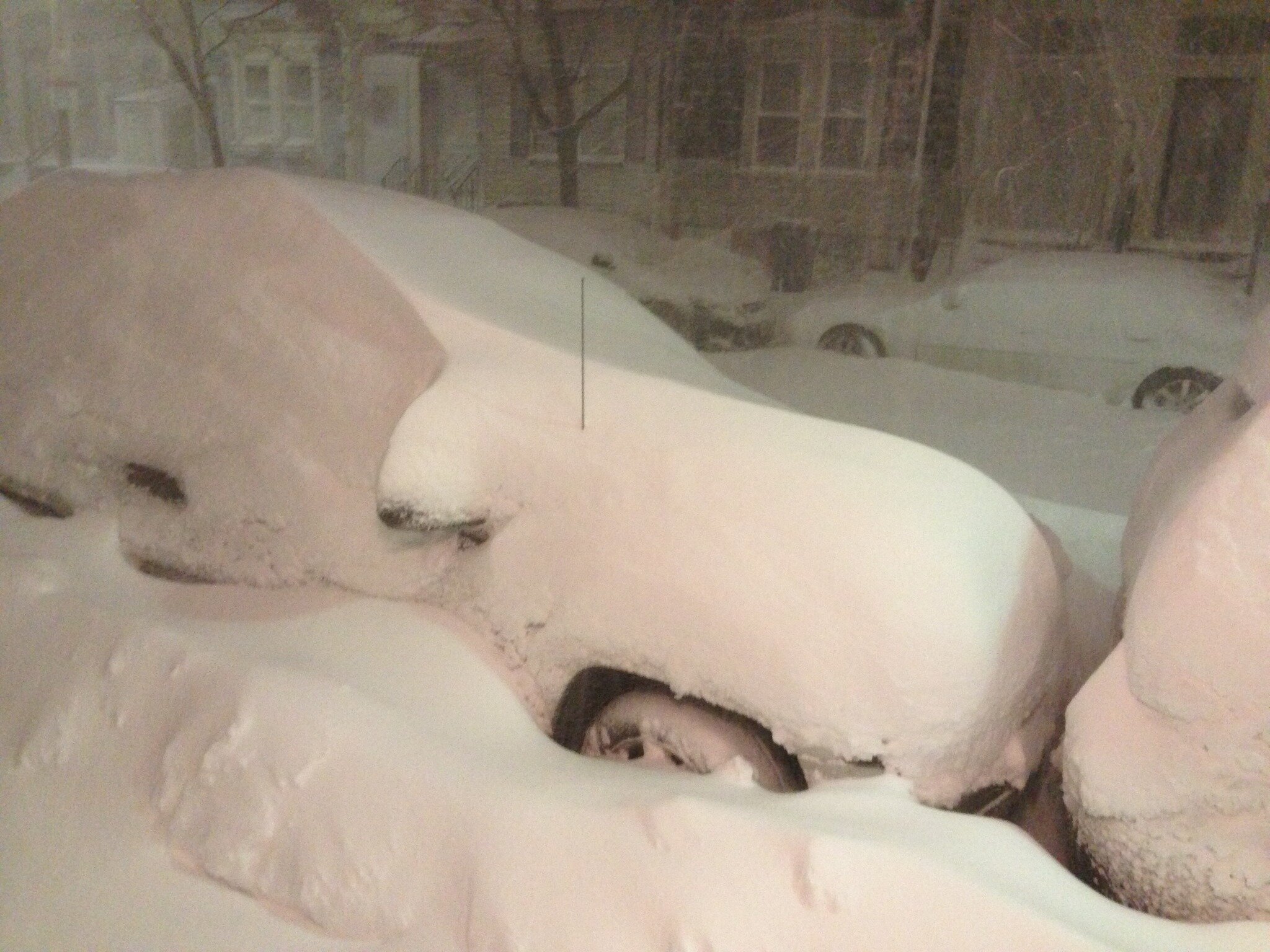
Now THAT'S a winter storm!

Image
0 likes   
The above post and any post by Texas Snowman is NOT an official forecast and should not be used as such. It is just the opinion of the poster and may or may not be backed by sound meteorological data. It is NOT endorsed by any professional institution including storm2k.org. For official information, please refer to NWS products.

User avatar
HouTXmetro
Category 5
Category 5
Posts: 3949
Joined: Sun Jun 13, 2004 6:00 pm
Location: District of Columbia, USA

#3950 Postby HouTXmetro » Fri Feb 08, 2013 11:14 pm

I'm over this boring cold. Ready for Longer hours of sun light, T-shirts and Shorts. Not looking forward to celebrating the NBA All-star game in sweaters and coats next weekend. :grr:
0 likes   
[Disclaimer: My Amateur Opinion, please defer to your local authorities or the NHC for Guidance.]

User avatar
Texas Snowman
Storm2k Moderator
Storm2k Moderator
Posts: 6179
Joined: Fri Jan 25, 2008 11:29 am
Location: Denison, Texas

Re:

#3951 Postby Texas Snowman » Fri Feb 08, 2013 11:18 pm

HouTXmetro wrote:I'm over this boring cold. Ready for Longer hours of sun light, T-shirts and Shorts. Not looking forward to celebrating the NBA All-star game in sweaters and coats next weekend. :grr:


I'm hoping they are shoveling snow...as Wxman57 rides his bike down the street! :grrr:
0 likes   
The above post and any post by Texas Snowman is NOT an official forecast and should not be used as such. It is just the opinion of the poster and may or may not be backed by sound meteorological data. It is NOT endorsed by any professional institution including storm2k.org. For official information, please refer to NWS products.

User avatar
HouTXmetro
Category 5
Category 5
Posts: 3949
Joined: Sun Jun 13, 2004 6:00 pm
Location: District of Columbia, USA

Re: Re:

#3952 Postby HouTXmetro » Fri Feb 08, 2013 11:44 pm

Texas Snowman wrote:
HouTXmetro wrote:I'm over this boring cold. Ready for Longer hours of sun light, T-shirts and Shorts. Not looking forward to celebrating the NBA All-star game in sweaters and coats next weekend. :grr:


I'm hoping they are shoveling snow...as Wxman57 rides his bike down the street! :grrr:


lol
0 likes   
[Disclaimer: My Amateur Opinion, please defer to your local authorities or the NHC for Guidance.]

User avatar
Texas Snowman
Storm2k Moderator
Storm2k Moderator
Posts: 6179
Joined: Fri Jan 25, 2008 11:29 am
Location: Denison, Texas

Re: Texas Winter 2012-2013

#3953 Postby Texas Snowman » Sat Feb 09, 2013 12:16 am

Looks like GOOD bike riding weather to me! :sled:

Image
0 likes   
The above post and any post by Texas Snowman is NOT an official forecast and should not be used as such. It is just the opinion of the poster and may or may not be backed by sound meteorological data. It is NOT endorsed by any professional institution including storm2k.org. For official information, please refer to NWS products.

User avatar
Texas Snowman
Storm2k Moderator
Storm2k Moderator
Posts: 6179
Joined: Fri Jan 25, 2008 11:29 am
Location: Denison, Texas

#3954 Postby Texas Snowman » Sat Feb 09, 2013 12:22 am

Does the Red River Valley get in on the fun?

Image
0 likes   
The above post and any post by Texas Snowman is NOT an official forecast and should not be used as such. It is just the opinion of the poster and may or may not be backed by sound meteorological data. It is NOT endorsed by any professional institution including storm2k.org. For official information, please refer to NWS products.

gpsnowman
S2K Supporter
S2K Supporter
Posts: 3186
Joined: Fri Jan 07, 2011 10:35 am
Location: Grand Prairie Tx

#3955 Postby gpsnowman » Sat Feb 09, 2013 12:48 am

Any good news from the models tonight? :cold:
0 likes   

User avatar
Ntxw
Storm2k Moderator
Storm2k Moderator
Posts: 22786
Joined: Wed Oct 21, 2009 6:34 pm
Location: DFW, Texas

Re:

#3956 Postby Ntxw » Sat Feb 09, 2013 12:51 am

gpsnowman wrote:Any good news from the models tonight? :cold:


The GFS likes southern Oklahoma still next Tues/Wednesday but drier, it's been going back and forth on that. Beyond that they are very adamant about a cold blast and another monster system for the US. It's that kind of pattern, one massive storm after another. The atmosphere looks explosive over the country the next two weeks and any one of those systems could be a doozy for somebody.
0 likes   
The above post and any post by Ntxw is NOT an official forecast and should not be used as such. It is just the opinion of the poster and may or may not be backed by sound meteorological data. It is NOT endorsed by any professional institution including Storm2k. For official information, please refer to NWS products.


  Help support Storm2K!

Help Support Storm2K


gpsnowman
S2K Supporter
S2K Supporter
Posts: 3186
Joined: Fri Jan 07, 2011 10:35 am
Location: Grand Prairie Tx

#3957 Postby gpsnowman » Sat Feb 09, 2013 12:55 am

Well, I certainly like the pattern trends. Hopefully one of those bad boys decides to come Texas way. Watching all this blizzard coverage is making me yearn for a big snow storm. As if I wasn't yearning already.
0 likes   

User avatar
Ntxw
Storm2k Moderator
Storm2k Moderator
Posts: 22786
Joined: Wed Oct 21, 2009 6:34 pm
Location: DFW, Texas

#3958 Postby Ntxw » Sat Feb 09, 2013 1:58 am

0z Euro is pretty ugly (compared to it's previous run). I say we call it an outlier and toss it :lol:. No need to bank this one!
0 likes   
The above post and any post by Ntxw is NOT an official forecast and should not be used as such. It is just the opinion of the poster and may or may not be backed by sound meteorological data. It is NOT endorsed by any professional institution including Storm2k. For official information, please refer to NWS products.


  Help support Storm2K!

Help Support Storm2K


User avatar
RedRiverRefuge
S2K Supporter
S2K Supporter
Posts: 31
Joined: Sun Feb 27, 2011 1:33 pm
Location: West Central Florida

#3959 Postby RedRiverRefuge » Sat Feb 09, 2013 9:18 am

From the NWS-FW for Monday night: ACROSS THE NORTHERN ZONES...SURFACE TEMPS MAY GET COLD
ENOUGH NEAR THE CORE OF THE UPPER LOW TO SUPPORT A RAIN/SNOW MIX.
HOWEVER MODEL GUIDANCE HAS TRENDED THE TRACK OF THE UPPER SYSTEM
FARTHER TO THE NORTH. SUCH A TRACK WOULD KEEP THE SNOW POTENTIAL
IN OKLAHOMA.

Questions: Doesn't model guidance usually suggest a track further north then plays out further south? They always seem to get it wrong :D .. Im on the Red River.. Please track further south
0 likes   
This post is NOT AN OFFICIAL FORECAST and should not be used as such. It is just the opinion of the poster and may or may not be backed by sound meteorological data. It is NOT endorsed by any professional institution including storm2k.org. For Official Information please refer to the NHC and NWS products

User avatar
Ntxw
Storm2k Moderator
Storm2k Moderator
Posts: 22786
Joined: Wed Oct 21, 2009 6:34 pm
Location: DFW, Texas

Re:

#3960 Postby Ntxw » Sat Feb 09, 2013 11:31 am

:oops: Questions: Doesn't model guidance usually suggest a track further north then plays out further south? They always seem to get it wrong :D .. Im on the Red River.. Please track further south


While this is often true, not so much in this case. It can easily go north as it can go south. There is no big high to surpress the storm and cold is marginal.
0 likes   
The above post and any post by Ntxw is NOT an official forecast and should not be used as such. It is just the opinion of the poster and may or may not be backed by sound meteorological data. It is NOT endorsed by any professional institution including Storm2k. For official information, please refer to NWS products.


  Help support Storm2K!

Help Support Storm2K


Return to “Winter Weather”

Who is online

Users browsing this forum: No registered users and 7 guests