2013 Steering Pattern / Early indicators

This is the general tropical discussion area. Anyone can take their shot at predicting a storms path.

Moderator: S2k Moderators

Forum rules

The posts in this forum are NOT official forecasts and should not be used as such. They are just the opinion of the poster and may or may not be backed by sound meteorological data. They are NOT endorsed by any professional institution or STORM2K. For official information, please refer to products from the National Hurricane Center and National Weather Service.

Help Support Storm2K
Message
Author
User avatar
vbhoutex
Storm2k Executive
Storm2k Executive
Posts: 29112
Age: 73
Joined: Wed Oct 09, 2002 11:31 pm
Location: Cypress, TX
Contact:

Re: 2013 Steering Pattern / Early indicators

#121 Postby vbhoutex » Wed Apr 17, 2013 11:56 am

RL3AO wrote:
ROCK wrote:Not sure I want another summer death ridge over Texas this year.... :D like to see a TS make its way over here. I need a new roof! If you know what I mean :D


I don't know. If storms get into the GOM this year, I'm worried they'll be far from tropical storms.

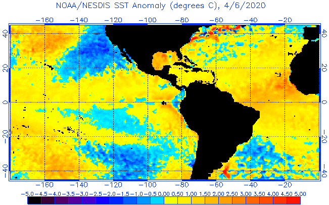
I hear you RL3AO. The different forecasters I have talked with are ALL concerned about the GOM this year. Conditions appear to be favorable for anything that gets into the Caribbean(next stop GOM)to develop into a TC, if it isn't one already, unlike last year, which would mean that unless conditions in the GOM are hostile we would have the possibility of some major Hurricanes in the GOM. Unfortunately, once in the GOM TCs have to landfall somewhere. Like Rock I would not be averse to some weak tropical systems coming into our area and bringing us the rain we still need.
0 likes   
Skywarn, C.E.R.T.
Please click below to donate to STORM2K to help with the expenses of keeping the site going:
Image

User avatar
South Texas Storms
Professional-Met
Professional-Met
Posts: 4225
Joined: Thu Jun 24, 2010 12:28 am
Location: Houston, TX

Re: 2013 Steering Pattern / Early indicators

#122 Postby South Texas Storms » Wed Apr 17, 2013 4:45 pm

cycloneye wrote:This is the UKMET forecast of precipitation for July/August and September. Look how enhanced is the moisture in the MDR area.

https://pbs.twimg.com/media/BHhA3tACMAA4aZR.png:large


Where did you get the UKMET long range precipitation maps Luis?
0 likes   

User avatar
cycloneye
Admin
Admin
Posts: 145299
Age: 68
Joined: Thu Oct 10, 2002 10:54 am
Location: San Juan, Puerto Rico

Re: 2013 Steering Pattern / Early indicators

#123 Postby cycloneye » Wed Apr 17, 2013 4:57 pm

South Texas Storms wrote:
cycloneye wrote:This is the UKMET forecast of precipitation for July/August and September. Look how enhanced is the moisture in the MDR area.

https://pbs.twimg.com/media/BHhA3tACMAA4aZR.png:large


Where did you get the UKMET long range precipitation maps Luis?


I got it from another site that was posted without a link. I will try to find the source to then post it.
0 likes   
Visit the Caribbean-Central America Weather Thread where you can find at first post web cams,radars
and observations from Caribbean basin members Click Here

USTropics
Professional-Met
Professional-Met
Posts: 2650
Joined: Sun Aug 12, 2007 3:45 am
Location: Florida State University

Re: 2013 Steering Pattern / Early indicators

#124 Postby USTropics » Thu Apr 18, 2013 6:01 am

South Texas Storms wrote:
cycloneye wrote:This is the UKMET forecast of precipitation for July/August and September. Look how enhanced is the moisture in the MDR area.

https://pbs.twimg.com/media/BHhA3tACMAA4aZR.png:large


Where did you get the UKMET long range precipitation maps Luis?


You can find the source files here:
http://www.metoffice.gov.uk/research/climate/seasonal-to-decadal/gpc-outlooks/ens-mean
0 likes   

User avatar
cycloneye
Admin
Admin
Posts: 145299
Age: 68
Joined: Thu Oct 10, 2002 10:54 am
Location: San Juan, Puerto Rico

Re: 2013 Steering Pattern / Early indicators

#125 Postby cycloneye » Thu Apr 18, 2013 6:07 am

USTropics wrote:
South Texas Storms wrote:
cycloneye wrote:This is the UKMET forecast of precipitation for July/August and September. Look how enhanced is the moisture in the MDR area.

https://pbs.twimg.com/media/BHhA3tACMAA4aZR.png:large


Where did you get the UKMET long range precipitation maps Luis?


You can find the source files here:
http://www.metoffice.gov.uk/research/climate/seasonal-to-decadal/gpc-outlooks/ens-mean


Thank you for posting the link.
0 likes   
Visit the Caribbean-Central America Weather Thread where you can find at first post web cams,radars
and observations from Caribbean basin members Click Here

User avatar
cycloneye
Admin
Admin
Posts: 145299
Age: 68
Joined: Thu Oct 10, 2002 10:54 am
Location: San Juan, Puerto Rico

Re: 2013 Steering Pattern / Early indicators

#126 Postby cycloneye » Thu Apr 18, 2013 1:10 pm

Here is a two month loop of how things have evolved in the Pacific and the Atlantic

Image
0 likes   
Visit the Caribbean-Central America Weather Thread where you can find at first post web cams,radars
and observations from Caribbean basin members Click Here

User avatar
cycloneye
Admin
Admin
Posts: 145299
Age: 68
Joined: Thu Oct 10, 2002 10:54 am
Location: San Juan, Puerto Rico

Re: 2013 Steering Pattern / Early indicators

#127 Postby cycloneye » Thu Apr 18, 2013 8:22 pm

This is the 500mb forecast by UKMET for July/August/September.

Image
0 likes   
Visit the Caribbean-Central America Weather Thread where you can find at first post web cams,radars
and observations from Caribbean basin members Click Here

User avatar
South Texas Storms
Professional-Met
Professional-Met
Posts: 4225
Joined: Thu Jun 24, 2010 12:28 am
Location: Houston, TX

Re: 2013 Steering Pattern / Early indicators

#128 Postby South Texas Storms » Fri Apr 19, 2013 12:13 am

USTropics wrote:
South Texas Storms wrote:
cycloneye wrote:This is the UKMET forecast of precipitation for July/August and September. Look how enhanced is the moisture in the MDR area.

https://pbs.twimg.com/media/BHhA3tACMAA4aZR.png:large


Where did you get the UKMET long range precipitation maps Luis?


You can find the source files here:
http://www.metoffice.gov.uk/research/climate/seasonal-to-decadal/gpc-outlooks/ens-mean


Yeah thanks for posting the link.
0 likes   

User avatar
cycloneye
Admin
Admin
Posts: 145299
Age: 68
Joined: Thu Oct 10, 2002 10:54 am
Location: San Juan, Puerto Rico

Re: 2013 Steering Pattern / Early indicators

#129 Postby cycloneye » Fri Apr 19, 2013 2:22 pm

The JMA model for precipitation imitates the UKMET as it has plenty in the MDR and Caribbean. This is for June,July and August.

Image

https://twitter.com/TropicalTidbits/sta ... 60/photo/1
0 likes   
Visit the Caribbean-Central America Weather Thread where you can find at first post web cams,radars
and observations from Caribbean basin members Click Here

User avatar
Hurricaneman
Category 5
Category 5
Posts: 7351
Age: 45
Joined: Tue Aug 31, 2004 3:24 pm
Location: central florida

Re: 2013 Steering Pattern / Early indicators

#130 Postby Hurricaneman » Fri Apr 19, 2013 9:36 pm

This past week there has been an area of low pressure over Algeria and Libya dropping decent amounts of rain, could that possibly cause SAL outbreaks to be less extreme

The posts in this forum are NOT official forecast and should not be used as such. They are just the opinion of the poster and may or may not be backed by sound meteorological data. They are NOT endorsed by any professional institution or storm2k.org. For official information, please refer to the NHC and NWS products.
0 likes   

User avatar
cycloneye
Admin
Admin
Posts: 145299
Age: 68
Joined: Thu Oct 10, 2002 10:54 am
Location: San Juan, Puerto Rico

Re: 2013 Steering Pattern / Early indicators

#131 Postby cycloneye » Sat Apr 20, 2013 2:37 pm

The latest Vertical Instability in Caribbean is slightly above normal and at MDR is slightly below average.

Image

Image
0 likes   
Visit the Caribbean-Central America Weather Thread where you can find at first post web cams,radars
and observations from Caribbean basin members Click Here

User avatar
artist
Category 5
Category 5
Posts: 9792
Joined: Mon Jun 06, 2005 3:26 pm
Location: West Palm

#132 Postby artist » Sat Apr 20, 2013 6:27 pm

could anyone help explain to us less knowledgeable what these mean?
0 likes   

User avatar
TropicalAnalystwx13
Category 5
Category 5
Posts: 2109
Age: 27
Joined: Tue Jul 19, 2011 8:20 pm
Location: Wilmington, NC
Contact:

Re:

#133 Postby TropicalAnalystwx13 » Sat Apr 20, 2013 9:34 pm

artist wrote:could anyone help explain to us less knowledgeable what these mean?

Could you be more specific on what you're confused about?
0 likes   

User avatar
artist
Category 5
Category 5
Posts: 9792
Joined: Mon Jun 06, 2005 3:26 pm
Location: West Palm

Re: Re:

#134 Postby artist » Sun Apr 21, 2013 12:41 pm

TropicalAnalystwx13 wrote:
artist wrote:could anyone help explain to us less knowledgeable what these mean?

Could you be more specific on what you're confused about?

what are the patterns indicating as to where storms may or may not form, etc. and how to interpret them? :lol:
0 likes   

User avatar
cycloneye
Admin
Admin
Posts: 145299
Age: 68
Joined: Thu Oct 10, 2002 10:54 am
Location: San Juan, Puerto Rico

Re:

#135 Postby cycloneye » Sun Apr 21, 2013 1:06 pm

artist wrote:could anyone help explain to us less knowledgeable what these mean?


Maybe this video by Levi Cowan helps you a little bit to understand how the patterns are evolving.

http://www.tropicaltidbits.com/blog/201 ... e-season//
0 likes   
Visit the Caribbean-Central America Weather Thread where you can find at first post web cams,radars
and observations from Caribbean basin members Click Here

User avatar
cycloneye
Admin
Admin
Posts: 145299
Age: 68
Joined: Thu Oct 10, 2002 10:54 am
Location: San Juan, Puerto Rico

Re: 2013 Steering Pattern / Early indicators

#136 Postby cycloneye » Sun Apr 21, 2013 1:28 pm

Here is a discussion by Levi Cowan about the MSLP forecast by CFS and how it differs from the ECMWF April one.

CFS MSLP forecast for May - July has lower pressures SE of the US but also in the Arctic. Such a pattern can become dangerous for US and Caribbean landfalls if it lasts into August/September, because low pressure in tropics + arctic means a ridge in between that is far enough south to block or delay the recurvature of storms leading to more landfalls. Also worth noting is the CFS MSLP forecast in the tropical Atlantic is opposite to the current ECMWF forecast as brought out by others

https://twitter.com/tropicaltidbits


Image
0 likes   
Visit the Caribbean-Central America Weather Thread where you can find at first post web cams,radars
and observations from Caribbean basin members Click Here

User avatar
Hurricaneman
Category 5
Category 5
Posts: 7351
Age: 45
Joined: Tue Aug 31, 2004 3:24 pm
Location: central florida

Re: 2013 Steering Pattern / Early indicators

#137 Postby Hurricaneman » Sun Apr 21, 2013 2:28 pm

Luis, It looks like something similar to a 2004 pattern on the CFS where the recurve didn't happen until stuff went through Florida which is making me take notice. I'm more likely to take the CFS forecast seriously than the Euro especially if the pressure pattern remains
0 likes   

User avatar
artist
Category 5
Category 5
Posts: 9792
Joined: Mon Jun 06, 2005 3:26 pm
Location: West Palm

Re: 2013 Steering Pattern / Early indicators

#138 Postby artist » Sun Apr 21, 2013 8:09 pm

cycloneye wrote:Here is a discussion by Levi Cowan about the MSLP forecast by CFS and how it differs from the ECMWF April one.

CFS MSLP forecast for May - July has lower pressures SE of the US but also in the Arctic. Such a pattern can become dangerous for US and Caribbean landfalls if it lasts into August/September, because low pressure in tropics + arctic means a ridge in between that is far enough south to block or delay the recurvature of storms leading to more landfalls. Also worth noting is the CFS MSLP forecast in the tropical Atlantic is opposite to the current ECMWF forecast as brought out by others

https://twitter.com/tropicaltidbits


Image


exactly what I was hoping for. Thank you!
0 likes   

User avatar
cycloneye
Admin
Admin
Posts: 145299
Age: 68
Joined: Thu Oct 10, 2002 10:54 am
Location: San Juan, Puerto Rico

Re: 2013 Steering Pattern / Early indicators

#139 Postby cycloneye » Mon Apr 22, 2013 10:54 am

Even thou the Eurosip April update out on the 22nd of April (Posted at ENSO Updates thread) shows a wide scope between El Nino and La Nina for the next few months,the ensemble tercile also out today has normal to below normal pressures for the June,July,August and for July,August,September. That is contrary to what the ECMWF operational had in it's April forecast of higher pressures.

Image

Image
0 likes   
Visit the Caribbean-Central America Weather Thread where you can find at first post web cams,radars
and observations from Caribbean basin members Click Here

User avatar
chaser1
S2K Supporter
S2K Supporter
Posts: 5464
Age: 64
Joined: Sat Oct 15, 2005 5:59 pm
Location: Longwood, Fl

Re: 2013 Steering Pattern / Early indicators

#140 Postby chaser1 » Mon Apr 22, 2013 3:31 pm

Hurricaneman wrote:Luis, It looks like something similar to a 2004 pattern on the CFS where the recurve didn't happen until stuff went through Florida which is making me take notice. I'm more likely to take the CFS forecast seriously than the Euro especially if the pressure pattern remains


northjaxpro wrote:We had two land-falling tropical cyclones impact my area just last season, with Beryl striking my area directly. Fortunately they did not become hurricanes, but it was bad enough. I have a bad vibe that the peninsula is going to get impacted heavily this upcoming tropical season. I really hope I am wrong about this.


I'm right there with you guys..... I'm all the way down the peninsula from you (Miami area) and totally share the same sense of foreboding as you do. I have concerns for the Florida East coast from Jensen Beach to points north. Also really concerned about the Sarasota to Ceder Key area. Other than my own pre-season guess that there might be a few low latitude Caribbean systems that will keep on buzzing westward, am also concerned that the Carolina's will be a target as well by other higher latitude re-curving systems approaching from E. of Florida

I am always curious to see the origin and track of the first (tropical or non tropical) depression or two. I have most always found some semblance of recurring later year tropical cyclone track that would seem to fit these early season formative weak systems.

Another curious tendency which I have noticed over the years, is a type of pattern theory which an old chaser friend of mine shared with me years ago. Over many years of seasonal track observations it would seem that the Atlantic basin would tend to have 2 predominant areas (and motion) of tropical system tracks. Almost as if the overall steering flow for any particular season had 2 generally dominant track signatures. 'Course, its still too early to have any handle on that quite yet, but each year around this time I start looking for clues.

Come April I start looking at any mid to upper level conditions as hints. Then I start paying a bit more attention at the long range just to see what level of continuity or shifts that the GFS & EURO might indicate. The accuracy of the long range forecast at this point really is less relevant to me than seeing "downstream" what actually verified (in comparison to what was forecasted 7-10 days prior). What i'm especially curious about are those tendencies possibly indicating either greater or lessor strengths (and direction) of steering and upper level wind flow. Naturally, long wave patterns and conditions evolve from Spring to Summer, but redundant patterns over time are certainly not uncommon. So basically there are present conditions (showing near normal, or higher or lower anomalies), forecasted conditions (showing the same) and of course the longer range as well. I'm mostly interested in seeing if some consistency of tendencies (such as SST's, MSLP, TUTT conditions, 200mb wind strength/direction, 500mb flow, general instability, etc) not only show "at", "above", or "below" seasonal norm for the time of year....but if such conditions continue to be under or over forecasted by the respective long range models.

Anyway, just my weird way of simply taking "consistency" and trying to project longer range based on a continued measure of under-forecast or over-forecast long range model accuracy. I call it my own "Persistance on Crack" theory, LOL!
0 likes   
Andy D

(For official information, please refer to the NHC and NWS products.)


Return to “Talkin' Tropics”

Who is online

Users browsing this forum: Ulf and 17 guests