ENSO Updates (2007 thru 2023)
Moderator: S2k Moderators
Forum rules

The posts in this forum are NOT official forecasts and should not be used as such. They are just the opinion of the poster and may or may not be backed by sound meteorological data. They are NOT endorsed by any professional institution or STORM2K. For official information, please refer to products from the National Hurricane Center and National Weather Service.

Re: ENSO:Mid-May update of models=Neutral thru end of 2013
0 likes
-
Bocadude85

- Category 5

- Posts: 2991
- Age: 39
- Joined: Mon Apr 18, 2005 2:20 pm
- Location: Honolulu,Hi
Re: Re:
TropicalAnalystwx13 wrote:SoupBone wrote:TropicalAnalystwx13 wrote: I'd bet on the horseshoe-shaped water not being as cool as one would believe it should be due to a farther east-displaced ridge like we've seen all winter and spring, which also happens to be really bad for the USA if it persists (landfalls).
What particular areas of the U.S. did you have in mind? Gulf Coast, East Coast, Texas Coast (I know this is part of the Gulf Coast, but it's so big it nearly deserves its own designation)?
The East Coast in particular, though I'm also a little concerned about the eastern Gulf Coast. The seasonal model forecasts are for expansive ridging across southern and eastern Canada during the peak of the season, with minor troughing in the central USA extending ever so slightly into the East. This puts anyone on the East Coast at play, especially Florida. Cyclones that develop or get pretty far south initially may get pulled north into whatever trough is positioned across the country at the time. (Ivan/Dennis).
Not trying to nitpick at all but just curious why on your risk map in the other thread you have Florida at a medium risk of a landfall if the upcoming pattern would favor landfalls in Florida? Wouldn't that warrant a high risk for Florida?
0 likes
-
TropicalAnalystwx13

- Category 5
- Posts: 2109
- Age: 28
- Joined: Tue Jul 19, 2011 8:20 pm
- Location: Wilmington, NC
- Contact:
Re: Re:
Bocadude85 wrote:Not trying to nitpick at all but just curious why on your risk map in the other thread you have Florida at a medium risk of a landfall if the upcoming pattern would favor landfalls in Florida? Wouldn't that warrant a high risk for Florida?
It was a mess-up on my part. It should have been red.
I deleted the PSD file afterwards because I wasn't planning on doing another impact map this year, so I couldn't revise it either.
0 likes


Latest MJO forecasts from the models show it weakening into the circle after exiting Indonesia. If this is indeed the case and it does not progress into the Pacific, we'll likely continue the cooling trend of the eastern ENSO regions. A weaker MJO wave could also lessen the potential, not completely rule it out, of development in the EPAC and Atlantic basin the rest of May.
0 likes
The above post and any post by Ntxw is NOT an official forecast and should not be used as such. It is just the opinion of the poster and may or may not be backed by sound meteorological data. It is NOT endorsed by any professional institution including Storm2k. For official information, please refer to NWS products.
Help support Storm2K!
-
cycloneye

- Admin

- Posts: 149468
- Age: 69
- Joined: Thu Oct 10, 2002 10:54 am
- Location: San Juan, Puerto Rico
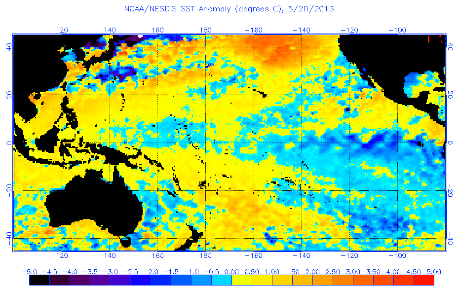
Re: ENSO: CPC 5/20/13 update= Nino 3.4 cools down to -0.4C
Climate Prediction Center 5/20/13 update
A big drop from -0.1C of last week's update to this week's -0.4C
http://www.cpc.ncep.noaa.gov/products/a ... ts-web.pdf

A big drop from -0.1C of last week's update to this week's -0.4C
http://www.cpc.ncep.noaa.gov/products/a ... ts-web.pdf
0 likes
Visit the Caribbean-Central America Weather Thread where you can find at first post web cams,radars
and observations from Caribbean basin members Click Here
and observations from Caribbean basin members Click Here
-
cycloneye
- Admin
- Posts: 149468
- Age: 69
- Joined: Thu Oct 10, 2002 10:54 am
- Location: San Juan, Puerto Rico
Re:
Ntxw wrote:Latest MJO forecasts from the models show it weakening into the circle after exiting Indonesia. If this is indeed the case and it does not progress into the Pacific, we'll likely continue the cooling trend of the eastern ENSO regions. A weaker MJO wave could also lessen the potential, not completely rule it out, of development in the EPAC and Atlantic basin the rest of May.
And the cooling continues. If a warming of the Equatorial Pacific occurs it has to wait a while longer.
0 likes
Visit the Caribbean-Central America Weather Thread where you can find at first post web cams,radars
and observations from Caribbean basin members Click Here
and observations from Caribbean basin members Click Here
I think we've got most of our cooling done for the next few weeks. It should move back up a few notches slowly as the MJO has exited the cooling phases (Indonesia) and is now incoherent, but likely not by much.
0 likes
The above post and any post by Ntxw is NOT an official forecast and should not be used as such. It is just the opinion of the poster and may or may not be backed by sound meteorological data. It is NOT endorsed by any professional institution including Storm2k. For official information, please refer to NWS products.
Help support Storm2K!
Help support Storm2K!
-
cycloneye
- Admin
- Posts: 149468
- Age: 69
- Joined: Thu Oct 10, 2002 10:54 am
- Location: San Juan, Puerto Rico
Re: ENSO Updates
The May update of the EUROSIP is up and is wide in the forecast as you can see.

0 likes
Visit the Caribbean-Central America Weather Thread where you can find at first post web cams,radars
and observations from Caribbean basin members Click Here
and observations from Caribbean basin members Click Here
-
Hurricaneman
- Category 5
- Posts: 7404
- Age: 45
- Joined: Tue Aug 31, 2004 3:24 pm
- Location: central florida
Re: ENSO Updates
Most of the euro ensembles stay in the neutral range, looks like this year will continue neutral for the hurricane season
0 likes
Daily, 30 day, and 90 day SOI have really gone positive lately. At the same time mountain torque has been in the very negative territory is giving off -AAM anomalies past couple of days. Both the MJO and the features above have created a very La Nina-esque pattern worldwide (i.e. uptick in tornado activity across the US). How much of this will effect SST's?
0 likes
The above post and any post by Ntxw is NOT an official forecast and should not be used as such. It is just the opinion of the poster and may or may not be backed by sound meteorological data. It is NOT endorsed by any professional institution including Storm2k. For official information, please refer to NWS products.
Help support Storm2K!
Help support Storm2K!
-
cycloneye
- Admin
- Posts: 149468
- Age: 69
- Joined: Thu Oct 10, 2002 10:54 am
- Location: San Juan, Puerto Rico
Re:
Ntxw wrote:Daily, 30 day, and 90 day SOI have really gone positive lately. At the same time mountain torque has been in the very negative territory is giving off -AAM anomalies past couple of days. Both the MJO and the features above have created a very La Nina-esque pattern worldwide (i.e. uptick in tornado activity across the US). How much of this will effect SST's?
If things continue the cooling trend I would not be surprised to see a Weak La Nina instead of Neutral at least for part of Summer.
0 likes
Visit the Caribbean-Central America Weather Thread where you can find at first post web cams,radars
and observations from Caribbean basin members Click Here
and observations from Caribbean basin members Click Here
Re: Re:
cycloneye wrote:Ntxw wrote:Daily, 30 day, and 90 day SOI have really gone positive lately. At the same time mountain torque has been in the very negative territory is giving off -AAM anomalies past couple of days. Both the MJO and the features above have created a very La Nina-esque pattern worldwide (i.e. uptick in tornado activity across the US). How much of this will effect SST's?
If things continue the cooling trend I would not be surprised to see a Weak La Nina instead of Neutral at least for part of Summer.
Not completely would agree with you but I would say that the chances of a weak La Nina could certainly go up if the current trend continues, IMO.
0 likes
-
Kingarabian

- S2K Supporter

- Posts: 16364
- Joined: Sat Aug 08, 2009 3:06 am
- Location: Honolulu, Hawaii
-
cycloneye
- Admin
- Posts: 149468
- Age: 69
- Joined: Thu Oct 10, 2002 10:54 am
- Location: San Juan, Puerto Rico
Re: ENSO Updates
Look how Nino 3.4 has gone downhill in the past few days.


0 likes
Visit the Caribbean-Central America Weather Thread where you can find at first post web cams,radars
and observations from Caribbean basin members Click Here
and observations from Caribbean basin members Click Here
-
Hurricaneman
- Category 5
- Posts: 7404
- Age: 45
- Joined: Tue Aug 31, 2004 3:24 pm
- Location: central florida
Re: ENSO Updates
cycloneye wrote:Look how Nino 3.4 has gone downhill in the past few days.
Im starting to see a possible la nina coming on
0 likes
-
RainbowAppleJackDash
Re: ENSO Updates
Hurricaneman wrote:cycloneye wrote:Look how Nino 3.4 has gone downhill in the past few days.
Im starting to see a possible la nina coming on
Oh GOD. This means that we could see a potential category 5. WHO AGREES?
0 likes
-
lester

- S2K Supporter
- Posts: 1305
- Age: 37
- Joined: Sat Aug 27, 2005 5:21 pm
- Location: Washington, DC
- Contact:
Re: ENSO Updates
RainbowAppleJackDash wrote:Hurricaneman wrote:cycloneye wrote:Look how Nino 3.4 has gone downhill in the past few days.
Im starting to see a possible la nina coming on
Oh GOD. This means that we could see a potential category 5. WHO AGREES?
ENSO has nothing to do with that.
0 likes
While the odds of a weak La Nina are growing it is still a fairly slim chance so lets not get carried away. Warming and cooling goes in cycles during neutral years as the MJO is a bigger factor than when a true La Nina or El Nino is present. Neutral is still the best bet and even if La Nina were to come on we will not have enough to fit the criteria of 5 consecutive tri-monthlies unless the Pacific went bonkers and -1c or lower the next several months. It will be the fall at the very soonest if La Nina were to be officially present therefore it will be neutral through the summer at least. Though this is not to say La Nina-like weather conditions can't be present especially if the cooler neutral continues.
0 likes
The above post and any post by Ntxw is NOT an official forecast and should not be used as such. It is just the opinion of the poster and may or may not be backed by sound meteorological data. It is NOT endorsed by any professional institution including Storm2k. For official information, please refer to NWS products.
Help support Storm2K!
Help support Storm2K!
-
RainbowAppleJackDash
Re: ENSO Updates
RainbowAppleJackDash wrote:Hurricaneman wrote:cycloneye wrote:
ENSO has nothing to do with that.
Oh ok then.
0 likes
Who is online
Users browsing this forum: hcane27 and 144 guests