Multi-day outbreak of May 25-31

U.S. & Caribbean Weather Discussions and Severe Weather Events

Moderator: S2k Moderators

Forum rules

The posts in this forum are NOT official forecast and should not be used as such. They are just the opinion of the poster and may or may not be backed by sound meteorological data. They are NOT endorsed by any professional institution or STORM2K.

Help Support Storm2K
Message
Author
User avatar
TwisterFanatic
Category 5
Category 5
Posts: 1041
Joined: Mon Jun 28, 2010 12:43 pm
Location: Sallisaw, Oklahoma

#161 Postby TwisterFanatic » Fri May 31, 2013 11:38 am

DAY 1 CONVECTIVE OUTLOOK
NWS STORM PREDICTION CENTER NORMAN OK
1129 AM CDT FRI MAY 31 2013

VALID 311630Z - 011200Z

...THERE IS A MDT RISK OF SVR TSTMS THIS AFTERNOON AND EVENING
ACROSS PARTS OF CNTRL OK...SERN KS...AND SWRN MO...


...THERE IS A SLGT RISK OF SVR TSTMS OVER PARTS OF THE GREAT PLAINS
INTO UPPER MIDWEST...

...REGIONAL SEVERE WEATHER OUTBREAK POSSIBLE TODAY OVER PARTS OF
CENTRAL/EASTERN OK...SOUTHEAST KS...AND SOUTHWEST MO. VERY LARGE
HAIL...WIDESPREAD DAMAGING WINDS...AND A FEW STRONG
TORNADOES/VIOLENT ARE POSSIBLE...


...OK/KS/MO...
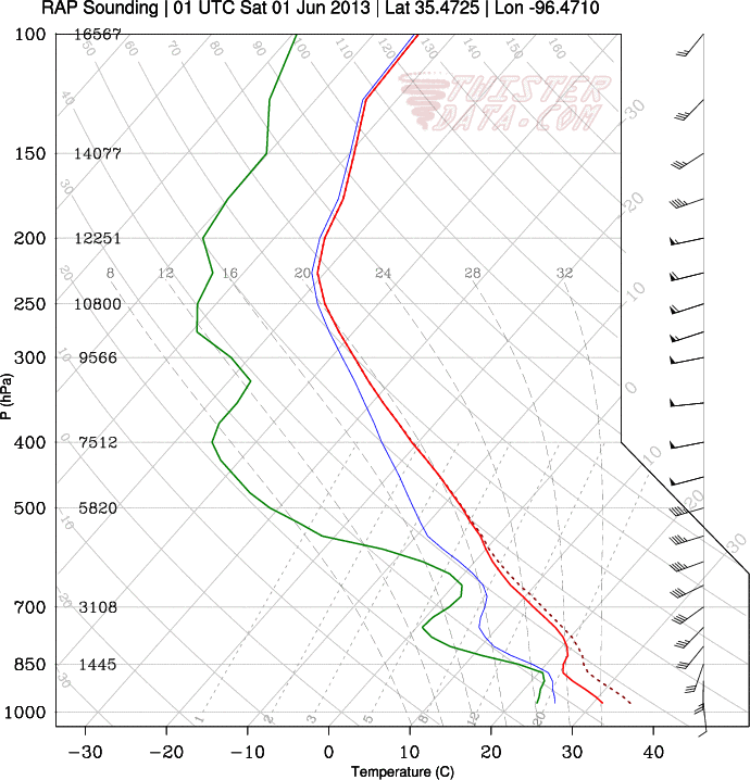
ANOTHER VERY VOLATILE ENVIRONMENT IS IN PLACE ACROSS PARTS OF THE
SOUTHERN PLAINS AND MID MS VALLEY TODAY. WIDESPREAD VERY STEEP MID
LEVEL LAPSE RATES AND DEWPOINTS IN THE UPPER 60S/LOWER 70S ARE
RESULTING IN THE POTENTIAL FOR AFTERNOON MLCAPE VALUES OVER 4000
J/KG. THIS AIR MASS IS CURRENTLY CAPPED...AND THE CAP SHOULD
RESTRAIN DEEP CONVECTION THROUGH MUCH OF THE DAY ALLOWING STRONG
HEATING.

BY MID/LATE AFTERNOON...A SHORTWAVE TROUGH INDICATED IN WATER VAPOR
IMAGERY OVER THE TX PANHANDLE...ALONG WITH A SECOND AND STRONGER
TROUGH OVER CO...WILL APPROACH THE REGION. THIS WILL RAPIDLY WEAKEN
THE CAP AND ALLOW EXPLOSIVE THUNDERSTORM DEVELOPMENT ALONG THE
DRYLINE OVER WEST-CENTRAL OK...AND ALONG THE COLD FRONT EXTENDING
FROM CENTRAL OK INTO SOUTHWEST MO. DEEP LAYER EFFECTIVE SHEAR
VALUES ARE FAVORABLE FOR SUPERCELL STORMS CAPABLE OF VERY LARGE
HAIL...DAMAGING WINDS...AND TORNADOES. SHEAR VECTORS PERPENDICULAR
TO THE N-S DRYLINE OVER CENTRAL OK WILL FAVOR DISCRETE STORM
STRUCTURES. ALL 12Z MODEL GUIDANCE INDICATES RAPID INTENSIFICATION
OF THE LOW LEVEL JET OVER CENTRAL OK BY EVENING AS THE UPPER TROUGH
APPROACHES. GIVEN THESE PARAMETERS...IT APPEARS THE THREAT OF A FEW
STRONG/VIOLENT TORNADOES ARE IN PLACE. HAVE INCREASED SEVERE
PROBABILITIES OVER THIS REGION...AND PORTIONS OF CENTRAL/EASTERN OK
WILL BE CONSIDERED FOR AN UPGRADE TO HIGH RISK AT 20Z IF
SHORTER-TERM MESOSCALE MODELS MAINTAIN THIS SCENARIO.


DURING THE EVENING...NUMEROUS THUNDERSTORMS ARE EXPECTED TO CONGEAL
INTO A FAST-MOVING MCS THAT TRACKS NORTHEASTWARD ACROSS NORTHEAST OK
INTO SOUTHWEST KS. HIGH CAPE VALUES AND AN INCREASING LOW LEVEL JET
WILL PROMOTE THE POTENTIAL FOR WIDESPREAD WIND DAMAGE...ALONG WITH
LARGE HAIL AND ISOLATED TORNADOES.

...IA/MN/WI...
AN UPPER LOW IS PRESENT THIS MORNING OVER WESTERN SD...WITH MULTIPLE
SHORTWAVE TROUGHS ROTATING NORTHWARD ACROSS IA/MN. STRONG DAYTIME
HEATING IS OCCURRING AHEAD OF THE SHORTWAVE TROUGHS OVER PARTS OF
MN/WI/IA WHERE MODERATE AFTERNOON CAPE IS EXPECTED. SCATTERED
THUNDERSTORMS ARE EXPECTED TO FORM BY MID AFTERNOON OVER MN/IA AND
TRACK NORTHEASTWARD. A FEW OF THESE STORMS COULD BE SUPERCELLULAR
WITH A RISK OF HAIL/DAMAGING WINDS OR AN ISOLATED TORNADO.

...IL/IND...
AN ONGOING CLUSTER OF THUNDERSTORMS IN THE STL AREA MAY RE-INTENSIFY
THIS AFTERNOON AS IT TRACKS INTO AN INCREASINGLY MOIST/UNSTABLE AIR
MASS OVER IL/IND. IF THIS OCCURS...LOCALLY DAMAGING WINDS AND HAIL
WILL BE POSSIBLE.

..HART/LEITMAN.. 05/31/2013


Image
0 likes   
Personal Forecast Disclaimer:
The posts in this forum are NOT official forecast and should not be used as such. They are just the opinion of the poster and may or may not be backed by sound meteorological data. They are NOT endorsed by any professional institution or storm2k.org. For official information, please refer to the NHC and NWS products.

User avatar
TwisterFanatic
Category 5
Category 5
Posts: 1041
Joined: Mon Jun 28, 2010 12:43 pm
Location: Sallisaw, Oklahoma

#162 Postby TwisterFanatic » Fri May 31, 2013 11:52 am

Have we had a PDS watch this year?
0 likes   
Personal Forecast Disclaimer:
The posts in this forum are NOT official forecast and should not be used as such. They are just the opinion of the poster and may or may not be backed by sound meteorological data. They are NOT endorsed by any professional institution or storm2k.org. For official information, please refer to the NHC and NWS products.

EF-5bigj
Category 3
Category 3
Posts: 864
Joined: Tue Feb 07, 2012 10:36 pm
Location: Spartanburg,SC

#163 Postby EF-5bigj » Fri May 31, 2013 12:11 pm

I don't think we have had a PDS this year yet.
0 likes   

CrazyC83
Professional-Met
Professional-Met
Posts: 34002
Joined: Tue Mar 07, 2006 11:57 pm
Location: Deep South, for the first time!

#164 Postby CrazyC83 » Fri May 31, 2013 12:13 pm

One PDS watch this year, on April 18, which busted. I'd expect a PDS watch to be issued this afternoon in that core area though.
0 likes   

CrazyC83
Professional-Met
Professional-Met
Posts: 34002
Joined: Tue Mar 07, 2006 11:57 pm
Location: Deep South, for the first time!

#165 Postby CrazyC83 » Fri May 31, 2013 12:34 pm

If there isn't a High Risk today, the last time there were none before the end of May was 2000 (that year, there were none at all - that was a fairly boring year for weather all around).
0 likes   

User avatar
Bunkertor
Category 5
Category 5
Posts: 3397
Joined: Tue May 09, 2006 3:48 pm

#166 Postby Bunkertor » Fri May 31, 2013 12:48 pm

mistake
Last edited by Bunkertor on Fri May 31, 2013 3:50 pm, edited 1 time in total.
0 likes   

EF-5bigj
Category 3
Category 3
Posts: 864
Joined: Tue Feb 07, 2012 10:36 pm
Location: Spartanburg,SC

#167 Postby EF-5bigj » Fri May 31, 2013 1:01 pm

Well if they issue a high risk I can see why. Oklahoma just can't catch a break :(
0 likes   

CrazyC83
Professional-Met
Professional-Met
Posts: 34002
Joined: Tue Mar 07, 2006 11:57 pm
Location: Deep South, for the first time!

#168 Postby CrazyC83 » Fri May 31, 2013 1:32 pm

Those in OKC should certainly stay off the roads if at all possible between 4 and 7 pm and have access to an underground shelter if necessary. They could either try to leave from work early (if safe at home) or stay longer (if safer at work). Did they dismiss schools early or cancel schools today?
0 likes   

User avatar
wx247
S2K Supporter
S2K Supporter
Posts: 14279
Age: 41
Joined: Wed Feb 05, 2003 10:35 pm
Location: Monett, Missouri
Contact:

#169 Postby wx247 » Fri May 31, 2013 1:35 pm

Skies have cleared here and it definitely "feels" like it is going to storm. Not a good setup for us here in SW MO at all either.
0 likes   
Personal Forecast Disclaimer:
The posts in this forum are NOT official forecast and should not be used as such. They are just the opinion of the poster and may or may not be backed by sound meteorological data. They are NOT endorsed by any professional institution or storm2k.org. For official information, please refer to the NHC and NWS products.

EF-5bigj
Category 3
Category 3
Posts: 864
Joined: Tue Feb 07, 2012 10:36 pm
Location: Spartanburg,SC

#170 Postby EF-5bigj » Fri May 31, 2013 1:38 pm

The setup today is more volitile then Thursday. I hope everyone stays safe today.
0 likes   

CrazyC83
Professional-Met
Professional-Met
Posts: 34002
Joined: Tue Mar 07, 2006 11:57 pm
Location: Deep South, for the first time!

Re: Multi-day outbreak for most of this week

#171 Postby CrazyC83 » Fri May 31, 2013 1:39 pm

From NWS Norman:

000
NOUS44 KOUN 311831
PNSOUN
OKZ004>048-050>052-TXZ083>090-010745-

PUBLIC INFORMATION STATEMENT
NATIONAL WEATHER SERVICE NORMAN OK
131 PM CDT FRI MAY 31 2013


...DANGEROUS STORMS POSSIBLE THIS AFTERNOON AND EVENING...

YOUR BEST OPTIONS FOR TORNADO SAFETY ARE (IN THIS ORDER)

1. IN AN UNDERGROUND STORM SHELTER, STORM CELLAR, BASEMENT OR
ENGINEERED SAFE ROOM DESIGNED TO WITHSTAND A TORNADO.

2. ON THE LOWEST FLOOR OF A STURDY BUILDING,
A. STAY AWAY FROM DOORS, WINDOWS AND OUTSIDE WALLS.
B. PUT AS MANY WALLS BETWEEN YOU AND THE TORNADO AS YOU CAN.
C. USE AS MANY PILLOWS, COUCH CUSHIONS, SLEEPING BAGS, A MATTRESS
OR BLANKETS TO COVER UP AS YOU CAN.
D. IF YOU OR YOUR CHILDREN HAVE HELMETS, WEAR THEM!
E. IF YOU HAVE AN INFANT, PUT THEM IN THEIR CAR SEAT OR CARRIER

OTHER IMPORTANT SHELTERING REMINDERS:

* WEAR LONG PANTS, LONG SLEEVE SHIRT, AND REAL SHOES
(NOT FLIP FLOPS OR SANDALS!)
* CHARGE YOUR CELL PHONE AND TAKE IT WITH YOU TO SHELTER
* MAKE SURE YOU KNOW WHAT YOU WILL DO WITH YOUR PETS. FIND
LEASHES AND CARRIERS NOW.

YOU CAN SURVIVE ALMOST EVERY TORNADO IF YOU FOLLOW THESE GUIDELINES!

IF YOU DO NOT FEEL SAFE FROM A TORNADO WHERE YOU ARE, AND YOU
FEEL THE NEED TO DRIVE SOMEWHERE ELSE TO FIND BETTER SHELTER, IT
IS CRITICAL THAT YOU DO NOT WAIT TOO LATE TO MAKE THAT CRITICAL
DECISION.

IF YOU WAIT UNTIL THE TORNADO WARNING IS IN EFFECT FOR YOUR
LOCATION, IT IS PROBABLY TOO LATE TO BE ABLE TO DRIVE AWAY SAFELY!!

IF YOU CHOOSE TO LEAVE IN YOUR VEHICLE, BE SURE YOU KNOW WHERE YOU
ARE GOING BEFORE YOU START THE CAR. TRY TO LET SOMEONE KNOW YOU
ARE NOT AT HOME AND WHERE YOU ARE GOING.

DO NOT ASSUME THAT PUBLIC BUILDINGS ARE TORNADO SHELTERS. CHECK
WITH YOUR LOCAL COMMUNITY WHILE THE SUN IS STILL SHINING AND
BEFORE STORMS EVER DEVELOP!

BE SURE THAT YOU ARE NOT PUTTING YOURSELF IN MORE DANGER BY DRIVING
INTO ANOTHER STORM.
0 likes   

EF-5bigj
Category 3
Category 3
Posts: 864
Joined: Tue Feb 07, 2012 10:36 pm
Location: Spartanburg,SC

#172 Postby EF-5bigj » Fri May 31, 2013 1:43 pm

Are they going to upgrade to a High Risk soon then?
0 likes   

CrazyC83
Professional-Met
Professional-Met
Posts: 34002
Joined: Tue Mar 07, 2006 11:57 pm
Location: Deep South, for the first time!

#173 Postby CrazyC83 » Fri May 31, 2013 1:43 pm

Yes, a direct hit by an EF-4 or EF-5 tornado is not survivable unless underground or in a reinforced shelter. The fact is that, while many areas are likely to see tornadoes, few areas will see that kind of damage, even if violent tornadoes touch down. Anything up to an EF-3 is survivable without a basement in a solid structure.
0 likes   

CrazyC83
Professional-Met
Professional-Met
Posts: 34002
Joined: Tue Mar 07, 2006 11:57 pm
Location: Deep South, for the first time!

Re:

#174 Postby CrazyC83 » Fri May 31, 2013 1:43 pm

EF-5bigj wrote:Are they going to upgrade to a High Risk soon then?


We'll know in 60-90 minutes. They might issue a Mesoscale Discussion ahead of the upgrade as well.
0 likes   

User avatar
wx247
S2K Supporter
S2K Supporter
Posts: 14279
Age: 41
Joined: Wed Feb 05, 2003 10:35 pm
Location: Monett, Missouri
Contact:

Re: Re:

#175 Postby wx247 » Fri May 31, 2013 1:45 pm

CrazyC83 wrote:
EF-5bigj wrote:Are they going to upgrade to a High Risk soon then?


We'll know in 60-90 minutes. They might issue a Mesoscale Discussion ahead of the upgrade as well.


Generally if they upgrade to high they will put out a special mesoscale discussion.
Last edited by wx247 on Fri May 31, 2013 1:46 pm, edited 1 time in total.
0 likes   

WeatherGuesser
Category 5
Category 5
Posts: 2672
Joined: Tue Jun 29, 2010 6:46 am

Re:

#176 Postby WeatherGuesser » Fri May 31, 2013 1:46 pm

CrazyC83 wrote:If there isn't a High Risk today, the last time there were none before the end of May was 2000 (that year, there were none at all - that was a fairly boring year for weather all around).


That goes back to what I've been trying to say abut these threads. This is Spring; really nothing unusual or extreme. Yeah, Moore got hit bad for the second time, and we're in our second streak of 4 or more Moderate Risk days, but all-in-all, it's been a fairly unremarkable season.

In fact, it's been more remarkable for what hasn't happened; namely the record flooding that was expected from all the late snowfalls.
0 likes   

EF-5bigj
Category 3
Category 3
Posts: 864
Joined: Tue Feb 07, 2012 10:36 pm
Location: Spartanburg,SC

Re: Re:

#177 Postby EF-5bigj » Fri May 31, 2013 1:50 pm

CrazyC83 wrote:
EF-5bigj wrote:Are they going to upgrade to a High Risk soon then?


We'll know in 60-90 minutes. They might issue a Mesoscale Discussion ahead of the upgrade as well.

That's what I wanted to know thanks :) but again I hope everyone in the area of concern stays safe.
0 likes   

CrazyC83
Professional-Met
Professional-Met
Posts: 34002
Joined: Tue Mar 07, 2006 11:57 pm
Location: Deep South, for the first time!

Re: Multi-day outbreak for most of this week

#178 Postby CrazyC83 » Fri May 31, 2013 1:53 pm

First of likely two watches coming. Could be PDS.

MESOSCALE DISCUSSION 0905
NWS STORM PREDICTION CENTER NORMAN OK
0149 PM CDT FRI MAY 31 2013

AREAS AFFECTED...NERN OK...SERN KS...CNTRL/SWRN MO

CONCERNING...SEVERE POTENTIAL...TORNADO WATCH LIKELY

VALID 311849Z - 312045Z

PROBABILITY OF WATCH ISSUANCE...95 PERCENT

SUMMARY...TSTM COVERAGE SHOULD INCREASE RAPIDLY IN THE NEXT FEW
HOURS. HIGHLY FAVORABLE COMBINATION OF CAPE/SHEAR WILL YIELD
SUPERCELLS WITH RISKS OF LARGE HAIL /SOME SIGNIFICANT/...TORNADOES
/POSSIBLY STRONG/
AND ISOLATED DAMAGING WINDS.

DISCUSSION...TCU/SMALL CBS HAVE BECOME INCREASINGLY AGITATED ALONG A
COUPLE OF SW/NE-ORIENTED CLOUD STREETS ACROSS FAR SERN KS.
LARGE-SCALE ASCENT ASSOCIATED WITH PERSISTENT LOW-LEVEL WAA AND
APPROACH OF A SHORT WAVE IMPULSE OVER THE CNTRL HIGH PLAINS SHOULD
FOSTER DEEPENING CONVECTION THROUGH THE AFTERNOON. MODIFIED 18Z SGF
RAOB SUGGESTS MLCIN HAS BECOME MINIMAL WITH PRESENCE OF A STRONGLY
UNSTABLE AIR MASS. ALTHOUGH LOW-LEVEL SHEAR MAY DIMINISH SLIGHTLY
OVER THE NEXT FEW HOURS...IT WILL REMAIN MORE THAN ADEQUATE FOR
SUPERCELLS AND AN ASSOCIATED TORNADO RISK. THIS THREAT MAY BE
MAXIMIZED INVOF REMNANT OUTFLOW BOUNDARY ARCING ACROSS PARTS OF
CNTRL MO.

..GRAMS/HART.. 05/31/2013


ATTN...WFO...LSX...SGF...EAX...TSA...TOP...ICT...

LAT...LON 38729452 38889303 38549115 38249114 37259230 36619347
36379436 36349485 36549569 36879592 37219597 38029543
38729452
0 likes   

RL3AO
Moderator-Pro Met
Moderator-Pro Met
Posts: 16308
Joined: Thu Jun 14, 2007 10:03 pm
Location: NC

#179 Postby RL3AO » Fri May 31, 2013 1:54 pm

Image
0 likes   

RL3AO
Moderator-Pro Met
Moderator-Pro Met
Posts: 16308
Joined: Thu Jun 14, 2007 10:03 pm
Location: NC

#180 Postby RL3AO » Fri May 31, 2013 2:02 pm

Image

01z forecast sounding for East Central Oklahoma. Very good looking sounding.
0 likes   


Return to “USA & Caribbean Weather”

Who is online

Users browsing this forum: AnnularCane and 10 guests