

Multi-day outbreak of May 25-31
Moderator: S2k Moderators
Forum rules

The posts in this forum are NOT official forecast and should not be used as such. They are just the opinion of the poster and may or may not be backed by sound meteorological data. They are NOT endorsed by any professional institution or STORM2K.
-
TwisterFanatic

- Category 5

- Posts: 1041
- Joined: Mon Jun 28, 2010 12:43 pm
- Location: Sallisaw, Oklahoma
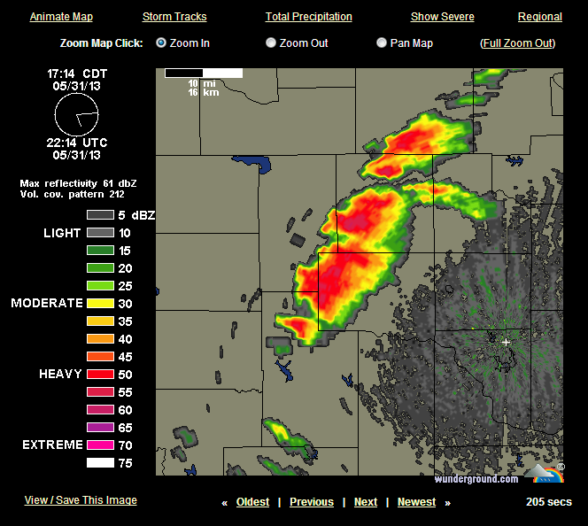
Southern storm is ingesting the middle storm, could become a dominate supercell in time.
0 likes
Personal Forecast Disclaimer:
The posts in this forum are NOT official forecast and should not be used as such. They are just the opinion of the poster and may or may not be backed by sound meteorological data. They are NOT endorsed by any professional institution or storm2k.org. For official information, please refer to the NHC and NWS products.
The posts in this forum are NOT official forecast and should not be used as such. They are just the opinion of the poster and may or may not be backed by sound meteorological data. They are NOT endorsed by any professional institution or storm2k.org. For official information, please refer to the NHC and NWS products.

Re: Multi-day outbreak for most of this week
CrazyC83 wrote:Cyclenall wrote:CrazyC83 wrote:TORNADO ON THE GROUND - West of Calumet, OK
That was insanely fast!!!
It lifted but could come back fast!
There wasn't even a tornado warning for it.

If all those cells become super, oh man...
0 likes
-
TwisterFanatic
- Category 5
- Posts: 1041
- Joined: Mon Jun 28, 2010 12:43 pm
- Location: Sallisaw, Oklahoma
Rotation increasing near Bridgeport.
0 likes
Personal Forecast Disclaimer:
The posts in this forum are NOT official forecast and should not be used as such. They are just the opinion of the poster and may or may not be backed by sound meteorological data. They are NOT endorsed by any professional institution or storm2k.org. For official information, please refer to the NHC and NWS products.
The posts in this forum are NOT official forecast and should not be used as such. They are just the opinion of the poster and may or may not be backed by sound meteorological data. They are NOT endorsed by any professional institution or storm2k.org. For official information, please refer to the NHC and NWS products.


Re: Multi-day outbreak for most of this week
They appear to be hooking up now....
0 likes
NOTICE: I cannot give an expert analysis. Most of my "observations" are made visually with the help of only vital information provided by public advisories.
-
TwisterFanatic
- Category 5
- Posts: 1041
- Joined: Mon Jun 28, 2010 12:43 pm
- Location: Sallisaw, Oklahoma
Rotation real strong just west of Geary, OK
0 likes
Personal Forecast Disclaimer:
The posts in this forum are NOT official forecast and should not be used as such. They are just the opinion of the poster and may or may not be backed by sound meteorological data. They are NOT endorsed by any professional institution or storm2k.org. For official information, please refer to the NHC and NWS products.
The posts in this forum are NOT official forecast and should not be used as such. They are just the opinion of the poster and may or may not be backed by sound meteorological data. They are NOT endorsed by any professional institution or storm2k.org. For official information, please refer to the NHC and NWS products.

Re: Multi-day outbreak for most of this week
Cyclenall wrote:If all those cells become super, oh man...
There is enough energy to feed 5 cells
0 likes
-
TwisterFanatic
- Category 5
- Posts: 1041
- Joined: Mon Jun 28, 2010 12:43 pm
- Location: Sallisaw, Oklahoma
Re:
EF-5bigj wrote:TWC is showing a wall cloud that rapidly developed.
Think that is the Geary storm I was talking about.
0 likes
Personal Forecast Disclaimer:
The posts in this forum are NOT official forecast and should not be used as such. They are just the opinion of the poster and may or may not be backed by sound meteorological data. They are NOT endorsed by any professional institution or storm2k.org. For official information, please refer to the NHC and NWS products.
The posts in this forum are NOT official forecast and should not be used as such. They are just the opinion of the poster and may or may not be backed by sound meteorological data. They are NOT endorsed by any professional institution or storm2k.org. For official information, please refer to the NHC and NWS products.

-
SouthDadeFish

- Professional-Met

- Posts: 2835
- Joined: Thu Sep 23, 2010 2:54 pm
- Location: Miami, FL
- Contact:
-
SouthDadeFish
- Professional-Met
- Posts: 2835
- Joined: Thu Sep 23, 2010 2:54 pm
- Location: Miami, FL
- Contact:
-
TwisterFanatic
- Category 5
- Posts: 1041
- Joined: Mon Jun 28, 2010 12:43 pm
- Location: Sallisaw, Oklahoma
Re:
SouthDadeFish wrote:I hate to say it, but the tornado warned cell in Canadian county is heading right at OKC as of now.
The dreaded 'coming down I-40' storm.
0 likes
Personal Forecast Disclaimer:
The posts in this forum are NOT official forecast and should not be used as such. They are just the opinion of the poster and may or may not be backed by sound meteorological data. They are NOT endorsed by any professional institution or storm2k.org. For official information, please refer to the NHC and NWS products.
The posts in this forum are NOT official forecast and should not be used as such. They are just the opinion of the poster and may or may not be backed by sound meteorological data. They are NOT endorsed by any professional institution or storm2k.org. For official information, please refer to the NHC and NWS products.
Re: Multi-day outbreak for most of this week
Bunkertor wrote:Cyclenall wrote:If all those cells become super, oh man...
There is enough energy to feed 5 cells
What calculation did you do to come up with that number?
Those supercells to the west of OKC are congealing into larger supercells and that is reminding me even more of May 24, 2011 now. You can still get violent tornadoes out of these, EF5's included.
I thought this was ridiculous, look at this forecast for OKC from TWN:


Does anyone know how I could maybe stream one of these video streams on VLC media player instead of flash in a web browser? If anyone knows or can provide a URL that I can input into VLC, thank you.
I hate to say it, but the tornado warned cell in Canadian county is heading right at OKC as of now.
Yes, extremely dangerous storm there.
0 likes
Re: Multi-day outbreak for most of this week
Cyclenall wrote:Bunkertor wrote:Cyclenall wrote:If all those cells become super, oh man...
There is enough energy to feed 5 cells
What calculation did you do to come up with that number?
Nothing special mate. Just refering to the vast amounts of J available, especially when the LLJ will kick in.
0 likes
Return to “USA & Caribbean Weather”
Who is online
Users browsing this forum: mmmmsnouts and 67 guests