ATL: CHANTAL - Post-Tropical

Moderator: S2k Moderators

Message
Author
User avatar
SouthFLTropics
Category 5
Category 5
Posts: 4236
Age: 50
Joined: Thu Aug 14, 2003 8:04 am
Location: Port St. Lucie, Florida

Re: ATL: CHANTAL - Tropical Storm - Discussion

#801 Postby SouthFLTropics » Mon Jul 08, 2013 11:58 am

gatorcane wrote:
BUCMAN48 wrote:Actually the 12Z GFS builds the ridge back in much faster possibly pushing Chantel across central Florida between Tampa and
FT. Myers at hr 152 and then into the Gulf


Wasn't JB saying a few weeks ago to watch for a system to impact Florida between Orlando and Miami in the mid July timeframe (I think he said Jul 12th).

At the time I thought he was crazy...the fact that it has some chance of actually happening now is unbelievable.

July is usually a very quite month for tropical threats for Florida when you look at climatology.


Especially coming from that direction. I would be more inclined to see something brew in the Bahamas and then approach as a weak system versus a long tracker from the Lesser Antilles. Or possibly something coming up from the South. If we take a shot from the east this early I hate to think what August and September are going to be like.

SFT
0 likes   
Fourth Generation Florida Native

Personal Storm History: David 79, Andrew 92, Erin 95, Floyd 99, Irene 99, Frances 04, Jeanne 04, Wilma 05, Matthew 16, Irma 17, Ian 22, Nicole 22, Milton 24

User avatar
Jevo
S2K Supporter
S2K Supporter
Posts: 1729
Age: 47
Joined: Tue Aug 03, 2004 8:45 pm
Location: The Flemish Cap
Contact:

Re: Re:

#802 Postby Jevo » Mon Jul 08, 2013 11:58 am

chaser1 wrote:(Here's something that I find peculiar about this 12Z 850mb run that you are displaying)

Jevo wrote:12z GFS MSLP & 10m Wind Speed full Loop


Thanks Jevo, but thats kinda my point? Surface maps see no more than a 1013 remnant low treking across Florida. The 850mb charts would seem to indicate a significantly more developed system (albiet not necessarily at the surface). Do you find this to be a better indicator of development, or do you find the GFS surface forecast maps that much less reliable of forecasted intensity. (Contrary to most circumstances, I will admit that the GFS did not forecast Chantal's development..., jeez, i'm not sure if I recall whether its crazy uncle CMC even forecasted Chantal LOL)


After reading your previous comments I decided it would be advantageous to post the MSLP run on the storm. I'm using the 850mb run more as a location marker as opposed to intensity, because as you mentioned SSP maps are not picking up the storm that well at this point.
Last edited by Jevo on Mon Jul 08, 2013 12:00 pm, edited 1 time in total.
0 likes   
Disclaimer: 50% of the time I have no clue of what I am talking about. Chances are I am taking a less than educated guess that sounds good because 10 years ago I stole Mike Watkins book 'The Hurricane and its Impact'. For official information please direct yourself to the NHC and their cadre of weather geniuses.

User avatar
Rgv20
S2K Supporter
S2K Supporter
Posts: 2466
Age: 38
Joined: Wed Jan 05, 2011 5:42 pm
Location: Edinburg/McAllen Tx

#803 Postby Rgv20 » Mon Jul 08, 2013 11:58 am

Going to be interesting how strong recon finds her..

Image
0 likes   
The following post is NOT an official forecast and should not be used as such. It is just the opinion of the poster and may or may not be backed by sound meteorological data. It is NOT endorsed by any professional institution including storm2k.org For Official Information please refer to the NHC and NWS products.

User avatar
Evil Jeremy
S2K Supporter
S2K Supporter
Posts: 5463
Age: 32
Joined: Mon Apr 10, 2006 2:10 pm
Location: Los Angeles, CA

Re:

#804 Postby Evil Jeremy » Mon Jul 08, 2013 11:58 am

floridasun78 wrote:gfs vs EURO who right Models let war begain :lol: :lol: :lol:


No need for model wars or debates. Lets keep the focus on the storm at hand and keep the petty "this model is better" stuff for the downtime between storms.

Wx_Warrior wrote:My brother, who is a PRO MET: "I haven't looked at the GFS in 2 years."


To each their own. The GFS is a good counterbalance to the ECMWF and other models. You can't have one without the other. Selectively choosing which models to follow doesn't make sense to me personally, as the more data to consider, the better.
0 likes   
Frances 04 / Jeanne 04 / Katrina 05 / Wilma 05 / Fay 08 / Debby 12 / Andrea 13 / Colin 16 / Hermine 16 / Matthew 16 / Irma 17

floridasun78
Category 5
Category 5
Posts: 3755
Joined: Sun May 17, 2009 10:16 pm
Location: miami fl

#805 Postby floridasun78 » Mon Jul 08, 2013 11:59 am

so let wait untill ECMWF come out look gfs on drug
0 likes   

User avatar
chaser1
S2K Supporter
S2K Supporter
Posts: 5467
Age: 64
Joined: Sat Oct 15, 2005 5:59 pm
Location: Longwood, Fl

Re: ATL: CHANTAL - Models

#806 Postby chaser1 » Mon Jul 08, 2013 11:59 am

Wx_Warrior wrote:My brother, who is a PRO MET: "I haven't looked at the GFS in 2 years."


Does your brother have a computer? - JUST KIDDING :lol: (just a little "model smack talk" :wink:
0 likes   
Andy D

(For official information, please refer to the NHC and NWS products.)

User avatar
Evil Jeremy
S2K Supporter
S2K Supporter
Posts: 5463
Age: 32
Joined: Mon Apr 10, 2006 2:10 pm
Location: Los Angeles, CA

Re:

#807 Postby Evil Jeremy » Mon Jul 08, 2013 12:00 pm

floridasun78 wrote:so let wait untill ECMWF come out look gfs on drug


...... The GFS is not on drugs. I don't feel the need to elaborate on that more.
0 likes   
Frances 04 / Jeanne 04 / Katrina 05 / Wilma 05 / Fay 08 / Debby 12 / Andrea 13 / Colin 16 / Hermine 16 / Matthew 16 / Irma 17

User avatar
Evil Jeremy
S2K Supporter
S2K Supporter
Posts: 5463
Age: 32
Joined: Mon Apr 10, 2006 2:10 pm
Location: Los Angeles, CA

Re: ATL: CHANTAL - Tropical Storm - Discussion

#808 Postby Evil Jeremy » Mon Jul 08, 2013 12:01 pm

gatorcane wrote:
BUCMAN48 wrote:Actually the 12Z GFS builds the ridge back in much faster possibly pushing Chantel across central Florida between Tampa and
FT. Myers at hr 152 and then into the Gulf


Wasn't JB saying a few weeks ago to watch for a system to impact Florida between Orlando and Miami in the mid July timeframe (I think he said Jul 12th)..


Hey, if you keep throwing darts at a dart board, eventually one will hit the target lol.
0 likes   
Frances 04 / Jeanne 04 / Katrina 05 / Wilma 05 / Fay 08 / Debby 12 / Andrea 13 / Colin 16 / Hermine 16 / Matthew 16 / Irma 17

User avatar
SouthDadeFish
Professional-Met
Professional-Met
Posts: 2835
Joined: Thu Sep 23, 2010 2:54 pm
Location: Miami, FL
Contact:

#809 Postby SouthDadeFish » Mon Jul 08, 2013 12:01 pm

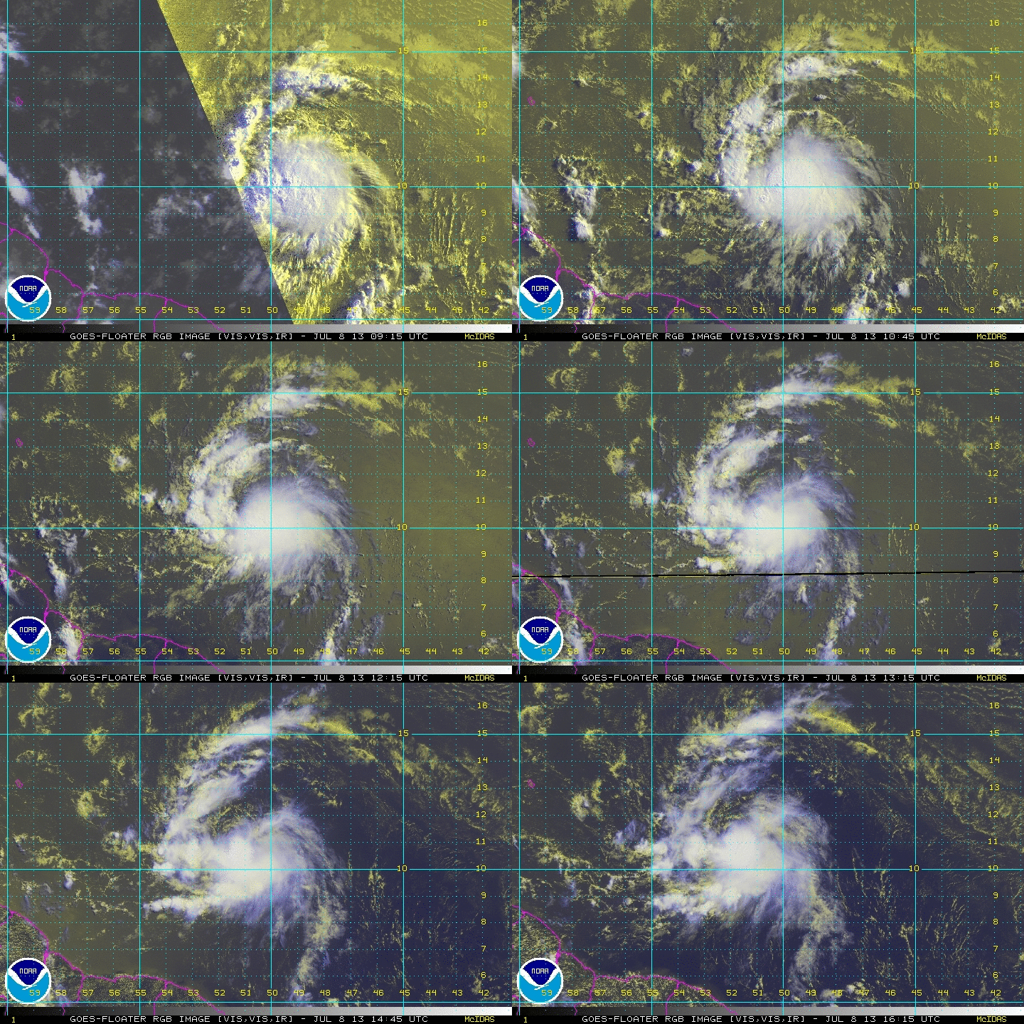
Looking better on satellite imagery with those banding features. Also, in the last few frames it seems like a tight band leading toward the core from the SW is trying to wrap up. With recon flying in today, I'm most curious to see how tight the circulation is, if it is tight at all.
0 likes   

User avatar
Bocadude85
Category 5
Category 5
Posts: 2991
Age: 38
Joined: Mon Apr 18, 2005 2:20 pm
Location: Honolulu,Hi

Re: ATL: CHANTAL - Tropical Storm - Discussion

#810 Postby Bocadude85 » Mon Jul 08, 2013 12:03 pm

SouthFLTropics wrote:
gatorcane wrote:
BUCMAN48 wrote:Actually the 12Z GFS builds the ridge back in much faster possibly pushing Chantel across central Florida between Tampa and
FT. Myers at hr 152 and then into the Gulf


Wasn't JB saying a few weeks ago to watch for a system to impact Florida between Orlando and Miami in the mid July timeframe (I think he said Jul 12th).

At the time I thought he was crazy...the fact that it has some chance of actually happening now is unbelievable.

July is usually a very quite month for tropical threats for Florida when you look at climatology.


Especially coming from that direction. I would be more inclined to see something brew in the Bahamas and then approach as a weak system versus a long tracker from the Lesser Antilles. Or possibly something coming up from the South. If we take a shot from the east this early I hate to think what August and September are going to be like.

SFT


What's interesting is that years that South or Central Florida have been effected by a tropical system in July featured a major hurricane landfall in South Florida during September. 1926 is one of those years
0 likes   

User avatar
chaser1
S2K Supporter
S2K Supporter
Posts: 5467
Age: 64
Joined: Sat Oct 15, 2005 5:59 pm
Location: Longwood, Fl

Re: Re:

#811 Postby chaser1 » Mon Jul 08, 2013 12:05 pm

[/quote]No need for model wars or debates. Lets keep the focus on the storm at hand and keep the petty "this model is better" stuff for the downtime between storms.[/quote]

No, No of course. I agree and furthermore have found that just like a sports team, model accuracy seems to almost run in streaks. Some years, I find one model to just have that much more of an edge of accuracy than others. As previously stated, the basic point of forecasting (and better anticipation) is to hopefully start seeing an overall convergence of models.
0 likes   
Andy D

(For official information, please refer to the NHC and NWS products.)

User avatar
lester
S2K Supporter
S2K Supporter
Posts: 1305
Age: 36
Joined: Sat Aug 27, 2005 5:21 pm
Location: Washington, DC
Contact:

#812 Postby lester » Mon Jul 08, 2013 12:06 pm

the 00z version of the Euro didn't even initialize right, hopefully the 12z will do better.
0 likes   

User avatar
wxman57
Moderator-Pro Met
Moderator-Pro Met
Posts: 22979
Age: 67
Joined: Sat Jun 21, 2003 8:06 pm
Location: Houston, TX (southwest)

Re: ATL: CHANTAL - Models

#813 Postby wxman57 » Mon Jul 08, 2013 12:07 pm

Wx_Warrior wrote:My brother, who is a PRO MET: "I haven't looked at the GFS in 2 years."


That's nothing I'd brag about. The GFS does an excellent job at times while the Euro doesn't. Currently, the 00Z Euro didn't even initialize Chantal well. Euro did well with Sandy last year but totally sucked with Debby (which the GFS nailed).
0 likes   

User avatar
Dave
Retired Staff
Retired Staff
Posts: 13442
Age: 74
Joined: Tue Aug 01, 2006 3:57 pm
Location: Milan Indiana
Contact:

#814 Postby Dave » Mon Jul 08, 2013 12:08 pm

Please no model wars now or anytime. :D
0 likes   
This post is NOT AN OFFICIAL FORECAST and should not be used as such. It is just the opinion of the poster and may or may not be backed by sound meteorological data. It is NOT endorsed by any professional institution including storm2k.org. For Official Information please refer to the NHC and NWS products.

User avatar
northjaxpro
S2K Supporter
S2K Supporter
Posts: 8900
Joined: Mon Sep 27, 2010 11:21 am
Location: Jacksonville, FL

Re: Re:

#815 Postby northjaxpro » Mon Jul 08, 2013 12:09 pm

Evil Jeremy wrote:
floridasun78 wrote:gfs vs EURO who right Models let war begain :lol: :lol: :lol:


No need for model wars or debates. Lets keep the focus on the storm at hand and keep the petty "this model is better" stuff for the downtime between storms.


I totally agree with you on this. Please keep the model war discussion for another time folks.
0 likes   
NEVER, EVER SAY NEVER in the tropics and weather in general, and most importantly, with life itself!!

________________________________________________________________________________________

Fay 2008 Beryl 2012 Debby 2012 Colin 2016 Hermine 2016 Julia 2016 Matthew 2016 Irma 2017 Dorian 2019

User avatar
Tireman4
S2K Supporter
S2K Supporter
Posts: 5853
Age: 59
Joined: Fri Jun 30, 2006 1:08 pm
Location: Humble, Texas
Contact:

Re: ATL: CHANTAL - Models

#816 Postby Tireman4 » Mon Jul 08, 2013 12:11 pm

torrea40 wrote:Users browsing this forum: alan1961, andrewsurvivor, Annie Oakley, AnnularCane, AtlanticWind, Bocadude85, bonjourno, BreinLa, Brent, BUCMAN48, butch, Caribwxgirl, Cdenton12, chaser1, chris_fit, crownweather, Dave, Decomdoug, Evil Jeremy, FLCrackerGirl, floridasun78, Fyzn94, galaxy401, GCANE, greenkat, Gustywind, HeatherAKC, HurricaneBelle, hurricanefloyd5, HurricaneFrances04, hurricanekid416, islandguy246, Jevo, jhpigott, lester, MSN [Bot], mufasa157, NONAME, northjaxpro, Orlando_wx, pcolaman, petit_bois, quaqualita, RedC5, Rgv20, Riptide, robbielyn, rockyman, ronjon, Sal Collaziano, SFLcane, Siker, SouthDadeFish, SouthFLTropics, Stangfriik, Stormlover2012, sweetpea, TexasSam, TheStormExpert, tim_in_ga, timmeister, Tireman4, ToneLoc, Torgo, torrea40, Tx_Summer, Wx_Warrior, wxman57, WYNweather and 216 guests


:eek: :eek: :eek: :eek: :eek: :eek: :eek: :eek: :eek: :eek: :eek: :eek: :eek: :eek: :eek: :eek: :eek: :eek: :eek: :eek: :flag: :flag:


We are all here. Woo Hoo!!!!
0 likes   

User avatar
Rgv20
S2K Supporter
S2K Supporter
Posts: 2466
Age: 38
Joined: Wed Jan 05, 2011 5:42 pm
Location: Edinburg/McAllen Tx

#817 Postby Rgv20 » Mon Jul 08, 2013 12:12 pm

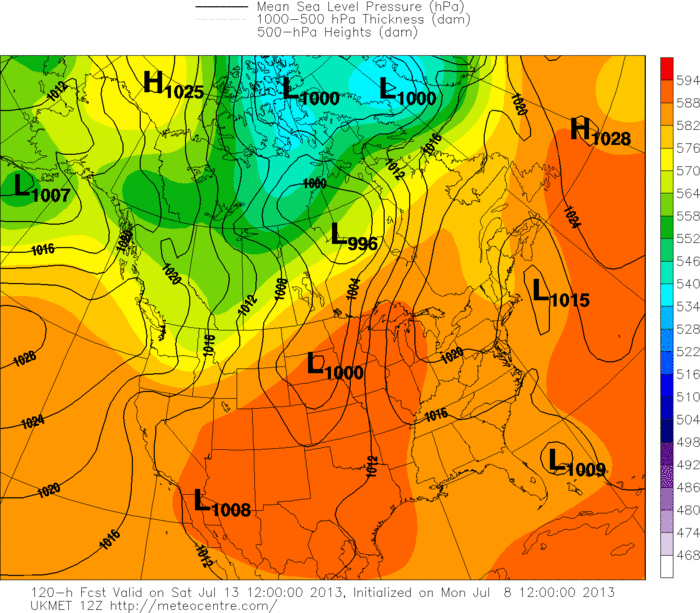
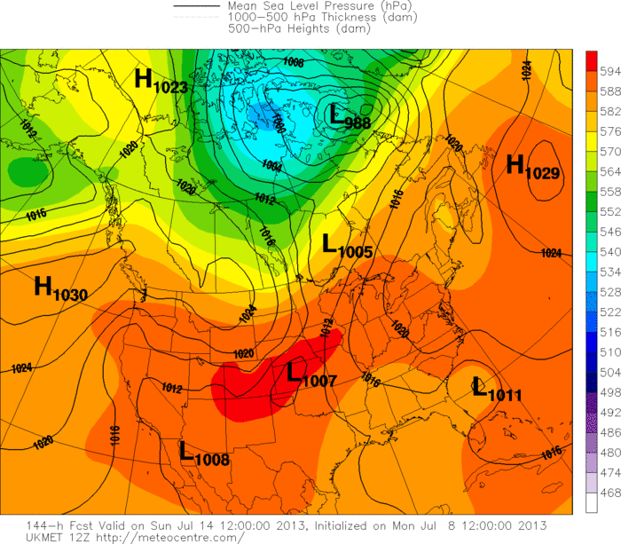
12zUKMET still has Chantal moving North very slowly by days 5 and 6...We will see if in later runs the UKMET is going to forecast a west turn..

Day 5
Image


Day 6
Image
0 likes   
The following post is NOT an official forecast and should not be used as such. It is just the opinion of the poster and may or may not be backed by sound meteorological data. It is NOT endorsed by any professional institution including storm2k.org For Official Information please refer to the NHC and NWS products.

User avatar
Gustywind
Category 5
Category 5
Posts: 12334
Joined: Mon Sep 03, 2007 7:29 am
Location: Baie-Mahault, GUADELOUPE

#818 Postby Gustywind » Mon Jul 08, 2013 12:12 pm

Martinica has issued an orange alert due to Chantal arrival during the next 24H...
http://www.meteo.fr/temps/domtom/antill ... ameter=new Date().getTime()
0 likes   

User avatar
ROCK
Category 5
Category 5
Posts: 9484
Age: 54
Joined: Tue Aug 17, 2004 7:30 am
Location: Kemah, Texas

Re: ATL: CHANTAL - Models

#819 Postby ROCK » Mon Jul 08, 2013 12:17 pm

wxman57 wrote:
Wx_Warrior wrote:My brother, who is a PRO MET: "I haven't looked at the GFS in 2 years."


That's nothing I'd brag about. The GFS does an excellent job at times while the Euro doesn't. Currently, the 00Z Euro didn't even initialize Chantal well. Euro did well with Sandy last year but totally sucked with Debby (which the GFS nailed).


not sure I would say nailed it....the GFS just found a nut.... :lol:
0 likes   

User avatar
AtlanticWind
S2K Supporter
S2K Supporter
Posts: 1890
Age: 66
Joined: Sun Aug 08, 2004 9:57 pm
Location: Plantation,Fla

#820 Postby AtlanticWind » Mon Jul 08, 2013 12:18 pm

0 likes   


Return to “2013”

Who is online

Users browsing this forum: No registered users and 2 guests