


Moderator: S2k Moderators


tolakram wrote:I'm wondering if the same pattern that avoids recurves is also a negative for CV formation, since a strong high pressure system will almost always result in increased trade winds and cooler ocean temps.
Ntxw wrote:Wxman57 made a good post above we should all consider, -NAO does usually re-curve when you're speaking about strong CV originated systems, but those that get their act together near, west of the Islands, or just north of the Antilles usually aren't effected as much with the 're-curve' idea.
tolakram wrote:I'm wondering if the same pattern that avoids recurves is also a negative for CV formation, since a strong high pressure system will almost always result in increased trade winds and cooler ocean temps.
ninel conde wrote:Ntxw wrote:Wxman57 made a good post above we should all consider, -NAO does usually re-curve when you're speaking about strong CV originated systems, but those that get their act together near, west of the Islands, or just north of the Antilles usually aren't effected as much with the 're-curve' idea.
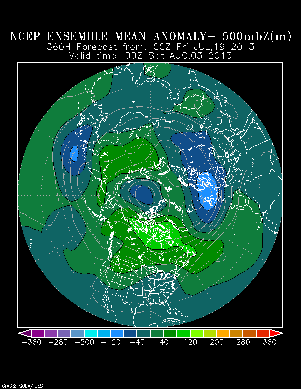
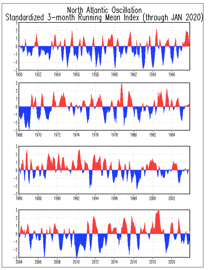
thats assuming anything makes it that far. the last 3 seasons had a neg NAO every month of the hurricane season, in fact that streak was finally broken last month i think, and we can see the results. very few cane hits on the US and no majors. what we saw most often was weak sheared systems past 65west.


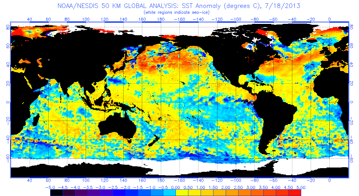
'CaneFreak wrote:I would encourage EVERYONE to read this paper (Wang et. al 2011). Great paper. For those that read it, this year's SST pattern strongly resembles a small AWP or Atlantic Warm Pool as referenced in the paper.
http://www.aoml.noaa.gov/phod/docs/Wang_etal_2011.pdf


Users browsing this forum: Europa non è lontana, NotSparta, Ntxw and 142 guests


