Yellow Evan wrote:This is likely too early to ask this, but what are the odds of an El Nino next year?
You said it "too early". We may have a better idea by November/December.
Moderator: S2k Moderators


Yellow Evan wrote:This is likely too early to ask this, but what are the odds of an El Nino next year?

NDG wrote::uarrow: Nice to finally see the ECMWF come on board with the rest of the dynamical models.
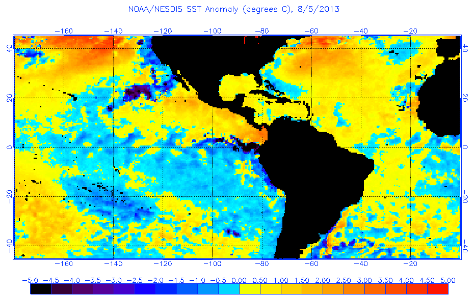
Frank2 wrote:As of last Friday CSU and TWC have lowered their Atlantic totals for this season, while the EPAC is busier than usual - almost sounds like a weak El Nino pattern of some kind, because despite an above-average number of Atlantic systems so far all were relatively weak...
Since I've not kept up with the El Nino updates was wondering if that's still ongoing or did it end last year?
Thanks
Frank2 wrote:Thanks to all for that information (and sorry admin for my starting another El Nino topic - I didn't notice this thread)...
Frank


Frank2 wrote:As of last Friday CSU and TWC have lowered their Atlantic totals for this season, while the EPAC is busier than usual - almost sounds like a weak El Nino pattern of some kind, because despite an above-average number of Atlantic systems so far all were relatively weak...
Since I've not kept up with the El Nino updates was wondering if that's still ongoing or did it end last year?
Thanks

Users browsing this forum: No registered users and 196 guests


