Don't forget the troughing the global models are showing is for the first couple of weeks of August plus they may not be correct especially as you go out beyond 168 hours and especially 240 hours.
Also, there is no reason this trough won't be replaced by strong ridging down the road in mid to late August or even September and beyond.
The long wave pattern is not constant and changes periodically. Last year we learned even sometimes in November the trough cannot save us (Re: Sandy).
I think the global models are going to start latching on to something to form around the Aug 15th-Aug 20th timeframe looking at the climate prediction center forecast for instability across the Atlantic basin, the last couple of runs of the GFS out through 384 hours which basically shows nothing, and the latest long-range CFS run.
Of course this doesn't mean something may not form sooner that the global models did not forecast(RE: Chantal).
Global model runs discussion
Moderator: S2k Moderators
-
gatorcane

- S2K Supporter

- Posts: 23708
- Age: 48
- Joined: Sun Mar 13, 2005 3:54 pm
- Location: Boca Raton, FL
Re: Global Model Runs Discussion
0 likes
-
CYCLONE MIKE
- Category 5

- Posts: 2183
- Joined: Tue Aug 31, 2004 6:04 pm
- Location: Gonzales, LA
Re: Global Model Runs Discussion
We shall see gatorcane, we shall see. But on the other hand even a blind squirrel finds a nut once in a while and they could be correct  Just the pattern has been so constant so far starting to have serious doubts the season is going to be half as bad as the predictions were saying. Not talking overall number of storms, but talking hurricanes land falling hurricanes/storms. Especially in my area in of the gulf coast. But total number of storms might be needed to be reduced as well.
0 likes
-
Hurricane Alexis

- Category 2

- Posts: 683
- Age: 29
- Joined: Thu Jun 14, 2012 7:59 pm
- Location: Miami,Florida

0 likes
Personal Forecast Disclaimer:
The posts in this forum are NOT official forecast and should not be used as such. They are just the opinion of the poster and may or may not be backed by sound meteorological data. They are NOT endorsed by any professional institution or storm2k.org. For official information, please refer to the NHC and NWS products.
The posts in this forum are NOT official forecast and should not be used as such. They are just the opinion of the poster and may or may not be backed by sound meteorological data. They are NOT endorsed by any professional institution or storm2k.org. For official information, please refer to the NHC and NWS products.

Re:
Hurricane Alexis wrote:00z GFS has a healthy wave rolling off Africa at about 108 hours.
http://img543.imageshack.us/img543/6941/zpz.gif
Uploaded with ImageShack.us
SAL should affect it, shouldn't it?
0 likes
-
Hurricane Alexis
- Category 2
- Posts: 683
- Age: 29
- Joined: Thu Jun 14, 2012 7:59 pm
- Location: Miami,Florida
Re: Re:
LaBreeze wrote:Hurricane Alexis wrote:00z GFS has a healthy wave rolling off Africa at about 108 hours.
http://img543.imageshack.us/img543/6941/zpz.gif
Uploaded with ImageShack.us
SAL should affect it, shouldn't it?
Could be, the rest of the run kills it off. But, it's 5+ days out so it could all change.
0 likes
Personal Forecast Disclaimer:
The posts in this forum are NOT official forecast and should not be used as such. They are just the opinion of the poster and may or may not be backed by sound meteorological data. They are NOT endorsed by any professional institution or storm2k.org. For official information, please refer to the NHC and NWS products.
The posts in this forum are NOT official forecast and should not be used as such. They are just the opinion of the poster and may or may not be backed by sound meteorological data. They are NOT endorsed by any professional institution or storm2k.org. For official information, please refer to the NHC and NWS products.
-
Hurricane Alexis
- Category 2
- Posts: 683
- Age: 29
- Joined: Thu Jun 14, 2012 7:59 pm
- Location: Miami,Florida

0 likes
Personal Forecast Disclaimer:
The posts in this forum are NOT official forecast and should not be used as such. They are just the opinion of the poster and may or may not be backed by sound meteorological data. They are NOT endorsed by any professional institution or storm2k.org. For official information, please refer to the NHC and NWS products.
The posts in this forum are NOT official forecast and should not be used as such. They are just the opinion of the poster and may or may not be backed by sound meteorological data. They are NOT endorsed by any professional institution or storm2k.org. For official information, please refer to the NHC and NWS products.
-
Dean4Storms
- S2K Supporter
- Posts: 6358
- Age: 63
- Joined: Sun Aug 31, 2003 1:01 pm
- Location: Miramar Bch. FL

Re: Global Model Runs Discussion
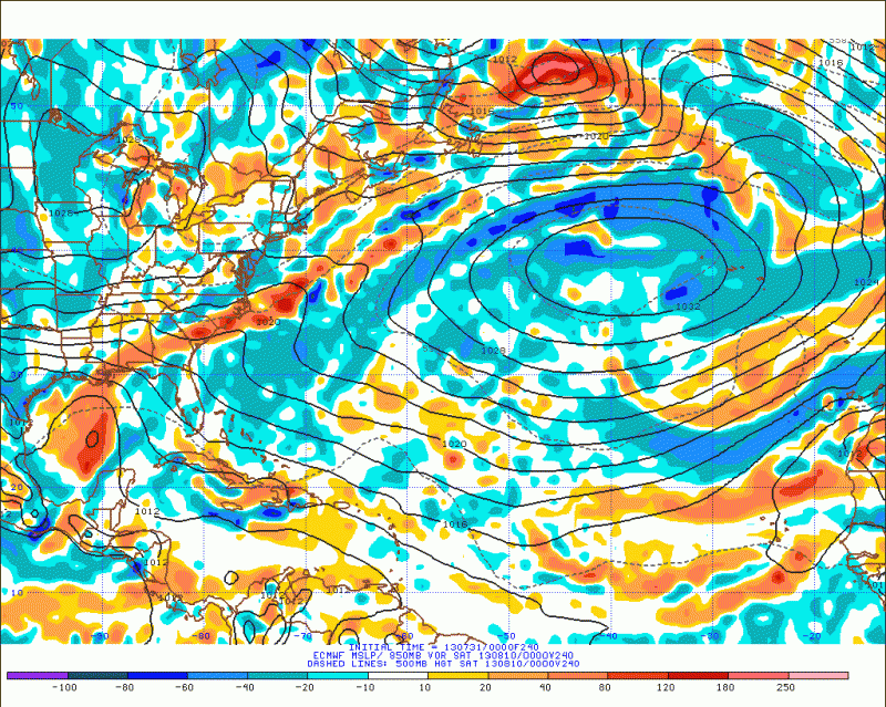
ECMWF's long range forecast shows possible tropical development in the eastern GOM from a frontal boundary/trough in the SE US next week, earlier 12z run also showed falling pressures. (BTW, notice the 600+ dm Atlantic ridge it shows building again)
0 likes
-
hurricaneCW
- Category 5
- Posts: 1799
- Joined: Wed Mar 03, 2010 6:20 am
- Location: Toms River, NJ
Re:
ninel conde wrote:cmc looks like a repeat of the last several years. big east coast trof.
Models are showing ridging rebuilding around the time tropical activity starts to pick up. The subtropical ridging and Western Atlantic Ridge has been much more prominent than in the past few years.
The east coast trough is looking to retrograde by mid August opening the door for east coast landfalls if anything should come that way.
0 likes
-
'CaneFreak

- Category 5
- Posts: 1487
- Joined: Mon Jun 05, 2006 10:50 am
- Location: New Bern, NC
Re:
This is getting annoying with the east coast trough posts. Please stop. Thanks. 
ninel conde wrote:cmc looks like a repeat of the last several years. big east coast trof.
0 likes
-
tolakram
- Admin

- Posts: 20185
- Age: 62
- Joined: Sun Aug 27, 2006 8:23 pm
- Location: Florence, KY (name is Mark)
Re: Global Model Runs Discussion
GFS 6Z shows a 1004MB low in the east Atlantic. Simulated IR shows precipitation making its way across the Atlantic into the Caribbean by the end of the run. Long range, but something to keep an eye on for future runs.
0 likes
M a r k
- - - - -
Join us in chat: Storm2K Chatroom Invite. Android and IOS apps also available.
The posts in this forum are NOT official forecasts and should not be used as such. Posts are NOT endorsed by any professional institution or STORM2K.org. For official information and forecasts, please refer to NHC and NWS products.
-
StormTracker

- S2K Supporter
- Posts: 2909
- Age: 59
- Joined: Thu Jun 29, 2006 6:06 am
- Location: Quail Heights(Redlands), FL.
Re: Global Model Runs Discussion
There is climo & history, there are models & predictions, there are also mets(some that are pretty damn good), forecasters & just plain old weather-interested members such as myself that are here to try to learn and figure out what will happen in the future with the weather! May I remind everyone that there are higher powers involved in the evolution of our weather! Sometimes I think we get a little too overly wound up in "this is right/this is wrong" or I'm right/your'e wrong". Technology has brought us a long way in our trek to "getting the track right & exact" but i think we can all agree that we are imperfect human beings striving to get ever so close to perfection! That's why we are all here on S2K right? Now, back to the global model runs discussions. Only time will tell what's gonna be stronger and win out between the troughs vs. the strong Atlantic ridging that I personally don't remember seeing lasting this long & strong for a few seasons now!
0 likes
Something's wrong when you regret, things that haven't happened yet!
-
andrewsurvivor
- Tropical Low

- Posts: 43
- Age: 69
- Joined: Mon Aug 02, 2010 11:45 am
- Location: So.Florida
Re: Global Model Runs Discussion
You are so right ST. Have been in Miami since 1980 and remember writing off another year in '92 and we know what happened then. It's still early and the peak of the season may bring surprises we can't see yet. While we all enjoy storm tracking, a year with no major storm making landfall is always welcome 
0 likes
Cat 5
-
cycloneye

- Admin
- Posts: 149472
- Age: 69
- Joined: Thu Oct 10, 2002 10:54 am
- Location: San Juan, Puerto Rico
Re: Global Model Runs Discussion
Finnally,activity in the models of different scenarios but at least is a change from not having anything. Let's see what the 12z package has.
0 likes
Visit the Caribbean-Central America Weather Thread where you can find at first post web cams,radars
and observations from Caribbean basin members Click Here
and observations from Caribbean basin members Click Here
-
Hurricaneman

- Category 5
- Posts: 7404
- Age: 45
- Joined: Tue Aug 31, 2004 3:24 pm
- Location: central florida
Re: Global Model Runs Discussion
cycloneye wrote:Finnally,activity in the models of different scenarios but at least is a change from not having anything. Let's see what the 12z package has.
yep, the 6zGFS says that a wave over central Africa will become a low at day 5 and drifts north until hr 180 which seems weird and basically shoots it west all the way into the Caribbean where the low dissipates
The posts in this forum are NOT official forecast and should not be used as such. They are just the opinion of the poster and may or may not be backed by sound meteorological data. They are NOT endorsed by any professional institution or storm2k.org. For official information, please refer to the NHC and NWS products
0 likes
-
Hurricaneman
- Category 5
- Posts: 7404
- Age: 45
- Joined: Tue Aug 31, 2004 3:24 pm
- Location: central florida
Re: Global Model Runs Discussion
I noticed that the models seem to develop near Africa after the current bout of SAL ends and it seems that may be the beginning of the meat of the hurricane season
The posts in this forum are NOT official forecast and should not be used as such. They are just the opinion of the poster and may or may not be backed by sound meteorological data. They are NOT endorsed by any professional institution or storm2k.org. For official information, please refer to the NHC and NWS products
The posts in this forum are NOT official forecast and should not be used as such. They are just the opinion of the poster and may or may not be backed by sound meteorological data. They are NOT endorsed by any professional institution or storm2k.org. For official information, please refer to the NHC and NWS products
0 likes

Re: Global Model Runs Discussion
The 12z Canadian has gone back to its old ways. Two Hurricanes in the long range.

0 likes
The following post is NOT an official forecast and should not be used as such. It is just the opinion of the poster and may or may not be backed by sound meteorological data. It is NOT endorsed by any professional institution including storm2k.org For Official Information please refer to the NHC and NWS products.
-
tolakram
- Admin
- Posts: 20185
- Age: 62
- Joined: Sun Aug 27, 2006 8:23 pm
- Location: Florence, KY (name is Mark)
Re: Global Model Runs Discussion
12Z GFS, still something past 192 but nothing up till then.
Canadian showing something means, to me anyway, that conditions will be more favorable. The Euro is doing horrible in the deep tropics this year, showing nothing in the EPAC either, so GFS will be the one to watch.
Canadian showing something means, to me anyway, that conditions will be more favorable. The Euro is doing horrible in the deep tropics this year, showing nothing in the EPAC either, so GFS will be the one to watch.
0 likes
M a r k
- - - - -
Join us in chat: Storm2K Chatroom Invite. Android and IOS apps also available.
The posts in this forum are NOT official forecasts and should not be used as such. Posts are NOT endorsed by any professional institution or STORM2K.org. For official information and forecasts, please refer to NHC and NWS products.
- - - - -
Join us in chat: Storm2K Chatroom Invite. Android and IOS apps also available.
The posts in this forum are NOT official forecasts and should not be used as such. Posts are NOT endorsed by any professional institution or STORM2K.org. For official information and forecasts, please refer to NHC and NWS products.
-
supercane4867
- Category 5
- Posts: 4966
- Joined: Wed Nov 14, 2012 10:43 am
Re: Global Model Runs Discussion
blp wrote:The 12z Canadian has gone back to its old ways. Two Hurricanes in the long range.
This is likely an error, these two storms were actually in the WPAC according to 10m wind map

0 likes
Who is online
Users browsing this forum: No registered users and 46 guests