
Checking Cuba stations: seeing light west and south winds. Pressures 1016 to 1017mb.
http://www.hurricanecity.com/wx/index.p ... &icao=MUCA
ATL: DORIAN - Post-Tropical - Discussion
Moderator: S2k Moderators
Re: ATL: Ex INVEST 91L - Dorian Remnants - Discussion
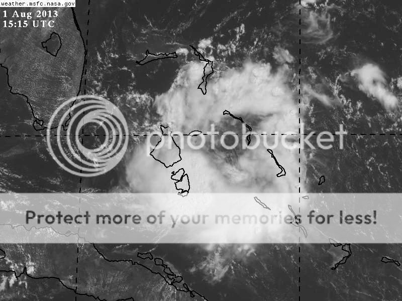
That dry slot over Cuba is filling in fast.
I think it's dead Jim - as far as the ULL is concerned.
http://www.ssd.noaa.gov/goes/east/watl/flash-wv.html
I think it's dead Jim - as far as the ULL is concerned.
http://www.ssd.noaa.gov/goes/east/watl/flash-wv.html
0 likes
-
HurricaneBelle

- S2K Supporter

- Posts: 1209
- Joined: Sun Aug 27, 2006 6:12 pm
- Location: Clearwater, FL
-
wxman57

- Moderator-Pro Met

- Posts: 23174
- Age: 68
- Joined: Sat Jun 21, 2003 8:06 pm
- Location: Houston, TX (southwest)
Re: ATL: Ex INVEST 91L - Dorian Remnants - Discussion
Pressures in the region are high and rising. The storms are being produced by an upper-level low. There is no surface feature.
0 likes
-
Dean4Storms
- S2K Supporter
- Posts: 6358
- Age: 63
- Joined: Sun Aug 31, 2003 1:01 pm
- Location: Miramar Bch. FL
Re: ATL: Ex INVEST 91L - Dorian Remnants - Discussion
wxman57 wrote:Pressures in the region are high and rising. The storms are being produced by an upper-level low. There is no surface feature.
Agree for now, you can see LL clouds getting drawn northward into the circulation however between it and Cuba. Not out of the question that this is trying to works its way to the surface.
0 likes
-
Dean4Storms
- S2K Supporter
- Posts: 6358
- Age: 63
- Joined: Sun Aug 31, 2003 1:01 pm
- Location: Miramar Bch. FL
GFS 12z does close this off at 850mb off the SE FL Coast.
http://www.tropicaltidbits.com/analysis ... _watl.html
http://www.tropicaltidbits.com/analysis ... _watl.html
0 likes

Re:
Dean4Storms wrote:GFS 12z does close this off at 850mb off the SE FL Coast.
http://www.tropicaltidbits.com/analysis ... _watl.html
so possibly lot's more rain here when we are just beginning to try to dry out?
0 likes
-
Weatherboy1

- Category 5

- Posts: 1190
- Age: 50
- Joined: Mon Jul 05, 2004 1:50 pm
- Location: Jupiter/Sarasota, FL
Re: ATL: Ex INVEST 91L - Dorian Remnants - Discussion
With the stronger vorticity in the 700mb to 500mb range and staying south of GBI, this could catch a ride thru the FL Straits.
0 likes
Re: ATL: Ex INVEST 91L - Dorian Remnants - Discussion
Winds swinging around to out of the NE at Settlement Point
http://www.ndbc.noaa.gov/plot_met.php?s ... _label=EDT
http://www.ndbc.noaa.gov/plot_met.php?s ... _label=EDT
0 likes
-
tolakram
- Admin

- Posts: 20185
- Age: 62
- Joined: Sun Aug 27, 2006 8:23 pm
- Location: Florence, KY (name is Mark)
Re: ATL: Ex INVEST 91L - Dorian Remnants - Discussion
You can now see low level clouds streaming toward the NE into the convection.
http://wwwghcc.msfc.nasa.gov/cgi-bin/ge ... umframes=5
This has fooled me many times, but boy it appears something is happening down there.
http://wwwghcc.msfc.nasa.gov/cgi-bin/ge ... umframes=5
This has fooled me many times, but boy it appears something is happening down there.
0 likes
M a r k
- - - - -
Join us in chat: Storm2K Chatroom Invite. Android and IOS apps also available.
The posts in this forum are NOT official forecasts and should not be used as such. Posts are NOT endorsed by any professional institution or STORM2K.org. For official information and forecasts, please refer to NHC and NWS products.
-
gatorcane

- S2K Supporter
- Posts: 23708
- Age: 48
- Joined: Sun Mar 13, 2005 3:54 pm
- Location: Boca Raton, FL
Re: ATL: Ex INVEST 91L - Dorian Remnants - Discussion
tolakram wrote:You can now see low level clouds streaming toward the NE into the convection.
http://wwwghcc.msfc.nasa.gov/cgi-bin/ge ... umframes=5
This has fooled me many times, but boy it appears something is happening down there.
Yeah I do see that. Looking rather interesting I must say. Given some model support, wouldn't be surprised if this is tagged an invest..NHC should mention it at 2pm outlook.
0 likes
-
tolakram
- Admin
- Posts: 20185
- Age: 62
- Joined: Sun Aug 27, 2006 8:23 pm
- Location: Florence, KY (name is Mark)
Re: ATL: Ex INVEST 91L - Dorian Remnants - Discussion
Live WV loop: http://wwwghcc.msfc.nasa.gov/cgi-bin/ge ... mframes=20
0 likes
M a r k
- - - - -
Join us in chat: Storm2K Chatroom Invite. Android and IOS apps also available.
The posts in this forum are NOT official forecasts and should not be used as such. Posts are NOT endorsed by any professional institution or STORM2K.org. For official information and forecasts, please refer to NHC and NWS products.
- - - - -
Join us in chat: Storm2K Chatroom Invite. Android and IOS apps also available.
The posts in this forum are NOT official forecasts and should not be used as such. Posts are NOT endorsed by any professional institution or STORM2K.org. For official information and forecasts, please refer to NHC and NWS products.

Re: ATL: Ex INVEST 91L - Dorian Remnants - Discussion
It's starting wrap up on satellite. Not sure if it's all the way to the surface yet.
0 likes
-
tolakram
- Admin
- Posts: 20185
- Age: 62
- Joined: Sun Aug 27, 2006 8:23 pm
- Location: Florence, KY (name is Mark)
Re: ATL: Ex INVEST 91L - Dorian Remnants - Discussion
Reaching a bit here, but CMC and GFS show what might be a small low pressure area at the surface.


0 likes
M a r k
- - - - -
Join us in chat: Storm2K Chatroom Invite. Android and IOS apps also available.
The posts in this forum are NOT official forecasts and should not be used as such. Posts are NOT endorsed by any professional institution or STORM2K.org. For official information and forecasts, please refer to NHC and NWS products.
- - - - -
Join us in chat: Storm2K Chatroom Invite. Android and IOS apps also available.
The posts in this forum are NOT official forecasts and should not be used as such. Posts are NOT endorsed by any professional institution or STORM2K.org. For official information and forecasts, please refer to NHC and NWS products.
Re: ATL: Ex INVEST 91L - Dorian Remnants - Discussion
3500 CAPE air over central Cuba.
http://www.twisterdata.com/data/models/ ... URFACE.png
Should see massive thunderstorms fire off in a few hours and feed into this.
That should fuel it up for overnight.
Should see an interesting DMAX in the morning.
http://www.twisterdata.com/data/models/ ... URFACE.png
Should see massive thunderstorms fire off in a few hours and feed into this.
That should fuel it up for overnight.
Should see an interesting DMAX in the morning.
0 likes
-
CalmBeforeStorm

- Category 2

- Posts: 600
- Age: 72
- Joined: Tue Aug 10, 2004 7:55 pm
- Location: Stuart, Florida
http://moe.met.fsu.edu/cgi-bin/cmctc2.c ... =Animation
~~~~~~~~~
12z CMC develops this feature into what looks like a hurricane off the mid-altantic states heading north. Of corse it is the CMC.
~~~~~~~~~
12z CMC develops this feature into what looks like a hurricane off the mid-altantic states heading north. Of corse it is the CMC.
0 likes
-
tolakram
- Admin
- Posts: 20185
- Age: 62
- Joined: Sun Aug 27, 2006 8:23 pm
- Location: Florence, KY (name is Mark)
Re: ATL: Ex INVEST 91L - Dorian Remnants - Discussion
This loop isn't usable yet due to the position change but repositioned over this area: http://rammb.cira.colostate.edu/ramsdis ... height=480
from this page: http://rammb.cira.colostate.edu/ramsdis ... opical.asp
from this page: http://rammb.cira.colostate.edu/ramsdis ... opical.asp
0 likes
M a r k
- - - - -
Join us in chat: Storm2K Chatroom Invite. Android and IOS apps also available.
The posts in this forum are NOT official forecasts and should not be used as such. Posts are NOT endorsed by any professional institution or STORM2K.org. For official information and forecasts, please refer to NHC and NWS products.
- - - - -
Join us in chat: Storm2K Chatroom Invite. Android and IOS apps also available.
The posts in this forum are NOT official forecasts and should not be used as such. Posts are NOT endorsed by any professional institution or STORM2K.org. For official information and forecasts, please refer to NHC and NWS products.
Who is online
Users browsing this forum: No registered users and 32 guests