WPAC: UTOR - Post-Tropical

Moderator: S2k Moderators

Message
Author
User avatar
mrbagyo
Category 5
Category 5
Posts: 3711
Age: 32
Joined: Thu Apr 12, 2012 9:18 am
Location: 14.13N 120.98E
Contact:

Re: WPAC: UTOR - Typhoon (Labuyo PAGASA)

#221 Postby mrbagyo » Sun Aug 11, 2013 12:42 am

the northern eye wall is intense but the max is at 97-100 knots...
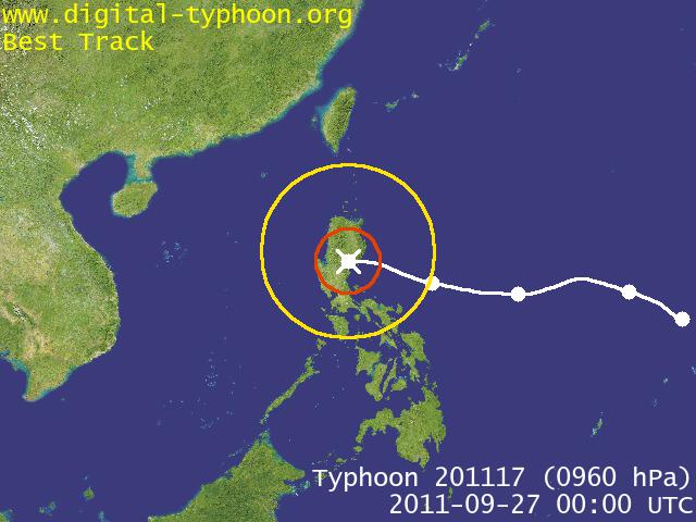
not yet a cat 4 but it's going there
Image

Uploaded with ImageShack.us
0 likes   
The posts in this forum are NOT official forecast and should not be used as such. They are just the opinion of the poster and may or may not be backed by sound meteorological data. They are NOT endorsed by any professional institution or storm2k.org. For official information, please refer to RSMC, NHC and NWS products.

dexterlabio
Category 5
Category 5
Posts: 3466
Joined: Sat Oct 24, 2009 11:50 pm

Re: WPAC: UTOR - Typhoon (Labuyo PAGASA)

#222 Postby dexterlabio » Sun Aug 11, 2013 12:44 am

mrbagyo wrote:
we might feel some effects of UTOR but I don't think it will be as bad as Nesat. The south west monsoon aka "HABAGAT" is relatively weak right now...


I still don't buy the idea that the monsoon did all those high waves in Manila Bay during Nesat. I just assumed that Nesat's windfield was so large that high-end TS force winds reached Manila... Besides, the moisture from the monsoon is what affects us but not the wind itself.
0 likes   
Personal Forecast Disclaimer:
The posts in this forum are NOT official forecast and should not be used as such. They are just the opinion of the poster and may or may not be backed by sound meteorological data. They are NOT endorsed by any professional institution or storm2k.org. For official information, please refer to the NHC and NWS products.

dexterlabio
Category 5
Category 5
Posts: 3466
Joined: Sat Oct 24, 2009 11:50 pm

Re: WPAC: UTOR - Typhoon (Labuyo PAGASA)

#223 Postby dexterlabio » Sun Aug 11, 2013 12:47 am

so far, Utor matched the intensity of its 2006 counterpart... :lol:
0 likes   
Personal Forecast Disclaimer:
The posts in this forum are NOT official forecast and should not be used as such. They are just the opinion of the poster and may or may not be backed by sound meteorological data. They are NOT endorsed by any professional institution or storm2k.org. For official information, please refer to the NHC and NWS products.

User avatar
mrbagyo
Category 5
Category 5
Posts: 3711
Age: 32
Joined: Thu Apr 12, 2012 9:18 am
Location: 14.13N 120.98E
Contact:

Re: WPAC: UTOR - Typhoon (Labuyo PAGASA)

#224 Postby mrbagyo » Sun Aug 11, 2013 1:04 am

dexterlabio wrote:
mrbagyo wrote:
we might feel some effects of UTOR but I don't think it will be as bad as Nesat. The south west monsoon aka "HABAGAT" is relatively weak right now...


I still don't buy the idea that the monsoon did all those high waves in Manila Bay during Nesat. I just assumed that Nesat's windfield was so large that high-end TS force winds reached Manila... Besides, the moisture from the monsoon is what affects us but not the wind itself.


looks like you're correct.. but monsoon indeed add some fuel to NESAT

Typhoon force wind did Metro Manila. here is the extent of winds of typhoon NESAT
0 likes   
The posts in this forum are NOT official forecast and should not be used as such. They are just the opinion of the poster and may or may not be backed by sound meteorological data. They are NOT endorsed by any professional institution or storm2k.org. For official information, please refer to RSMC, NHC and NWS products.

RL3AO
Moderator-Pro Met
Moderator-Pro Met
Posts: 16308
Joined: Thu Jun 14, 2007 10:03 pm
Location: NC

#225 Postby RL3AO » Sun Aug 11, 2013 1:19 am

Wowzer. That eye has warmed dramatically the past hour or two. Might make a run at 140kts in the next 12 to 18 hours.
0 likes   

vrif
Category 1
Category 1
Posts: 282
Joined: Sun Jun 09, 2013 10:51 pm

Re: WPAC: UTOR - Typhoon (Labuyo PAGASA)

#226 Postby vrif » Sun Aug 11, 2013 1:25 am

OSCAT 0811 0308Z pass
Image
0 likes   

User avatar
mrbagyo
Category 5
Category 5
Posts: 3711
Age: 32
Joined: Thu Apr 12, 2012 9:18 am
Location: 14.13N 120.98E
Contact:

Re: WPAC: UTOR - Typhoon (Labuyo PAGASA)

#227 Postby mrbagyo » Sun Aug 11, 2013 1:38 am

who can give a link to the BALER RADAR??

Image
source: PAGASA facebook page.
0 likes   
The posts in this forum are NOT official forecast and should not be used as such. They are just the opinion of the poster and may or may not be backed by sound meteorological data. They are NOT endorsed by any professional institution or storm2k.org. For official information, please refer to RSMC, NHC and NWS products.

dexterlabio
Category 5
Category 5
Posts: 3466
Joined: Sat Oct 24, 2009 11:50 pm

#228 Postby dexterlabio » Sun Aug 11, 2013 1:40 am

DT numbers now up to 6.0, equivalent to a Category 4 typhoon. Maybe the only good news is that the storm is compact and the area of extreme typhoon winds is limited.
0 likes   
Personal Forecast Disclaimer:
The posts in this forum are NOT official forecast and should not be used as such. They are just the opinion of the poster and may or may not be backed by sound meteorological data. They are NOT endorsed by any professional institution or storm2k.org. For official information, please refer to the NHC and NWS products.

vrif
Category 1
Category 1
Posts: 282
Joined: Sun Jun 09, 2013 10:51 pm

Re: WPAC: UTOR - Typhoon (Labuyo PAGASA)

#229 Postby vrif » Sun Aug 11, 2013 1:41 am

That is one very clear eye.
Image
Image
Image
0 likes   

dexterlabio
Category 5
Category 5
Posts: 3466
Joined: Sat Oct 24, 2009 11:50 pm

Re: WPAC: UTOR - Typhoon (Labuyo PAGASA)

#230 Postby dexterlabio » Sun Aug 11, 2013 1:48 am

Image
0 likes   
Personal Forecast Disclaimer:
The posts in this forum are NOT official forecast and should not be used as such. They are just the opinion of the poster and may or may not be backed by sound meteorological data. They are NOT endorsed by any professional institution or storm2k.org. For official information, please refer to the NHC and NWS products.

RL3AO
Moderator-Pro Met
Moderator-Pro Met
Posts: 16308
Joined: Thu Jun 14, 2007 10:03 pm
Location: NC

#231 Postby RL3AO » Sun Aug 11, 2013 1:49 am

Getting raw T# of 7.1 from ADT. Looking at how quickly the eye was warmed, I can't say I'm surprised.
0 likes   

vrif
Category 1
Category 1
Posts: 282
Joined: Sun Jun 09, 2013 10:51 pm

Re: WPAC: UTOR - Typhoon (Labuyo PAGASA)

#232 Postby vrif » Sun Aug 11, 2013 1:53 am

JMA upgraded Utor to a Very Strong Typhoon from a Strong Typhoon

Image
WTPQ20 RJTD 110600
RSMC TROPICAL CYCLONE ADVISORY
NAME TY 1311 UTOR (1311)
ANALYSIS
PSTN 110600UTC 15.1N 124.8E GOOD
MOVE WNW 12KT
PRES 940HPA
MXWD 090KT
GUST 130KT
50KT 70NM
30KT 150NM
FORECAST
24HF 120600UTC 17.5N 120.8E 75NM 70%
MOVE WNW 11KT
PRES 950HPA
MXWD 080KT
GUST 115KT
48HF 130600UTC 19.7N 116.0E 140NM 70%
MOVE WNW 12KT
PRES 945HPA
MXWD 085KT
GUST 120KT
72HF 140600UTC 21.0N 112.7E 160NM 70%
MOVE WNW 09KT
PRES 945HPA
MXWD 085KT
GUST 120KT =
0 likes   

dexterlabio
Category 5
Category 5
Posts: 3466
Joined: Sat Oct 24, 2009 11:50 pm

#233 Postby dexterlabio » Sun Aug 11, 2013 1:56 am

so do you think Utor is pulling off a Cimaron or Chebi 2006?
0 likes   
Personal Forecast Disclaimer:
The posts in this forum are NOT official forecast and should not be used as such. They are just the opinion of the poster and may or may not be backed by sound meteorological data. They are NOT endorsed by any professional institution or storm2k.org. For official information, please refer to the NHC and NWS products.

User avatar
mrbagyo
Category 5
Category 5
Posts: 3711
Age: 32
Joined: Thu Apr 12, 2012 9:18 am
Location: 14.13N 120.98E
Contact:

Re: WPAC: UTOR - Typhoon (Labuyo PAGASA)

#234 Postby mrbagyo » Sun Aug 11, 2013 1:59 am

dexterlabio wrote:so do you think Utor is pulling off a Cimaron or Chebi 2006?


Its pulling a Cimaron... the intensification, the looks, and the tracks are quite similar.
0 likes   
The posts in this forum are NOT official forecast and should not be used as such. They are just the opinion of the poster and may or may not be backed by sound meteorological data. They are NOT endorsed by any professional institution or storm2k.org. For official information, please refer to RSMC, NHC and NWS products.

Alyono
Professional-Met
Professional-Met
Posts: 6961
Joined: Fri Apr 26, 2013 3:52 pm
Location: Texas Coast

Re:

#235 Postby Alyono » Sun Aug 11, 2013 2:01 am

RL3AO wrote:Getting raw T# of 7.1 from ADT. Looking at how quickly the eye was warmed, I can't say I'm surprised.


Just had a look and am now getting a T number of 6.5

Looks like my forecast of 120 KT will bust low
0 likes   

dexterlabio
Category 5
Category 5
Posts: 3466
Joined: Sat Oct 24, 2009 11:50 pm

#236 Postby dexterlabio » Sun Aug 11, 2013 2:11 am

On a side note, it's funny how the Euro initialized Utor as a TS on their 00z run. I mean come on. I used to like ECMWF back in 2008-2011.
0 likes   
Personal Forecast Disclaimer:
The posts in this forum are NOT official forecast and should not be used as such. They are just the opinion of the poster and may or may not be backed by sound meteorological data. They are NOT endorsed by any professional institution or storm2k.org. For official information, please refer to the NHC and NWS products.

stormstrike
Tropical Storm
Tropical Storm
Posts: 159
Joined: Thu Nov 29, 2012 12:37 am

Re: WPAC: UTOR - Typhoon (Labuyo PAGASA)

#237 Postby stormstrike » Sun Aug 11, 2013 2:22 am

i'm quite sure next JTWC bulletin we'll have a Category 4 typhoon..
0 likes   

Typhoon Hunter
WesternPacificWeather.com
Posts: 1221
Joined: Wed Oct 11, 2006 11:37 am
Location: Tokyo
Contact:

Re: WPAC: UTOR - Typhoon (Labuyo PAGASA)

#238 Postby Typhoon Hunter » Sun Aug 11, 2013 2:45 am

Still appears to be gaining latitude. Already level with 12z JTWC forecast point so is currently north of their forecast track. Meteorologically a beautiful looking system.

Image

Uploaded with ImageShack.us
0 likes   
James - Documenting tropical cyclones...

http://www.youtube.com/TyphoonHunter

dexterlabio
Category 5
Category 5
Posts: 3466
Joined: Sat Oct 24, 2009 11:50 pm

Re: WPAC: UTOR - Typhoon (Labuyo PAGASA)

#239 Postby dexterlabio » Sun Aug 11, 2013 2:55 am

Yeah landfall might occur in the border of Isabela and Aurora, unless the eye wobbles a bit more. A supertyphoon isn't impossible, is it?
0 likes   
Personal Forecast Disclaimer:
The posts in this forum are NOT official forecast and should not be used as such. They are just the opinion of the poster and may or may not be backed by sound meteorological data. They are NOT endorsed by any professional institution or storm2k.org. For official information, please refer to the NHC and NWS products.

User avatar
mrbagyo
Category 5
Category 5
Posts: 3711
Age: 32
Joined: Thu Apr 12, 2012 9:18 am
Location: 14.13N 120.98E
Contact:

Re: WPAC: UTOR - Typhoon (Labuyo PAGASA)

#240 Postby mrbagyo » Sun Aug 11, 2013 3:25 am

looks more solid in this image
Image

Uploaded with ImageShack.us
0 likes   
The posts in this forum are NOT official forecast and should not be used as such. They are just the opinion of the poster and may or may not be backed by sound meteorological data. They are NOT endorsed by any professional institution or storm2k.org. For official information, please refer to RSMC, NHC and NWS products.


Return to “2013”

Who is online

Users browsing this forum: No registered users and 562 guests