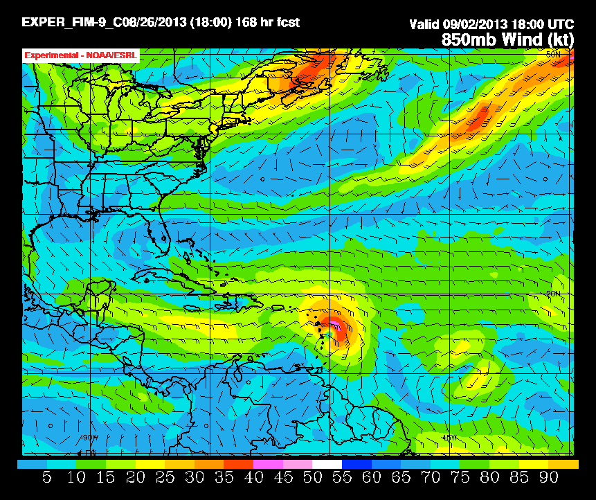
gatorcane wrote:The FIM model is not nearly as bullish as yesterday either.
So looking at the last 24 hours, the "big three" (GFS/ECMWF/FIM) have all become less bullish with this wave. Only the CMC has gone the other way but we know that it is the CMC afterall
240 hours from now shows a strong tropical wave now passing through Puerto Rico and the Eastern Caribbean but no cyclone becomes of this any longer:

doesnt look like it develops the other storm the gfs shows either.