ATL: GABRIELLE - Remnants - Discussion

Moderator: S2k Moderators

Message
Author
USTropics
Professional-Met
Professional-Met
Posts: 2650
Joined: Sun Aug 12, 2007 3:45 am
Location: Florida State University

Re: ATL: INVEST 97L - Discussion

#121 Postby USTropics » Sat Aug 31, 2013 11:23 pm

Until the ULL ceases to induce WSW shear over 97L, the upper level vorticity will continue to be stretched out. You can clearly see that's what is occurring currently:

Image

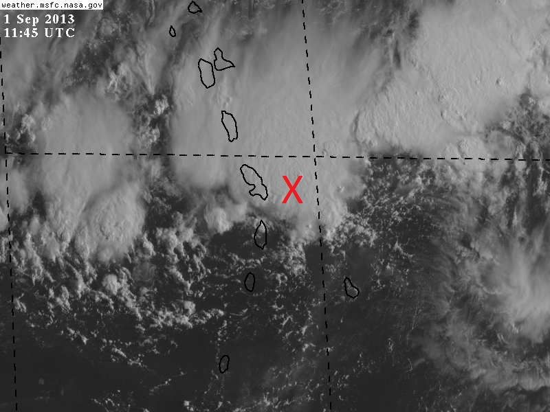
However, there remains strong low level vorticity and the mid level has improved somewhat over the past 6-9 hours. Still has a ways to go, and the western Caribbean will provide a better environment with a lot of heat potential and piled up air to work with.

This post is NOT AN OFFICIAL FORECAST and should not be used as such. It is just the opinion of the poster and may or may not be backed by sound meteorological data. It is NOT endorsed by any professional institution including storm2k.org. For Official Information please refer to the NHC and NWS products.
0 likes   

hurrtracker79
Tropical Depression
Tropical Depression
Posts: 94
Joined: Sun Jul 28, 2013 1:32 pm

Re: ATL: INVEST 97L - Discussion

#122 Postby hurrtracker79 » Sat Aug 31, 2013 11:38 pm

Appears to me that the upper low is moving west at a good clip now AWAY from 97L. Is anyone else seeing this?
0 likes   

User avatar
NDG
S2K Supporter
S2K Supporter
Posts: 15446
Joined: Sun Jul 09, 2006 10:14 pm
Location: Orlando, FL

Re: ATL: INVEST 97L - Discussion

#123 Postby NDG » Sat Aug 31, 2013 11:49 pm

:uarrow: Yes, earlier Saturday morning it was north of P.R. now is over Hispaniola and still moving westward.
Meantime 97L appears to be moving WSW thanks to a narrow mid level ridge centered to its northwest, stretched NW to SW, which could keep it away from the strongest UL shear from the ULL.
0 likes   

hurrtracker79
Tropical Depression
Tropical Depression
Posts: 94
Joined: Sun Jul 28, 2013 1:32 pm

Re: ATL: INVEST 97L - Discussion

#124 Postby hurrtracker79 » Sat Aug 31, 2013 11:53 pm

NDG wrote::uarrow: Yes, earlier Saturday morning it was north of P.R. now is over Hispaniola and still moving westward.
Meantime 97L appears to be moving WSW thanks to a narrow mid level ridge centered to its northwest, stretched NW to SW, which could keep it away from the strongest UL shear from the ULL.


So, conditions may not be as hostile in the Caribbean as the GFS model has been forecasting if this upper low is moving west? Seems to me conditions are slightly improving
0 likes   

User avatar
ROCK
Category 5
Category 5
Posts: 9484
Age: 54
Joined: Tue Aug 17, 2004 7:30 am
Location: Kemah, Texas

Re: ATL: INVEST 97L - Discussion

#125 Postby ROCK » Sat Aug 31, 2013 11:58 pm

:uarrow: the GFS never had this looking like this at any point of the last few runs.....IMO, the closer it gets to the EPAC the better off it will be....EC track....not this one. Not deep enough.
0 likes   

ninel conde

#126 Postby ninel conde » Sun Sep 01, 2013 6:20 am

looks rather linear. seems unlikely to develop.
0 likes   

User avatar
northjaxpro
S2K Supporter
S2K Supporter
Posts: 8900
Joined: Mon Sep 27, 2010 11:21 am
Location: Jacksonville, FL

#127 Postby northjaxpro » Sun Sep 01, 2013 6:39 am

Will watch closely what happens today with 97L. I don't foresee any significant devlopment at all until that ULL near Hispanolia either moves farther away or weakens and when 97L gets father west into the Caribbean past 65 degrees longitude.

We have turned the page and now into September. Is Mother Nature finally breathing some type of life into the tropics, or is she just giving us another big tease, which we have seen too often this season out there.
Last edited by northjaxpro on Sun Sep 01, 2013 7:12 am, edited 1 time in total.
0 likes   
NEVER, EVER SAY NEVER in the tropics and weather in general, and most importantly, with life itself!!

________________________________________________________________________________________

Fay 2008 Beryl 2012 Debby 2012 Colin 2016 Hermine 2016 Julia 2016 Matthew 2016 Irma 2017 Dorian 2019

User avatar
NDG
S2K Supporter
S2K Supporter
Posts: 15446
Joined: Sun Jul 09, 2006 10:14 pm
Location: Orlando, FL

Re: ATL: INVEST 97L - Discussion

#128 Postby NDG » Sun Sep 01, 2013 6:48 am

Barbados has been reporting westerly winds since earlier this morning.

http://w1.weather.gov/data/obhistory/TBPB.html
0 likes   

caneman

Re: ATL: INVEST 97L - Discussion

#129 Postby caneman » Sun Sep 01, 2013 6:59 am

ninel conde wrote:looks rather linear. seems unlikely to develop.


Any facts to back up your statement? Actually looks better to me. Has a 1009 pressure with it now and as NDG reported, there are West winds in Barbados. Further, the ULL is moving West at a good clip now. The one negative is that it is moving somewhat Southerly (believe the GFS showed this) and how long does that go on for. Long enough to push it into South America?
0 likes   

User avatar
NDG
S2K Supporter
S2K Supporter
Posts: 15446
Joined: Sun Jul 09, 2006 10:14 pm
Location: Orlando, FL

#130 Postby NDG » Sun Sep 01, 2013 7:05 am

Up to 20/30% now. Wording is starting to change.


AN ELONGATED AREA OF LOW PRESSURE...CENTERED JUST TO THE EAST OF
MARTINIQUE...IS PRODUCING A LARGE AREA OF CLOUDINESS AND SCATTERED
THUNDERSTORMS ACROSS MUCH OF THE LESSER ANTILLES AND ADJACENT
WATERS OF THE ATLANTIC AND NORTHEASTERN CARIBBEAN SEA. RADAR DATA
FROM MARTINIQUE AND SATELLITE IMAGERY INDICATE THAT SHOWER ACTIVITY
HAS BECOME A LITTLE BETTER ORGANIZED THIS MORNING...AND NEARBY
SHIPS HAVE BEEN REPORTING WINDS TO NEAR GALE FORCE IN SOME OF THE
STRONG SQUALLS ON THE NORTH SIDE OF THE LOW. ALTHOUGH ENVIRONMENTAL
CONDITIONS ARE ONLY MARGINALLY FAVORABLE...SOME GRADUAL DEVELOPMENT
OF THIS BROAD DISTURBANCE IS POSSIBLE WHILE IT MOVES WESTWARD AT
ABOUT 15 MPH ACROSS THE CARIBBEAN SEA DURING THE NEXT SEVERAL DAYS.
THIS SYSTEM HAS A LOW CHANCE...20 PERCENT...OF BECOMING A TROPICAL
CYCLONE DURING THE NEXT 48 HOURS...AND A MEDIUM CHANCE...30
PERCENT...OF BECOMING A TROPICAL CYCLONE DURING THE NEXT 5 DAYS.
REGARDLESS OF DEVELOPMENT...LOCALLY HEAVY RAINFALL AND STRONG GUSTY
WINDS ARE EXPECTED TO AFFECT THE PORTIONS OF THE LESSER ANTILLES...
ESPECIALLY THE LEEWARD ISLANDS...TODAY THROUGH MONDAY.
0 likes   

User avatar
perk
Category 3
Category 3
Posts: 825
Joined: Mon Aug 09, 2004 9:35 am
Location: Richmond Texas

Re: ATL: INVEST 97L - Discussion

#131 Postby perk » Sun Sep 01, 2013 7:20 am

That ULL to the west of 97L appears to be moving west at a good clip.
0 likes   

User avatar
Gustywind
Category 5
Category 5
Posts: 12334
Joined: Mon Sep 03, 2007 7:29 am
Location: Baie-Mahault, GUADELOUPE

#132 Postby Gustywind » Sun Sep 01, 2013 7:21 am

8 AM Tropical Weather Discussion.

A TROPICAL WAVE ASSOCIATED WITH A 1009 MB LOW EXTENDS AN AXIS
FROM 17N58W TO THE LOW NEAR 14N58W TO 10N58W AND MOVES W NEAR 10
KT.
TOTAL PRECIPITABLE WATER IMAGERY DEPICT THE WAVE CONTINUES
WITHIN A HIGH MOIST ENVIRONMENT WITH MAXIMUM VALUES NOW
EXTENDING EAST AND WEST OF THE WAVE AXIS. SCATTERED MODERATE
CONVECTION COINCIDES WITH THE AREAS OF MOISTURE MAXIMA AND IS
LOCATED FROM 12N-17N BETWEEN 51W-58W AS WELL AS FROM 14N-17N
BETWEEN 58W-65W.
0 likes   

User avatar
cycloneye
Admin
Admin
Posts: 145295
Age: 68
Joined: Thu Oct 10, 2002 10:54 am
Location: San Juan, Puerto Rico

Re: ATL: INVEST 97L - Discussion

#133 Postby cycloneye » Sun Sep 01, 2013 7:27 am

12z Best Track.

AL, 97, 2013090112, , BEST, 0, 146N, 605W, 30, 1008, LO
0 likes   
Visit the Caribbean-Central America Weather Thread where you can find at first post web cams,radars
and observations from Caribbean basin members Click Here

User avatar
NDG
S2K Supporter
S2K Supporter
Posts: 15446
Joined: Sun Jul 09, 2006 10:14 pm
Location: Orlando, FL

Re: ATL: INVEST 97L - Discussion

#134 Postby NDG » Sun Sep 01, 2013 7:40 am

I placed the X where 97L's 12z Best Track is, position looks good to me.

Image
0 likes   

caneman

Re: ATL: INVEST 97L - Discussion

#135 Postby caneman » Sun Sep 01, 2013 7:50 am

cycloneye wrote:12z Best Track.

AL, 97, 2013090112, , BEST, 0, 146N, 605W, 30, 1008, LO


Down to 1008 Now???

2 point drop from last night?
0 likes   

User avatar
cycloneye
Admin
Admin
Posts: 145295
Age: 68
Joined: Thu Oct 10, 2002 10:54 am
Location: San Juan, Puerto Rico

Re: ATL: INVEST 97L - Discussion

#136 Postby cycloneye » Sun Sep 01, 2013 8:19 am

Martinique radar shows well the low pressure.

Image
0 likes   
Visit the Caribbean-Central America Weather Thread where you can find at first post web cams,radars
and observations from Caribbean basin members Click Here

User avatar
cycloneye
Admin
Admin
Posts: 145295
Age: 68
Joined: Thu Oct 10, 2002 10:54 am
Location: San Juan, Puerto Rico

Re: ATL: INVEST 97L - Discussion

#137 Postby cycloneye » Sun Sep 01, 2013 8:23 am

Joe Bastardi
‏@BigJoeBastardi
55m
Energy strung out with system moving into islands...West winds at Barbados indicate this has a low level circulation
0 likes   
Visit the Caribbean-Central America Weather Thread where you can find at first post web cams,radars
and observations from Caribbean basin members Click Here

HurricaneDREW92
Category 1
Category 1
Posts: 320
Age: 26
Joined: Sun Jul 28, 2013 11:56 am
Location: Boston, MA

Re: ATL: INVEST 97L - Discussion

#138 Postby HurricaneDREW92 » Sun Sep 01, 2013 8:44 am

Sorry bout last night guys. I was tired and angry :oops:
0 likes   
This post is NOT AN OFFICIAL FORECAST and should not be used as such. It is just the opinion of the poster and may or may not be backed by sound meteorological data. It is NOT endorsed by any professional institution including storm2k.org. For Official Information please refer to the NHC and NWS products.

-THE ABOVE IS THE OPINION OF DREW ONLY

User avatar
abajan
S2K Supporter
S2K Supporter
Posts: 4230
Joined: Sun Sep 07, 2003 5:10 am
Location: Barbados

Re: ATL: INVEST 97L - Discussion

#139 Postby abajan » Sun Sep 01, 2013 9:12 am

cycloneye wrote:Martinique radar shows well the low pressure.

http://oi41.tinypic.com/2nar77k.jpg
Well, that certainly seems to indicate a strung out system because with the center west of the area between St. Vincent and St. Lucia, I would think that Barbados should be getting southwesterly winds rather than westerly ones. Also, 97L appears to be continuing on a WSW track.

The posts in this forum are NOT official forecast and should not be used as such. They are just the opinion of the poster and may or may not be backed by sound meteorological data. They are NOT endorsed by any professional institution or storm2k.org. For official information, please refer to the NHC and NWS products.
0 likes   

User avatar
abajan
S2K Supporter
S2K Supporter
Posts: 4230
Joined: Sun Sep 07, 2003 5:10 am
Location: Barbados

Re: ATL: INVEST 97L - Discussion

#140 Postby abajan » Sun Sep 01, 2013 9:17 am

HurricaneDREW92 wrote:Sorry bout last night guys. I was tired and angry :oops:
Hey, no problem. I think most of us weather enthusiasts are tired and angry that after all the pre-season hype everything seems to be going POOF this year! :lol:
(Not that any of us would like to see a system affect populated areas, of course. Powerful "fish" hurricanes are fine.)
0 likes   


Return to “2013”

Who is online

Users browsing this forum: No registered users and 3 guests