For BOC area.
BEGIN
NHC_ATCF
invest_al992013.invest
FSTDA
R
U
040
010
0000
201309051146
NONE
NOTIFY=ATRP
END
INVEST, AL, L, , , , , 99, 2013, DB, O, 2013090506, 9999999999, , , , , , METWATCH, , AL992013
AL, 99, 2013090406, , BEST, 0, 215N, 917W, 15, 1013, LO, 0, , 0, 0, 0, 0,
AL, 99, 2013090412, , BEST, 0, 215N, 926W, 15, 1013, LO, 0, , 0, 0, 0, 0,
AL, 99, 2013090418, , BEST, 0, 215N, 934W, 15, 1012, LO, 0, , 0, 0, 0, 0,
AL, 99, 2013090500, , BEST, 0, 215N, 940W, 15, 1011, LO, 0, , 0, 0, 0, 0,
AL, 99, 2013090506, , BEST, 0, 215N, 944W, 20, 1010, LO, 34, NEQ, 0, 0, 0, 0, 1013, 180, 40, 0, 0, L, 0, , 0, 0, INVEST, S,
Thread at Talking Tropics forum that was the topic for this area.
viewtopic.php?f=31&t=115559&hilit=&start=0
ATL: EIGHT - Post-Tropical - Discussion
Moderator: S2k Moderators
-
cycloneye

- Admin

- Posts: 149677
- Age: 69
- Joined: Thu Oct 10, 2002 10:54 am
- Location: San Juan, Puerto Rico
ATL: EIGHT - Post-Tropical - Discussion
0 likes
Visit the Caribbean-Central America Weather Thread where you can find at first post web cams,radars
and observations from Caribbean basin members Click Here
and observations from Caribbean basin members Click Here
-
supercane4867
- Category 5

- Posts: 4966
- Joined: Wed Nov 14, 2012 10:43 am

-
tolakram
- Admin
- Posts: 20186
- Age: 62
- Joined: Sun Aug 27, 2006 8:23 pm
- Location: Florence, KY (name is Mark)
Re: ATL: INVEST 99L - Discussion
IR loop, no visible yet.
http://wwwghcc.msfc.nasa.gov/cgi-bin/get-goes?satellite=GOES-E%20CONUS&lat=22&lon=-93&info=ir&zoom=1&width=1000&height=800&quality=95&type=Animation&palette=ir2.pal&numframes=5
http://wwwghcc.msfc.nasa.gov/cgi-bin/get-goes?satellite=GOES-E%20CONUS&lat=22&lon=-93&info=ir&zoom=1&width=1000&height=800&quality=95&type=Animation&palette=ir2.pal&numframes=5
0 likes
M a r k
- - - - -
Join us in chat: Storm2K Chatroom Invite. Android and IOS apps also available.
The posts in this forum are NOT official forecasts and should not be used as such. Posts are NOT endorsed by any professional institution or STORM2K.org. For official information and forecasts, please refer to NHC and NWS products.

Re: ATL: INVEST 99L - Discussion
all guidance points to MX so this should be pretty cut and dry track if it does develop.
0 likes
-
cycloneye
- Admin
- Posts: 149677
- Age: 69
- Joined: Thu Oct 10, 2002 10:54 am
- Location: San Juan, Puerto Rico
Re: ATL: INVEST 99L - Discussion
12z Best Track.
AL, 99, 2013090512, , BEST, 0, 213N, 944W, 20, 1010, LO
AL, 99, 2013090512, , BEST, 0, 213N, 944W, 20, 1010, LO
0 likes
Visit the Caribbean-Central America Weather Thread where you can find at first post web cams,radars
and observations from Caribbean basin members Click Here
and observations from Caribbean basin members Click Here
-
Portastorm

- Storm2k Moderator

- Posts: 9955
- Age: 63
- Joined: Fri Jul 11, 2003 9:16 am
- Location: Round Rock, TX
- Contact:
Re:
ninel conde wrote:Hopefully it can get some moisture to texas. might get to be a weak TS.
Nice thought but it'll probably be too far south.
0 likes
Any forecasts under my name are to be taken with a grain of salt. Get your best forecasts from the National Weather Service and National Hurricane Center.
-
tolakram
- Admin
- Posts: 20186
- Age: 62
- Joined: Sun Aug 27, 2006 8:23 pm
- Location: Florence, KY (name is Mark)
Re: ATL: INVEST 99L - Discussion

0 likes
M a r k
- - - - -
Join us in chat: Storm2K Chatroom Invite. Android and IOS apps also available.
The posts in this forum are NOT official forecasts and should not be used as such. Posts are NOT endorsed by any professional institution or STORM2K.org. For official information and forecasts, please refer to NHC and NWS products.
- - - - -
Join us in chat: Storm2K Chatroom Invite. Android and IOS apps also available.
The posts in this forum are NOT official forecasts and should not be used as such. Posts are NOT endorsed by any professional institution or STORM2K.org. For official information and forecasts, please refer to NHC and NWS products.

-
Gustywind

- Category 5
- Posts: 12334
- Joined: Mon Sep 03, 2007 7:29 am
- Location: Baie-Mahault, GUADELOUPE
8 AM Tropical Weather Discussion.
BROAD SURFACE LOW PRESSURE COVERS THE SOUTHWESTERN CORNER OF THE
GULF OF MEXICO. A SURFACE TROUGH EXTENDS FROM A 1012 MB LOW
PRESSURE CENTER THAT IS NEAR 19N91W AT THE COAST OF MEXICO...
TO 21N93W AND 24N94W. CONVECTIVE PRECIPITATION...NUMEROUS STRONG
FROM 21N TO 24N BETWEEN 92W AND 95W. THE CLOUDINESS AND CONVECTIVE
PRECIPITATION THAT ARE AND HAVE BEEN IN THE SOUTHWESTERN CORNER
OF THE GULF OF MEXICO HAVE INCREASED COMPARATIVELY. FURTHER
DEVELOPMENT OF THIS SYSTEM IS POSSIBLE BEFORE IT MOVES INLAND
ALONG THE COAST OF MAINLAND MEXICO ON FRIDAY. THIS SYSTEM HAS
A MEDIUM CHANCE OF BECOMING A TROPICAL CYCLONE DURING THE NEXT
48 HOURS...AND A MEDIUM CHANCE OF BECOMING A TROPICAL CYCLONE
DURING THE NEXT 5 DAYS.
0 likes
-
CrazyC83
- Professional-Met

- Posts: 34316
- Joined: Tue Mar 07, 2006 11:57 pm
- Location: Deep South, for the first time!
000
NOUS42 KNHC 041553
REPRPD
WEATHER RECONNAISSANCE FLIGHTS
CARCAH, NATIONAL HURRICANE CENTER, MIAMI, FL.
1145 AM EDT WED 04 SEPTEMBER 2013
SUBJECT: TROPICAL CYCLONE PLAN OF THE DAY (TCPOD)
VALID 05/1100Z TO 06/1100Z SEPTEMBER 2013
TCPOD NUMBER.....13-095
I. ATLANTIC REQUIREMENTS
1. SUSPECT AREA (CARIBBEAN)
FLIGHT ONE -- TEAL 71 FLIGHT TWO -- TEAL 72
A. 05/1200Z,1800Z A. 06/0000Z,06000Z
B. AFXXX 0207A CYCLONE B. AFXXX 0307A CYCLONE
C. 05/1045Z C. 05/2230Z
D. 18.0N 68.0W D. 19.5N 69.0W
E. 05/1130Z TO 05/1800Z E. 05/2330Z TO 06/0600Z
F. SFC TO 10,000 FT F. SFC TO 10,000 FT
2. SUSPECT AREA (WESTERN GULF OF MEXICO)
FLIGHT ONE -- TEAL 75
A. 05/2000Z
B. AFXXX 01EEA INVEST
C. 05/1730Z
D. 22.0N 95.0W
E. 05/1900Z TO 05/2300Z
F. SFC TO 10,000 FT
3. OUTLOOK FOR SUCCEEDING DAY: CONTINUE 6-HRLY FIXES ON
CARIBBEAN SYSTEM WHILE IT REMAINS A THREAT.
4. REMARK: THE NASA 872 GLOBAL HAWK IS FLYING A 24-HOUR
RESEARCH MISSION TODAY OVER AND EAST OF THE CARIBBEAN SYSTEM
AS MENTIONED IN TCPOD 13-094 AND WILL RELEASE 80 DROPSONDES.
II. PACIFIC REQUIREMENTS
1. NEGATIVE RECONNAISSANCE REQUIREMENTS.
2. OUTLOOK FOR SUCCEEDING DAY.....NEGATIVE.
$$
SEF
Recon still flying into this?
0 likes
-
Extratropical94

- Professional-Met
- Posts: 3545
- Age: 31
- Joined: Wed Oct 20, 2010 6:36 am
- Location: Hamburg, Germany
- Contact:
Re:
CrazyC83 wrote:Recon still flying into this?
It looks like they're still planning to go.
There's no remark in today's TCPOD about a cancellation of today's flight.
Only the flights to Gabrielle have been cancelled...
[...]
4. REMARKS:
A. THE MISSIONS ON GABRIELLE FOR 05/1800Z, 06/0000Z
AND 06/0600Z WERE CANCELED AT 05/1400Z BY NHC.
B. NOAA WILL DEPLOY EITHER ONE OR 3 AIRCRAFT TO ST CROIX
FRIDAY FOR RESEARCH MISSIONS THIS WEEKEND
[...]
0 likes
54° 11' 59'' N, 9° 9' 20'' E
Boomer Sooner!
Go Broncos! Go Cards!
Clinching counties, one at a time: https://mob-rule.com/user-gifs/USA/xtrp94.gif
- Daniel
Boomer Sooner!
Go Broncos! Go Cards!
Clinching counties, one at a time: https://mob-rule.com/user-gifs/USA/xtrp94.gif
- Daniel
-
'CaneFreak

- Category 5
- Posts: 1487
- Joined: Mon Jun 05, 2006 10:50 am
- Location: New Bern, NC
-
'CaneFreak
- Category 5
- Posts: 1487
- Joined: Mon Jun 05, 2006 10:50 am
- Location: New Bern, NC
Re: ATL: INVEST 99L - Discussion
BTW, that image was from late yesterday afternoon just so you know.
supercane4867 wrote:Well defined LLC
0 likes
-
TeamPlayersBlue

- Category 5
- Posts: 3531
- Joined: Tue Feb 02, 2010 1:44 am
- Location: Denver/Applewood, CO
Heading west?
0 likes
Personal Forecast Disclaimer:
The posts in this forum are NOT official forecast and should not be used as such. They are just the opinion of the poster and may or may not be backed by sound meteorological data. They are NOT endorsed by any professional institution or storm2k.org. For official information, please refer to the NHC and NWS products.
The posts in this forum are NOT official forecast and should not be used as such. They are just the opinion of the poster and may or may not be backed by sound meteorological data. They are NOT endorsed by any professional institution or storm2k.org. For official information, please refer to the NHC and NWS products.
-
Extratropical94
- Professional-Met
- Posts: 3545
- Age: 31
- Joined: Wed Oct 20, 2010 6:36 am
- Location: Hamburg, Germany
- Contact:
Re:
TeamPlayersBlue wrote:Heading west?
A little south of west, but very slowly at the moment.
AL, 99, 2013090500, , BEST, 0, 215N, 940W, 15, 1011, LO,
AL, 99, 2013090506, , BEST, 0, 215N, 943W, 20, 1010, LO,
AL, 99, 2013090512, , BEST, 0, 213N, 944W, 20, 1010, LO,
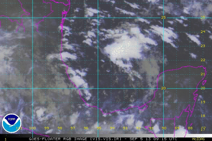
Animated visible: http://www.ssd.noaa.gov/PS/TROP/floater ... imated.gif
0 likes
54° 11' 59'' N, 9° 9' 20'' E
Boomer Sooner!
Go Broncos! Go Cards!
Clinching counties, one at a time: https://mob-rule.com/user-gifs/USA/xtrp94.gif
- Daniel
Boomer Sooner!
Go Broncos! Go Cards!
Clinching counties, one at a time: https://mob-rule.com/user-gifs/USA/xtrp94.gif
- Daniel
-
Rgv20

- S2K Supporter

- Posts: 2466
- Age: 39
- Joined: Wed Jan 05, 2011 5:42 pm
- Location: Edinburg/McAllen Tx
Saved Image: Looking good so far.

0 likes
The following post is NOT an official forecast and should not be used as such. It is just the opinion of the poster and may or may not be backed by sound meteorological data. It is NOT endorsed by any professional institution including storm2k.org For Official Information please refer to the NHC and NWS products.
Who is online
Users browsing this forum: No registered users and 73 guests