
from ftp://goes.gsfc.nasa.gov/pub/goeseast/overview2/vis/
Moderator: S2k Moderators


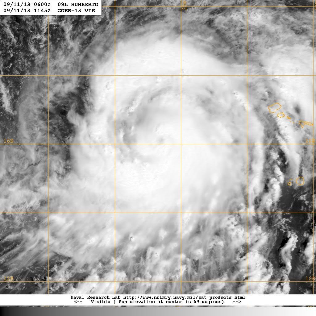
RL3AO wrote:It has a banding eye feature. I'm not going to try to do a Dvorak analysis on that, but it does look like the banding feature is worth a +1.0.
Syx6sic wrote:RL3AO wrote:It has a banding eye feature. I'm not going to try to do a Dvorak analysis on that, but it does look like the banding feature is worth a +1.0.
That's good to see I am not having eye tricks this morning but I see in the track after going north some it does a west turn is the west turn going to keep going west after or recurve to go north then north east?


supercane4867 wrote:Humberto appears to be rapidly intensifying

Sanibel wrote:In my opinion Humberto didn't tie the record because the rebound I didn't expect should retroactively make that eye feature and CDO from yesterday show Humberto was near or at hurricane at the time. If I had a vote I'd say the record stands.
Users browsing this forum: No registered users and 55 guests


