ATL: KAREN - Remnants - Discussion
Moderator: S2k Moderators
-
supercane4867
- Category 5

- Posts: 4966
- Joined: Wed Nov 14, 2012 10:43 am
ATL: KAREN - Remnants - Discussion
BEGIN
NHC_ATCF
invest_al972013.invest
FSTDA
R
U
040
010
0000
201309290721
NONE
NOTIFY=ATRP
END
NHC_ATCF
invest_al972013.invest
FSTDA
R
U
040
010
0000
201309290721
NONE
NOTIFY=ATRP
END
Last edited by supercane4867 on Thu Oct 03, 2013 1:03 am, edited 2 times in total.
0 likes
Re: ATL: INVEST 97L - SW Caribbean: 20% / 40%
Scrolling through the 3hr frames on the various vort levels, it looks like a LLC may be forming
850mb to 500mb seems somewhat aligning; and 200mb is in the clear - all conducive for genesis.
http://tropic.ssec.wisc.edu/real-time/windmain.php?&basin=atlantic&sat=wg8&prod=vor&zoom=&time=
http://tropic.ssec.wisc.edu/real-time/windmain.php?&basin=atlantic&sat=wg8&prod=vor3&zoom=&time=
http://tropic.ssec.wisc.edu/real-time/windmain.php?&basin=atlantic&sat=wg8&prod=vor2&zoom=&time=
http://tropic.ssec.wisc.edu/real-time/windmain.php?&basin=atlantic&sat=wg8&prod=vor1&zoom=&time=
Starting to see a flare popup close to the estimated COC.
Sat est COC @ ~ 15.2N 76.2W. Convection firing up just to the SE @ 14.9W 75.5W.
Unfortunately, not able to get near-real-time rain-rate measurements.
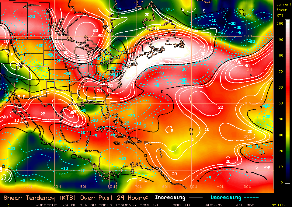
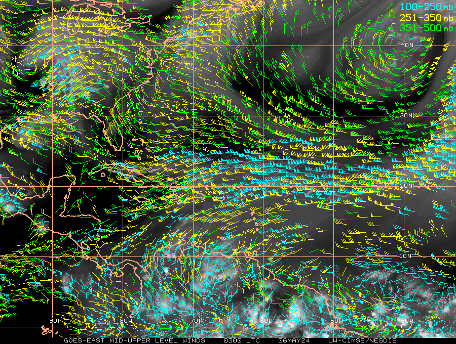
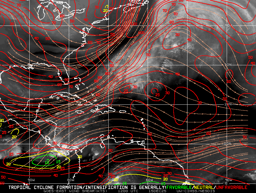
Looks like this may be on the edge of a strong shear boundary.
If a hot-tower pops up, this could wipe a good portion of the NW flanking shear out of the way.


0 likes
Re: ATL: INVEST 97L - SW Caribbean: 20% / 40%
An awesome poleward outflow-channel sink is in place from that ULL at 35N 73W.
Kicker is that this is forecast to move east as 97L will move north into the GOM setting up nearly ideal conditions for UL ventilation.

Kicker is that this is forecast to move east as 97L will move north into the GOM setting up nearly ideal conditions for UL ventilation.
0 likes
- cycloneye
- Admin

- Posts: 149672
- Age: 69
- Joined: Thu Oct 10, 2002 10:54 am
- Location: San Juan, Puerto Rico
Re: ATL: INVEST 97L - Discussion - 20% / 40%
0 likes
Visit the Caribbean-Central America Weather Thread where you can find at first post web cams,radars
and observations from Caribbean basin members Click Here
and observations from Caribbean basin members Click Here
Re: ATL: INVEST 97L - Discussion - 20% / 40%
NATIONAL WEATHER SERVICE TAMPA BAY RUSKIN FL
418 AM EDT SUN SEP 29 2013
LONG TERM (TUESDAY NIGHT-SATURDAY)...
HIGH DEGREE OF UNCERTAINTY REMAINS IN THE LONG RANGE DUE TO A
TROUGH OF LOW PRESSURE OVER THE CENTRAL AND SOUTHWESTERN CARIBBEAN
SEA WHICH IS EXPECTED TO GRADUALLY MOVE NORTHWEST TOWARD THE
SOUTHEAST GULF OF MEXICO WEDNESDAY AND THURSDAY. CANADIAN AND GFS
SHOW A RELATIVELY WELL DEVELOPED AREA OF LOW PRESSURE MOVING OVER
THE EASTERN GULF OF MEXICO. HOWEVER THE GFS SLOWS THE SYSTEM
BEFORE MOVING IT TOWARD WEST CENTRAL FLORIDA BY THE WEEKEND
WHEREAS THE CANADIAN IS MUCH MORE PROGRESSIVE MOVING IT TOWARD THE
FLORIDA PANHANDLE LATE THURSDAY. AND THE 28/12Z ECMWF IS MUCH
FURTHER WEST OVER THE CENTRAL GULF. REGARDLESS OF THE STRENGTH OF
THIS SYSTEM...DEEP TROPICAL MOISTURE ON THE EAST SIDE OF THE
TROUGH/LOW WILL LIKELY ADVECT OVER WEST CENTRAL AND SOUTHWEST
FLORIDA LATE WEDNESDAY INTO THURSDAY. INCREASING INSTABILITY
COMBINED WITH THE DEEP LAYER MOISTURE WILL GENERATE SCATTERED TO
NUMEROUS SHOWERS AND THUNDERSTORMS ACROSS THE AREA LATE WEDNESDAY
THROUGH FRIDAY WITH THE THREAT OF LOCALLY HEAVY RAIN. SYSTEM MAY
BE VERY SLOW MOVING...PER THE GFS...AND WAIT TO BE PICKED UP BY A
L/W TROUGH MOVING OVER THE SOUTHEAST U.S. LATE FRIDAY AND
SATURDAY. WILL TREND POPS AROUND 50 IN THE EXTENDED BASED ON
UNCERTAINTY IN EVOLUTION AND TRACK OF SYSTEM TO THE SOUTH.
0 likes
The posts in this forum are NOT official forecasts and should not be used as such. They are just the opinion of the poster and may or may not be backed by sound meteorological data. They are NOT endorsed by any professional institution or STORM2K. For official information, please refer to products from the NHC and NWS.
- cycloneye
- Admin

- Posts: 149672
- Age: 69
- Joined: Thu Oct 10, 2002 10:54 am
- Location: San Juan, Puerto Rico
Re: ATL: INVEST 97L - Discussion - 20% / 40%
8 AM TWO:
A TROUGH OF LOW PRESSURE OVER THE CENTRAL AND SOUTHWESTERN CARIBBEAN
SEA CONTINUES TO PRODUCE DISORGANIZED SHOWERS AND THUNDERSTORMS.
SOME DEVELOPMENT OF THIS DISTURBANCE IS POSSIBLE OVER THE NEXT
COUPLE OF DAYS WHILE IT MOVES SLOWLY NORTHWESTWARD...AND THIS
SYSTEM HAS A LOW CHANCE...20 PERCENT...OF BECOMING A TROPICAL
CYCLONE DURING THE NEXT 48 HOURS. AFTER THAT TIME...ENVIRONMENTAL
CONDITIONS COULD BECOME MORE CONDUCIVE FOR DEVELOPMENT WHEN THE
SYSTEM MOVES OVER THE NORTHWESTERN CARIBBEAN SEA AND THE
SOUTHEASTERN GULF OF MEXICO. THIS SYSTEM HAS A MEDIUM CHANCE...40
PERCENT...OF BECOMING A TROPICAL CYCLONE DURING THE NEXT 5 DAYS.
LOCALLY HEAVY RAINFALL AND GUSTY WINDS WILL BE POSSIBLE OVER
JAMAICA AND WESTERN HAITI TODAY AND MONDAY...AND GRADUALLY SPREAD
ACROSS THE CAYMAN ISLANDS AND EASTERN CUBA BY TUESDAY.
0 likes
Visit the Caribbean-Central America Weather Thread where you can find at first post web cams,radars
and observations from Caribbean basin members Click Here
and observations from Caribbean basin members Click Here
- wxman57
- Moderator-Pro Met

- Posts: 23175
- Age: 68
- Joined: Sat Jun 21, 2003 8:06 pm
- Location: Houston, TX (southwest)
Re: ATL: INVEST 97L - Discussion - 20% / 40%
00Z and 06Z GFS runs develop only a very weak low. Euro has a brief weak low in the Gulf before it merges with a cold front west of Florida next Saturday. At the very most, conditions favor only a weak TS that gets sheared or absorbed by a cold front before reaching Florida. Only threat appears to be rain.
0 likes
Re: ATL: INVEST 97L - Discussion - 20% / 40%
Thx wxman57 ill take the rain without the wind being an issue.
0 likes
Re: ATL: INVEST 97L - Discussion - 20% / 40%
Anti-cyclone has developed to the SW of the convection and appears to be taking a bite out of the shear.

0 likes
- cycloneye
- Admin

- Posts: 149672
- Age: 69
- Joined: Thu Oct 10, 2002 10:54 am
- Location: San Juan, Puerto Rico
Re: ATL: INVEST 97L - Discussion - 20% / 40%
12z Best Track.
AL, 97, 2013092912, , BEST, 0, 138N, 766W, 20, 1009, DB
AL, 97, 2013092912, , BEST, 0, 138N, 766W, 20, 1009, DB
0 likes
Visit the Caribbean-Central America Weather Thread where you can find at first post web cams,radars
and observations from Caribbean basin members Click Here
and observations from Caribbean basin members Click Here
-
CYCLONE MIKE
- Category 5

- Posts: 2183
- Joined: Tue Aug 31, 2004 6:04 pm
- Location: Gonzales, LA
Re: ATL: INVEST 97L - Discussion - 20% / 40%
Agree with wxman's thoughts on this. Just don't see this one doing much of nothing just like the other invests that made it into the gulf. Only thing that might be interesting to watch is how strong next weeks front will be and how far south it makes it, in turn where does all the moisture go. The one currently at the tx/LA border WAS forecast to be fairly strong and make it all the way into the gulf a few days ago as well as drop highs into the mid 80's for us. Well now it looks as though it will not even reach south LA and we are still in the 90's.
Point being this disturbance might make it further west and north than being shown currently. But in the big scheme of things wont matter much because it will still have 2013 gom conditions to deal with.
Point being this disturbance might make it further west and north than being shown currently. But in the big scheme of things wont matter much because it will still have 2013 gom conditions to deal with.
0 likes
This post is NOT AN OFFICIAL FORECAST and should not be used as such. It is just the opinion of the poster and may or may not be backed by sound meteorological data. It is NOT endorsed by any professional institution including storm2k.org. For Official Information please refer to the NHC and NWS products.
Re: ATL: INVEST 97L - Discussion - 20% / 40%
Upper level conditions as a whole are not so great with west to Southwest winds blowing off the little convection it can stir up. Wait until tomm. evening when the 200mb winds are forecast to relax significantly. This is when I am expecting any development to really try & occur.
0 likes
Andy D
(For official information, please refer to the NHC and NWS products.)
(For official information, please refer to the NHC and NWS products.)
- cycloneye
- Admin

- Posts: 149672
- Age: 69
- Joined: Thu Oct 10, 2002 10:54 am
- Location: San Juan, Puerto Rico
Re: ATL: INVEST 97L - Discussion - 20% / 40%
First recon mission on Tuesday afternoon. (If needed)
WEATHER RECONNAISSANCE FLIGHTS
CARCAH, NATIONAL HURRICANE CENTER, MIAMI, FL.
1045 AM EDT SUN 29 SEPTEMBER 2013
SUBJECT: TROPICAL CYCLONE PLAN OF THE DAY (TCPOD)
VALID 30/1100Z TO 01/1100Z OCTOBER 2013
TCPOD NUMBER.....13-120
I. ATLANTIC REQUIREMENTS
1. NEGATIVE RECONNAISSANCE REQUIREMENTS.
2. OUTLOOK FOR SUCCEEDING DAY:PSBL LOW LEVEL INVEST
AT 20N AND 81W FOR 01/1800Z, AND BEGIN 6 HRLY FIXES
02/1200Z IF SYSTEM IS A THREAT.
0 likes
Visit the Caribbean-Central America Weather Thread where you can find at first post web cams,radars
and observations from Caribbean basin members Click Here
and observations from Caribbean basin members Click Here
- ConvergenceZone
- Category 5

- Posts: 5241
- Joined: Fri Jul 29, 2005 1:40 am
- Location: Northern California
Yea, just too much dry air/shear out there right now for it too do much...
On a side note, What I don't understand is that why isn't the lack of activity making national headlines??? You think with all the money that's being saved due to the lack of hurricanes/storms, the national headlines would be rejoicing in all of this??
I mean, this is fantastic news, right?
On a side note, What I don't understand is that why isn't the lack of activity making national headlines??? You think with all the money that's being saved due to the lack of hurricanes/storms, the national headlines would be rejoicing in all of this??
I mean, this is fantastic news, right?
0 likes
Re:
ConvergenceZone wrote:Yea, just too much dry air/shear out there right now for it too do much...
On a side note, What I don't understand is that why isn't the lack of activity making national headlines??? You think with all the money that's being saved due to the lack of hurricanes/storms, the national headlines would be rejoicing in all of this??
I mean, this is fantastic news, right?
Yeah, I really don't need a hurricane right now. The first one (Charley) was fun and enough.
0 likes
Re: ATL: INVEST 97L - Discussion - 20% / 40%
Other billion dollar weather events have made up for the benign season so far. Not sure a lack of news is newsworthy with 2 months left in the season. Best not to call a game in the 7th inning
0 likes
- SFLcane
- S2K Supporter

- Posts: 10281
- Age: 48
- Joined: Sat Jun 05, 2010 1:44 pm
- Location: Lake Worth Florida
Re: ATL: INVEST 97L - Discussion - 20% / 40%
chaser1 wrote:Upper level conditions as a whole are not so great with west to Southwest winds blowing off the little convection it can stir up. Wait until tomm. evening when the 200mb winds are forecast to relax significantly. This is when I am expecting any development to really try & occur.
This is correct shear should relax some in a few days development if any could accur with CCKW passage.
0 likes
-
floridasun78
- Category 5

- Posts: 3755
- Joined: Sun May 17, 2009 10:16 pm
- Location: miami fl
Who is online
Users browsing this forum: No registered users and 154 guests


