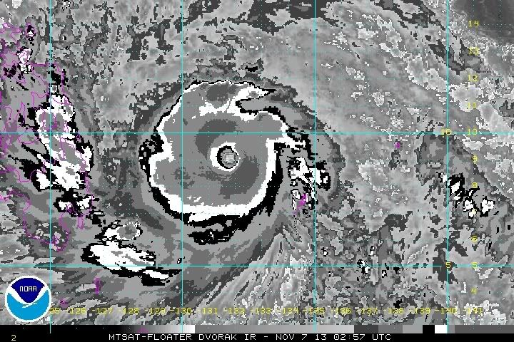
WPAC: HAIYAN - Post-Tropical

Moderator: S2k Moderators

Message
Author
stormstrike
Tropical Storm
Tropical Storm
Posts: 159
Joined: Thu Nov 29, 2012 12:37 am

Re: Re:

#381 Postby stormstrike » Wed Nov 06, 2013 9:11 pm

xtyphooncyclonex wrote:
stormstrike wrote:
dexterlabio wrote:Dry spot around the eye again. There are hints of another EWRC, though it could be as swift and neat as it did previously. The cycle was almost unnoticeable in satellite imagery. I feel another EWRC will just cause an expansion of the strongest winds. Those filling in the eye might be mesovortices, and they are usual for a cyclone this intense. But the eye still looks clean to me.


Oh...I thought it's weakening.. oh well...this would really be the strongest typhoon that I would ever experience.. :roll:

Well, even if it will pass over Abuyog.....


Well yes.. wherever the shift of track is.. Leyte would always be the front liner.. :roll:
and looking at the loops I think it's now more moving WNW..
0 likes   

stormstrike
Tropical Storm
Tropical Storm
Posts: 159
Joined: Thu Nov 29, 2012 12:37 am

Re: WPAC: HAIYAN - Typhoon

#382 Postby stormstrike » Wed Nov 06, 2013 9:13 pm

euro6208 wrote:warming convection around the eye... it must be going through another EWC and a much larger eye will appear...


I hope it would take long :lol:
0 likes   

Alyono
Professional-Met
Professional-Met
Posts: 6961
Joined: Fri Apr 26, 2013 3:52 pm
Location: Texas Coast

#383 Postby Alyono » Wed Nov 06, 2013 9:29 pm

what warming convection? I sure do not see it. The EWRC is complete and the larger eye is just now becoming visible on convectional satellite imagery

as for Cebu, not sure about typhoon winds in the city itself. Probably for the northern end of the island, however
0 likes   

User avatar
xtyphooncyclonex
Category 5
Category 5
Posts: 3861
Age: 23
Joined: Sat Dec 08, 2012 9:07 am
Location: Cebu City
Contact:

Re:

#384 Postby xtyphooncyclonex » Wed Nov 06, 2013 9:32 pm

Alyono wrote:what warming convection? I sure do not see it. The EWRC is complete and the larger eye is just now becoming visible on convectional satellite imagery

as for Cebu, not sure about typhoon winds in the city itself. Probably for the northern end of the island, however

well we'll see... during typhoon Fengshen of 2008, I remembered that even if it was over Masbate, the winds were so strong. Take note that it was just a category 1!
0 likes   
REMINDER: My opinions that I, or any other NON Pro-Met in this forum, are unofficial. Please do not take my opinions as an official forecast and warning. I am NOT a meteorologist. Following my forecasts blindly may lead to false alarm, danger and risk if official forecasts from agencies are ignored.

User avatar
cycloneye
Admin
Admin
Posts: 145308
Age: 68
Joined: Thu Oct 10, 2002 10:54 am
Location: San Juan, Puerto Rico

Re: WPAC: HAIYAN - Typhoon

#385 Postby cycloneye » Wed Nov 06, 2013 9:35 pm

What about Metro Manila? Will that city experience Typhoon force winds?
0 likes   
Visit the Caribbean-Central America Weather Thread where you can find at first post web cams,radars
and observations from Caribbean basin members Click Here

User avatar
xtyphooncyclonex
Category 5
Category 5
Posts: 3861
Age: 23
Joined: Sat Dec 08, 2012 9:07 am
Location: Cebu City
Contact:

Re: WPAC: HAIYAN - Typhoon

#386 Postby xtyphooncyclonex » Wed Nov 06, 2013 9:38 pm

cycloneye wrote:What about Metro Manila? Will that city experience Typhoon force winds?

I guess tropical storm. It's too far north, but still 65 kph winds because that happens whenever a typhoon's bands are nearby.
0 likes   
REMINDER: My opinions that I, or any other NON Pro-Met in this forum, are unofficial. Please do not take my opinions as an official forecast and warning. I am NOT a meteorologist. Following my forecasts blindly may lead to false alarm, danger and risk if official forecasts from agencies are ignored.

hurricanes1234
Category 5
Category 5
Posts: 2907
Joined: Sat Jul 28, 2012 6:19 pm
Location: Trinidad and Tobago

Re: WPAC: HAIYAN - Typhoon

#387 Postby hurricanes1234 » Wed Nov 06, 2013 9:45 pm

I don't think this will weaken much anytime soon. In fact, the eye looks to be clearing out even further, as can be seen in this astonishing image. This could easily be 180 mph now.


Image
0 likes   
PLEASE NOTE: With the exception of information from weather agencies that I may copy and paste here, my posts will NEVER be official, since I am NOT a meteorologist. They are solely my amateur opinion, and may or may not be accurate. Therefore, please DO NOT use them as official details, particularly when making important decisions. Thank you.

User avatar
Filipinas50
Tropical Depression
Tropical Depression
Posts: 77
Age: 60
Joined: Tue May 28, 2013 2:07 am
Location: Planet Earth

Re: WPAC: HAIYAN - Typhoon

#388 Postby Filipinas50 » Wed Nov 06, 2013 9:45 pm

Outer Rainbands of Super Typhoon Haiyan Now Affecting the Central Visayas Region ...

Image
0 likes   
RETIRED FROM THE 9-5 RAT RACE

User avatar
xtyphooncyclonex
Category 5
Category 5
Posts: 3861
Age: 23
Joined: Sat Dec 08, 2012 9:07 am
Location: Cebu City
Contact:

Re: WPAC: HAIYAN - Typhoon

#389 Postby xtyphooncyclonex » Wed Nov 06, 2013 9:48 pm

hurricanes1234 wrote:I don't think this will weaken much anytime soon. In fact, the eye looks to be clearing out even further, as can be seen in this astonishing image. This could easily be 180 mph now.


Image

Very impressive!
0 likes   
REMINDER: My opinions that I, or any other NON Pro-Met in this forum, are unofficial. Please do not take my opinions as an official forecast and warning. I am NOT a meteorologist. Following my forecasts blindly may lead to false alarm, danger and risk if official forecasts from agencies are ignored.

hurricanes1234
Category 5
Category 5
Posts: 2907
Joined: Sat Jul 28, 2012 6:19 pm
Location: Trinidad and Tobago

Re: WPAC: HAIYAN - Typhoon

#390 Postby hurricanes1234 » Wed Nov 06, 2013 9:53 pm

More like unbelievable too. :eek:
0 likes   
PLEASE NOTE: With the exception of information from weather agencies that I may copy and paste here, my posts will NEVER be official, since I am NOT a meteorologist. They are solely my amateur opinion, and may or may not be accurate. Therefore, please DO NOT use them as official details, particularly when making important decisions. Thank you.

User avatar
Filipinas50
Tropical Depression
Tropical Depression
Posts: 77
Age: 60
Joined: Tue May 28, 2013 2:07 am
Location: Planet Earth

Re: WPAC: HAIYAN - Typhoon

#391 Postby Filipinas50 » Wed Nov 06, 2013 9:55 pm

Current Forecast Track Takes the Storm Directly Towards the Resort Island of Boracay ...

Image
0 likes   
RETIRED FROM THE 9-5 RAT RACE

User avatar
cycloneye
Admin
Admin
Posts: 145308
Age: 68
Joined: Thu Oct 10, 2002 10:54 am
Location: San Juan, Puerto Rico

Re: WPAC: HAIYAN - Typhoon

#392 Postby cycloneye » Wed Nov 06, 2013 10:13 pm

A word to describe this is "Amazing".

Image
0 likes   
Visit the Caribbean-Central America Weather Thread where you can find at first post web cams,radars
and observations from Caribbean basin members Click Here

User avatar
Macrocane
Category 5
Category 5
Posts: 4218
Age: 36
Joined: Sun May 24, 2009 5:35 pm
Location: El Salvador

Re: WPAC: HAIYAN - Typhoon

#393 Postby Macrocane » Wed Nov 06, 2013 10:14 pm

With the mild start of the season who would've thought we were going to see these monsters in the late season, I guess the ATL and EPAC energy had to go somewhere and that was the WPAC and the NIND.

Image
0 likes   

Meow

#394 Postby Meow » Wed Nov 06, 2013 10:23 pm

An eye can be clear on IR imagery, but it is impossible to be clear on VIS imagery or even MODIS pictures. There are always low-level clouds or even anticyclonic vortices in a mature eye in real.
0 likes   

User avatar
PaulR
Tropical Depression
Tropical Depression
Posts: 70
Joined: Mon Dec 03, 2012 2:43 pm
Location: Mid-South USA

Re:

#395 Postby PaulR » Wed Nov 06, 2013 10:34 pm

Alyono wrote:seems Ormoc may be the city at most risk.

That city did see nearly 6,000 dead from Thelma in 1991 and it was "only" a tropical storm


Hi, all - I'm back after a long absence. I'd love to spend more time here, but am generally too busy to post, unless a storm is severely threatening relatives, as is the case with Haiyan...

My wife (and therefor I) have relatives in and around Ormoc -- very scary. Back in '91, according to Wikipedia, Thelma's flash flooding killed 4,922 people, with 3,000 missing and now presumed also perished. There are around 4,900 buried in a mass grave... :(

http://en.wikipedia.org/wiki/Ormoc#1991_Flash_Flood

That all said, just looking at the map and the storm track, I wonder about Tacloban City (Pop. 221,174). It sure looks primed for a tremendous storm surge coming into that confined bay and strait. I'd think the San Juanico Bridge would also be at great risk.

Image

Can anyone with more information / expertise comment?
0 likes   
"Normal" is Chicago under a mile of ice.

euro6208

Re: WPAC: HAIYAN - Typhoon

#396 Postby euro6208 » Wed Nov 06, 2013 10:36 pm

what is causing this not to get an 8.0?

Dark grey convection? Additional warming of the eye?


Image
Last edited by euro6208 on Wed Nov 06, 2013 10:41 pm, edited 1 time in total.
0 likes   

euro6208

Re: WPAC: HAIYAN - Typhoon

#397 Postby euro6208 » Wed Nov 06, 2013 10:37 pm

WDPN33 PGTW 070300
MSGID/GENADMIN/JOINT TYPHOON WRNCEN PEARL HARBOR HI//
SUBJ/PROGNOSTIC REASONING FOR SUPER TYPHOON 31W (HAIYAN) WARNING NR
16//
RMKS/
1. FOR METEOROLOGISTS.
2. 6 HOUR SUMMARY AND ANALYSIS.
SUPER TYPHOON 31W (HAIYAN), LOCATED APPROXIMATELY 123 NM
NORTHWEST OF
KOROR, PALAU, HAS TRACKED WEST-NORTHWESTWARD AT 16 KNOTS OVER THE
PAST SIX HOURS. ANIMATED MULTISPECTRAL SATELLITE IMAGERY REVEALS STY
31W HAS MAINTAINED THE DEEP CONVECTIVE EYEWALL, WITH DVORAK
ESTIMATES FROM PGTW, KNES, AND RJTD MAINTAINING THE CURRENT
INTENSITY AT 150 KNOTS. SEA SURFACE TEMPERATURES (SSTS) ALONG THE
TRACK REMAIN VERY FAVORABLE PROVIDING AMPLE SURFACE HEATING,
SUPPORTING THE SUPER TYPHOON INTENSITY OVER THE PAST FEW HOURS.
UPPER LEVEL ANALYSIS INDICATES A FAVORABLE ENVIRONMENT WITH NEAR-
RADIAL OUTFLOW AND LOW (05 TO 10 KNOTS) VERTICAL WIND SHEAR. STY 31W
IS CURRENTLY TRACKING ALONG THE SOUTHERN PERIPHERY OF THE DEEP-
LAYERED SUBTROPICAL RIDGE (STR), WHICH IS ENTRENCHED TO THE NORTH.
3. FORECAST REASONING.
A. NO SIGNIFICANT CHANGE TO THE FORECAST PHILOSOPHY FROM THE
PREVIOUS PROGNOSTIC REASONING MESSAGE.
B. STY 31W IS EXPECTED TO MAINTAIN A WESTWARD TRACK ALONG THE
SOUTHERN EDGE OF THE STR, SHIFTING TO A WEST-NORTHWESTWARD TRACK BY
TAU 72. DUE TO VERY FAVORABLE ENVIRONMENTAL CONDITIONS, THE SYSTEM
IS EXPECTED TO REMAIN AT SUPER TYPHOON INTENSITY OVER THE NEXT 24
HOURS. LANDFALL WITH THE PHILIPPINES IS ANTICIPATED AROUND TAU 24
AND WILL START TO IMPACT THE LOW LEVEL INFLOW, LEADING TO A SLIGHT
WEAKENING TREND THROUGH TAU 72. STY 31W WILL TRACK INTO THE SOUTH
CHINA SEA (SCS) WHERE SSTS BEGIN TO SLOWLY DECREASE, AND
SUBSEQUENTLY THE SURFACE HEAT POTENTIAL WILL NOT SUPPORT THE
STRONGER SUPER TYPHOON INTENSITIES.
C. IN THE EXTENDED TAUS, STY 31W IS FORECAST TO WEAKEN AFTER TAU
72 AS IT TRACKS OVER MARGINAL SSTS IN THE WESTERN SCS AND BEGINS TO
ENCOUNTER LAND, MAKING LANDFALL SHORTLY BEFORE TAU 96, WHICH WILL
LEAD TO A MORE RAPID WEAKENING OF THE LOW LEVEL STRUCTURE AS THE
SYSTEM TRACKS INTO THE CENTRAL REGION OF SOUTHEASTERN ASIA. DYNAMIC
GUIDANCE REMAINS IN GOOD AGREEMENT THROUGH THE EXTENDED TAUS,
THEREFORE, THERE IS HIGH CONFIDENCE IN THE JTWC FORECAST.//
NNNN
0 likes   

RL3AO
Moderator-Pro Met
Moderator-Pro Met
Posts: 16308
Joined: Thu Jun 14, 2007 10:03 pm
Location: NC

Re: WPAC: HAIYAN - Typhoon

#398 Postby RL3AO » Wed Nov 06, 2013 10:39 pm

euro6208 wrote:what is causing this not to get an 8.0?


On a modified Dvorak scale, it would need cold dark grey (CDG) surrounding the eye to get up to 8.0

Right now, the CDG is only 20 to 30% around the eye.

Image
0 likes   

euro6208

Re: WPAC: HAIYAN - Typhoon

#399 Postby euro6208 » Wed Nov 06, 2013 10:43 pm

RL3AO wrote:
euro6208 wrote:what is causing this not to get an 8.0?


On a modified Dvorak scale, it would need cold dark grey (CDG) surrounding the eye to get up to 8.0

Right now, the CDG is only 20 to 30% around the eye.


too strict...seems more like a beauty contest or something...

oh how i would love recon right now...
0 likes   

User avatar
xtyphooncyclonex
Category 5
Category 5
Posts: 3861
Age: 23
Joined: Sat Dec 08, 2012 9:07 am
Location: Cebu City
Contact:

Re: WPAC: HAIYAN - Typhoon

#400 Postby xtyphooncyclonex » Wed Nov 06, 2013 10:46 pm

euro6208 wrote:
RL3AO wrote:
euro6208 wrote:what is causing this not to get an 8.0?


On a modified Dvorak scale, it would need cold dark grey (CDG) surrounding the eye to get up to 8.0

Right now, the CDG is only 20 to 30% around the eye.


too strict...seems more like a beauty contest or something...

oh how i would love recon right now...

8.0 means perfect storm, and lacks dark gray spots - that's why. Why do you like this to be stronger? To wipe us out?
Last edited by xtyphooncyclonex on Wed Nov 06, 2013 10:47 pm, edited 1 time in total.
0 likes   
REMINDER: My opinions that I, or any other NON Pro-Met in this forum, are unofficial. Please do not take my opinions as an official forecast and warning. I am NOT a meteorologist. Following my forecasts blindly may lead to false alarm, danger and risk if official forecasts from agencies are ignored.


Return to “2013”

Who is online

Users browsing this forum: No registered users and 10 guests