Ntxw wrote:The euro is still very on for wintry precip for pretty much the NW and northern half of Texas, quite impressive actually (foot in some places). I think the reason it has so much is it may be mixing some of it with sleet. This will be interesting, I don't think the GFS has a handle on the cold air mass just yet and ecmwf is in it's kill mid range zone, big highs 1050+ don't come and go quietly. Once the upper low passes overhead that's prime time and it may not be the only threat before this month is out, Rex Block.
93 was mentioned and I think it's a good month to compare, the atmosphere is in a very Nino like state in the north Pacific
It's either going to rain a cold rain in the 30s or be a big wintry mess
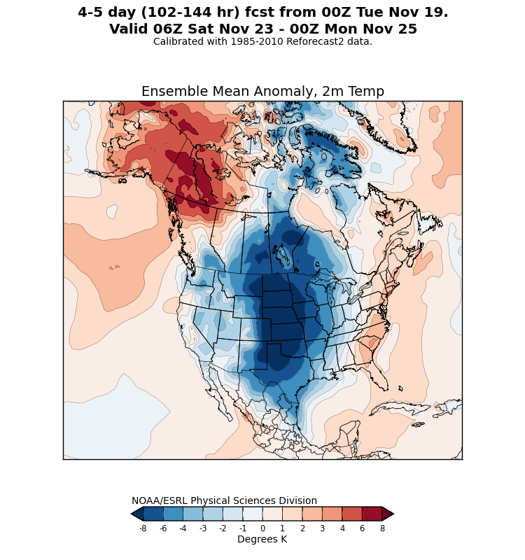
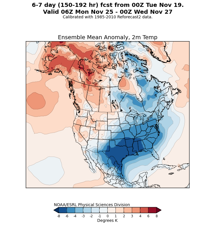
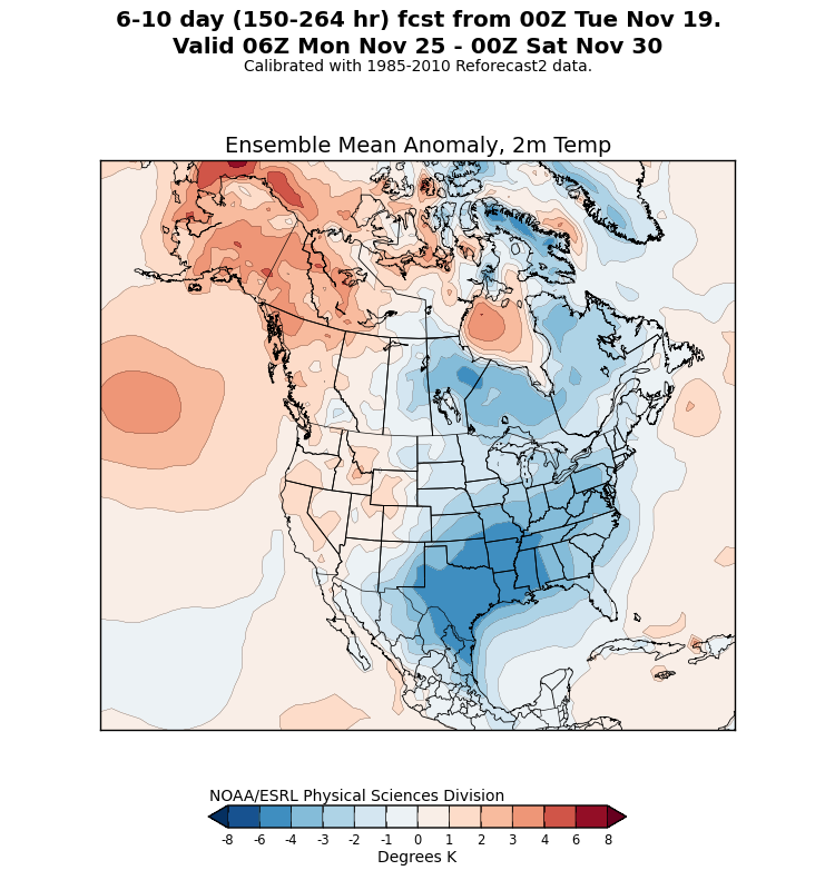
I totally agree in that the GFS may not be handling the cold that well, to me it is moving the Arctic air at the surface eastward too fast, the ensemble reforecast map below has the core of the cold air finding a home in TX & the lower MS river valley a bit longer than what the GFS shows.