
Latest 12z GFSX MOS forecasted lows guidance:
Tuesday & Wednesday mornings:
North FL:
Gainesville: 20, 22 deg F
Jacksonville airport: 19, 23 deg F
Panama City: 21, 22 deg F
Pensacola: 17, 23 deg F
Tallahassee: 17, 18 deg F
Central FL
Ocala: 21, 22 deg F
Brooksville: 27, 23 deg F
Daytona Beach: 28, 35 deg F
Lakeland: 31, 35 deg F
Melbourne: 32, 42 deg F
Orlando, KORL: 34, 37 deg F
Orlando, KMCO: 32, 35 deg F
St Petersburg: 40, 39 deg F
Tampa: 33, 31 degs
South FL
Ft Myers 38, 36 degs
Miami: 47, 53 degs
Naples: 43, 37 degs
West Palm: 39, 50 degs
Florida Weather
Moderator: S2k Moderators
Forum rules

The posts in this forum are NOT official forecast and should not be used as such. They are just the opinion of the poster and may or may not be backed by sound meteorological data. They are NOT endorsed by any professional institution or STORM2K.
-
northjaxpro

- S2K Supporter

- Posts: 8900
- Joined: Mon Sep 27, 2010 11:21 am
- Location: Jacksonville, FL
As I expected, the winds veered enough to northeast that just kept my locale above the freezing mark earlier today. The low was 34.3 this morning. Yesterday bought only the second freeze of this season at my locale with 30.6 degrees. The max daytime temp here yesterday was only 45 degrees.
Currently, it is already warmer here than it got all day yeterday, currently 50.4 degrees and overcast. The moderation trend will contnue though tomorrow night. May see 70s late tomorrow in the southerly flow ahead of the deep developing upper level trough moving out from the Plains. Some scattered rain developing late Sunday into Monday, then the arctic boundary will plow through and the big plunge will ensue.
Currently, it is already warmer here than it got all day yeterday, currently 50.4 degrees and overcast. The moderation trend will contnue though tomorrow night. May see 70s late tomorrow in the southerly flow ahead of the deep developing upper level trough moving out from the Plains. Some scattered rain developing late Sunday into Monday, then the arctic boundary will plow through and the big plunge will ensue.
0 likes
NEVER, EVER SAY NEVER in the tropics and weather in general, and most importantly, with life itself!!
________________________________________________________________________________________
Fay 2008 Beryl 2012 Debby 2012 Colin 2016 Hermine 2016 Julia 2016 Matthew 2016 Irma 2017 Dorian 2019
________________________________________________________________________________________
Fay 2008 Beryl 2012 Debby 2012 Colin 2016 Hermine 2016 Julia 2016 Matthew 2016 Irma 2017 Dorian 2019


I mentioned this in the Deep south thread but the latest GFS has Florida cities showing dewpoints below 0, -10 or more in some places. Is that some kind of record? I mean this is Florida we're talking about...
0 likes
The above post and any post by Ntxw is NOT an official forecast and should not be used as such. It is just the opinion of the poster and may or may not be backed by sound meteorological data. It is NOT endorsed by any professional institution including Storm2k. For official information, please refer to NWS products.
Help support Storm2K!
-
northjaxpro
- S2K Supporter
- Posts: 8900
- Joined: Mon Sep 27, 2010 11:21 am
- Location: Jacksonville, FL
I'll check back later after I completely analyze the most recent model runs. However, as have been my feeling for a few days, I am even more confident that the GFS solution is going to be closer to verifyng for this arctic outbreak event for the region. The North Florida area Tuesday morning has a pretty good potential of experiencing some of the coldest weather we have seen in this area in a long, long time. Temps in that 15-20 degree range are looking likely across the the Suwannee River Valley and Big Bend region, and the 18-22 degree range for my locale 12Z Tuesday. Will follow this closely.
Last edited by northjaxpro on Sun Jan 05, 2014 10:27 am, edited 3 times in total.
0 likes
NEVER, EVER SAY NEVER in the tropics and weather in general, and most importantly, with life itself!!
________________________________________________________________________________________
Fay 2008 Beryl 2012 Debby 2012 Colin 2016 Hermine 2016 Julia 2016 Matthew 2016 Irma 2017 Dorian 2019
________________________________________________________________________________________
Fay 2008 Beryl 2012 Debby 2012 Colin 2016 Hermine 2016 Julia 2016 Matthew 2016 Irma 2017 Dorian 2019
-
northjaxpro
- S2K Supporter
- Posts: 8900
- Joined: Mon Sep 27, 2010 11:21 am
- Location: Jacksonville, FL
Also, WFOs in Ruskin and Melbourne has finally bought into the GFS as the Ruskin office has issued Hard Freeze Watch for the Nature Coast area for Tuesday morning. Forecast for temps to reach the low to mid 20s in that area Tuesday morning.
WFO in Melbourne has issued Freeze Watch for thecounties of Orange, Osceola, Seminole, Lake, Volusia and for now Northern Brevard on Tuesday morning.
Of course, the entire northern peninsula under Hard Freeze Watch, which will certainly be upgraded to warning by tomorrow morning.
WFO in Melbourne has issued Freeze Watch for thecounties of Orange, Osceola, Seminole, Lake, Volusia and for now Northern Brevard on Tuesday morning.
Of course, the entire northern peninsula under Hard Freeze Watch, which will certainly be upgraded to warning by tomorrow morning.
0 likes
NEVER, EVER SAY NEVER in the tropics and weather in general, and most importantly, with life itself!!
________________________________________________________________________________________
Fay 2008 Beryl 2012 Debby 2012 Colin 2016 Hermine 2016 Julia 2016 Matthew 2016 Irma 2017 Dorian 2019
________________________________________________________________________________________
Fay 2008 Beryl 2012 Debby 2012 Colin 2016 Hermine 2016 Julia 2016 Matthew 2016 Irma 2017 Dorian 2019
Re: Florida Weather
Updated MOS forecast from last night's GFSX MOS guidance:
North FL:
Gainesville: 20, 22 deg F
Jacksonville Int'l airport: 19, 23 deg F
Jacksonville Nav'l AS: 24, 31 deg F
Panama City: 20, 22 deg F
Pensacola: 15, 22 deg F
Tallahassee: 16, 20 deg F
Central FL
Ocala: 19, 24 deg F
Brooksville: 24, 24 deg F
Daytona Beach: 26, 36 deg F
Lakeland: 30, 35 deg F
Melbourne: 30, 42 deg F
Orlando, KORL: 30, 37 deg F
Orlando, KMCO: 30, 36 deg F
St Petersburg: 37, 36 deg F
Tampa: 29, 32 degs
South FL
Ft Myers 36, 38 degs
Miami: 44, 55 degs
Naples: 41, 39 degs
West Palm: 37, 52 degs
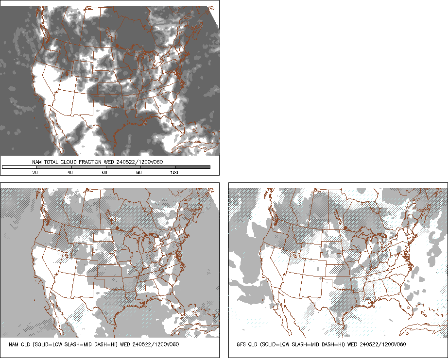
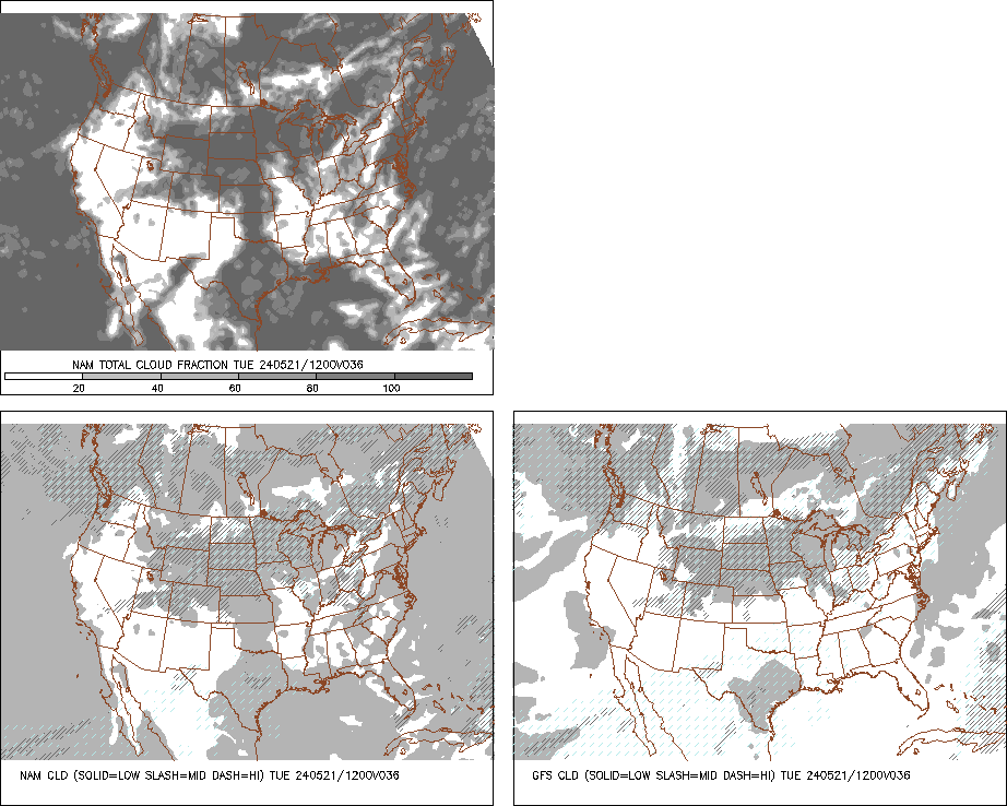
IMO, with the fact that MOS guidance for central & south FL are usually cold bias from past events, I only see a light freeze along the I-4 corridor on southward towards Lake Okeechobee Tuesday morning only, with the duration of freezing temps 1-4 hrs at the most, freezes at such short duration do not do that much damage to vegetation. This will not be a record breaking event for central FL, at the most it will tie the records from the 2010 event on the same day. Both the GFS and NAM are still forecasting cloud cover for central & S FL Tuesday morning which could keep temps from really dipping that low, hope they are right.
North FL:
Gainesville: 20, 22 deg F
Jacksonville Int'l airport: 19, 23 deg F
Jacksonville Nav'l AS: 24, 31 deg F
Panama City: 20, 22 deg F
Pensacola: 15, 22 deg F
Tallahassee: 16, 20 deg F
Central FL
Ocala: 19, 24 deg F
Brooksville: 24, 24 deg F
Daytona Beach: 26, 36 deg F
Lakeland: 30, 35 deg F
Melbourne: 30, 42 deg F
Orlando, KORL: 30, 37 deg F
Orlando, KMCO: 30, 36 deg F
St Petersburg: 37, 36 deg F
Tampa: 29, 32 degs
South FL
Ft Myers 36, 38 degs
Miami: 44, 55 degs
Naples: 41, 39 degs
West Palm: 37, 52 degs
IMO, with the fact that MOS guidance for central & south FL are usually cold bias from past events, I only see a light freeze along the I-4 corridor on southward towards Lake Okeechobee Tuesday morning only, with the duration of freezing temps 1-4 hrs at the most, freezes at such short duration do not do that much damage to vegetation. This will not be a record breaking event for central FL, at the most it will tie the records from the 2010 event on the same day. Both the GFS and NAM are still forecasting cloud cover for central & S FL Tuesday morning which could keep temps from really dipping that low, hope they are right.
0 likes
-
TheStormExpert
Acting like the middle of summer down here in SE Florida especially northern Palm Beach County with the training of showers and even a few rumbles of thunder in the mix! Some might find it hard to believe that in about 36hrs. we will be experiencing some of the coldest temps. so far this winter season here in S. Florida!


0 likes
-
TheStormExpert


-
gatorcane

- S2K Supporter
- Posts: 23708
- Age: 48
- Joined: Sun Mar 13, 2005 3:54 pm
- Location: Boca Raton, FL
This cold snap is going to be quick - about 48 hours for Southern Florida and then look at the stubborn ridge over the SW Atlantic extending into the Northern Caribbean flexing it's muscles once again by Wed...the ridge holds strong for many days then the flow becomes quite zonal across the Eastern CONUS and Western Atlantic which basically means mostly above average temps for a while yet again after this cold front for much of Florida:
12Z GFS 99 hours:

12Z GFS 99 hours:
0 likes
-
gatorcane
- S2K Supporter
- Posts: 23708
- Age: 48
- Joined: Sun Mar 13, 2005 3:54 pm
- Location: Boca Raton, FL
Re: Florida Weather
NDG wrote:Both the GFS and NAM are still forecasting cloud cover for central & S FL Tuesday morning which could keep temps from really dipping that low, hope they are right.
Looking at the saved GIF IR loop, we can see alot of cloud cover over Mexico streaming East along the subtropical jet. It certainly makes sense why the models are showing some cloud cover over the peninsula Mon - Tues. nights.
Plus I was checking the 18Z GFS and it keeps the freezing line across North-Central Florida now, so it has nudged it north some from previous runs I was looking at yesterday. By the way, it is easy to make out the front which stretches across the Western Gulf and into the Mississippi delta area and to the northeast:

Last edited by gatorcane on Sun Jan 05, 2014 8:56 pm, edited 1 time in total.
0 likes
Re: Florida Weather
gatorcane wrote:This cold snap is going to be quick - about 48 hours for Southern Florida and then look at the stubborn ridge over the SW Atlantic extending into the Northern Caribbean flexing it's muscles once again by Wed...the ridge holds strong for many days then the flow becomes quite zonal across the Eastern CONUS and Western Atlantic which basically means mostly above average temps for a while yet again after this cold front for much of Florida:
12Z GFS 99 hours:
http://img607.imageshack.us/img607/4645/hzb.gif
For S FL 48hrs? Probably barely 36 hrs, you will be back in the 70s by Wednesday afternoon with the cold front not cooling you down there until late tomorrow night.
0 likes
-
gatorcane
- S2K Supporter
- Posts: 23708
- Age: 48
- Joined: Sun Mar 13, 2005 3:54 pm
- Location: Boca Raton, FL
Re: Florida Weather
NDG wrote:gatorcane wrote:This cold snap is going to be quick - about 48 hours for Southern Florida and then look at the stubborn ridge over the SW Atlantic extending into the Northern Caribbean flexing it's muscles once again by Wed...the ridge holds strong for many days then the flow becomes quite zonal across the Eastern CONUS and Western Atlantic which basically means mostly above average temps for a while yet again after this cold front for much of Florida:
12Z GFS 99 hours:
http://img607.imageshack.us/img607/4645/hzb.gif
For S FL 48hrs? Probably barely 36 hrs, you will be back in the 70s by Wednesday afternoon with the cold front not cooling you down there until late tomorrow night.
Yeah you are right. Looks like a 36 hour event as winds turn east Wed. with highs in the lower 70s. Cold air won't move in until Mon. night.
0 likes

Re: Florida Weather
Looks like South Florida seems a bit left out regarding this MASSIVE arctic outbreak, I wonder how things will really turn out once this front smashes through the region come tomorrow. I remember the Thanksgiving front was stronger than thought in South FL...maybe this one a bit underestimated for here? 
0 likes
Georges '98, Irene '99, Frances '04, Jeanne '04, Katrina '05, Wilma '05, Gustav '08, Isaac '12, Matthew '16, Florence '18, Michael '18, Ian '22
-
northjaxpro
- S2K Supporter
- Posts: 8900
- Joined: Mon Sep 27, 2010 11:21 am
- Location: Jacksonville, FL
Arctic Front has just moved through Mobile AL, where they saw a dramatic shift from southerly wind to northwest 15 mph gusting to near 25 mph. There is a very narrow band of showers just ahead of the front currently moving across Pensacola and will continue to move rapidly east. The Arctic front should move through the Tallahassee area by 3 a.m. and push through the Jax area and Northeast Florida just after sunrise.
Temperatures are going to plumment all day long, near 60 degrees at the start of the day to the upper 30s in the Jax area by sunset. The Arctic front should be moving through central peninsula by midday, and move through the remaing portions of the peninsula by late afternoon.
The coldest of the air will lag back and stay north of extreme southern peninsula.. Expecting mid 40s-to near 50 for areas south and east of Lake Okeechobee.
Upper teens to the lower 20s look likely across this area on Tuesday morning with a powerful advective freeze spreading over North Florida and Southeast GA. Tuesday will be among one of the coldest days not seen here in years. Maximum temperatures at my locale on Tuesday is forecast to only reach the mid- upper 30s!
As we have all cited, the progressive pattern we are in now with only keep he frigid air i our area for only 36-40 hours, then the warm-up starting fully on Thursday right on into next weekend.
I will check back in here early in the morning.
Last edited by northjaxpro on Sun Jan 05, 2014 11:57 pm, edited 2 times in total.
0 likes
NEVER, EVER SAY NEVER in the tropics and weather in general, and most importantly, with life itself!!
________________________________________________________________________________________
Fay 2008 Beryl 2012 Debby 2012 Colin 2016 Hermine 2016 Julia 2016 Matthew 2016 Irma 2017 Dorian 2019
________________________________________________________________________________________
Fay 2008 Beryl 2012 Debby 2012 Colin 2016 Hermine 2016 Julia 2016 Matthew 2016 Irma 2017 Dorian 2019
-
northjaxpro
- S2K Supporter
- Posts: 8900
- Joined: Mon Sep 27, 2010 11:21 am
- Location: Jacksonville, FL
Re: Florida Weather
FireRat wrote:Looks like South Florida seems a bit left out regarding this MASSIVE arctic outbreak, I wonder how things will really turn out once this front smashes through the region come tomorrow. I remember the Thanksgiving front was stronger than thought in South FL...maybe this one a bit underestimated for here?
That is a fair assessment. Now,it is not anticipated to get ccolder than what has been analyzed down there at this time. However, there is a chance the magnitude of this cold event may surprise us even more and it may be stronger. It may get a few degrees colder down in South Florida. GFS was initially not on board with EURO earlier in the week, but since Last Thursday GFS has been trending colder overall to now with this event. The next runs may shed a light as to see if it may get a few degrees colder down there.
0 likes
NEVER, EVER SAY NEVER in the tropics and weather in general, and most importantly, with life itself!!
________________________________________________________________________________________
Fay 2008 Beryl 2012 Debby 2012 Colin 2016 Hermine 2016 Julia 2016 Matthew 2016 Irma 2017 Dorian 2019
________________________________________________________________________________________
Fay 2008 Beryl 2012 Debby 2012 Colin 2016 Hermine 2016 Julia 2016 Matthew 2016 Irma 2017 Dorian 2019
-
Bocadude85

- Category 5

- Posts: 2991
- Age: 39
- Joined: Mon Apr 18, 2005 2:20 pm
- Location: Honolulu,Hi
Re: Florida Weather
I see the NWS Miami has raised the minimum lows for my area (Boca Raton) from 45 to 47 and then were backing into the 80's by Thursday. Very short cold snap for sure.
0 likes
Re: Florida Weather
Here is the most recent forecast 06z GFS MOS guidance for lows tomorrow morning and Wednesday morning, Any significant drops have been for North FL down to Ocala only, Central FL remains about the same and for S FL they have actually trended up during the past 24 hrs.
Notice that for Wednesday morning it does not call for freezing temps from the I-4 corridor on southward, if anything it has been trending up for Wed morning for the last couple of days.
North FL:
Gainesville: 16, 21 deg F
Jacksonville Int'l airport: 16, 22 deg F
Jacksonville Nav'l AS: 22, 31 deg F
Panama City: 19, 24 deg F
Pensacola: 17, 21 deg F
Tallahassee: 15, 18 deg F
Central FL
Ocala: 16, 25 deg F
Brooksville: 22, 25 deg F
Daytona Beach: 26, 37 deg F
Lakeland: 29, 38 deg F
Melbourne: 33, 45 deg F
Orlando, KORL: 31, 38 deg F
Orlando, KMCO: 30, 38 deg F
St Petersburg: 39, 42 deg F
Tampa: 28, 35 degs
South FL
Ft Myers 37, 41 degs
Miami: 49, 55 degs
Naples: 39, 43 degs
West Palm: 41, 56 degs
http://www.nws.noaa.gov/cgi-bin/mos/get ... A&sta=KPBI
0 likes
Re:
gatorcane wrote:Latest 12Z GFS run shows the freezing line extending through Central Florida (blue line in the image):
The 00Z GFS is actually quite similar:
After all the GFS a couple of days ago was a little cold bias with the H85 forecast temps, the freezing line at H85 will not make it as far south and -10 deg C isotherm will not get that close to Jacksonville as earlier forecasted.

0 likes
Return to “USA & Caribbean Weather”
Who is online
Users browsing this forum: TomballEd and 144 guests