Texas Winter 2013-2014
Moderator: S2k Moderators
Forum rules
 The posts in this forum are NOT official forecast and should not be used as such. They are just the opinion of the poster and may or may not be backed by sound meteorological data. They are NOT endorsed by any professional institution or STORM2K.

The posts in this forum are NOT official forecast and should not be used as such. They are just the opinion of the poster and may or may not be backed by sound meteorological data. They are NOT endorsed by any professional institution or STORM2K.
-
wxman22

- Category 5

- Posts: 1928
- Joined: Mon Jan 30, 2006 12:39 am
- Location: Wichita Falls, TX
- Contact:
Re: Texas Winter 2013-2014
0z NAM shows up to a .25 of an inch of precip across Harris county, thats a big difference from the previous runs considering it was showing only a .10 of an inch of precip at most.
0 likes

Re: Texas Winter 2013-2014
wxman22 wrote:0z NAM shows up to a .25 of an inch of precip across Harris county, thats a big difference from the previous runs considering it was showing only a .10 of an inch of precip at most.
That it does, still all sleet and freezing rain.
0 likes
The above post and any post by Ntxw is NOT an official forecast and should not be used as such. It is just the opinion of the poster and may or may not be backed by sound meteorological data. It is NOT endorsed by any professional institution including Storm2k. For official information, please refer to NWS products.
Help support Storm2K!

Re: Texas Winter 2013-2014
Portastorm wrote:This could be a long night after all ... the first of what could be many surprises:
AREA FORECAST DISCUSSION
NATIONAL WEATHER SERVICE AUSTIN/SAN ANTONIO TX
813 PM CST MON JAN 27 2014
.UPDATE...
AN UPDATED WSW PRODUCT TO BE ISSUED SHORTLY.
ALTHOUGH A GOOD PORTION OF THE RADAR ECHOES MOVING INTO SOUTH
CENTRAL AND WEST CENTRAL TEXAS REFLECT A FAIR AMOUNT OF MELTING
LAYER ENHANCEMENT...SURFACE REPORTS ARE CATCHING A MIX OF LIGHT
RAIN AND PROBABLY LIGHT SNOW ACROSS THE SOUTHERN EDWARDS PLATEAU.
GIVEN THIS TREND AND THE FEED OF A DENSE LAYER OF MID LEVEL CLOUDS
EXTENDING SW TO THE PACIFIC SUBTROPICAL LOW...WILL NUDGE POPS
WESTWARD FOR LATE TONIGHT...AND INCREASE POPS TO 30 PERCENT OVER
CENTRAL TX FOR AFTER MIDNIGHT. QPF WILL BE INCREASED SLIGHTLY FOR
THIS AREA WITH A LIGHT DUSTING OF SNOW SUGGESTED FOR AREAS ALONG
AND N OF A FREDERICKSBURG TO GIDDINGS LINE. EVENING QPF AMOUNTS
ARE NIL AS THE FIRST WAVE OF INSTABILITY HAS TO FALL THROUGH
ALMOST 10000 FEET OF DRIER AIR.
NO MAJOR CHANGES WERE NOTED FOR THE SOUTHERN PORTION OF THE
ADVISORY AREA...BUT HAVE INCREASED THE ONSET OF MIXING INTO SLEET
WITHOUT MAKING CHANGES TO TEMPERATURES. VERY DRY AIR WAS NOTED ON
THE DRT SOUNDING WHICH SHOULD ENHANCE THE PROCESS OF RAIN CHANGING
OVER TO THE MIX. VERY LIGHT AMOUNTS ARE STILL REFLECTED IN NEW
MODEL ARRIVALS FOR THE SOUTHERN PORTION OF THE ADVISORY AREA.
Pulling for you Porta!
0 likes
Any forecast I make is based on my opinion only. Please refer to the NWS or NHC for official forecasts.
-
Portastorm

- Storm2k Moderator

- Posts: 9955
- Age: 63
- Joined: Fri Jul 11, 2003 9:16 am
- Location: Round Rock, TX
- Contact:
Re: Texas Winter 2013-2014
Just deleted my post after I saw someone had already posted the updated AFD. Heh, this could get interesting after all. Who knew?! Don't you love it when Mother Nature tells us "um, you don't know me as well as you think you do!"
0 likes
Any forecasts under my name are to be taken with a grain of salt. Get your best forecasts from the National Weather Service and National Hurricane Center.
-
Wntrwthrguy
- Tropical Storm

- Posts: 161
- Joined: Thu Nov 21, 2013 8:48 pm
- Location: North Austin
-
Rgv20

- S2K Supporter

- Posts: 2466
- Age: 39
- Joined: Wed Jan 05, 2011 5:42 pm
- Location: Edinburg/McAllen Tx
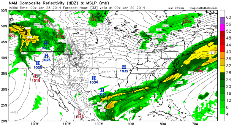
0zNAM lights up the Radar for Deep South Texas at 3AM Wednesday morning with temperatures in the mid 30s!

0 likes
The following post is NOT an official forecast and should not be used as such. It is just the opinion of the poster and may or may not be backed by sound meteorological data. It is NOT endorsed by any professional institution including storm2k.org For Official Information please refer to the NHC and NWS products.
-
Tireman4

- S2K Supporter
- Posts: 5903
- Age: 60
- Joined: Fri Jun 30, 2006 1:08 pm
- Location: Humble, Texas
- Contact:
Re: Texas Winter 2013-2014
Snowman67 wrote:Portastorm wrote:This could be a long night after all ... the first of what could be many surprises:
AREA FORECAST DISCUSSION
NATIONAL WEATHER SERVICE AUSTIN/SAN ANTONIO TX
813 PM CST MON JAN 27 2014
.UPDATE...
AN UPDATED WSW PRODUCT TO BE ISSUED SHORTLY.
ALTHOUGH A GOOD PORTION OF THE RADAR ECHOES MOVING INTO SOUTH
CENTRAL AND WEST CENTRAL TEXAS REFLECT A FAIR AMOUNT OF MELTING
LAYER ENHANCEMENT...SURFACE REPORTS ARE CATCHING A MIX OF LIGHT
RAIN AND PROBABLY LIGHT SNOW ACROSS THE SOUTHERN EDWARDS PLATEAU.
GIVEN THIS TREND AND THE FEED OF A DENSE LAYER OF MID LEVEL CLOUDS
EXTENDING SW TO THE PACIFIC SUBTROPICAL LOW...WILL NUDGE POPS
WESTWARD FOR LATE TONIGHT...AND INCREASE POPS TO 30 PERCENT OVER
CENTRAL TX FOR AFTER MIDNIGHT. QPF WILL BE INCREASED SLIGHTLY FOR
THIS AREA WITH A LIGHT DUSTING OF SNOW SUGGESTED FOR AREAS ALONG
AND N OF A FREDERICKSBURG TO GIDDINGS LINE. EVENING QPF AMOUNTS
ARE NIL AS THE FIRST WAVE OF INSTABILITY HAS TO FALL THROUGH
ALMOST 10000 FEET OF DRIER AIR.
NO MAJOR CHANGES WERE NOTED FOR THE SOUTHERN PORTION OF THE
ADVISORY AREA...BUT HAVE INCREASED THE ONSET OF MIXING INTO SLEET
WITHOUT MAKING CHANGES TO TEMPERATURES. VERY DRY AIR WAS NOTED ON
THE DRT SOUNDING WHICH SHOULD ENHANCE THE PROCESS OF RAIN CHANGING
OVER TO THE MIX. VERY LIGHT AMOUNTS ARE STILL REFLECTED IN NEW
MODEL ARRIVALS FOR THE SOUTHERN PORTION OF THE ADVISORY AREA.
Pulling for you Porta!
Here we go!!!!!!!!!!!!
0 likes
-
TeamPlayersBlue

- Category 5
- Posts: 3530
- Joined: Tue Feb 02, 2010 1:44 am
- Location: Denver/Applewood, CO
Re:
Rgv20 wrote:0zNAM lights up the Radar for Deep South Texas at 3AM Wednesday morning with temperatures in the mid 30s!
[img]http://i61.photobucket.com/albums/h62/cantu5977/Win ter%202012-13/nam_reflectivity_us_10_zpsae2d6852.png[/img]
Pullin for ya!!!!!
0 likes
Personal Forecast Disclaimer:
The posts in this forum are NOT official forecast and should not be used as such. They are just the opinion of the poster and may or may not be backed by sound meteorological data. They are NOT endorsed by any professional institution or storm2k.org. For official information, please refer to the NHC and NWS products.
The posts in this forum are NOT official forecast and should not be used as such. They are just the opinion of the poster and may or may not be backed by sound meteorological data. They are NOT endorsed by any professional institution or storm2k.org. For official information, please refer to the NHC and NWS products.
-
Portastorm
- Storm2k Moderator
- Posts: 9955
- Age: 63
- Joined: Fri Jul 11, 2003 9:16 am
- Location: Round Rock, TX
- Contact:
Re:
Wntrwthrguy wrote:Trying to understand what has occurred that might give austin a surprise or two. Is there more moisture now than previously thought? Is the low moving further north? Etc
I'll tell you one thing ... one reason why is that our computer models attempt to forecast using limited data when it comes to disturbances out of Mexico. That air is not sampled at all unlike the air here in the US with the many tools we use. So, consequently, sometimes we can get "surprises" coming out of ol' Mexico. Perhaps tonight is one of those times. It has happened before.
0 likes
Any forecasts under my name are to be taken with a grain of salt. Get your best forecasts from the National Weather Service and National Hurricane Center.
Radar loop

0 likes
The above post and any post by Ntxw is NOT an official forecast and should not be used as such. It is just the opinion of the poster and may or may not be backed by sound meteorological data. It is NOT endorsed by any professional institution including Storm2k. For official information, please refer to NWS products.
Help support Storm2K!
Help support Storm2K!
-
Portastorm
- Storm2k Moderator
- Posts: 9955
- Age: 63
- Joined: Fri Jul 11, 2003 9:16 am
- Location: Round Rock, TX
- Contact:
Re: Re:
TeamPlayersBlue wrote:Rgv20 wrote:0zNAM lights up the Radar for Deep South Texas at 3AM Wednesday morning with temperatures in the mid 30s!
[img]http://i61.photobucket.com/albums/h62/cantu5977/Win ter%202012-13/nam_reflectivity_us_10_zpsae2d6852.png[/img]
Pullin for ya!!!!!
You too! This is why HGX stuck to their guns about the weather warnings. They held out the caveat that because we're dealing with a system out of Mexico that a surprise or two may lurk. This will likely impact y'all as well.
0 likes
Any forecasts under my name are to be taken with a grain of salt. Get your best forecasts from the National Weather Service and National Hurricane Center.
-
Wntrwthrguy
- Tropical Storm
- Posts: 161
- Joined: Thu Nov 21, 2013 8:48 pm
- Location: North Austin
Re: Re:
Portastorm wrote:Wntrwthrguy wrote:Trying to understand what has occurred that might give austin a surprise or two. Is there more moisture now than previously thought? Is the low moving further north? Etc
I'll tell you one thing ... one reason why is that our computer models attempt to forecast using limited data when it comes to disturbances out of Mexico. That air is not sampled at all unlike the air here in the US with the many tools we use. So, consequently, sometimes we can get "surprises" coming out of ol' Mexico. Perhaps tonight is one of those times. It has happened before.
Thanks Porta! Didn't even think about that! Here's to hoping surprises for everyone!
0 likes
Any post should not be taken as a forecast. I am just an amateur living the dream.

Re: Texas Winter 2013-2014
NAM ejecting that ULL energy right into deep STX now a lot more than the runs today....now almost back to where it was a few days ago....lol...
CMC might have been on to something earlier...
CMC might have been on to something earlier...
0 likes
Re: Texas Winter 2013-2014
Portastorm wrote::uarrow:
Just deleted my post after I saw someone had already posted the updated AFD. Heh, this could get interesting after all. Who knew?! Don't you love it when Mother Nature tells us "um, you don't know me as well as you think you do!"
Yup. Hoping that God has a little surprise in store for us
0 likes
Any forecast I make is based on my opinion only. Please refer to the NWS or NHC for official forecasts.


![[img]http://i61.photobucket.com/albums/h62/cantu5977/Win ter%202012-13/nam_reflectivity_us_10_zpsae2d6852.png[/img]](http://s61.photobucket.com/user/cantu5977/media/Win%20ter%202012-13/nam_reflectivity_us_10_zpsae2d6852.png.html)
-
Rgv20
- S2K Supporter
- Posts: 2466
- Age: 39
- Joined: Wed Jan 05, 2011 5:42 pm
- Location: Edinburg/McAllen Tx
Re: Texas Winter 2013-2014
ROCK wrote:NAM ejecting that ULL energy right into deep STX now a lot more than the runs today....now almost back to where it was a few days ago....lol...
CMC might have been on to something earlier...
Indeed, NAM is also ejecting the energy a little bit faster than the 18z run and is a bit further north than past runs. Corpus noted in one of their discussions that even a track 50-100 miles more north would have huge implications to QPF totals. Deep South Texas and South Texas may be in for a surprise Tomorrow night and Wednesday morning!
0 likes
The following post is NOT an official forecast and should not be used as such. It is just the opinion of the poster and may or may not be backed by sound meteorological data. It is NOT endorsed by any professional institution including storm2k.org For Official Information please refer to the NHC and NWS products.
-
TeamPlayersBlue
- Category 5
- Posts: 3530
- Joined: Tue Feb 02, 2010 1:44 am
- Location: Denver/Applewood, CO
Porta i agree. The SJT surprises us very often. Thats what my silly forecast a couple pages ago is banking on.
0 likes
Personal Forecast Disclaimer:
The posts in this forum are NOT official forecast and should not be used as such. They are just the opinion of the poster and may or may not be backed by sound meteorological data. They are NOT endorsed by any professional institution or storm2k.org. For official information, please refer to the NHC and NWS products.
The posts in this forum are NOT official forecast and should not be used as such. They are just the opinion of the poster and may or may not be backed by sound meteorological data. They are NOT endorsed by any professional institution or storm2k.org. For official information, please refer to the NHC and NWS products.
-
Tireman4
- S2K Supporter
- Posts: 5903
- Age: 60
- Joined: Fri Jun 30, 2006 1:08 pm
- Location: Humble, Texas
- Contact:
Re: Re:
Portastorm wrote:TeamPlayersBlue wrote:Rgv20 wrote:0zNAM lights up the Radar for Deep South Texas at 3AM Wednesday morning with temperatures in the mid 30s!
[img]http://i61.photobucket.com/albums/h62/cantu5977/Win ter%202012-13/nam_reflectivity_us_10_zpsae2d6852.png[/img]
Pullin for ya!!!!!
You too! This is why HGX stuck to their guns about the weather warnings. They held out the caveat that because we're dealing with a system out of Mexico that a surprise or two may lurk. This will likely impact y'all as well.
And I totally agreed with them Porta. David Paul has too. You should hear what folks are saying to he and Brooks Garner on their Facebook page. Being a met is hard. Being a met in Texas is hard. Being a met in Texas during the winter season trying to predict frozen precipitation is even harder. When others were jumping off and calling it a bust, HGX has stuck to their guns. Goodness. Just relax folks and believe in Champ The Charger.
0 likes
-
Tireman4
- S2K Supporter
- Posts: 5903
- Age: 60
- Joined: Fri Jun 30, 2006 1:08 pm
- Location: Humble, Texas
- Contact:
Re: Texas Winter 2013-2014
ROCK wrote:NAM ejecting that ULL energy right into deep STX now a lot more than the runs today....now almost back to where it was a few days ago....lol...
CMC might have been on to something earlier...
Not the crazy Uncle...nooo!!
0 likes
Who is online
Users browsing this forum: No registered users and 31 guests