The posts in this forum are NOT official forecast and should not be used as such. They are just the opinion of the poster and may or may not be backed by sound meteorological data. They are NOT endorsed by any professional institution or

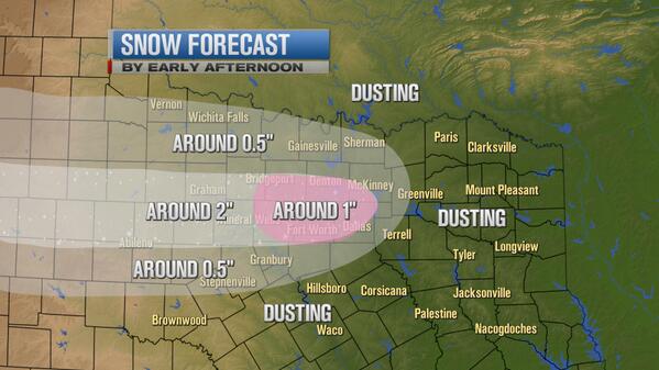
orangeblood wrote:Ntxw wrote:Tcu101 wrote:DFW received .05" of liquid equivalent today which equated to around 1 inch of snow. 20 to 1 ratio? Impressive ratio
This is correct. The column was very efficient at making dendrites. Making the most out of very little qpf. The seasonal snow total (sleet and ice is counted as snow) is 4.1 inches.
Yep, this season is definitely making up for the last two lack luster ones.
Was anyone else questioning what the heck Steve McCauley posted earlier saying this was wet snow and that is reason for melting ??? This was extremely dry powdery 20-1 ratio snow and melted on streets quickly once solar radiation reached its peak this afternoon.....some of his posts are very puzzling!!
Also, Ntxw - checked out the new Euro weeklies yet ? has your - EPO back and in full effect towards end of Feb, early March , along with a possible - AO
I'm glad you mentioned that about Steve's post, because that was a bit puzzling to me too? The snow was very dry ! I guess he was not expecting such large snowflakes?? Can large snowflakes not be dry?