
ENSO Updates (2007 thru 2023)
Moderator: S2k Moderators
Forum rules

The posts in this forum are NOT official forecasts and should not be used as such. They are just the opinion of the poster and may or may not be backed by sound meteorological data. They are NOT endorsed by any professional institution or STORM2K. For official information, please refer to products from the National Hurricane Center and National Weather Service.
-
cycloneye

- Admin

- Posts: 149463
- Age: 69
- Joined: Thu Oct 10, 2002 10:54 am
- Location: San Juan, Puerto Rico
Re: Australian update of 3/11/14=Chance of El Nino by Summer
If and is a big if at this time 2014 will have a strong El Nino but if it comes,the effects can be felt in many different ways around the globe.Here is a graphic of the 1997-1998 strong El Nino effects.
0 likes
Visit the Caribbean-Central America Weather Thread where you can find at first post web cams,radars
and observations from Caribbean basin members Click Here
and observations from Caribbean basin members Click Here
-
tolakram
- Admin
- Posts: 20185
- Age: 62
- Joined: Sun Aug 27, 2006 8:23 pm
- Location: Florence, KY (name is Mark)
Re: Australian update of 3/11/14=Chance of El Nino by Summer
NE Brazil has been in a horrible drought hasn't it? El Nino conditions portend dry conditions there? Good grief.
0 likes
M a r k
- - - - -
Join us in chat: Storm2K Chatroom Invite. Android and IOS apps also available.
The posts in this forum are NOT official forecasts and should not be used as such. Posts are NOT endorsed by any professional institution or STORM2K.org. For official information and forecasts, please refer to NHC and NWS products.


30 day SOI from longpaddock is at -8. Caveat is we have lost most of the +SOI's so now we chip away at negatives with the moving index. Daily SOI has been negative for quite awhile but we will need to match or exceed the values lost to maintain or continue to dive.
0 likes
The above post and any post by Ntxw is NOT an official forecast and should not be used as such. It is just the opinion of the poster and may or may not be backed by sound meteorological data. It is NOT endorsed by any professional institution including Storm2k. For official information, please refer to NWS products.
Help support Storm2K!

Re: Atlantic Sea Surface Temperatures and Anomalies
Hurricaneman wrote:The closest analog as far as anomalies is 1997 as far as the atlantic is concerned and even to the date seems to match 1997 in the ENSO but the main difference that I see is less in the way of westerlies to upwell those + anomalies but it could be temporary or could be one of those conflicting signals that needs to be watched as if the westerlies aren't as strong in the ENSO regions it could lead to less upwelling and would lead to less shear in the atlantic and possibly a really bad hurricane season with those + anomalies near land
The posts in this forum are NOT official forecast and should not be used as such. They are just the opinion of the poster and may or may not be backed by sound meteorological data. They are NOT endorsed by any professional institution or storm2k.org. For official information, please refer to the NHC and NWS products
Could you explain more how sst anomalies for 2014 resemble 1997? When i look back at march of 1997 i dont see the resemblance that much. March of 1997 was below average in carribean and western atlantic. I would like to learn more.
0 likes
Personal Forecast Disclaimer:
The posts in this forum are NOT official forecast and should not be used as such. They are just the opinion of the poster and may or may not be backed by sound meteorological data. They are NOT endorsed by any professional institution or storm2k.org. For official information, please refer to the NHC and NWS products.
The posts in this forum are NOT official forecast and should not be used as such. They are just the opinion of the poster and may or may not be backed by sound meteorological data. They are NOT endorsed by any professional institution or storm2k.org. For official information, please refer to the NHC and NWS products.
-
cycloneye
- Admin
- Posts: 149463
- Age: 69
- Joined: Thu Oct 10, 2002 10:54 am
- Location: San Juan, Puerto Rico
Re: Australian update of 3/11/14=Chance of El Nino by Summer
Well,well,well, after all the fuss about El Nino coming we get this. Maybe is a blip or glitch on the data but this is a crash not expected. Let's remember too that many bouys are dead as different circunstances has made those not on operation so maybe there is some missing data that we don't see. Ntcw when is the next WB coming to reinforce that warm pool at sub-surface?

0 likes
Visit the Caribbean-Central America Weather Thread where you can find at first post web cams,radars
and observations from Caribbean basin members Click Here
and observations from Caribbean basin members Click Here
0 likes
The above post and any post by Ntxw is NOT an official forecast and should not be used as such. It is just the opinion of the poster and may or may not be backed by sound meteorological data. It is NOT endorsed by any professional institution including Storm2k. For official information, please refer to NWS products.
Help support Storm2K!
Help support Storm2K!
Re: Australian update of 3/11/14=Chance of El Nino by Summer
Ntxw wrote:Why is everyone keep throwing around 2004? As of right now I see very little to resemble that year. We are not in a +PDO mode, nor peak of AMO. Just like last year 2005 was thrown around a lot. There is very little supportive evidence the atmosphere is in a state it was during the early 2000s. More like late 50s/60s/70s. We've had strings of neutrals and la ninas that have sapped the tropics of heat/moisture (reference instability) Unlike the early 2000s when things were very different.
But the GOM appears to be above average in vertical instability is it not? As well as below normal vertical shear and above average relative vorticity.
http://www.ssd.noaa.gov/PS/TROP/TCFP/atlantic.html
0 likes
Personal Forecast Disclaimer:
The posts in this forum are NOT official forecast and should not be used as such. They are just the opinion of the poster and may or may not be backed by sound meteorological data. They are NOT endorsed by any professional institution or storm2k.org. For official information, please refer to the NHC and NWS products.
The posts in this forum are NOT official forecast and should not be used as such. They are just the opinion of the poster and may or may not be backed by sound meteorological data. They are NOT endorsed by any professional institution or storm2k.org. For official information, please refer to the NHC and NWS products.
Re: Australian update of 3/11/14=Chance of El Nino by Summer
stephen23 wrote:Ntxw wrote:Why is everyone keep throwing around 2004? As of right now I see very little to resemble that year. We are not in a +PDO mode, nor peak of AMO. Just like last year 2005 was thrown around a lot. There is very little supportive evidence the atmosphere is in a state it was during the early 2000s. More like late 50s/60s/70s. We've had strings of neutrals and la ninas that have sapped the tropics of heat/moisture (reference instability) Unlike the early 2000s when things were very different.
But the GOM appears to be above average in vertical instability is it not? As well as below normal vertical shear and above average relative vorticity.
http://www.ssd.noaa.gov/PS/TROP/TCFP/atlantic.html
I was referencing the global regime, not just a region, in the atmosphere and oceans. SST's in a small region can and do change much quicker. Is it possible we see a 2004 repeat? Yes, but why keep using it when there is not all that great support for it. People say modoki, but there are also many other modoki's that were not like 04 as well. It's too early to pick a year for analogs.
You are correct GOM instability has been decent. But it was decent last year as well compared to MDR.
0 likes
The above post and any post by Ntxw is NOT an official forecast and should not be used as such. It is just the opinion of the poster and may or may not be backed by sound meteorological data. It is NOT endorsed by any professional institution including Storm2k. For official information, please refer to NWS products.
Help support Storm2K!
Help support Storm2K!
-
ninel conde
Re: Australian update of 3/11/14=Chance of El Nino by Summer
Ntxw wrote:stephen23 wrote:Ntxw wrote:Why is everyone keep throwing around 2004? As of right now I see very little to resemble that year. We are not in a +PDO mode, nor peak of AMO. Just like last year 2005 was thrown around a lot. There is very little supportive evidence the atmosphere is in a state it was during the early 2000s. More like late 50s/60s/70s. We've had strings of neutrals and la ninas that have sapped the tropics of heat/moisture (reference instability) Unlike the early 2000s when things were very different.
But the GOM appears to be above average in vertical instability is it not? As well as below normal vertical shear and above average relative vorticity.
http://www.ssd.noaa.gov/PS/TROP/TCFP/atlantic.html
I was referencing the global regime, not just a region, in the atmosphere and oceans. SST's in a small region can and do change much quicker. Is it possible we see a 2004 repeat? Yes, but why keep using it when there is not all that great support for it. People say modoki, but there are also many other modoki's that were not like 04 as well. It's too early to pick a year for analogs.
You are correct GOM instability has been decent. But it was decent last year as well compared to MDR.
last year a trof was dominant in the east so it didnt matter if the gom was unstable. if we have another trof with a nw flow alot it wont matter this season either.
0 likes
-
cycloneye
- Admin
- Posts: 149463
- Age: 69
- Joined: Thu Oct 10, 2002 10:54 am
- Location: San Juan, Puerto Rico
Re:
Ntxw wrote:30 day SOI from longpaddock is at -8. Caveat is we have lost most of the +SOI's so now we chip away at negatives with the moving index. Daily SOI has been negative for quite awhile but we will need to match or exceed the values lost to maintain or continue to dive.
Latest update of 30 day SOI is down to -6.8.
20140209,20140310,-6.8
http://www.bom.gov.au/climate/enso/soi.txt
0 likes
Visit the Caribbean-Central America Weather Thread where you can find at first post web cams,radars
and observations from Caribbean basin members Click Here
and observations from Caribbean basin members Click Here
Follow this link and you will see that not only is our warm pool below the surface very large and very strong, it's getting larger! This is a behemoth warm pool, not just in the sense of warmth but size.
http://www.ncdc.noaa.gov/teleconnections/enso/indicators/sea-temp.php?level=eq&begmonth=3&begday=1&begyear=2014&endmonth=3&endday=10&endyear=2014
Models show more MJO returning to the Pacific. Calm before the next one, looks big on the GEFS. You can also see between 0 and 60 the emergence of a new Kelvin wave in the far WPAC aka westerlies.


Now to lay the 2012 thoughts to rest. The greatest sub-surface pool that year was in July and it was puny compared to this thing. It wasn't even as deep are as expansive, no contest.

Mountain torque and AAM is still running high since Feb, especially when looking at the Himalayas. This favors the MJO/GWO in the Nino phases.

http://www.ncdc.noaa.gov/teleconnections/enso/indicators/sea-temp.php?level=eq&begmonth=3&begday=1&begyear=2014&endmonth=3&endday=10&endyear=2014
Models show more MJO returning to the Pacific. Calm before the next one, looks big on the GEFS. You can also see between 0 and 60 the emergence of a new Kelvin wave in the far WPAC aka westerlies.
Now to lay the 2012 thoughts to rest. The greatest sub-surface pool that year was in July and it was puny compared to this thing. It wasn't even as deep are as expansive, no contest.
Mountain torque and AAM is still running high since Feb, especially when looking at the Himalayas. This favors the MJO/GWO in the Nino phases.
0 likes
The above post and any post by Ntxw is NOT an official forecast and should not be used as such. It is just the opinion of the poster and may or may not be backed by sound meteorological data. It is NOT endorsed by any professional institution including Storm2k. For official information, please refer to NWS products.
Help support Storm2K!
Help support Storm2K!

Re: Australian update of 3/11/14=Chance of El Nino by Summer
Ntxw wrote:stephen23 wrote:Ntxw wrote:Why is everyone keep throwing around 2004? As of right now I see very little to resemble that year. We are not in a +PDO mode, nor peak of AMO. Just like last year 2005 was thrown around a lot. There is very little supportive evidence the atmosphere is in a state it was during the early 2000s. More like late 50s/60s/70s. We've had strings of neutrals and la ninas that have sapped the tropics of heat/moisture (reference instability) Unlike the early 2000s when things were very different.
But the GOM appears to be above average in vertical instability is it not? As well as below normal vertical shear and above average relative vorticity.
http://www.ssd.noaa.gov/PS/TROP/TCFP/atlantic.html
I was referencing the global regime, not just a region, in the atmosphere and oceans. SST's in a small region can and do change much quicker. Is it possible we see a 2004 repeat? Yes, but why keep using it when there is not all that great support for it. People say modoki, but there are also many other modoki's that were not like 04 as well. It's too early to pick a year for analogs.
You are correct GOM instability has been decent. But it was decent last year as well compared to MDR.
2004-2005 El Nino started around summer of 2004. It was a weak Modoki El Nino during warm PDO of 2002-2007. 1972-1973 El Nino started around spring of 1972. 1972-1973 El Nino was a strong Eastern Equatorial El Nino, which is unusual as it was during cool PDO. That cool PDO phase was from 1945 to 1977. 1970s had a bunch of La Ninas than went El Nino by late 1970s, which corresponds with PDO going into warm phase, which was around 1976 to 1977. That warm PDO phase lasted up to 1998, which went cool from 1998 to 2002.
http://ggweather.com/enso/oni.htm
0 likes

Re: Atlantic Sea Surface Temperatures and Anomalies
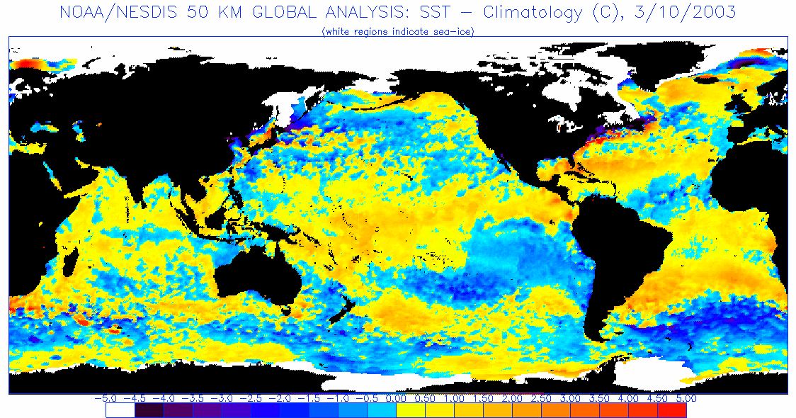
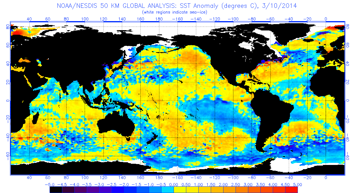
2003 has some similarities
0 likes
The following post is NOT an official forecast and should not be used as such. It is just the opinion of the poster and may or may not be backed by sound meteorological data. It is NOT endorsed by any professional institution including storm2k.org For Official Information please refer to the NHC and NWS products.
Re: Atlantic Sea Surface Temperatures and Anomalies
blp wrote:2003 has some similarities
http://www.ospo.noaa.gov/data/sst/anoma ... 0.2003.gif
http://www.ospo.noaa.gov/data/sst/anoma ... 0.2014.gif
Wasn't 2003 also a neutral year that was transitioning to el nino in 2004?
0 likes
Personal Forecast Disclaimer:
The posts in this forum are NOT official forecast and should not be used as such. They are just the opinion of the poster and may or may not be backed by sound meteorological data. They are NOT endorsed by any professional institution or storm2k.org. For official information, please refer to the NHC and NWS products.
The posts in this forum are NOT official forecast and should not be used as such. They are just the opinion of the poster and may or may not be backed by sound meteorological data. They are NOT endorsed by any professional institution or storm2k.org. For official information, please refer to the NHC and NWS products.
-
xtyphooncyclonex

- Category 5

- Posts: 3891
- Age: 24
- Joined: Sat Dec 08, 2012 9:07 am
- Location: Cebu City
- Contact:
Weather is abnormally dry in the Philippines and there are some high temperatures here, and a reported 33.4C in Manila! There are many cracks in the farms due to droughts. Haze over Malaysia..... SO HOT! 
To early to tell if an El Nino, but these are probably the first few signs observed over SE Asia.
To early to tell if an El Nino, but these are probably the first few signs observed over SE Asia.
0 likes
REMINDER: My opinions that I, or any other NON Pro-Met in this forum, are unofficial. Please do not take my opinions as an official forecast and warning. I am NOT a meteorologist. Following my forecasts blindly may lead to false alarm, danger and risk if official forecasts from agencies are ignored.
-
xtyphooncyclonex
- Category 5
- Posts: 3891
- Age: 24
- Joined: Sat Dec 08, 2012 9:07 am
- Location: Cebu City
- Contact:
In the West pac, we could expect another storm which may enhance the westerlies. Possibly Lusi in the SPAC can help too.
0 likes
REMINDER: My opinions that I, or any other NON Pro-Met in this forum, are unofficial. Please do not take my opinions as an official forecast and warning. I am NOT a meteorologist. Following my forecasts blindly may lead to false alarm, danger and risk if official forecasts from agencies are ignored.
-
cycloneye
- Admin
- Posts: 149463
- Age: 69
- Joined: Thu Oct 10, 2002 10:54 am
- Location: San Juan, Puerto Rico
Re: ENSO: PDO Febuary update is at +38
PDO Febuary update is up to +38
The Febuary update is up from the +30 of January.
http://jisao.washington.edu/pdo/PDO.latest
The Febuary update is up from the +30 of January.
http://jisao.washington.edu/pdo/PDO.latest
0 likes
Visit the Caribbean-Central America Weather Thread where you can find at first post web cams,radars
and observations from Caribbean basin members Click Here
and observations from Caribbean basin members Click Here
-
cycloneye
- Admin
- Posts: 149463
- Age: 69
- Joined: Thu Oct 10, 2002 10:54 am
- Location: San Juan, Puerto Rico
Re: ENSO: PDO Febuary update is up to +38
If this forecast of twin cyclones in each hemisphere pans out,then a strong West Wind Burst will occur to reinforce that large warm pool at sub-surface.

0 likes
Visit the Caribbean-Central America Weather Thread where you can find at first post web cams,radars
and observations from Caribbean basin members Click Here
and observations from Caribbean basin members Click Here
-
TropicalAnalystwx13

- Category 5
- Posts: 2109
- Age: 28
- Joined: Tue Jul 19, 2011 8:20 pm
- Location: Wilmington, NC
- Contact:
Re: Atlantic Sea Surface Temperatures and Anomalies
stephen23 wrote:blp wrote:2003 has some similarities
http://www.ospo.noaa.gov/data/sst/anoma ... 0.2003.gif
http://www.ospo.noaa.gov/data/sst/anoma ... 0.2014.gif
Wasn't 2003 also a neutral year that was transitioning to el nino in 2004?
2003 was the true definition of Neutral. El Nino conditions persisted into the first 3 months of the year, followed by a rapid transition to cool Neutral (0 < x > -0.5C) for the April-July period, followed by another rapid transition back to warm Neutral (0C < x > 0.5C) for the remainder of the year.
0 likes
-
wxman57

- Moderator-Pro Met

- Posts: 23174
- Age: 68
- Joined: Sat Jun 21, 2003 8:06 pm
- Location: Houston, TX (southwest)
Re: Atlantic Sea Surface Temperatures and Anomalies
2004 was El Nino, not warm neutral. JJA average anomaly -.5C. By July-Sept the 3-month average was -.7C. It's a good analog for what we're seeing this year, considering the predictions of El Nino. Not that we're expecting 4 major hurricane impacts in Florida in 2014. In 2003-2004, the Dec-Feb average was +.3C vs. -.7C for 2013-2014. SSTs in Nino 3.4 are 1C cooler than the start of 2004.
http://www.cpc.ncep.noaa.gov/products/analysis_monitoring/ensostuff/ensoyears.shtml
http://www.cpc.ncep.noaa.gov/products/analysis_monitoring/ensostuff/ensoyears.shtml
0 likes
Who is online
Users browsing this forum: Google [Bot] and 102 guests