Significant Severe Weather Outbreak Possible 04/26-30/2014
Moderator: S2k Moderators
Forum rules

The posts in this forum are NOT official forecast and should not be used as such. They are just the opinion of the poster and may or may not be backed by sound meteorological data. They are NOT endorsed by any professional institution or STORM2K.
-
apocalypt-flyer
- Category 1

- Posts: 468
- Joined: Sat Aug 27, 2005 11:51 am
-
cycloneye

- Admin

- Posts: 149372
- Age: 69
- Joined: Thu Oct 10, 2002 10:54 am
- Location: San Juan, Puerto Rico
Re:
CrazyC83 wrote:SEL0
URGENT - IMMEDIATE BROADCAST REQUESTED
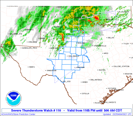
TORNADO WATCH NUMBER 110
NWS STORM PREDICTION CENTER NORMAN OK
235 PM EDT MON APR 28 2014
THE NWS STORM PREDICTION CENTER HAS ISSUED A
* TORNADO WATCH FOR PORTIONS OF
SOUTHEAST KENTUCKY
EASTERN TENNESSEE
FAR WESTERN VIRGINIA
* EFFECTIVE THIS MONDAY AFTERNOON AND EVENING FROM 235 PM UNTIL
800 PM EDT.
* PRIMARY THREATS INCLUDE...
A COUPLE TORNADOES POSSIBLE
SCATTERED LARGE HAIL EVENTS TO 1.5 INCHES IN DIAMETER POSSIBLE
ISOLATED DAMAGING WIND GUSTS TO 70 MPH POSSIBLE
THE TORNADO WATCH AREA IS APPROXIMATELY ALONG AND 60 STATUTE
MILES EAST AND WEST OF A LINE FROM 50 MILES NORTH OF BRISTOL
TENNESSEE TO 10 MILES EAST SOUTHEAST OF CHATTANOOGA TENNESSEE.
FOR A COMPLETE DEPICTION OF THE WATCH SEE THE ASSOCIATED WATCH
OUTLINE UPDATE (WOUS64 KWNS WOU0).
PRECAUTIONARY/PREPAREDNESS ACTIONS...
REMEMBER...A TORNADO WATCH MEANS CONDITIONS ARE FAVORABLE FOR
TORNADOES AND SEVERE THUNDERSTORMS IN AND CLOSE TO THE WATCH
AREA. PERSONS IN THESE AREAS SHOULD BE ON THE LOOKOUT FOR
THREATENING WEATHER CONDITIONS AND LISTEN FOR LATER STATEMENTS
AND POSSIBLE WARNINGS.
&&
OTHER WATCH INFORMATION...CONTINUE...WW 108...WW 109...
DISCUSSION...BROKEN BAND OF STORMS WILL CONTINUE TO SPREAD EWD
ACROSS ERN TN/SE KY THIS AFTERNOON...ALONG AN OUTFLOW BOUNDARY FROM
MORNING CONVECTION AND IN ADVANCE OF A WEAK MCV. VERTICAL SHEAR AND
INSTABILITY WILL BE SUFFICIENT FOR SOME RISK OF SUPERCELLS...WITH AN
ATTENDANT RISK FOR A COUPLE TORNADOES...LARGE HAIL...AND DAMAGING
GUSTS.
AVIATION...TORNADOES AND A FEW SEVERE THUNDERSTORMS WITH HAIL
SURFACE AND ALOFT TO 1.5 INCHES. EXTREME TURBULENCE AND SURFACE
WIND GUSTS TO 60 KNOTS. A FEW CUMULONIMBI WITH MAXIMUM TOPS TO
500. MEAN STORM MOTION VECTOR 25035.
...THOMPSON
0 likes
Visit the Caribbean-Central America Weather Thread where you can find at first post web cams,radars
and observations from Caribbean basin members Click Here
and observations from Caribbean basin members Click Here


Don't buckle in like me
apocalypt-flyer wrote:Tomorrow has been upgraded to MDT for East Mississippi and a lot of Alabama.
That was long, long overdue. Considering the SPC themselves said that Tuesday looked to be the most potent of all the days, it made no sense to have slight there.
Tireman4 wrote:Here we go again.....buckle up....
I leave my buckle undone so I fly off the rails when something happens.
We're already at 5 TOR warnings right now so this is a much faster start than yesterday. I'm amazed since there was so much pre-convection too in that spot. Area's not affected will be a power-keg. Its to the point that we should only start posting confirmed tornadoes now.
0 likes


Re: Significant Severe Weather Outbreak Possible 04/26-30/2014
Yep it is headed straight for Yazoo, they probably have 10 minutes or so.
0 likes

 . New sups might be forming south with appendages already showing, could be very explosive and dangerous.
-
CrazyC83
- Professional-Met

- Posts: 34315
- Joined: Tue Mar 07, 2006 11:57 pm
- Location: Deep South, for the first time!
Re: Significant Severe Weather Outbreak Possible 04/26-30/2014
No surprise here.
MESOSCALE DISCUSSION 0455
NWS STORM PREDICTION CENTER NORMAN OK
0209 PM CDT MON APR 28 2014
AREAS AFFECTED...CNTRL AND NE MS...NW AL
CONCERNING...SEVERE THUNDERSTORM WATCH 108...
VALID 281909Z - 282015Z
THE SEVERE WEATHER THREAT FOR SEVERE THUNDERSTORM WATCH 108
CONTINUES.
SUMMARY...TORNADO THREAT IS EXPECTED TO CONTINUE TO INCREASE LATE
THIS AFTERNOON AS NUMEROUS TORNADIC SUPERCELLS DEVELOP ACROSS PDS
TORNADO WATCH 108. THE AREA FROM CNTRL MS EXTENDING NEWD INTO NW AL
WILL BE UPGRADED TO HIGH RISK AT THE 20Z OUTLOOK.
DISCUSSION...SUPERCELL THUNDERSTORMS ARE CONTINUING TO DEVELOP
ACROSS CNTRL AND NRN MS THIS AFTERNOON IN RESPONSE TO STRONG UPLIFT
AND DESTABILIZATION. THE ENVIRONMENT IS CHARACTERIZED BY MODERATE
INSTABILITY...STRONG DEEP LAYER SHEAR AND SUBSTANTIAL LOW-LEVEL
SHEAR. THE WSR-88D VWPS IN CNTRL AND NRN MS SHOW LOOPED HODOGRAPHS
WITH 0-3 KM STORM RELATIVE HELICITIES IN THE 450 TO 500 M2/S2 RANGE.
THIS SHOULD SUPPORT A THREAT FOR STRONG TORNADOES AS SUPERCELLS
CONTINUE TO INTENSIFY. DUE TO THIS IMPRESSIVE SHEAR ENVIRONMENT...AN
OUTBREAK OF TORNADOES APPEARS LIKELY AND THE AREA FROM CNTRL MS
EXTENDING NEWD INTO NW AL WILL BE UPGRADED TO HIGH RISK FOR THE 20Z
OUTLOOK.
..BROYLES/THOMPSON.. 04/28/2014
ATTN...WFO...OHX...BMX...HUN...MEG...JAN...
LAT...LON 32498898 32189019 32299092 32639126 33279101 34348959
35408791 35408675 34758591 33978628 32918781 32498898
0 likes
-
cycloneye
- Admin
- Posts: 149372
- Age: 69
- Joined: Thu Oct 10, 2002 10:54 am
- Location: San Juan, Puerto Rico
Re: Significant Severe Weather Outbreak Possible 04/26-30/2014
Bryan Schuerman @SchuermanWxWHAG · 12m
BREAKING WEATHER: @NWSSPC will be upgrading shortly West Alabama to a HIGH RISK for severe weather.
BREAKING WEATHER: @NWSSPC will be upgrading shortly West Alabama to a HIGH RISK for severe weather.
0 likes
Visit the Caribbean-Central America Weather Thread where you can find at first post web cams,radars
and observations from Caribbean basin members Click Here
and observations from Caribbean basin members Click Here
-
CrazyC83
- Professional-Met
- Posts: 34315
- Joined: Tue Mar 07, 2006 11:57 pm
- Location: Deep South, for the first time!
SEVERE WEATHER STATEMENT
NATIONAL WEATHER SERVICE JACKSON MS
218 PM CDT MON APR 28 2014
MSC163-281945-
/O.CON.KJAN.TO.W.0030.000000T0000Z-140428T1945Z/
YAZOO MS-
218 PM CDT MON APR 28 2014
...A TORNADO WARNING REMAINS IN EFFECT FOR NORTH CENTRAL YAZOO COUNTY
UNTIL 245 PM CDT...
AT 218 PM CDT...A CONFIRMED TORNADO WAS LOCATED NEAR YAZOO CITY...AND
MOVING NORTHEAST AT 45 MPH.
HAZARD...DAMAGING TORNADO AND QUARTER SIZE HAIL.
SOURCE...WEATHER SPOTTERS CONFIRMED TORNADO.
IMPACT...FLYING DEBRIS WILL BE DANGEROUS TO THOSE CAUGHT WITHOUT
SHELTER. MOBILE HOMES WILL BE DAMAGED OR DESTROYED. DAMAGE
TO ROOFS...WINDOWS AND VEHICLES WILL OCCUR. TREE DAMAGE IS
LIKELY.
THIS TORNADIC STORM WILL AFFECT MAINLY RURAL AREAS OF NORTH CENTRAL
YAZOO COUNTY.
PRECAUTIONARY/PREPAREDNESS ACTIONS...
TO REPEAT...A TORNADO IS ON THE GROUND. TAKE COVER NOW. MOVE TO AN
INTERIOR ROOM ON THE LOWEST FLOOR OF A STURDY BUILDING. AVOID
WINDOWS. IF IN A MOBILE HOME...A VEHICLE OR OUTDOORS...MOVE TO THE
CLOSEST SUBSTANTIAL SHELTER AND PROTECT YOURSELF FROM FLYING DEBRIS.
&&
LAT...LON 3281 9043 3286 9047 3299 9029 3292 9011
TIME...MOT...LOC 1918Z 239DEG 38KT 3286 9038
TORNADO...OBSERVED
HAIL...1.00IN
$$
0 likes
Re: Significant Severe Weather Outbreak Possible 04/26-30/2014
CrazyC83 wrote:No surprise here.
The moment they saw those new cells firing along with the Yazoo one, they pulled the trigger in their minds. Using very strong wording in that one, moreso than the rest today too.
Alyono wrote:EF-5bigj wrote:It's a beast on radar...
with 80 kt G2G shear?
I think he means the supercell is a beast, not that the tornado is strong...for now.
0 likes
Re: Significant Severe Weather Outbreak Possible 04/26-30/2014
The rotation has intensified now with the latest scan, not sure how Yazoo city fared. They may have escaped the worst with a cycling of that storm.
0 likes
Return to “USA & Caribbean Weather”
Who is online
Users browsing this forum: Greener and 33 guests